Fire lookout · Cherokee County, Alabama
Daniel's Gap Tower
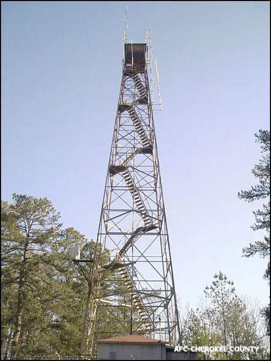
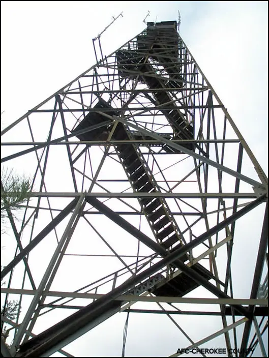
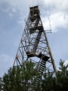
Alabama Forestry Commission's 100 ft Aermotor tower on Lookout Mountain in Cherokee County; register says 1960, a 1964 newspaper item says 1961.
- Standing
- Access unknown
- Verified
Visit & stay
Not rentable. As far as we know, this lookout cannot be booked for overnight stays.
Access
Access unknown
We do not know the access rules. Check with the land manager before you go.
- Can you climb it?
- Unknown
- Road to the top?
- Yes, you can drive up
- Trail
- A 1964 item says the site is easily accessible by car; current access is not described in the sources read.
- Staffing
- Unknown
Facts
- Status
- Type
- Cab on a tower100 ft Aermotor MC-39 with a 7 ft x 7 ft cabThe design: Aermotor MC-39
- Built of
- SteelGoing by its design; no source says so in words.
- Built
- 1960
- Height
- 98 ft (30.0 m)
- Elevation
- 1,127 ft (344 m)
- Agency
- Alabama Forestry Commission
- Land
- State land
- Location
- Cherokee County, Alabama
- Coordinates
- 34.28194, −85.68953
- Registers
- This entry
- VerifiedResearched, then checked independently. Updated 8 Oct 2026.
- Firefinder id
us-al-daniels-gap
View from the cab
What you see from the cab: every ridge out to about 93 miles, the named peaks in sight, and other fire lookouts within view, worked out from terrain data in your browser.
Downloads about 3.4 MB of terrain data the first time.
Or see what it could see on the map: the ground in its line of sight.
History
Then and now
- 1960 BuiltNHLR: completed by the Alabama Forestry Commission in 1960. A 1964 Anniston Star item (via Forest Lookouts) says built in 1961.Sources: nhlr.org, easternuslookouts.weebly.com
- 1961 EventTower erected in 1961 per the Anniston Star, quoted on Forest Lookouts; conflicts with the register's 1960Source: easternuslookouts.weebly.com
- 1964 StaffedJames C. Edlers began as full-time towerman on October 1, 1964 (Anniston Star item)Source: easternuslookouts.weebly.com
- No record between 1964 and 2011
- 2011 Added to the National Historic Lookout RegisterRegistered January 3, 2011 as US 897, AL 55Source: nhlr.org
- TodayStandingIt still stands, as far as our sources know.
Old maps of this spot
USGS topographic maps from the years a lookout stood may show it, often as a small symbol labelled “Lookout”. See the old topo maps around it on the Firefinder map, or find every scanned sheet of this spot on USGS TopoView (opens another site) (click the spot there to list them, with dates and downloads).
Story
Researched 8 Oct 2026, fact-checked.
Daniel's Gap Tower stands on Lookout Mountain in Cherokee County, Alabama.1,2 The Alabama Forestry Commission administers it, and the register says the commission completed it.1 It is a 100-foot Aermotor MC-39 with a 7-by-7-foot cab.1
Sources disagree on the year. The register gives 1960.1 A 1964 Anniston Star item, quoted on the Forest Lookouts site, says the tower was built in 1961, with telephone and radio.2
In October 1964 the county had a full-time towerman at the tower, James C. Edlers, who began work on October 1.2 The item says he climbed the tower's long staircase at 8 each morning and kept watch for fire until 5 p.m., and that he also served as a radio operator for the Division of Forestry, Game and Fish.2 The sources read do not name any fire the tower spotted.
The item describes the site as among the highest spots on Lookout Mountain and says it was easily reached by car.2 The register added the tower on January 3, 2011, as US 897, AL 55, with Thomas Kaufmann as nominator.1 Its photographs are dated October 19, 2013.1
Today the sources read do not describe the tower's condition or whether visitors may enter the cab. Check with the Alabama Forestry Commission before any visit, and do not climb a tower that is closed.
- Daniel's Gap Tower, National Historic Lookout Register, http://nhlr.org/lookouts/us/al/daniels-gap-tower/ (accessed 2026-10-08). ↩
- Daniels Gap, Forest Lookouts, https://easternuslookouts.weebly.com/daniels-gap.html (accessed 2026-10-08). ↩
Photos
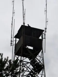
Photos keep their own rights and are shown with credit. Is one of these yours? You can ask for a different credit or for removal.
Sources
- National Historic Lookout Register (NHLR) (opens another site) Gave us: name, location, county, elevation, what it is built of, status, register numbers, agency, dates, photos, links National Historic Lookout Register (nhlr.org) · All rights reserved (American Resources, Inc.); facts extracted only, no prose copied. · retrieved 4 Oct 2026
- FOREST LOOKOUTS -- eastern US (easternuslookouts.weebly.com) (opens another site) Gave us: ownership, links easternuslookouts.weebly.com · No licence stated; facts only (county, coordinates where the page's own map widget gives them, status, height, design hints, register links). The site's own historical quotes, newspaper citations and narrative are not reproduced. · retrieved 8 Oct 2026
- OpenStreetMap -- fire lookout structures (opens another site) Gave us: type, height, register numbers, links © OpenStreetMap contributors · ODbL 1.0. (c) OpenStreetMap contributors. · retrieved 4 Oct 2026
- Firefinder research Gave us: summary, design, agency, visiting details, dates, links, fact-check Firefinder research (sources cited in the story footnotes) · Our own research notes; each fact cites its source in the lookout's story
More about this lookout elsewhere
- NHLR register entry US 897 (nhlr.org) (opens another site)
- Daniels Gap (easternuslookouts.weebly.com) (opens another site)
- Wikidata item Q86926322 (opens another site)
- OpenStreetMap node 4419730732 (opens another site)
Firefinder takes facts (places, dates, numbers) from these sources and writes its own words. See all sources and licences.