Fire lookout · Coconino County, Arizona
Thornton Lookout
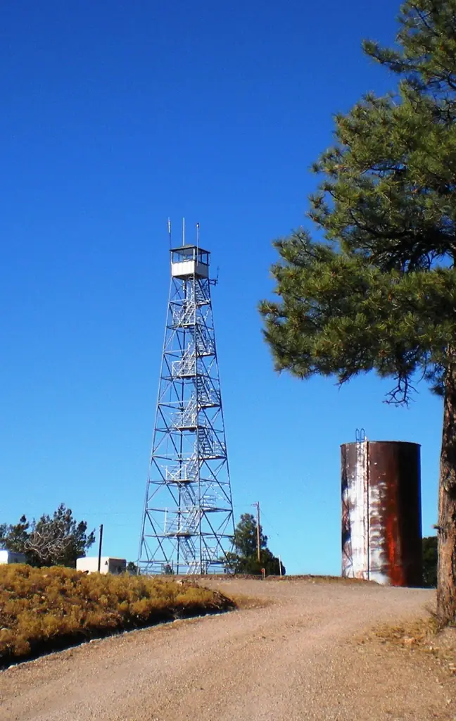
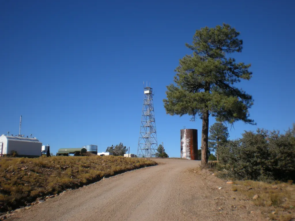
A 1945 Aermotor steel tower on the Hualapai Reservation, last recorded as staffed in 2011; sources disagree on county and no public visit route was found.
- Standing
- Access unknown
- Verified
Visit & stay
Not rentable. As far as we know, this lookout cannot be booked for overnight stays.
Access
Access unknown
We do not know the access rules. Check with the land manager before you go. On the Hualapai Reservation, administered by the Bureau of Indian Affairs (Hualapai Reservation) per the register. No public visitor information was found in the sources read.
- Can you climb it?
- Unknown
- Road to the top?
- Unknown
- Staffing
- Staffed during fire season (as of 2011)
Facts
- Status
- Type
- Cab on a tower100 ft Aermotor X-brace open steel tower with 7x7 observation-only cabinThe design: Aermotor
- Built of
- Steel
- Built
- 1945
- Height
- 100 ft (30.5 m)
- Elevation
- 6,780 ft (2,067 m)
- Agency
- Bureau of Indian Affairs, Hualapai Reservation
- Land
- Unknown
- Location
- Coconino County, Arizona
- Coordinates
- 35.84660, −113.05445
- Registers
- This entry
- VerifiedResearched, then checked independently. Updated 8 Oct 2026.
- Firefinder id
us-az-thornton
View from the cab
What you see from the cab: every ridge out to about 93 miles, the named peaks in sight, and other fire lookouts within view, worked out from terrain data in your browser.
Downloads about 2.8 MB of terrain data the first time.
Or see what it could see on the map: the ground in its line of sight.
History
Then and now
- 1945 BuiltConstructed as an Aermotor 100-foot X-brace open steel tower; register lists the Indian Emergency Civilian Work Program as a cooperatorSource: nhlr.org
- No record between 1945 and 1998
- 1998 AlteredNew siding and steps completedSource: nhlr.org
- 2011 StaffedRegister says the lookout continues to be staffed as of 2011Source: nhlr.org
- 2022 Added to the National Historic Lookout RegisterRegistered May 25, 2022 as US 1598, AZ 81; nominated by Brad EellsSource: nhlr.org
- TodayStandingIt still stands, as far as our sources know.
Old maps of this spot
USGS topographic maps from the years a lookout stood may show it, often as a small symbol labelled “Lookout”. See the old topo maps around it on the Firefinder map, or find every scanned sheet of this spot on USGS TopoView (opens another site) (click the spot there to list them, with dates and downloads).
Story
Researched 8 Oct 2026, fact-checked.
Thornton Lookout is a steel tower on the Hualapai Reservation, built in 1945.1 The National Historic Lookout Register gives it as a 100-foot steel tower by Aermotor, of open X-brace construction, topped by a 7-by-7 cabin used only for watching.1 The register lists the Indian Emergency Civilian Work Program among its cooperators.1 New siding and steps went on in 1998.1
The register says the lookout was still staffed as of 2011, the most recent staffing date I could find.1 It was added to the register on May 25, 2022, as US 1598, AZ 81, nominated by Brad Eells.1
Sources disagree on the county. The register and the Forest Fire Lookout Association's Arizona list both put the tower in Coconino County.1,2 A Wikidata entry agrees, but its photo file is titled with Mohave County, near Frazier Wells.3
Today the register lists the lookout as administered by the Bureau of Indian Affairs for the Hualapai Reservation.1 I found no public visitor information, trail, or listing for it, so whether visitors may approach the tower is unknown. Anyone interested should ask the tribe before going.
- Thornton Lookout, National Historic Lookout Register, http://nhlr.org/lookouts/us/az/thornton-lookout/ (accessed 2026-10-08). ↩
- Arizona fire lookouts, Forest Fire Lookout Association, https://firelookout.org/lookouts/us/az/ (accessed 2026-10-08). ↩
- Thornton Lookout Tower, Wikidata, https://www.wikidata.org/wiki/Q107507780 (accessed 2026-10-08). ↩
Photos

Photos keep their own rights and are shown with credit. Is one of these yours? You can ask for a different credit or for removal.
Sources
- National Historic Lookout Register (NHLR) (opens another site) Gave us: name, location, county, elevation, what it is built of, register numbers, agency, dates, photos, links National Historic Lookout Register (nhlr.org) · All rights reserved (American Resources, Inc.); facts extracted only, no prose copied. · retrieved 4 Oct 2026
- Forest Fire Lookout Association (FFLA) - US lookout lists (opens another site) Gave us: type, status, register numbers, links Forest Fire Lookout Association (firelookout.org) · No licence stated; facts extracted only, no prose copied. · retrieved 8 Oct 2026
- Wikidata -- US fire lookout towers (Q748998 and subclasses) (opens another site) Gave us: photos, links Wikidata · CC0 1.0 (Wikidata). Images keep their own Commons licence/credit. · retrieved 4 Oct 2026
- OpenStreetMap -- fire lookout structures (opens another site) Gave us: links © OpenStreetMap contributors · ODbL 1.0. (c) OpenStreetMap contributors. · retrieved 4 Oct 2026
- Firefinder research Gave us: summary, design, height, status, agency, access, staffing, dates, links, fact-check Firefinder research (sources cited in the story footnotes) · Our own research notes; each fact cites its source in the lookout's story
More about this lookout elsewhere
- NHLR register entry US 1598 (nhlr.org) (opens another site)
- FFLA Arizona lookout list (firelookout.org) (opens another site)
- Wikidata item Q107507780 (opens another site)
- OpenStreetMap node 359252520 (opens another site)
Firefinder takes facts (places, dates, numbers) from these sources and writes its own words. See all sources and licences.