Fire lookout · Tulare County, California
Baker Point Lookout
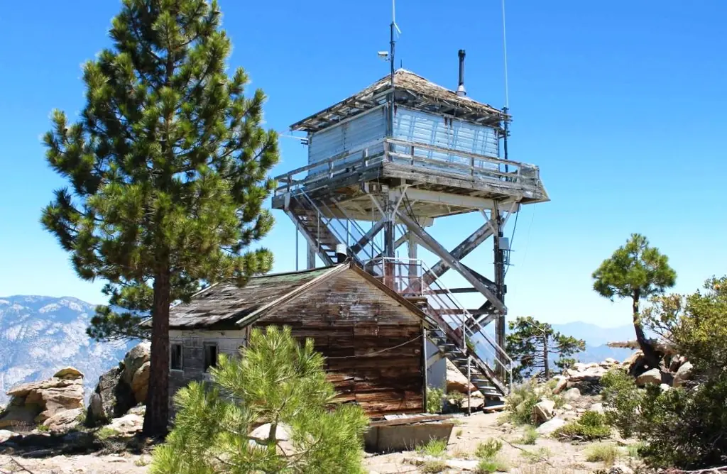
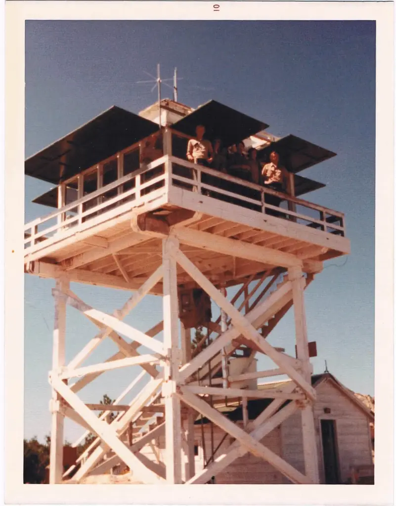
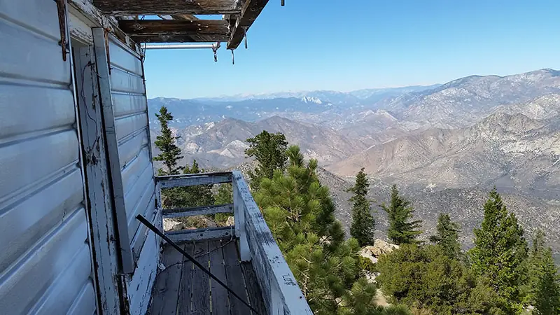
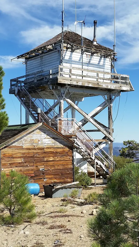
A 1950 L-6 live-in cab on a granite point above the Kern River in Sequoia National Forest; unstaffed, closed to visitors, and still used as a radio repeater.
- Standing
- Restricted access
- Verified
Visit & stay
Not rentable. As far as we know, this lookout cannot be booked for overnight stays.
Access
Restricted access
Access is seasonal, gated or needs a permit. Check before you go. CalWild describes a hiking trail to the lookout. Fire-lookouts.org (last updated 2013) says the structure is not staffed and is closed to the public, and NHLR says the cab is used only in emergencies. No source describes a visitor entry arrangement.
- Can you climb it?
- No
- Road to the top?
- No, you have to hike
- Trail
- Hike of 2-3 miles round trip from a parking area at about 7,500 ft (CalWild). Fire-lookouts.org calls the trail overgrown and puts it at two miles from the parking area to the lookout, about four miles round trip. Forest roads 24S15 and 23S16 are often closed; check with the Western Divide Ranger District.
- Staffing
- Not staffed (as of 2013)
Facts
- Status
- Type
- Cab on a tower14x14 ft live-in L-6 cab on an open timber tower about 20 ft tallThe designs: L-6, BC-301
- Built of
- Not recorded
- Also served as
- Aircraft Warning Service postDuring the Second World War it was staffed to spot and report aircraft.
- Built
- 1942 sources disagree
- Height
- 20 ft (6.1 m)
- Elevation
- 7,490 ft (2,283 m)
- Agency
- U.S. Forest Service, Sequoia National Forest, Hot Springs Ranger District
- Land
- Federal land
- Location
- Tulare County, California
- Coordinates
- 35.85234, −118.50278
- Registers
- This entry
- VerifiedResearched, then checked independently. Updated 8 Oct 2026.
- Firefinder id
us-ca-baker-point
View from the cab
What you see from the cab: every ridge out to about 93 miles, the named peaks in sight, and other fire lookouts within view, worked out from terrain data in your browser.
Downloads about 3.1 MB of terrain data the first time.
Or see what it could see on the map: the ground in its line of sight.
History
Then and now
- 1941 EventSequoia National Forest announced a planned lookout station on Baker Ridge to replace the one on Sunday Peak; a trail was to be built firstSource: californialookouts.weebly.com
- 1942 BuiltPeakbagging.com says the first structure on the site was built in 1942. A 1942 newspaper report said a temporary structure would be erected before the August 21 manning date. Fire-lookouts.org dates the first cab on maps to about 1943Sources: peakbagging.com, californialookouts.weebly.com, fire-lookouts.org
- 1943 BuiltOne-room wooden cabin beside the tower, built as living quarters; NHLR suggests it may have served the Aircraft Warning Service in WWIISources: nhlr.org, fire-lookouts.org, peakbagging.com
- 1946 EventReconstruction of the Baker Point Trail reported as nearing completionSource: californialookouts.weebly.com
- 1950 BuiltCurrent L-6 lookout; NHLR gives 1950 and Peakbagging.com says probably 1950; fire-lookouts.org says 1950s. NHLR says two mules were killed during constructionSources: nhlr.org, peakbagging.com, fire-lookouts.org
- No record between 1950 and 1986
- 1986 ClosedPeakbagging.com says the lookout has been closed since 1986Source: peakbagging.com
- 1988 Condition assessmentFire Lookout Evaluation Report by Mark Thornton gave 24 points for historical significance, which fire-lookouts.org says made it eligible for the National RegisterSource: fire-lookouts.org
- 2001 Added to the National Historic Lookout RegisterRegistered March 10, 2001, as US 376, CA 38Source: nhlr.org
- TodayStandingIt still stands, as far as our sources know.
Old maps of this spot
USGS topographic maps from the years a lookout stood may show it, often as a small symbol labelled “Lookout”. See the old topo maps around it on the Firefinder map, or find every scanned sheet of this spot on USGS TopoView (opens another site) (click the spot there to list them, with dates and downloads).
Story
Researched 8 Oct 2026, fact-checked.
Baker Point is a granite summit above the Kern River, north of Kernville, California, in the Sequoia National Forest.1,2 The U.S. Forest Service administers the lookout through the Hot Springs Ranger District.3,1
In July 1941 the Sequoia National Forest announced a planned lookout on Baker Ridge to replace the one on Sunday Peak. The first step would be a trail to haul in building materials.4 A year later a Bakersfield Californian report said the lookout would be manned from August 21, with a temporary structure to be erected first.4 Peakbagging.com dates the first structure on the site to 1942, while fire-lookouts.org says maps show a small wooden cab there around 1943, so the early dates disagree.5,1
The lookout that stands today is a 14-by-14-foot live-in cab on an open timber tower about 20 feet tall.3,1 The National Historic Lookout Register dates the cab to 1950, and Peakbagging.com says it was probably built that year.3,5 The NHLR calls the cab a BC-301, while fire-lookouts.org uses the labels C-3-L or L-6.3,1
All of the materials were packed in by horse and mule.1 Fire-lookouts.org says two pack animals died when part of the original trail gave way, while the NHLR says two mules were killed during construction in 1950.1,3 A one-room wooden cabin beside the tower was built in 1943 as living quarters, and the NHLR says it was likely used by the Aircraft Warning Service in World War II.1,5,3
The sources say little about notable fires spotted from the tower. Fire-lookouts.org, last updated on March 1, 2013, says the tower has not been used for fire detection for many years and is not staffed.1 Peakbagging.com says it has been closed since 1986.5 Today the NHLR says the cab is used only in emergencies, but the site still hosts an important radio repeater.3,1
Fire-lookouts.org says a 1988 Fire Lookout Evaluation Report by Mark Thornton gave Baker Point 24 points for historical significance, which made it eligible for the National Register of Historic Places.1 The NHLR registered it on March 10, 2001, as US 376.3
The Baker Point Trail is a relatively easy 2-3 mile round-trip hike from a parking area at about 7,500 feet, according to CalWild.2 Fire-lookouts.org calls the trail overgrown and tricky to follow. It puts the distance at two miles from the parking area to the lookout, which would make a round trip of about four miles.1 Forest roads 24S15 and 23S16 are often closed, so call the Western Divide Ranger District before setting out.2 Fire-lookouts.org says the structure is closed to the public, so keep to the trail and leave it alone.1
The elevations also disagree. The NHLR gives the lookout 7,490 feet, while fire-lookouts.org gives 7,754 feet for the lookout and CalWild gives that figure for the summit.3,1,2
- Baker Point Fire Lookout, fire-lookouts.org, https://www.fire-lookouts.org/cali/baker_point/index.htm (accessed 2026-10-08). ↩
- Baker Point Trail, California Wilderness Coalition (CALWILD), https://www.calwild.org/baker-point-trail/ (accessed 2026-10-08). ↩
- Baker Point Lookout, National Historic Lookout Register, http://nhlr.org/lookouts/us/ca/baker-point-lookout/ (accessed 2026-10-08). ↩
- Baker Point, Forest Lookouts (California), https://californialookouts.weebly.com/baker-point.html (accessed 2026-10-08). ↩
- Baker Point Lookout, Tulare County, California, Peakbagging.com, http://www.peakbagging.com/CALookoutPhotos/BakerPoint.html (accessed 2026-10-08). ↩
Photos
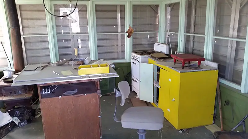
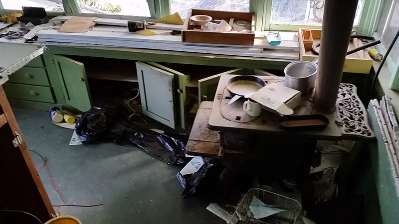
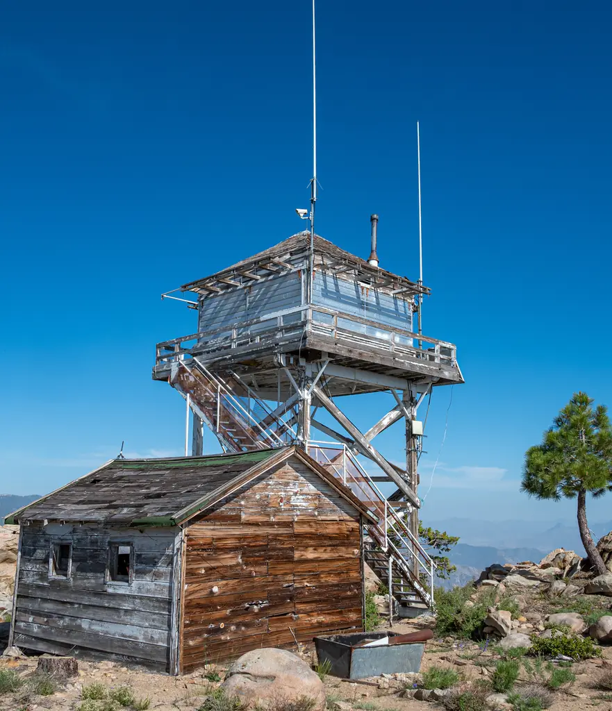
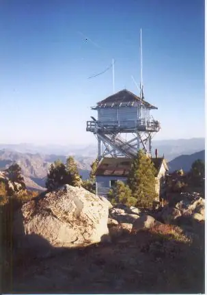
Photos keep their own rights and are shown with credit. Is one of these yours? You can ask for a different credit or for removal.
Where sources disagree
We show disagreements between sources instead of quietly picking one. If you know which is right, please tell us.
Sources disagree on the year it was built.
- NHLR: 1950
- California Fire Lookouts of the Sierra National Forest and Other Areas (fire-lookouts.org): 1943
Sources give different build years. Often one counts the first lookout on the site and another the structure there now.
Sources
- National Historic Lookout Register (NHLR) (opens another site) Gave us: name, location, county, elevation, wartime use, register numbers, agency, ownership, dates, photos, links National Historic Lookout Register (nhlr.org) · All rights reserved (American Resources, Inc.); facts extracted only, no prose copied. · retrieved 4 Oct 2026
- Forest Fire Lookout Association (FFLA) - US lookout lists (opens another site) Gave us: type, status, register numbers, links Forest Fire Lookout Association (firelookout.org) · No licence stated; facts extracted only, no prose copied. · retrieved 8 Oct 2026
- California Fire Lookouts of the Sierra National Forest and Other Areas (fire-lookouts.org) (opens another site) Gave us: design, register numbers, staffing, photos, links fire-lookouts.org · Public information per the site's disclaimer, credit requested. Facts + a short description reused under that permission -- see extra.license per record. · retrieved 4 Oct 2026
- FOREST LOOKOUTS -- western US (Ron Kemnow's weebly sites) (opens another site) Gave us: links Ron Kemnow's Forest Lookouts sites (westlookouts, californialookouts, idaholookouts, montanalookouts, oregonlookouts and washingtonlookouts .weebly.com) · No licence stated; facts only (county, land manager, status word, coordinates where the page's own map widget gives them, township-range-section, height and design hints, links). The site's own newspaper quotes, citations and narrative are not reproduced. · retrieved 8 Oct 2026
- Firefinder research Gave us: summary, design, height, status, agency, access, staffing, visiting details, dates, links, fact-check Firefinder research (sources cited in the story footnotes) · Our own research notes; each fact cites its source in the lookout's story
More about this lookout elsewhere
- NHLR register entry US 376 (nhlr.org) (opens another site)
- NHLR register entry (nhlr.org) (opens another site)
- Baker Point Lookout, Tulare County, California (Peakbagging.com) (opens another site)
- FFLA California lookout list (firelookout.org) (opens another site)
- Baker Point Lookout - Forest Lookouts Page (opens another site)
- Baker Point Trail - California Wilderness Coalition (opens another site)
- Baker Point Fire Lookout on fire-lookouts.org (Rich Camp) (opens another site)
Firefinder takes facts (places, dates, numbers) from these sources and writes its own words. See all sources and licences.