Fire lookout · Trinity County, California
Bonanza King Lookout
Trinity County summit lookout built to a 1934 Region 5 Plan 4AR design, with a WWII aircraft-warning cabin, fire-season staffing in the 1950s-60s, and good condition in 2009.
- Standing
- Open to the public
- Verified
Visit & stay
Not rentable. As far as we know, this lookout cannot be booked for overnight stays.
Access
Open to the public. Summit road about ten miles in from Highway 3; 4WD needed in the wet season and on the last half mile (2009 report). A road guide says 4WD is required and the road closes October 30 to May 1.
- Can you climb it?
- Unknown
- Road to the top?
- Yes, you can drive up
- Trail
- About ten miles in from Highway 3; 2WD for most of the road per the 2009 visit report; a road guide says 4WD is required
- Staffing
- Unknown
Facts
- Status
- Type
- Ground-level cabCalifornia Region 5 Plan 4AR wooden lookout house on a concrete and rock foundation; an Aircraft Warning Service residence cabin was added in WWIIThe design: D-5 (4-AR)
- Built of
- WoodGoing by its design; no source says so in words.
- Also served as
- Aircraft Warning Service postDuring the Second World War it was staffed to spot and report aircraft.
- Built
- 1934
- Height
- 955 ft (291.1 m)
- Elevation
- 6,956 ft (2,120 m)
- Agency
- U.S. Forest Service, Shasta-Trinity National Forest
- Land
- Federal land
- Location
- Trinity County, California
- Coordinates
- 41.08010, −122.62446 sources disagree
- Registers
- This entry
- VerifiedResearched, then checked independently. Updated 8 Oct 2026.
- Firefinder id
us-ca-bonanza-king
View from the cab
What you see from the cab: every ridge out to about 93 miles, the named peaks in sight, and other fire lookouts within view, worked out from terrain data in your browser.
Downloads about 3.8 MB of terrain data the first time.
Or see what it could see on the map: the ground in its line of sight.
History
Then and now
- 1924 EventNewspaper refers to a Bonanza King lookout station; telephone lines built to itSource: californialookouts.weebly.com
- 1929 EventLookout injured in a fall while searching for a fire on July 24; died in early AugustSource: californialookouts.weebly.com
- 1934 BuiltRegister date for the current California Region 5 Plan 4AR lookout houseSource: nhlr.org
- 1941 FireLookout Harry Churchman spotted a smoke plume 78 miles from his station and placed it on the Bogard District of the Lassen forestSource: californialookouts.weebly.com
- 1953 Condition assessmentCoast and Geodetic Survey station description of the lookout house: wooden, 16 ft square, about 20 ft tall, on a concrete and rock foundationSource: californialookouts.weebly.com
- 1954 StaffedJune Osborne opened the lookout May 20; Jeannie Dickson filling the post by mid-JuneSource: californialookouts.weebly.com
- 1962 StaffedBetty Carlson said she had been a lookout every fire season since 1962 (1987 article)Source: californialookouts.weebly.com
- No record between 1962 and 2009
- 2009 Condition assessmentVisit report: lookout in good shape, fresh deck paint, support buildings need paint, encroaching electronic sitesSource: nhlr.org
- 2015 Added to the National Historic Lookout RegisterRegistered January 3, 2015 as US 1056, CA 101; nominated by Mark BasqueSource: nhlr.org
- TodayStandingIt still stands, as far as our sources know.
Old maps of this spot
USGS topographic maps from the years a lookout stood may show it, often as a small symbol labelled “Lookout”. See the old topo maps around it on the Firefinder map, or find every scanned sheet of this spot on USGS TopoView (opens another site) (click the spot there to list them, with dates and downloads).
Story
Researched 8 Oct 2026, fact-checked.
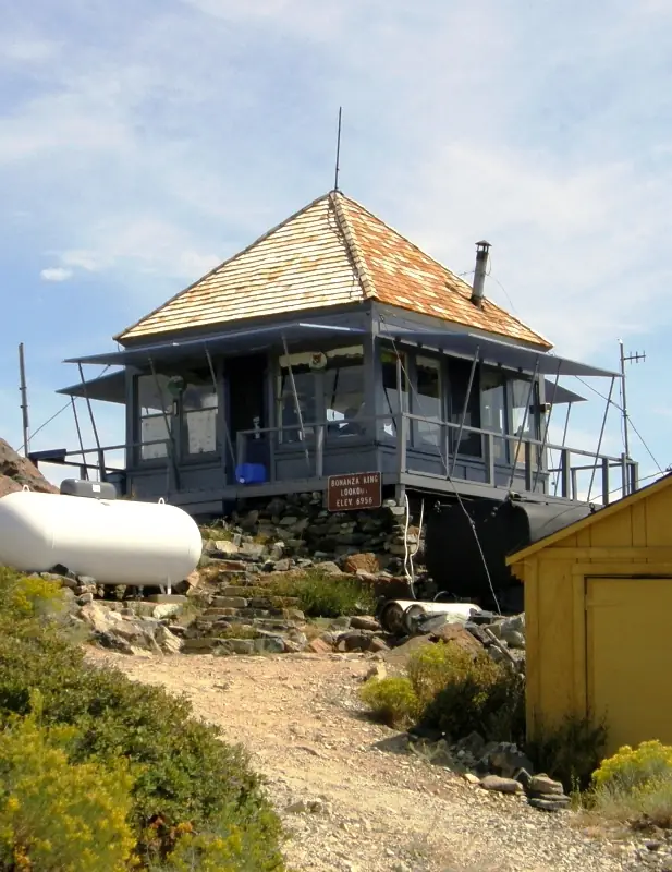
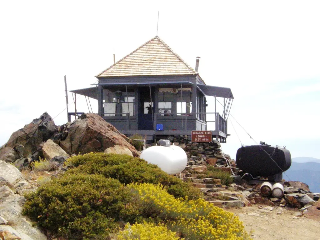
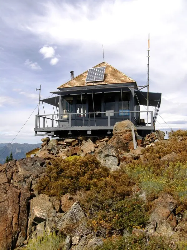
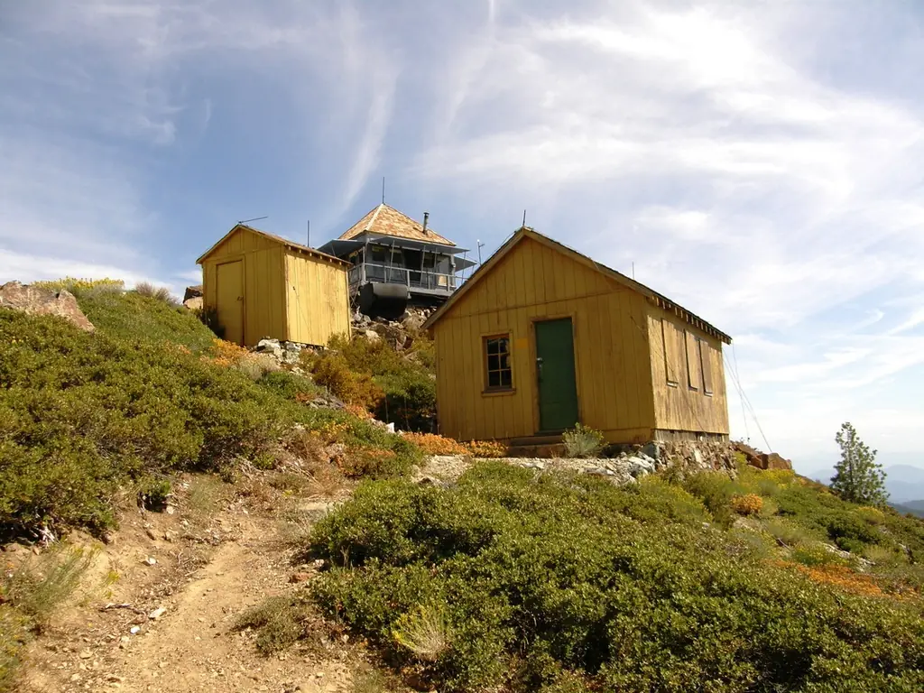
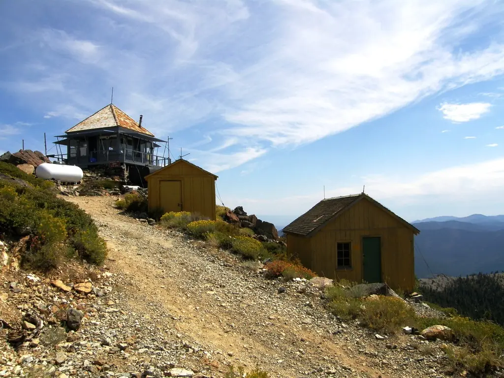
Bonanza King is a wooden lookout on the summit of Bonanza King Mountain, in Trinity County, northeast of Weaverville.1,2 The register gives the elevation as 6,956 feet and dates the lookout to 1934, when it was built to California Region 5 Plan 4AR. The register adds that the design was used very late in its life.1 A 1953 Coast and Geodetic Survey description gives the lookout house as wooden, about 16 feet square and 20 feet high, on a concrete and rock foundation on the extreme eastern rim, which is also the mountain's highest point.2 During World War II a residence cabin for the Aircraft Warning Service was added, which allowed round-the-clock staffing.1
The sources do not say what stood on the peak before the 1934 structure. A 1924 newspaper item already refers to a "Bonanza King lookout station."2
The newspaper record is patchy but telling. In July 1929 a lookout was searching for a fire with binoculars when he slipped on a rock and fell about ten feet.2 He died in Dunsmuir in early August.2 In the fall of 1941, Harry Churchman, the lookout, spotted a smoke plume 78 miles from his station and placed it on the Bogard District of the Lassen forest.2 Staffing passed between several lookouts.2 June Osborne opened the lookout on May 20, 1954, and by mid-June Jeannie Dickson had the post.2 Betty Carlson said she had been a lookout there every fire season since 1962, and a Forest Service fire officer quoted in a 1987 newspaper piece ranked her among the best the Shasta-Trinity forest has.2
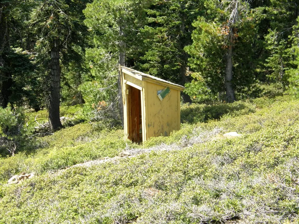
A November 2009 visit recorded in the register found the lookout in good shape, with fresh paint on the deck, though the support buildings still needed paint.1 The visitor also reported encroaching electronic sites, best guessed to be an agency repeater bunker and antennas.1 The register recorded the lookout on January 3, 2015, as US 1056, CA 101, after a nomination by Mark Basque.1
The summit is reached by a road that runs about ten miles in from Highway 3.1 The 2009 visit found it passable in 2WD for most of the way, with 4WD needed in the wet season and on the last half mile.1 A road guide disagrees about the vehicle.3 It describes the summit road as gravel and rocky, sometimes tippy and bumpy, says it needs 4WD, and gives a closure from October 30 to May 1.3 The same guide says the lookout is usually staffed in fire season, and it asks visitors not to go up when thunderstorms are in the area.3 The 2009 visitor found the lookout closed for the season when they stopped by.1 Check with the Shasta-Trinity office on current access and season dates before you go.
- Bonanza King Lookout, National Historic Lookout Register, http://nhlr.org/lookouts/us/ca/bonanza-king-lookout/ (accessed 2026-10-08). ↩
- Bonanza King - Forest Lookouts, California Lookouts (weebly), https://californialookouts.weebly.com/bonanza-king.html (accessed 2026-10-08). ↩
- Bonanza King, Dangerous Roads, https://www.dangerousroads.org/north-america/usa/9035-bonanza-king.html (accessed 2026-10-08). ↩
Photos
Photos keep their own rights and are shown with credit. Is one of these yours? You can ask for a different credit or for removal.
Where sources disagree
We show disagreements between sources instead of quietly picking one. If you know which is right, please tell us.
Sources disagree on the location by 1.7 km (1.1 mi).
- NHLR: 41.08010, −122.62446
- FOREST LOOKOUTS -- western US (Ron Kemnow's weebly sites): 41.09487, −122.63002
The map uses the position from NHLR.
Sources
- National Historic Lookout Register (NHLR) (opens another site) Gave us: name, location, county, elevation, what it is built of, wartime use, register numbers, agency, ownership, dates, photos, links National Historic Lookout Register (nhlr.org) · All rights reserved (American Resources, Inc.); facts extracted only, no prose copied. · retrieved 4 Oct 2026
- Forest Fire Lookout Association (FFLA) - US lookout lists (opens another site) Gave us: type, status, register numbers, links Forest Fire Lookout Association (firelookout.org) · No licence stated; facts extracted only, no prose copied. · retrieved 8 Oct 2026
- OpenStreetMap -- fire lookout structures (opens another site) Gave us: links © OpenStreetMap contributors · ODbL 1.0. (c) OpenStreetMap contributors. · retrieved 4 Oct 2026
- FOREST LOOKOUTS -- western US (Ron Kemnow's weebly sites) (opens another site) Gave us: height Ron Kemnow's Forest Lookouts sites (westlookouts, californialookouts, idaholookouts, montanalookouts, oregonlookouts and washingtonlookouts .weebly.com) · No licence stated; facts only (county, land manager, status word, coordinates where the page's own map widget gives them, township-range-section, height and design hints, links). The site's own newspaper quotes, citations and narrative are not reproduced. · retrieved 8 Oct 2026
- Firefinder research Gave us: summary, design, agency, access, visiting details, dates, links, fact-check Firefinder research (sources cited in the story footnotes) · Our own research notes; each fact cites its source in the lookout's story
More about this lookout elsewhere
- NHLR register entry US 1056 (nhlr.org) (opens another site)
- Bonanza King (Dangerous Roads) (opens another site)
- FFLA California lookout list (firelookout.org) (opens another site)
- Bonanza King Lookout - Forest Lookouts Page (opens another site)
- OpenStreetMap node 8973086102 (opens another site)
Firefinder takes facts (places, dates, numbers) from these sources and writes its own words. See all sources and licences.