Fire lookout · Tehama County, California
Brokeoff Mountain Lookout Site
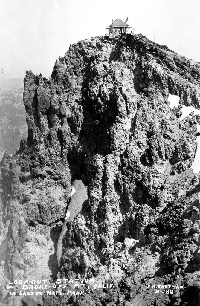
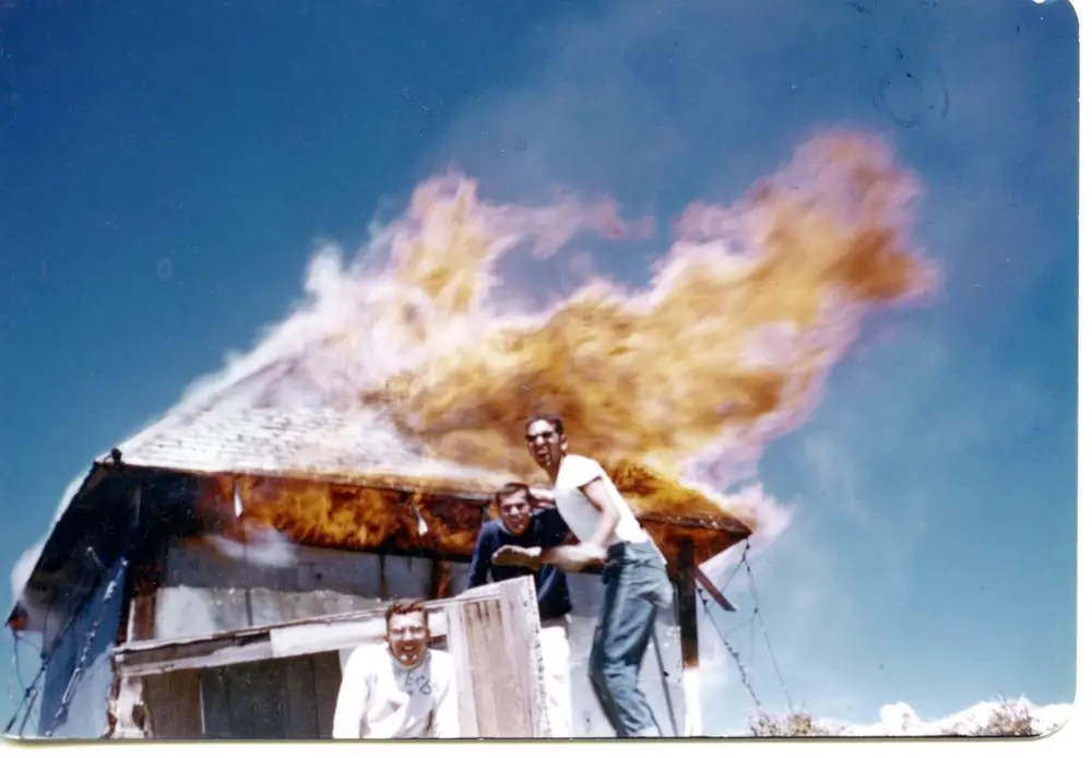
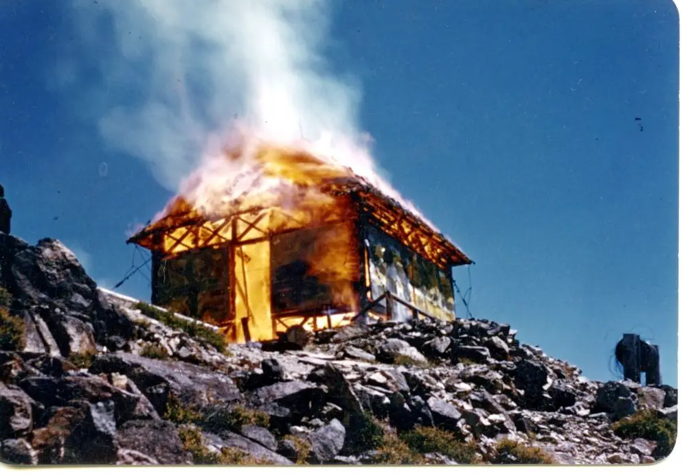
Lassen Volcanic lookout: an earlier station burned in 1915; the 1924 cabin was staffed by John Gransbury; the register says it was demolished in 1956 with nothing left, while Forest Lookouts says a trail crew burned it; the summit is a 7.4-mile round-trip hike.
- Gone
- Open to the public
- Verified
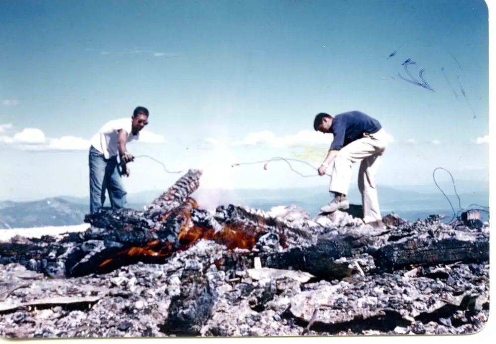
Gone: The lookout no longer stands. Only the site is left. The register says the tower was demolished in 1956 and nothing remains at the site; Forest Lookouts says a trail maintenance crew burned it that year.
Visit & stay
Gone: site only. The lookout no longer stands, so there is nothing to climb or rent. You may still be able to visit the site.
Access
Open to the public. Hiking trail in Lassen Volcanic National Park, starting at the Brokeoff Mountain parking lot near the southwest entrance.
- Road to the top?
- Unknown
- Trail
- Round trip 7.4 miles, about 6 hours; rocky, forested and alpine terrain; considered one of the toughest trails in the park.
Facts
- Status
- Type
- Ground-level cabCalifornia Region 5 Plan 4AR ground cabinThe design: D-5 (4-AR)
- Built of
- WoodGoing by its design; no source says so in words.
- Built
- 1924
- Height
- Unknown
- Elevation
- 9,127 ft (2,782 m)
- Agency
- National Park Service, Lassen Volcanic National Park
- Land
- Federal land
- Location
- Tehama County, California
- Coordinates
- 40.44560, −121.55959
- Registers
- This entry
- VerifiedResearched, then checked independently. Updated 9 Oct 2026.
- Firefinder id
us-ca-brokeoff-mountain
View from the cab
What the lookout saw from its cab: every ridge out to about 93 miles, the named peaks in sight, and other fire lookouts within view, worked out from terrain data in your browser.
This lookout is gone. The view is reconstructed from its recorded site and a typical height for a lookout like it.
Downloads about 3.3 MB of terrain data the first time.
Or see what it could see on the map: the ground in its line of sight.
History
Then and now
- 1915 BurnedEarlier frame-platform station under a canvas tent totally destroyed by fire; ranger Frank Hardin was away; report dated July 30, 1915Source: californialookouts.weebly.com
- 1924 BuiltCalifornia Region 5 Plan 4AR ground cabinSource: firetower.org
- 1924 StaffedJohn Gransbury held the lookout job from 1924, per a 1934 newspaperSource: californialookouts.weebly.com
- 1929 EventForest Ranger Hudson, in charge of the station, reported an eruption from the main peak of Mount Lassen (August 1929 item)Source: californialookouts.weebly.com
- No record between 1929 and 1956
- 1956 RemovedTower demolished per the register, which says nothing remains at the site; Forest Lookouts says it was burned by a trail maintenance crewSources: firetower.org, californialookouts.weebly.com
- No record between 1956 and 2020
- 2020 Added to the Former Fire Lookout Sites RegisterRegistered April 24, 2020Source: firetower.org
- TodayGoneThe lookout no longer stands. Only the site is left.
Old maps of this spot
USGS topographic maps from the years a lookout stood may show it, often as a small symbol labelled “Lookout”. See the old topo maps around it on the Firefinder map, or find every scanned sheet of this spot on USGS TopoView (opens another site) (click the spot there to list them, with dates and downloads).
Story
Researched 9 Oct 2026, fact-checked.
Brokeoff Mountain is the Tehama County high point. A lookout station was already on it in 1915, years before the cabin the register dates to 1924.1,2
A July 30, 1915 newspaper report says fire totally destroyed that station on a Wednesday evening.2 The station was a framed platform topped with a heavy canvas tent. Ranger Frank Hardin was away when the fire started, and the paper said the probable cause was live coals from his cook stove.2 The paper expected the station to be rebuilt, with a tent for shelter in the meantime.2
The register dates a later cabin to 1924 and calls it a California Region 5 Plan 4AR ground cabin.1
John Gransbury staffed the lookout for years after that.2 A 1934 newspaper said he had held the lookout job since 1924. A 1935 article said he had held the post for 11 years, going up about June 1 and coming down when the fall rains had removed the fire hazard.2 That article describes the station as a small building about 12 by 12 feet, fixed to the bare rock with heavy cables.2
The height figures disagree. A 1933 newspaper gave 9,232 feet, a 1935 article said 9,400 feet, the register gives 9,127 feet for the site, and the Park Service trail listing runs up to 9,235 feet.2,1,3
In August 1929 Forest Ranger Hudson, in charge of the station, reported an eruption from the main peak of Mount Lassen, with smoke and steam spouting 6,000 feet into the air.2 In June 1935 John Gransbury reported that his tower rocked violently from earth shocks near Lassen Peak.2
The register says the tower was demolished in 1956 and that nothing remains at the site.1 The Forest Lookouts page gives a different account, saying a trail maintenance crew burned the lookout that year.2
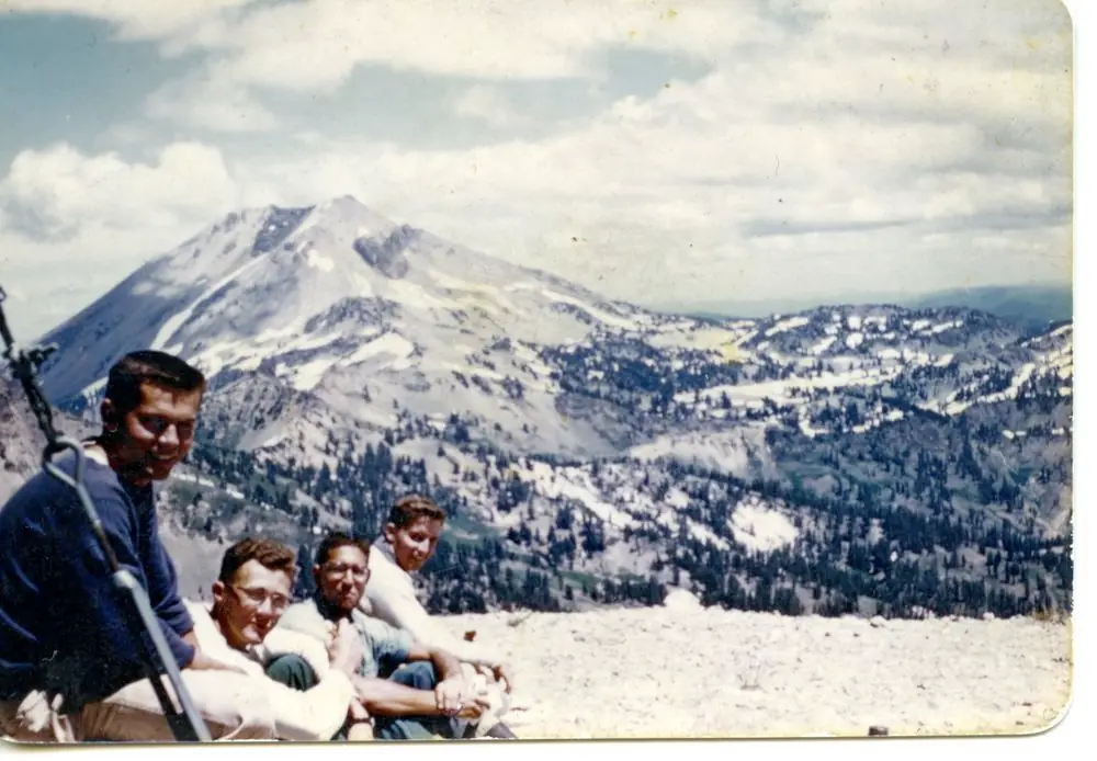
Lassen Volcanic National Park now manages the mountain.1,3 Its trail starts at the Brokeoff Mountain parking lot near the southwest entrance and runs 7.4 miles round trip, about six hours, over rocky, forested and alpine ground.3 The trail is considered one of the toughest in the park, and the view from the summit takes in the old Brokeoff Volcano caldera.3 With no lookout left to see, a visit is a hike for the mountain and its views.1,3
- Brokeoff Mountain Lookout Site, Former Fire Lookout Sites, http://firetower.org/lookouts/us/ca/brokeoff-mountain-lookout-site/ (accessed 2026-10-09). ↩
- Brokeoff Mountain, Forest Lookouts, https://californialookouts.weebly.com/brokeoff-mountain.html (accessed 2026-10-09). ↩
- Hiking Brokeoff Mountain Trail, Lassen Volcanic National Park, National Park Service, https://www.nps.gov/lavo/planyourvisit/hiking_brokeoff_mountain.htm (accessed 2026-10-09). ↩
Photos
Photos keep their own rights and are shown with credit. Is one of these yours? You can ask for a different credit or for removal.
Sources
- Former Fire Lookout Sites Register (FFLOS) (opens another site) Gave us: name, county, elevation, what it is built of, register numbers, agency, ownership, dates, photos, links Former Fire Lookout Sites Register (firetower.org) · All rights reserved (American Resources, Inc.); facts extracted only, no prose copied. · retrieved 4 Oct 2026
- Forest Fire Lookout Association (FFLA) - US lookout lists (opens another site) Gave us: location, type, status, register numbers, links Forest Fire Lookout Association (firelookout.org) · No licence stated; facts extracted only, no prose copied. · retrieved 8 Oct 2026
- FOREST LOOKOUTS -- western US (Ron Kemnow's weebly sites) (opens another site) Ron Kemnow's Forest Lookouts sites (westlookouts, californialookouts, idaholookouts, montanalookouts, oregonlookouts and washingtonlookouts .weebly.com) · No licence stated; facts only (county, land manager, status word, coordinates where the page's own map widget gives them, township-range-section, height and design hints, links). The site's own newspaper quotes, citations and narrative are not reproduced. · retrieved 8 Oct 2026
- Firefinder research Gave us: summary, design, status, agency, access, visiting details, dates, links, fact-check Firefinder research (sources cited in the story footnotes) · Our own research notes; each fact cites its source in the lookout's story
More about this lookout elsewhere
- FFLOS register entry US 2046 (firetower.org) (opens another site)
- Hiking Brokeoff Mountain Trail (Lassen Volcanic National Park, National Park Service) (opens another site)
- FFLA California lookout list (firelookout.org) (opens another site)
- Brokeoff Mountain Lookout - Forest Lookouts Page (opens another site)
Firefinder takes facts (places, dates, numbers) from these sources and writes its own words. See all sources and licences.