Fire lookout · Monterey County, California
Chews Ridge Lookout
Los Padres NF lookout: built 1924 or 1929 (sources disagree), cab burned in 1977, restored by volunteers in 2019, and the chapter is running a $20,000 campaign to preserve it, with a full roof replacement now needed.
- Standing
- Restricted access
- Verified
Visit & stay
Not rentable. As far as we know, this lookout cannot be booked for overnight stays.
Access
Restricted access
Access is seasonal, gated or needs a permit. Check before you go. volunteer-staffed working lookout on Forest Service land; no public visiting program described in the sources
- Can you climb it?
- Unknown
- Road to the top?
- Yes, you can drive up
- Trail
- reached from Carmel Valley Road by about 9 miles of Forest Route 18S02 / Tassajara Road, most of it unpaved; high clearance needed on some stretches
- Staffing
- Staffed by volunteers
Facts
- Status
- Type
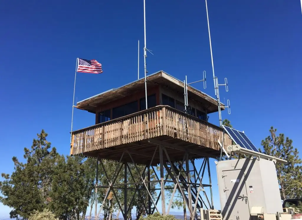
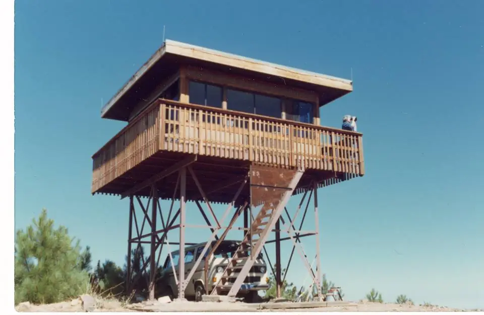
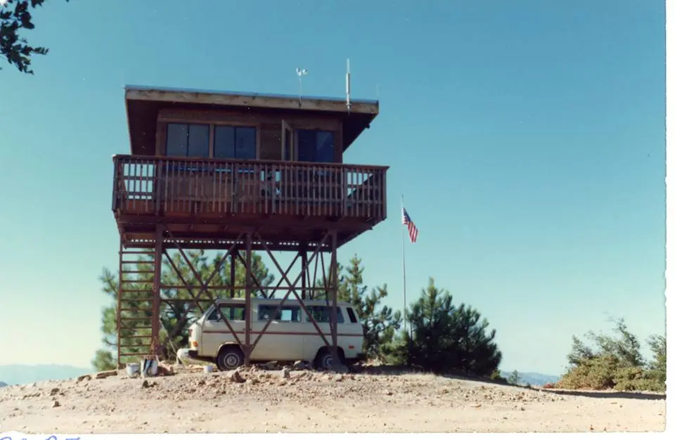
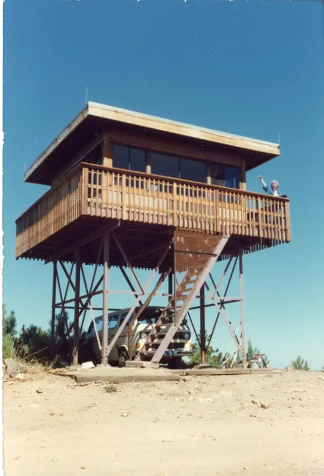
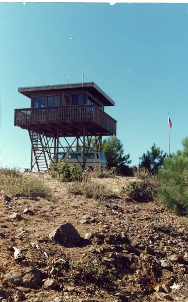
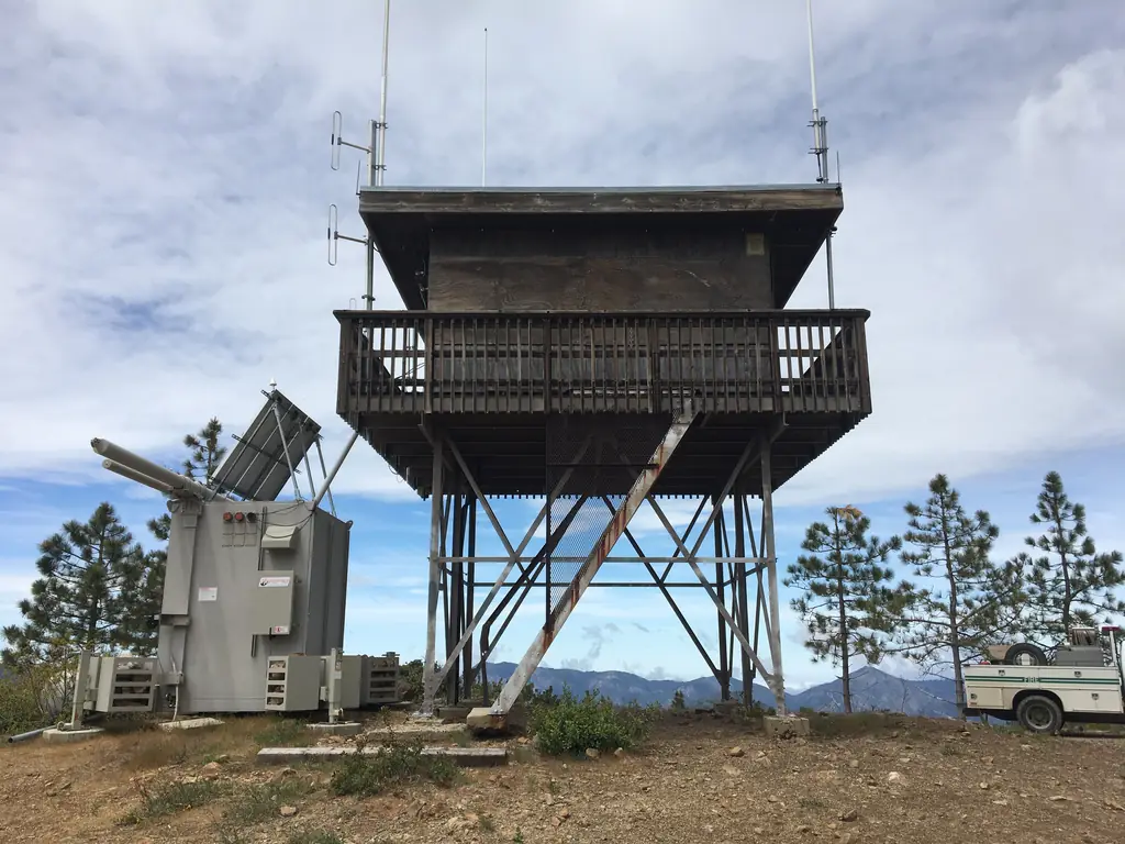
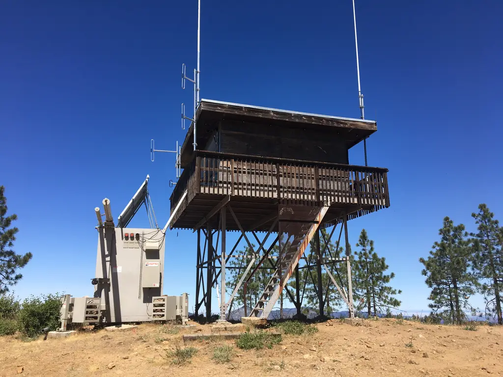
- Cab on a towersteel-frame tower under a 13 x 13 ft cab; flat-roofed R-6 style cab since 1984The design: R-6
- Built of
- Steel
- Built
- 1924
- Height
- 24 ft (7.3 m)
- Elevation
- 5,043 ft (1,537 m)
- Agency
- U.S. Forest Service
- Land
- Federal land
- Location
- Monterey County, California
- Coordinates
- 36.31083, −121.56833
- Registers
- This entry
- VerifiedResearched, then checked independently. Updated 8 Oct 2026.
- Firefinder id
us-ca-chews-ridge
View from the cab
What you see from the cab: every ridge out to about 93 miles, the named peaks in sight, and other fire lookouts within view, worked out from terrain data in your browser.
Downloads about 3.3 MB of terrain data the first time.
Or see what it could see on the map: the ground in its line of sight.
History
Then and now
- 1919 Eventa family lived in a government-owned cabin at the summit that also served as a fire lookoutSource: en.wikipedia.org
- 1924 BuiltNHLR gives 1924 for the 12-foot metal tower; Wikipedia dates the current tower to 1929Source: nhlr.org
- 1929 BuiltWikipedia dates the current 12-foot steel tower and 13 x 13 ft cab to 1929Source: en.wikipedia.org
- No record between 1929 and 1977
- 1977 Destroyedcab destroyed by fire in 1977 (Marble Cone Fire per Wikipedia)Sources: nhlr.org, en.wikipedia.org
- 1978 Rebuiltcab rebuilt after the 1977 fireSources: nhlr.org, en.wikipedia.org
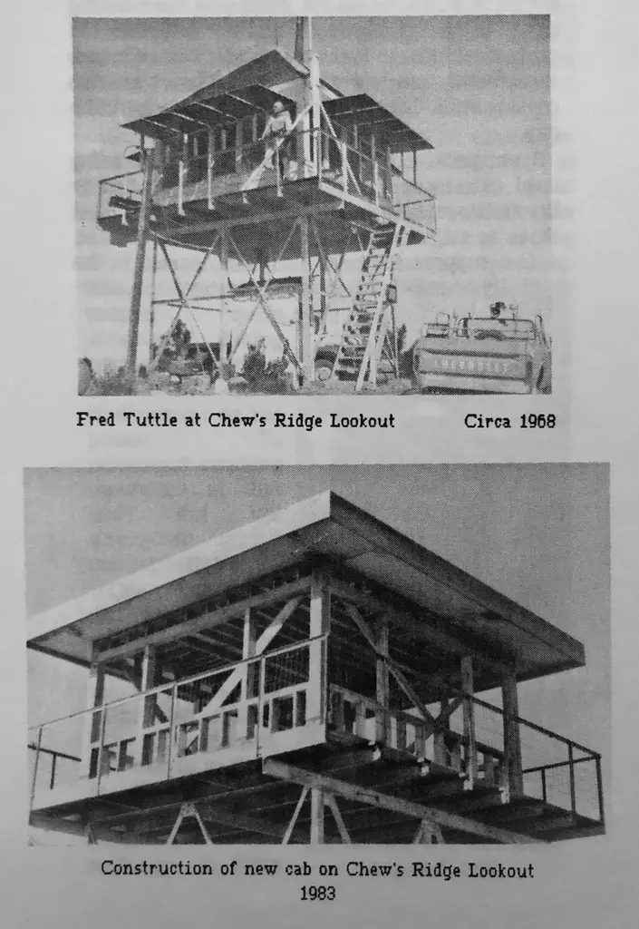
- 1984 Replaced by a new structurecab replaced with a standard R-6 flat-roof design with catwalkSources: nhlr.org, en.wikipedia.org
- 1990 Last staffedtaken out of service about 1990 (NHLR); not staffed by the Forest Service since about 1990 (Wikipedia)Sources: nhlr.org, en.wikipedia.org
- No record between 1990 and 2008
- 2008 Added to the National Historic Lookout Registerregistered on the National Historic Lookout RegisterSource: nhlr.org
- 2019 Restoredrestored by FFLA Monterey volunteers with Los Padres NF approvalSources: nhlr.org, ffla-monterey.org, firelookout.org
- 2019 Staffedvolunteer staffing began in August 2019Source: en.wikipedia.org
- 2025 EventFFLA gave a $500 sustainment grant toward the roof replacement fundraising after storm damage.Sources: firelookout.org, firelookout.org
- TodayStandingIt still stands, as far as our sources know.
Old maps of this spot
USGS topographic maps from the years a lookout stood may show it, often as a small symbol labelled “Lookout”. See the old topo maps around it on the Firefinder map, or find every scanned sheet of this spot on USGS TopoView (opens another site) (click the spot there to list them, with dates and downloads).
Story
Researched 8 Oct 2026, fact-checked.
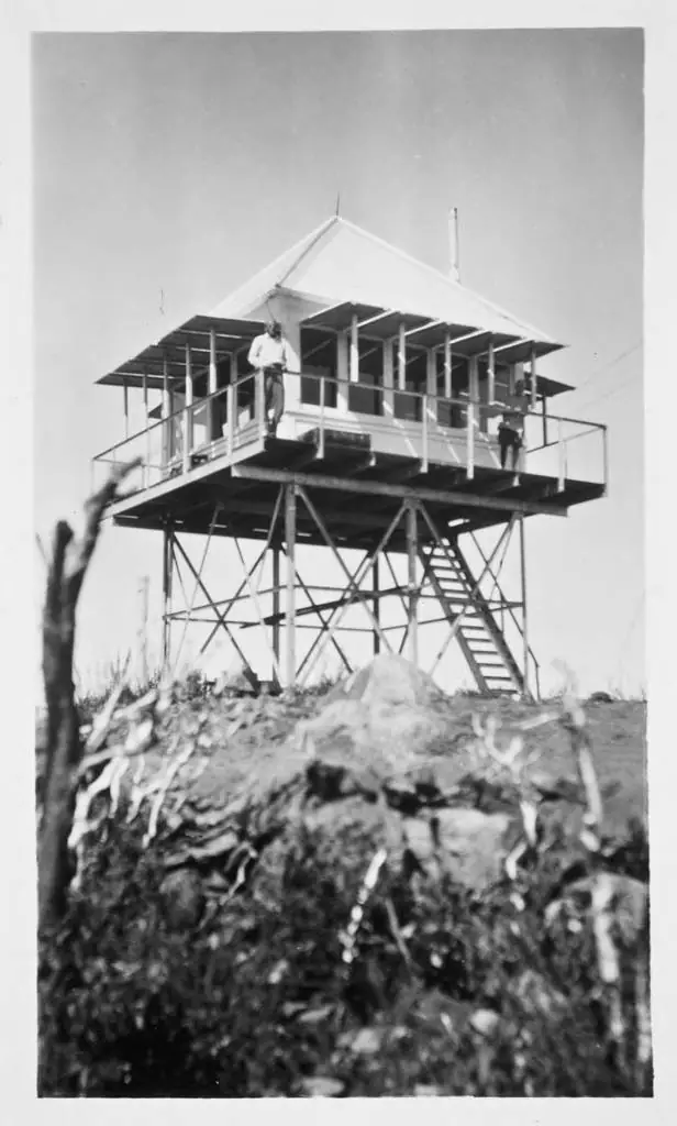
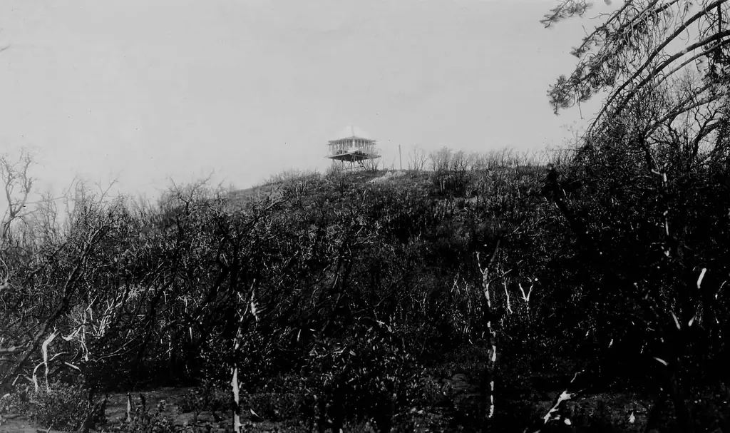
Chews Ridge Lookout sits at the northern end of the Santa Lucia Range in the Los Padres National Forest, about 50 miles southeast of Monterey.1 A family lived in a government-owned cabin at the summit in 1919, and that cabin also served as a lookout.1 Sources disagree on when the current tower went up. The National Historic Lookout Register says it was built in 1924, while Wikipedia dates the current steel tower and cab to 1929.2,1 I could not settle that from the sources I read.
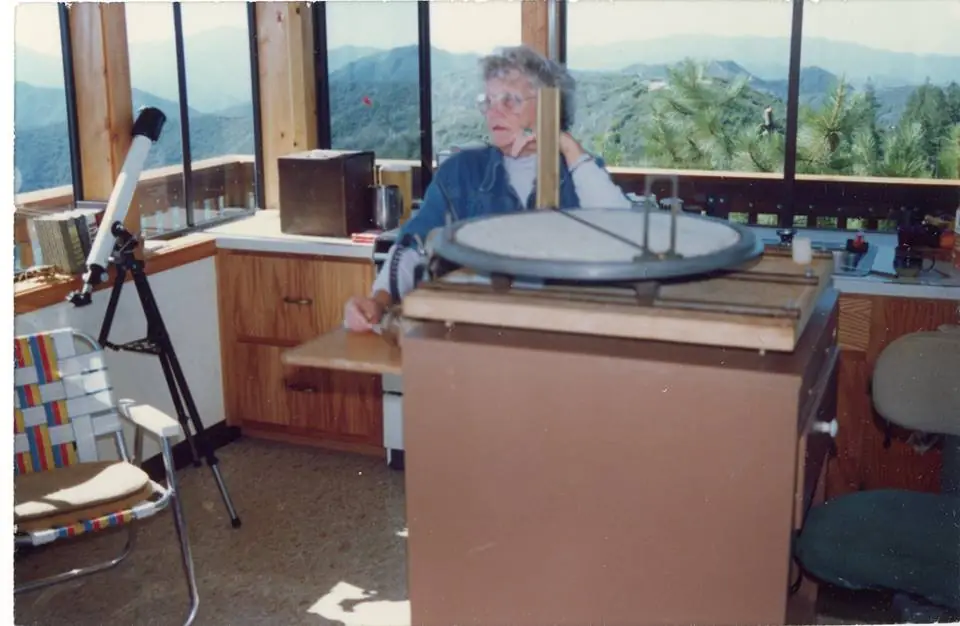
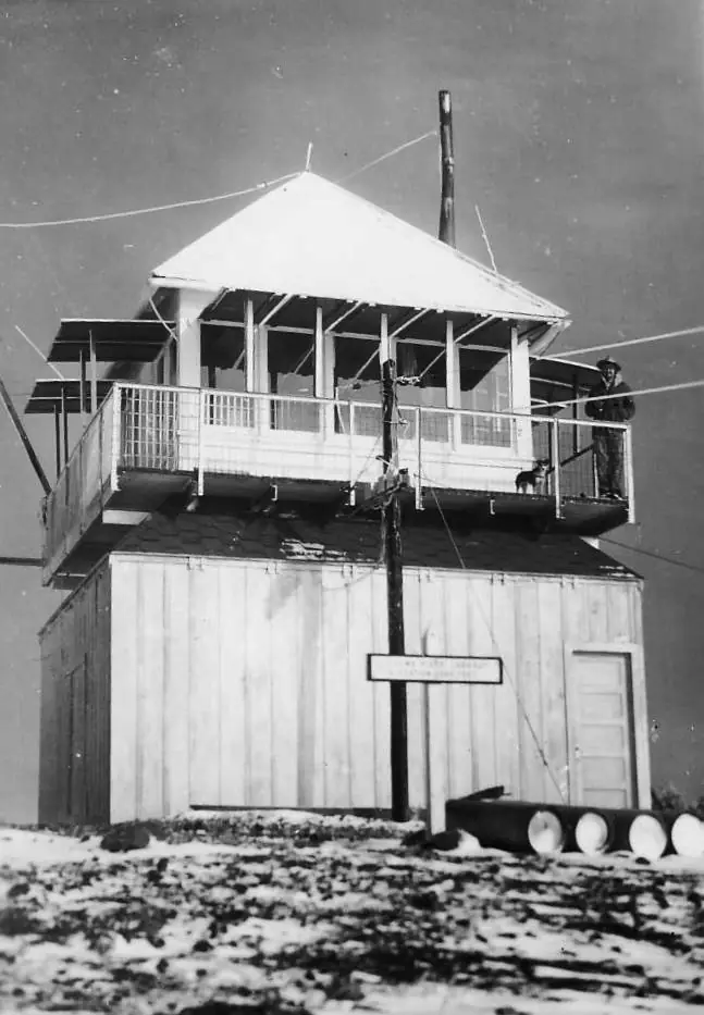
Beginning in the 1940s the tower was staffed seasonally. C. C. Yates and his wife of Arroyo Grande worked it each season, and they kept at it through the 1950s.1
A fire destroyed the cab in 1977, and it was rebuilt the following year.2,1 Wikipedia names the blaze as the Marble Cone Fire.1 In 1984 the cab was replaced with a standard R-6 design, with a catwalk and a flat roof.1
The Forest Service stopped staffing the tower around 1990, and afterward it housed radio repeater equipment and antennas.2,1
In 2019 the Monterey chapter of the Forest Fire Lookout Association restored the tower, with approval from the Los Padres National Forest.2,3 Volunteers began staffing it that August.1
The chapter says dozens of trained volunteers have staffed the tower since then. Its site also reports that wind has torn whole sections off the roof, that a full roof replacement is now needed, and that it is running a campaign to raise $20,000 to preserve the lookout.4
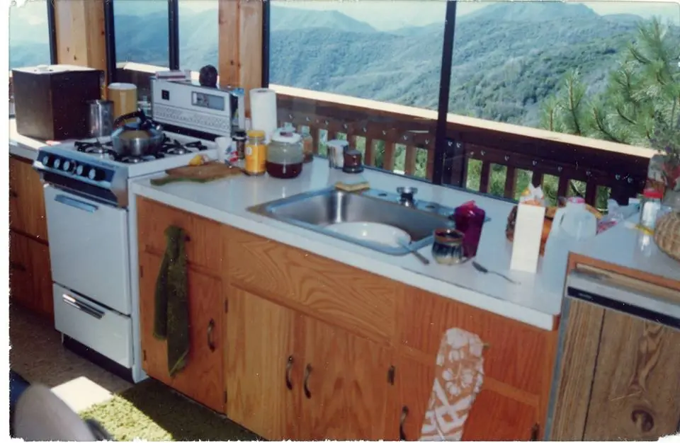
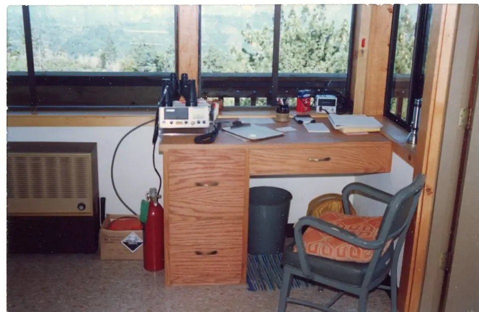
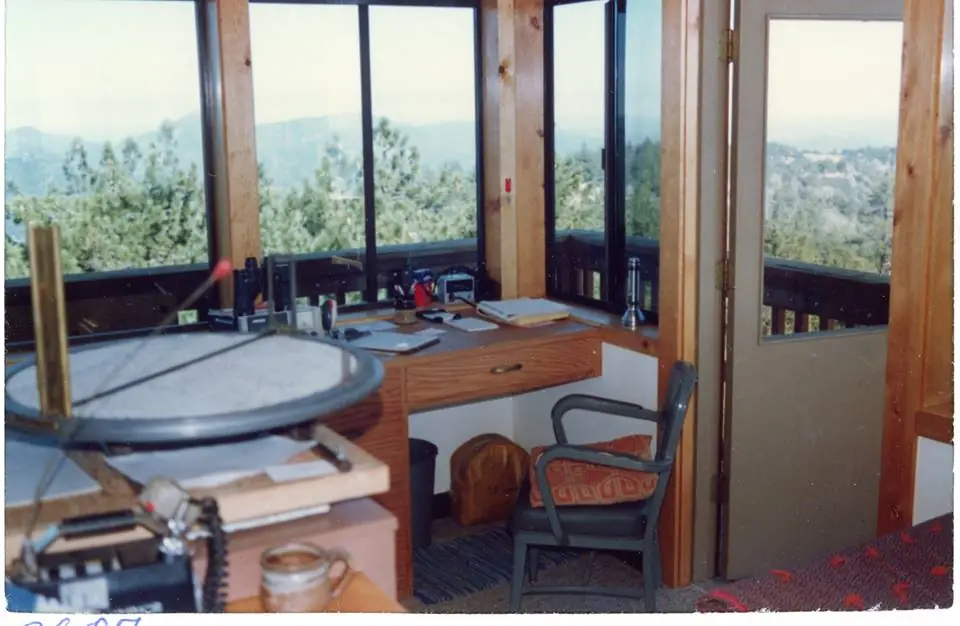
Getting there is a drive. The route runs from Carmel Valley Road about nine miles south on Tassajara Road, and most of that road is unpaved.1 Inside the cab there is no running water, electricity, or heat, and the stairs up are steep and narrow.1
Because a volunteer group runs the tower on national forest land, treat it as a working lookout and check with the chapter before planning any visit.1,4
- Chews Ridge Lookout, Wikipedia, https://en.wikipedia.org/wiki/Chews_Ridge_Lookout (accessed 2026-10-08). ↩
- Chews Ridge Lookout, National Historic Lookout Register, http://nhlr.org/lookouts/us/ca/chews-ridge-lookout/ (accessed 2026-10-08). ↩
- 2019 Year-End Report, California South Region, Forest Fire Lookout Association, https://firelookout.org/wp-content/uploads/2024/11/cr-ca-south-2019.pdf (accessed 2026-10-08). ↩
- Monterey Chapter, Forest Fire Lookout Association, https://ffla-monterey.org/ (accessed 2026-10-08). ↩
Photos
Photos keep their own rights and are shown with credit. Is one of these yours? You can ask for a different credit or for removal.
Sources
- National Historic Lookout Register (NHLR) (opens another site) Gave us: name, location, county, elevation, what it is built of, register numbers, agency, ownership, dates, photos, links National Historic Lookout Register (nhlr.org) · All rights reserved (American Resources, Inc.); facts extracted only, no prose copied. · retrieved 4 Oct 2026
- Forest Fire Lookout Association (FFLA) - US lookout lists (opens another site) Gave us: type, status, register numbers, links Forest Fire Lookout Association (firelookout.org) · No licence stated; facts extracted only, no prose copied. · retrieved 8 Oct 2026
- FFLA Monterey Chapter (opens another site) Gave us: design, staffing, dates, links Forest Fire Lookout Association, Monterey Chapter (ffla-monterey.org) · No licence stated; facts only (dates, the kind of work done). Every note is our own wording and the events link to the chapter's page. The position is copied from the NHLR record. · retrieved 8 Oct 2026
- Forest Fire Lookout Association chapter reports (opens another site) Gave us: dates, links Forest Fire Lookout Association, chapter and restoration-grant reports (firelookout.org) · No licence stated; facts only (dates, names, the kind of work done). Every note is our own wording and every event links to the FFLA report it comes from. Positions are copied from the NHLR, FFLOS and FFLA records. · retrieved 8 Oct 2026
- Wikidata -- US fire lookout towers (Q748998 and subclasses) (opens another site) Gave us: links Wikidata · CC0 1.0 (Wikidata). Images keep their own Commons licence/credit. · retrieved 4 Oct 2026
- OpenStreetMap -- fire lookout structures (opens another site) Gave us: height, links © OpenStreetMap contributors · ODbL 1.0. (c) OpenStreetMap contributors. · retrieved 4 Oct 2026
- FOREST LOOKOUTS -- western US (Ron Kemnow's weebly sites) (opens another site) Gave us: links Ron Kemnow's Forest Lookouts sites (westlookouts, californialookouts, idaholookouts, montanalookouts, oregonlookouts and washingtonlookouts .weebly.com) · No licence stated; facts only (county, land manager, status word, coordinates where the page's own map widget gives them, township-range-section, height and design hints, links). The site's own newspaper quotes, citations and narrative are not reproduced. · retrieved 8 Oct 2026
- FFLA chapters, affiliates and Friends groups: lookout pages (opens another site) Gave us: register numbers, links FFLA chapters and Friends groups (each link names the group) · Links to the groups' own pages; facts only from the California-South chapter's tower table (register page, operator, condition). No text or photos reproduced. · retrieved 8 Oct 2026
- Firefinder research Gave us: summary, design, height, status, agency, access, visiting details, dates, links, fact-check Firefinder research (sources cited in the story footnotes) · Our own research notes; each fact cites its source in the lookout's story
More about this lookout elsewhere
- NHLR register entry US 751 (nhlr.org) (opens another site)
- NHLR register entry (nhlr.org) (opens another site)
- Monterey Chapter, Forest Fire Lookout Association (FFLA Monterey) (opens another site)
- 2019 Year-End Report, California South Region (Forest Fire Lookout Association) (opens another site)
- FFLA California lookout list (firelookout.org) (opens another site)
- FFLA Monterey Chapter: work on Chews Ridge Lookout (opens another site)
- Forest Fire Lookout Association chapter reports: work on Chews Ridge Lookout (opens another site)
- FFLA California-South chapter: Southern California lookouts (opens another site)
- Wikipedia: Chews Ridge Lookout (opens another site)
- Chews Ridge on Forest Lookouts, western US (Ron Kemnow) (opens another site)
- Wikidata item Q96418109 (opens another site)
- OpenStreetMap way 203441541 (opens another site)
Firefinder takes facts (places, dates, numbers) from these sources and writes its own words. See all sources and licences.