Fire lookout · Shasta County, California
Girard Ridge Fire Lookout
The oldest surviving lookout of its design in California, built 1931 on Shasta-Trinity NF, staffed until 1981, restored in 1997 and rentable since 1998.
- Standing
- Rentable
- Open to the public
- Verified
Visit & stay
You can rent this lookout for overnight stays through recreation.gov.
- Getting there
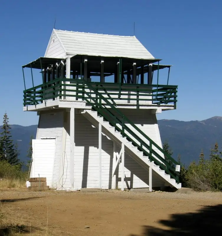
- Facilities Girard Ridge Lookout stands 13 feet off the ground and is accessed via a flight of stairs.
Rules
- Pack out all trash
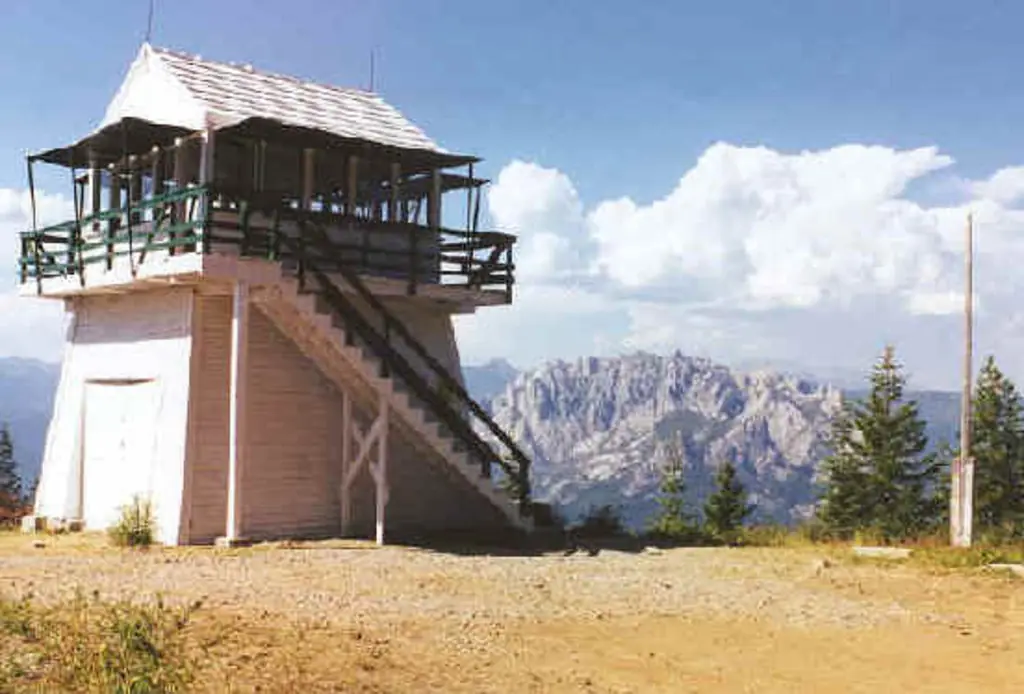
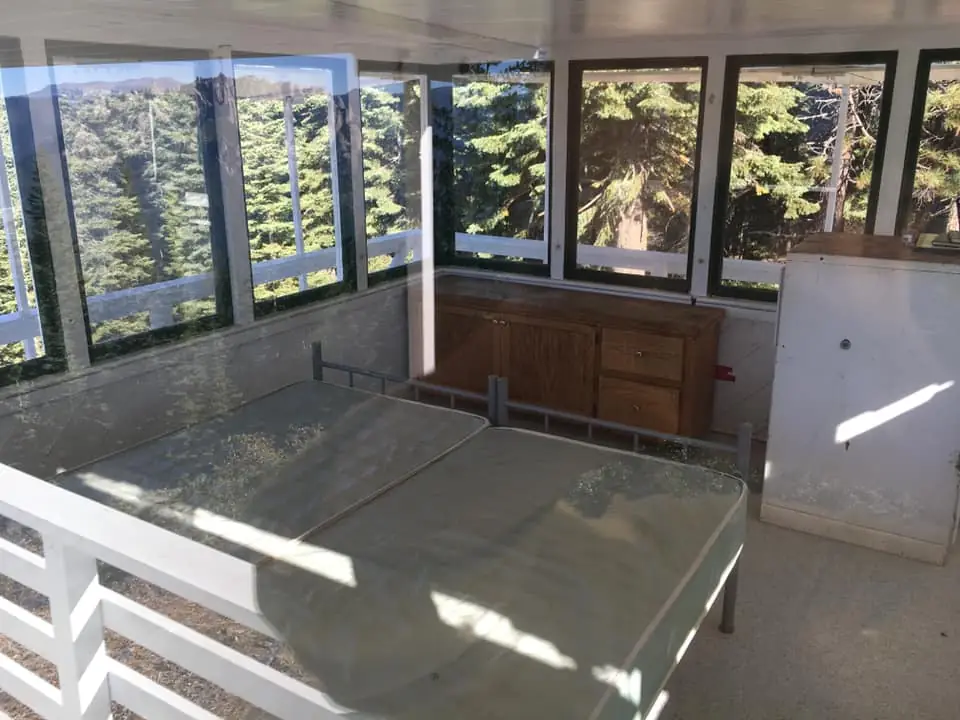
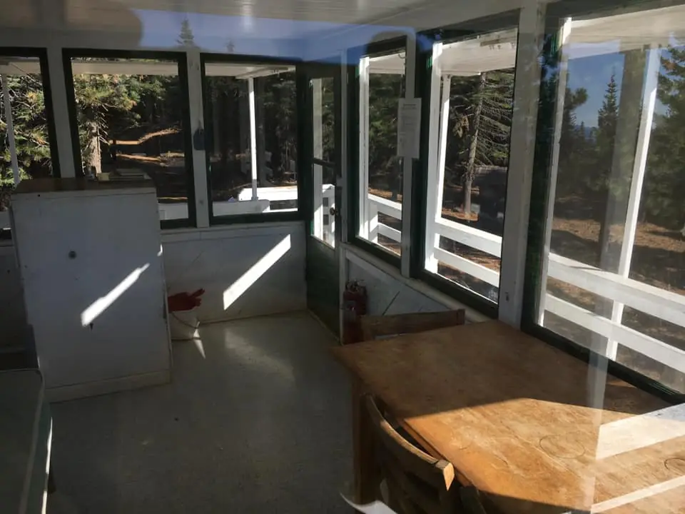
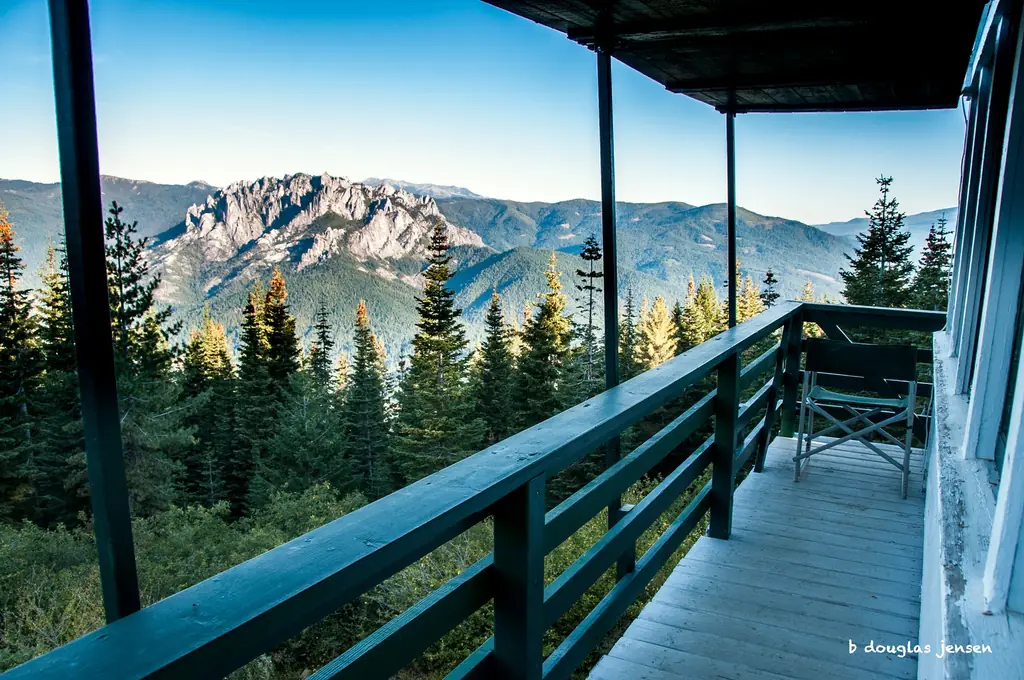
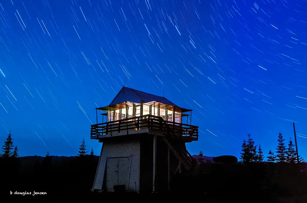
Overview Girard Ridge Lookout was constructed in 1931 and used by the Forest Service on a regular basis until 1981. It is one of the few remaining historic lookouts on the Shasta-Trinity National Forest. The structure at Girard Ridge is reportedly the oldest lookout of its particular design remaining in California. It was restored to its original character in 1997. The lookout offers primitive accommodations, but visitors are rewarded with panoramic views of the mountains during the day and bright, starry skies at night. Staying at Girard Ridge Lookout is an unforgettable experience. Recreation While the main recreation at Girard Ridge Lookout is enjoying the scenery, there are opportunities to hike, hunt, and fish. Hikers can walk north on the Forest Service road for 3 miles from the lookout to where it meets the Pacific Crest Trail. Facilities Girard Ridge Lookout stands 13 feet off the ground and is accessed via a flight of stairs. It has a standard 14x14 foot cabin with a gable roof and exterior catwalk. There is a separate building with a vault toilet that is accessed by going down the stairs and walking about 30 feet. The cabin offers two twin beds with mattresses. Cabinets are available for storage and there is a table for eating. Visitors have access to cleaning supplies, including a mop, broom, and cleansers. The lookout has no cooking facilities, no water and no electricity. Visitors are required to bring water. A heat source is needed in cooler temperatures. There are no dishes, utensils, cookware, linens or bedding at the lookout. Visitors must bring garbage bags to pack out trash. The use of portable stoves using gas, jellied petroleum or pressurized liquid fuel is allowed with a valid California campfire permit, but no wood or charcoal fires are permitted ( Click here for more information about Girard Ridge Lookout). Natural Features The lookout is located above the Sacramento River Canyon at a height of 4,809 feet. Spectacular views of Mount Shasta are seen to the north, the gray spires of the Castle Crags frame almost the entire view to the west and the distant silhouette of Lassen Peak can be seen to the southeast. Girard Ridge Lookout is surrounded by northern California mixed conifer forest. Bears and other animals live in the surrounding forest (click here for information on bear safety). Nearby Attractions Castle Crags State Park is nearby, offering hiking trails, including access to the Castle Crags Wilderness in the Shasta-Trinity National Forest, and the chance to fish and swim in the Sacramento River. Charges & Cancellations A $10.00 service fee will apply if you change or cancel your reservation. Late cancellations are subject to additional fees. For full details see NRRS Reservation Policy
Book on recreation.gov (opens recreation.gov)
Rental details from recreation.gov, checked 19 Oct 2026. Rules, fees and seasons change, so confirm on the booking page before you go. Data source: ridb.recreation.gov
Access
Open to the public. Forest Service rental; reached by steep, narrow dirt roads through private timberland with active log-truck traffic; gate combination must be requested a week ahead by phone.
- Can you climb it?
- No
- Road to the top?
- Yes, you can drive up
- Trail
- High-clearance vehicle recommended; hiking north 3 miles reaches the Pacific Crest Trail.
- Staffing
- Unknown
Facts
- Status
- Type
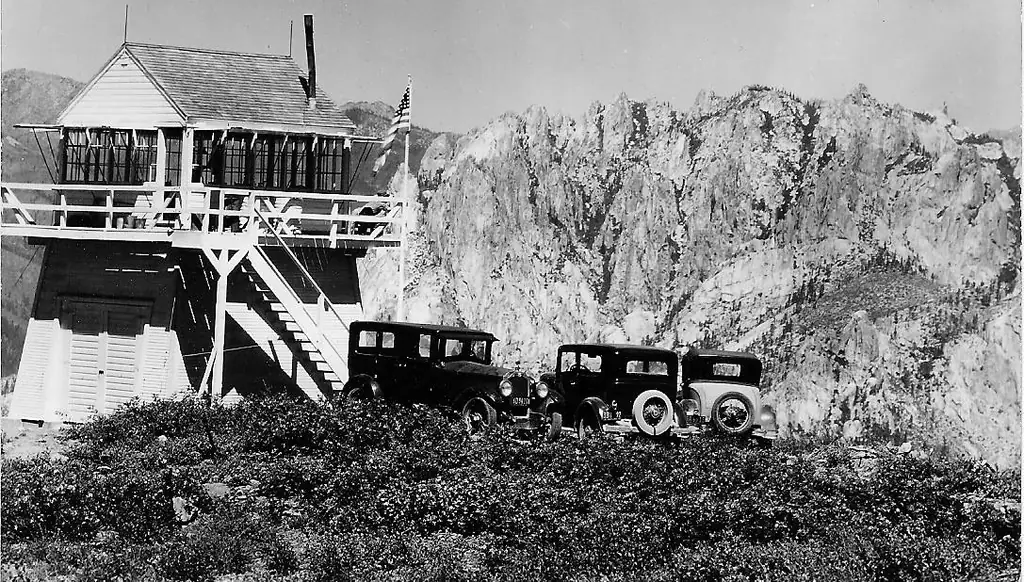
- Enclosed towerL-4 cab, 14'x14' with catwalk, atop an enclosed tapered 13-foot wooden tower, a 1917 design said to be unique to the California regionThe design: L-4
- Built of
- Wood
- Built
- 1931
- Height
- Unknown
- Elevation
- 4,753 ft (1,449 m)
- Agency
- U.S. Forest Service (Shasta-Trinity National Forest)
- Land
- Federal land
- Location
- Shasta County, California
- Coordinates
- 41.12816, −122.27947
- Registers
- This entry
- VerifiedResearched, then checked independently. Updated 19 Oct 2026.
- Firefinder id
us-ca-girard-ridge
View from the cab
What you see from the cab: every ridge out to about 93 miles, the named peaks in sight, and other fire lookouts within view, worked out from terrain data in your browser.
Downloads about 3.5 MB of terrain data the first time.
Or see what it could see on the map: the ground in its line of sight.
History
Then and now
- 1931 BuiltBuilt as an L-4 cab atop an enclosed, tapered wooden tower, a 1917-era design.Sources: nhlr.org, recreation.gov
- No record between 1931 and 1981
- 1981 Last staffedUsed by the Forest Service on a regular basis until 1981.Source: recreation.gov
- No record between 1981 and 1997
- 1997 RestoredRestored to its original specifications/character by the Forest Service and volunteers.Sources: nhlr.org, recreation.gov
- 1998 Added to the National Historic Lookout RegisterRegistered on the National Historic Lookout Register, May 15, 1998 (per brief/NHLR record).Source: nhlr.org
- 1998 Opened as a rentalPlaced on the lookout rental program.Source: nhlr.org
- TodayStandingIt still stands, as far as our sources know.
Old maps of this spot
USGS topographic maps from the years a lookout stood may show it, often as a small symbol labelled “Lookout”. See the old topo maps around it on the Firefinder map, or find every scanned sheet of this spot on USGS TopoView (opens another site) (click the spot there to list them, with dates and downloads).
Story
Researched 4 Oct 2026, fact-checked.
Girard Ridge Fire Lookout was built in 1931 on what is now the Shasta-Trinity National Forest, above the Sacramento River canyon.1,2 It's an L-4 cab, fourteen feet square with a catwalk, sitting atop an enclosed, tapered 13-foot wooden tower, a design dating to 1917 that the National Historic Lookout Register calls unique to the California region.1 The Register also states it's the oldest surviving structure of its type in the state.1
The Forest Service used Girard Ridge for regular fire-watch duty for roughly fifty years, into 1981.2 After that, the tower was taken out of active detection service.1
Rather than let it go, the Forest Service and volunteers restored Girard Ridge to its original specifications in 1997.1,2 It went into the agency's lookout rental program the following year, in 1998.1
Today the lookout is open to overnight renters, reached by dirt roads that are steep and narrow in places, running mostly through private timberland where log trucks are still active, so high-clearance vehicles are recommended.2 The gate combination has to be requested by phone a week ahead of arrival.2 Inside, the cabin has two twin beds with mattresses, storage cabinets, and a table, but no running water, electricity, or cooking facilities; portable gas stoves are allowed with a valid California campfire permit, though wood and charcoal fires are not.2 The reward for the primitive conditions is the view: renters look north to Mount Shasta, west across the Castle Crags, and southeast toward the distant silhouette of Lassen Peak.2
- Girard Ridge Fire Lookout, National Historic Lookout Register, http://nhlr.org/lookouts/us/ca/girard-ridge-fire-lookout/ (accessed 2026-10-04). ↩
- Girard Ridge Lookout, Shasta-Trinity National Forest, Recreation.gov, https://www.recreation.gov/camping/campgrounds/234403 (accessed 2026-10-04). ↩
Photos
Photos keep their own rights and are shown with credit. Is one of these yours? You can ask for a different credit or for removal.
Sources
- National Historic Lookout Register (NHLR) (opens another site) Gave us: name, location, county, elevation, what it is built of, register numbers, agency, dates, photos, links National Historic Lookout Register (nhlr.org) · All rights reserved (American Resources, Inc.); facts extracted only, no prose copied. · retrieved 4 Oct 2026
- Forest Fire Lookout Association (FFLA) - US lookout lists (opens another site) Gave us: type, status, register numbers, links Forest Fire Lookout Association (firelookout.org) · No licence stated; facts extracted only, no prose copied. · retrieved 8 Oct 2026
- Recreation Information Database (recreation.gov) (opens another site) Gave us: ownership, access, rental details, links Data source: ridb.recreation.gov · Public data from the US government · retrieved 19 Oct 2026
- Forest Fire Lookout Association: lookout rentals (opens another site) Gave us: rental details, links Forest Fire Lookout Association rentals list (firelookout.org) · No licence stated; facts extracted only (state, name, booking link, manager, closure note), no prose copied. The FFLA says it is not involved in managing any rental program. · retrieved 19 Oct 2026
- FOREST LOOKOUTS -- western US (Ron Kemnow's weebly sites) (opens another site) Gave us: links Ron Kemnow's Forest Lookouts sites (westlookouts, californialookouts, idaholookouts, montanalookouts, oregonlookouts and washingtonlookouts .weebly.com) · No licence stated; facts only (county, land manager, status word, coordinates where the page's own map widget gives them, township-range-section, height and design hints, links). The site's own newspaper quotes, citations and narrative are not reproduced. · retrieved 8 Oct 2026
- Firefinder research Gave us: summary, design, status, agency, access, visiting details, dates, links, fact-check Firefinder research (sources cited in the story footnotes) · Our own research notes; each fact cites its source in the lookout's story
More about this lookout elsewhere
- NHLR register entry US 266 (nhlr.org) (opens another site)
- Recreation.gov listing (opens another site)
- FFLA California lookout list (firelookout.org) (opens another site)
- FFLA lookout rentals list (firelookout.org) (opens another site)
- Girard Ridge on Forest Lookouts, western US (Ron Kemnow) (opens another site)
Firefinder takes facts (places, dates, numbers) from these sources and writes its own words. See all sources and licences.