Fire lookout · Shasta County, California
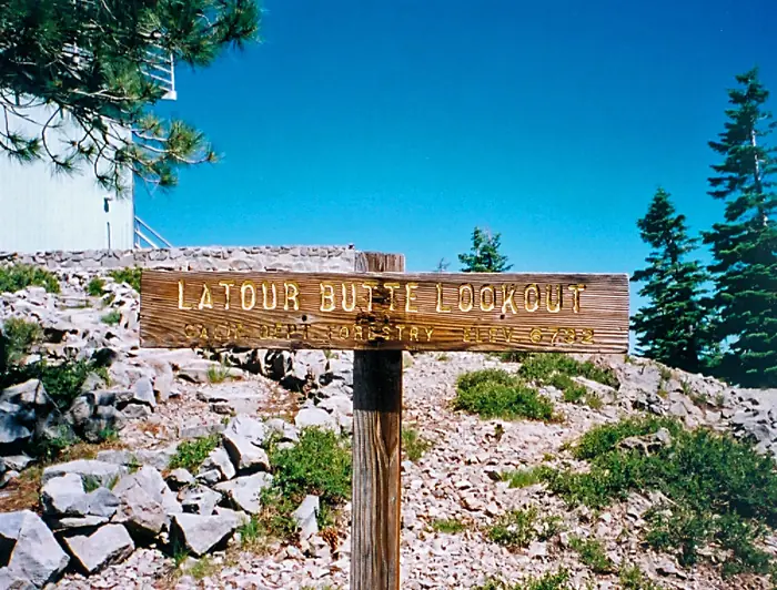
Latour Butte Lookout
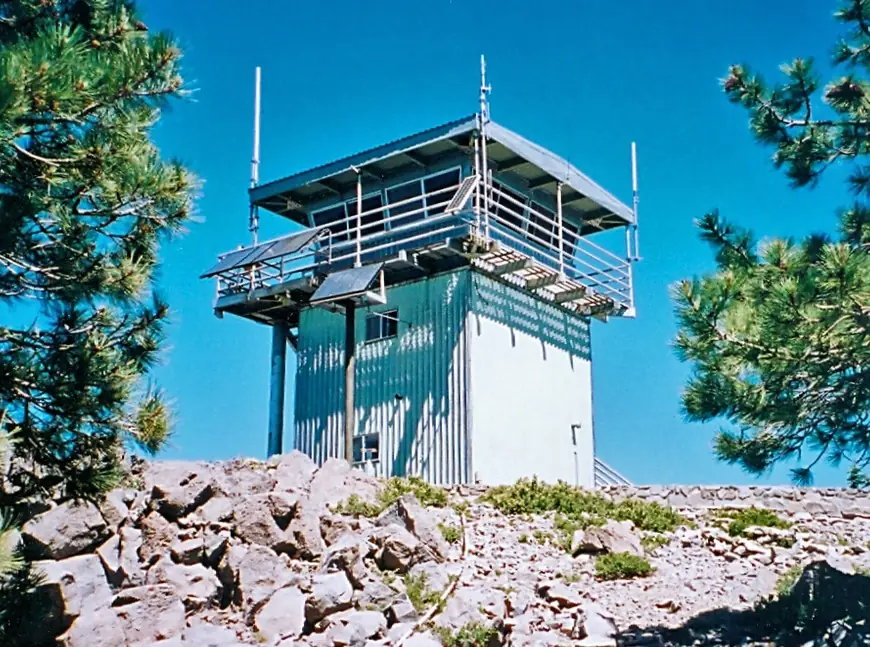
19-foot CCC-era tower on Latour Butte, Shasta County; register gives build years 1935/1978; not readily accessible behind locked gates.
- Standing
- Restricted access
- Verified
Visit & stay
Not rentable. As far as we know, this lookout cannot be booked for overnight stays.
Access
Restricted access
Access is seasonal, gated or needs a permit. Check before you go. Register: not readily accessible to the public, about 11 miles from paved road, behind locked gates. The note is attributed to 10/91.
- Can you climb it?
- Unknown
- Road to the top?
- Unknown
- Staffing
- Unknown
Facts
- Status
- Type
- Enclosed tower19-foot CCC building based closely on Forest Service L-101 or L-301 plan; original cab replaced with CDF standard cab designThe designs: BC-301, CDF 732-6A
- Built of
- Not recorded
- Built
- 1935
- Height
- 19 ft (5.8 m)
- Elevation
- 6,738 ft (2,054 m)
- Agency
- California Department of Forestry and Fire Protection - Shasta-Trinity Unit (Cal Fire SHU)
- Land
- Unknown
- Location
- Shasta County, California
- Coordinates
- 40.60753, −121.70885
- Registers
- This entry
- VerifiedResearched, then checked independently. Updated 8 Oct 2026.
- Firefinder id
us-ca-latour-butte
View from the cab
What you see from the cab: every ridge out to about 93 miles, the named peaks in sight, and other fire lookouts within view, worked out from terrain data in your browser.
Downloads about 3.1 MB of terrain data the first time.
Or see what it could see on the map: the ground in its line of sight.
History
Then and now
- 1935 BuiltRegister Built field reads 1935/1978; CCC buildingSource: nhlr.org
- No record between 1935 and 1978
- 1978 EventSecond year in the register's Built field (1935/1978); the register text does not say what happenedSource: nhlr.org
- No record between 1978 and 2019
- 2019 Added to the National Historic Lookout RegisterRegistered October 26, 2019 as US 1347, CA 170Source: nhlr.org
- TodayStandingIt still stands, as far as our sources know.
Old maps of this spot
USGS topographic maps from the years a lookout stood may show it, often as a small symbol labelled “Lookout”. See the old topo maps around it on the Firefinder map, or find every scanned sheet of this spot on USGS TopoView (opens another site) (click the spot there to list them, with dates and downloads).
Story
Researched 9 Oct 2026, fact-checked.
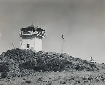
Latour Butte is a cinder cone in Shasta County, northwest of Lassen Volcanic National Park.1 The lookout on the butte is a 19-foot tower.1 The register calls it a CCC building modeled closely on one of two Forest Service plans, the L-101 or the L-301.1 The register gives the build years as 1935/1978 and does not explain the second date in its text.1 A photo captioned 1944 shows a BC-301 cab on a timber tower.1
The register says the original cab was swapped for the state forestry agency's standard cab design, and that the catwalk, exterior stair and paneling have been replaced too.1 It says only the framework, the inside stairway and part of the second floor seem to be original CCC work.1
The forest around the butte became a state forest in 1946.2 The register says the lookout station is not readily accessible to the public. It sits some 11 miles from paved road, behind locked gates, though that note is dated 10/91.1 The access door has also been removed and the doorway boarded shut, so the tower cannot be entered through its door.1
I could not read the Cal Fire page for the forest, so I have no current word on staffing or condition. I found nothing in the register dated after its 2019 registration.1
- Latour Butte Lookout, National Historic Lookout Register (nhlr.org), http://nhlr.org/lookouts/us/ca/latour-butte-lookout/ (accessed 2026-10-09). ↩
- LaTour Demonstration State Forest, Wikipedia, https://en.wikipedia.org/wiki/LaTour_Demonstration_State_Forest (accessed 2026-10-09). ↩
Photos
Photos keep their own rights and are shown with credit. Is one of these yours? You can ask for a different credit or for removal.
Sources
- National Historic Lookout Register (NHLR) (opens another site) Gave us: name, location, county, elevation, register numbers, agency, dates, photos, links National Historic Lookout Register (nhlr.org) · All rights reserved (American Resources, Inc.); facts extracted only, no prose copied. · retrieved 4 Oct 2026
- Forest Fire Lookout Association (FFLA) - US lookout lists (opens another site) Gave us: type, status, register numbers, links Forest Fire Lookout Association (firelookout.org) · No licence stated; facts extracted only, no prose copied. · retrieved 8 Oct 2026
- Firefinder research Gave us: summary, design, height, access, visiting details, dates, links, fact-check Firefinder research (sources cited in the story footnotes) · Our own research notes; each fact cites its source in the lookout's story
More about this lookout elsewhere
- NHLR register entry US 1347 (nhlr.org) (opens another site)
- LaTour Demonstration State Forest (Wikipedia) (opens another site)
- FFLA California lookout list (firelookout.org) (opens another site)
Firefinder takes facts (places, dates, numbers) from these sources and writes its own words. See all sources and licences.