Fire lookout · Tulare County, California
Mule Peak Lookout
Sequoia NF wood cab built by the CCC in 1935 or 1936; destroyed in the September 2021 Windy Fire, and no source read describes the site since.
- Gone
- Open to the public
- Verified
Gone: The lookout no longer stands. Only the site is left.
Visit & stay
Gone: site only. The lookout no longer stands, so there is nothing to climb or rent. You may still be able to visit the site.
Access
Open to the public. Forest Service trail page lists the trail open to hiking and horseback riding with no permit or fee; it says the trail may have washouts after recent fires and flooding and does not say whether the structure stands
- Road to the top?
- Unknown
- Trail
- Forest Service: 0.6-mile trail from Forest Road 22S03a, seasons June to November; fire-lookouts.org gives a 1.25-mile walk from the parking area; no permit or fee
Facts
- Status
- sources disagree
- Type
- Ground-level cabC-3 14 x 14 ft wood-frame groundhouse with catwalk, built by the CCC; packed in by mules and horsesThe design: C-3
- Built of
- WoodGoing by its design; no source says so in words.
- Built
- 1935
- Height
- Unknown
- Elevation
- 8,014 ft (2,443 m)
- Agency
- U.S. Forest Service, Sequoia National Forest; funded in part by the Tule River Indian Reservation
- Land
- Federal land
- Location
- Tulare County, California
- Coordinates
- 36.01610, −118.61430
- Registers
- This entry
- VerifiedResearched, then checked independently. Updated 9 Oct 2026.
- Firefinder id
us-ca-mule-peak
View from the cab
What the lookout saw from its cab: every ridge out to about 93 miles, the named peaks in sight, and other fire lookouts within view, worked out from terrain data in your browser.
This lookout is gone. The view is reconstructed from its recorded site and a typical height for a lookout like it.
Downloads about 3.1 MB of terrain data the first time.
Or see what it could see on the map: the ground in its line of sight.
History
Then and now
- 1935 BuiltBuild year 1935 per the NHLR data field and fire-lookouts.org; the NHLR description says 1936Sources: nhlr.org, fire-lookouts.org
- 1936 EventEstablished as a primary fire detection facility; the NHLR description gives the cost as $2,800Sources: fire-lookouts.org, nhlr.org
- 1947 EventLookout observers on Mule Peak and Tobias Peak reported California condors near Slate Mountain (Fresno Bee item)Source: californialookouts.weebly.com
- 1948 EventLookout observer Mrs. M. Melford reported the first condor flight of the season from the stationSource: californialookouts.weebly.com
- No record between 1948 and 2001
- 2001 Added to the National Historic Lookout RegisterRegistered June 10, 2001 as US 381, CA 42; nominated by Sequoia National ForestSources: nhlr.org, fire-lookouts.org
- 2011 Eventfire-lookouts.org reports the lookout currently unstaffed in 2011Source: fire-lookouts.org
- 2021 Burned'Removed' field on NHLR detail page: "2021 - Windy Fire".Source: NHLR register entry
- 2021 DestroyedDestroyed in the Windy Fire, September 2021; Forest Service says it was destroyed early in the fire despite fire-resistant wrappingSources: nhlr.org, inciweb-dev.fs2c.usda.gov, abc30.com
- TodayGoneThe lookout no longer stands. Only the site is left.
Old maps of this spot
USGS topographic maps from the years a lookout stood may show it, often as a small symbol labelled “Lookout”. See the old topo maps around it on the Firefinder map, or find every scanned sheet of this spot on USGS TopoView (opens another site) (click the spot there to list them, with dates and downloads).
Story
Researched 9 Oct 2026, fact-checked.
Mule Peak Lookout stood on a rocky peak in the Sequoia National Forest, in Tulare County, California.1,2 It was a 14-by-14-foot wood-frame cab.1,2 Sources give 1935 or 1936 as the build year, and the register gives the cost as $2,800.1,2 The Civilian Conservation Corps built the cab, and crews packed the materials in by horse and mule.1,2
The Tule River Indian Reservation, which the lookout overlooks, helped fund it, and it was staffed five days a week during fire season.1,2 A 1948 newspaper item quoted on the Forest Lookouts page describes a lookout observer, Mrs. M. Melford, reporting the first condor flight of that season near the station.3 By 2011 fire-lookouts.org reported the lookout as unstaffed, although the register still describes it as in active service.2,1
The Windy Fire, which burned in September 2021, destroyed the lookout.1,4 The Forest Service said it was destroyed early in the fire, even though it had been wrapped in fire-resistant material.4 Photos released afterward showed the structure reduced to rubble.5
The register says the lookout could be reached only by trail.1 Forest Service trail information still describes a 0.6-mile trail that ends at the lookout tower and says it is open to hikers and horseback riders with no permit needed.6 Other accounts put the walk at 1.25 miles from the parking area.2 The same trail page warns that recent fires and flooding may have left washouts and downed trees. It does not say whether the structure stands, and the 2021 reports describe it as destroyed.6,4,5
- Mule Peak Lookout, National Historic Lookout Register, http://nhlr.org/lookouts/us/ca/mule-peak-lookout/ (accessed 2026-10-09). ↩
- Mule Peak Fire Lookout, fire-lookouts.org, https://www.fire-lookouts.org/cali/mule_peak/index.htm (accessed 2026-10-09). ↩
- Mule Peak, Forest Lookouts, https://californialookouts.weebly.com/mule-peak.html (accessed 2026-10-09). ↩
- Windy Fire update, September 21, 2021, U.S. Forest Service via InciWeb, https://inciweb-dev.fs2c.usda.gov/incident-publication/casqf-windy-fire/windy-fire-update-september-21-2021 (accessed 2026-10-09). ↩
- New photos show Windy Fire's searing destruction in Sequoia National Forest, ABC30, https://abc30.com/post/windy-fire-update-damage-sequoia-national-forest-park/11117980/ (accessed 2026-10-09). ↩
- Mule Peak Lookout Trail, Sequoia National Forest, U.S. Forest Service, https://www.fs.usda.gov/r05/sequoia/recreation/trails/mule-peak-lookout-trail (accessed 2026-10-09). ↩
Photos
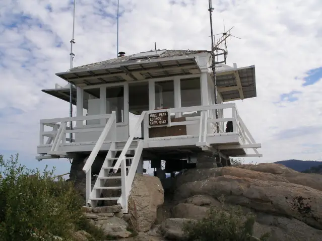
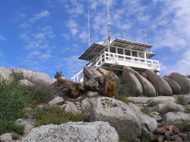
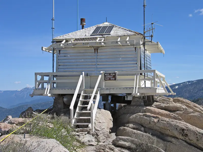
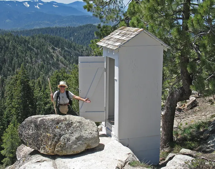
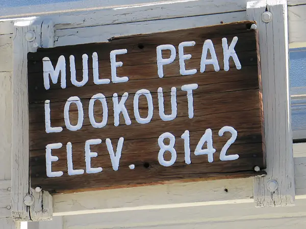
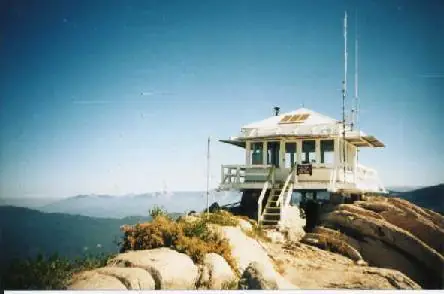
Photos keep their own rights and are shown with credit. Is one of these yours? You can ask for a different credit or for removal.
Where sources disagree
We show disagreements between sources instead of quietly picking one. If you know which is right, please tell us.
Sources disagree on whether it still stands.
- FFLA: Gone
- NHLR: Standing
- California Fire Lookouts of the Sierra National Forest and Other Areas (fire-lookouts.org): Standing
NHLR lists lookouts that were standing when registered.
Sources
- National Historic Lookout Register (NHLR) (opens another site) Gave us: name, location, county, elevation, what it is built of, register numbers, agency, ownership, dates, photos, links National Historic Lookout Register (nhlr.org) · All rights reserved (American Resources, Inc.); facts extracted only, no prose copied. · retrieved 4 Oct 2026
- Forest Fire Lookout Association (FFLA) - US lookout lists (opens another site) Gave us: type, status, register numbers, links Forest Fire Lookout Association (firelookout.org) · No licence stated; facts extracted only, no prose copied. · retrieved 8 Oct 2026
- California Fire Lookouts of the Sierra National Forest and Other Areas (fire-lookouts.org) (opens another site) Gave us: register numbers, staffing, photos, links fire-lookouts.org · Public information per the site's disclaimer, credit requested. Facts + a short description reused under that permission -- see extra.license per record. · retrieved 4 Oct 2026
- FOREST LOOKOUTS -- western US (Ron Kemnow's weebly sites) (opens another site) Gave us: links Ron Kemnow's Forest Lookouts sites (westlookouts, californialookouts, idaholookouts, montanalookouts, oregonlookouts and washingtonlookouts .weebly.com) · No licence stated; facts only (county, land manager, status word, coordinates where the page's own map widget gives them, township-range-section, height and design hints, links). The site's own newspaper quotes, citations and narrative are not reproduced. · retrieved 8 Oct 2026
- Firefinder research Gave us: summary, design, agency, access, staffing, visiting details, dates, links, fact-check Firefinder research (sources cited in the story footnotes) · Our own research notes; each fact cites its source in the lookout's story
More about this lookout elsewhere
- NHLR register entry US 381 (nhlr.org) (opens another site)
- NHLR register entry (nhlr.org) (opens another site)
- Windy Fire update, September 21, 2021 (U.S. Forest Service via InciWeb) (opens another site)
- New photos show Windy Fire's searing destruction in Sequoia National Forest (ABC30) (opens another site)
- Mule Peak Lookout Trail (Sequoia National Forest, U.S. Forest Service) (opens another site)
- FFLA California lookout list (firelookout.org) (opens another site)
- Mule Peak Lookout - Forest Lookouts Page (opens another site)
- Mule Pk Fire Lookout on fire-lookouts.org (Rich Camp) (opens another site)
Firefinder takes facts (places, dates, numbers) from these sources and writes its own words. See all sources and licences.