Fire lookout · Tuolumne County, California
Pilot Peak Lookout (Stanislaus National Forest)
Also known as Pilot Peak
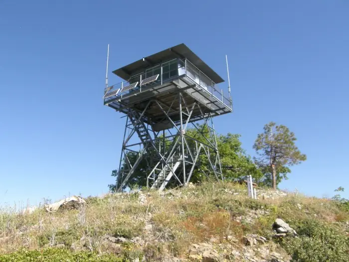
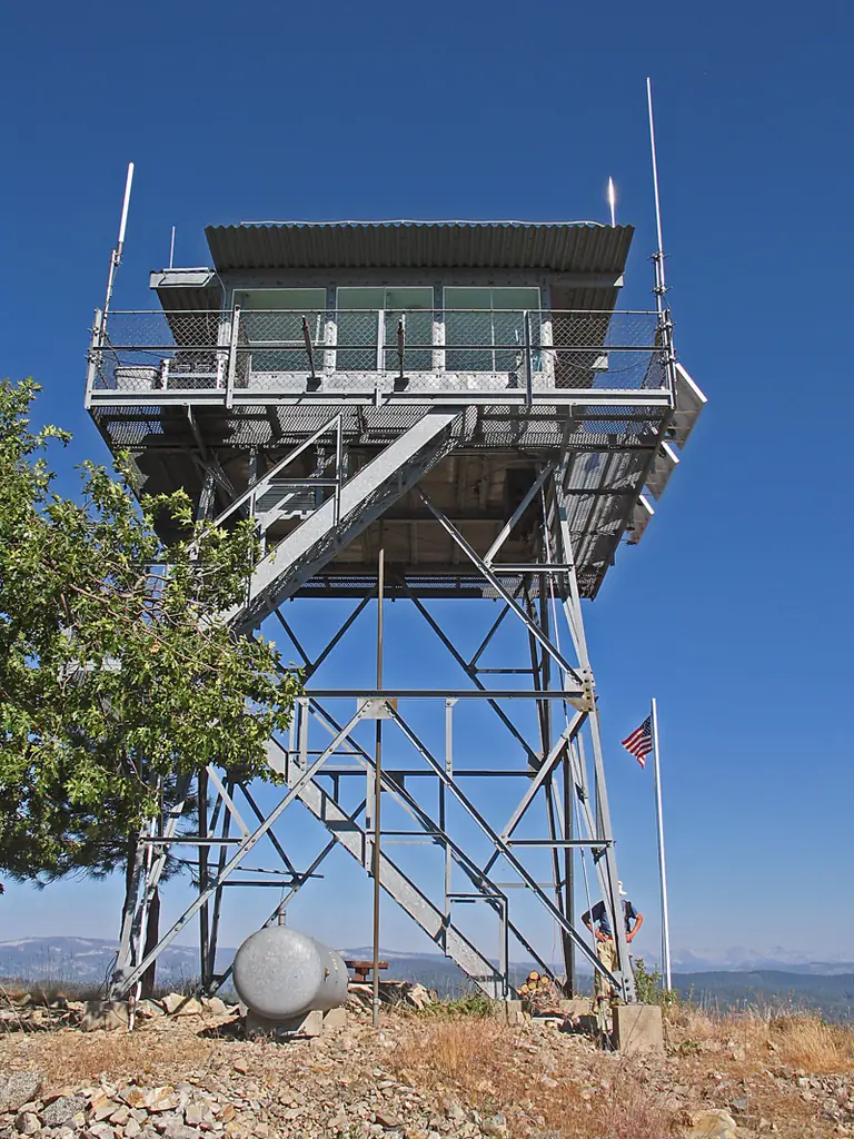
Pilot Peak Lookout on the Stanislaus NF: CL-100 cabin on a 20-ft steel tower built 1962-63, staffed in 2012; the NHLR number and two-story kind in the brief belong to a different Pilot Peak.
- Standing
- Access unknown
- Verified
Visit & stay
Not rentable. As far as we know, this lookout cannot be booked for overnight stays.
Access
Access unknown
We do not know the access rules. Check with the land manager before you go.
- Can you climb it?
- Unknown
- Road to the top?
- Unknown
- Staffing
- Staffed during fire season (as of 2012)
Facts
- Status
- Type
- Two-story buildingCL-100 cabin (1959 National Plan revision) atop a 20-foot K-Brace open steel towerThe design: CL-100
- Built of
- SteelGoing by its design; no source says so in words.
- Built
- 1919
- Height
- 20 ft (6.1 m)
- Elevation
- 6,011 ft (1,832 m)
- Agency
- US Forest Service, Stanislaus National Forest (Groveland Ranger District)
- Land
- Federal land
- Location
- Tuolumne County, California
- Coordinates
- 37.76263, −119.93596
- Registers
- This entry
- VerifiedResearched, then checked independently. Updated 8 Oct 2026.
- Firefinder id
us-ca-pilot-peak-stanislaus-national-forest
View from the cab
What you see from the cab: every ridge out to about 93 miles, the named peaks in sight, and other fire lookouts within view, worked out from terrain data in your browser.
Downloads about 3.3 MB of terrain data the first time.
Or see what it could see on the map: the ground in its line of sight.
History
Then and now
- 1919 BuiltSonora contractor Henry Grayson was building a steel lookout tower on the peak, per a Mariposa Gazette item of 4 October 1919; the sources do not say whether it is the tower standing todaySource: californialookouts.weebly.com
- 1921 StaffedRegister says the peak has been a fire detection point since at least 1921; John Hastie reported as lookout, with 63 visitors between June 6 and August 31, 1921Sources: nhlr.org, californialookouts.weebly.com
- No record between 1921 and 1937
- 1937 FireBarn fire in the Deer Flat district near Groveland, spotted by lookout M. Brown; a CCC fire crew confined it to three acres of grassland (item dated 6 July 1937)Source: californialookouts.weebly.com
- No record between 1937 and 1962
- 1962 BuiltCurrent CL-100 cabin on a 20-foot K-Brace open steel tower; the NHLR Built field reads 1962-63Source: nhlr.org
- No record between 1962 and 2012
- 2012 AlteredGroveland district work noted in 2012 report: electrical upgrade to solar panels and batteries under way; 1,200-gallon tank water system with shower installed; fuels reduced around the siteSource: firelookout.org
- 2012 StaffedStaffed seven days a week with a Forest Service employee, with regular maintenance (2012 report)Source: firelookout.org
- 2019 Added to the National Historic Lookout RegisterDate registered on the National Historic Lookout Register: December 1, 2019Source: nhlr.org
- TodayStandingIt still stands, as far as our sources know.
Old maps of this spot
USGS topographic maps from the years a lookout stood may show it, often as a small symbol labelled “Lookout”. See the old topo maps around it on the Firefinder map, or find every scanned sheet of this spot on USGS TopoView (opens another site) (click the spot there to list them, with dates and downloads).
Story
Researched 8 Oct 2026, fact-checked.
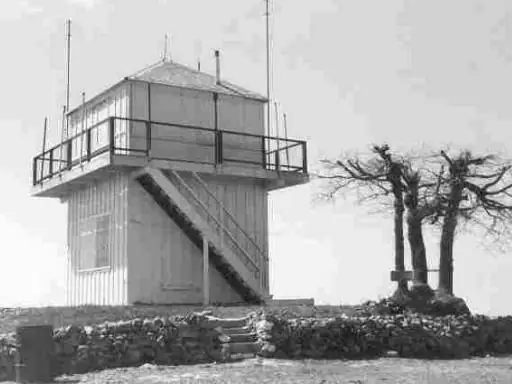
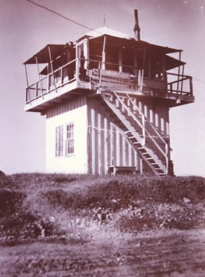
Pilot Peak Lookout stands at 6,011 feet in the forest's southern section, on the boundary between Tuolumne and Mariposa counties.1,2 In 1919 a Sonora contractor, Henry Grayson, was building a steel lookout tower on the peak, according to a Mariposa Gazette item quoted on the California Lookouts site.2 The sources do not say whether that tower is the one standing today. The Register dates the present cabin, a CL-100 design on a 20-foot open steel tower, to 1962-63.1
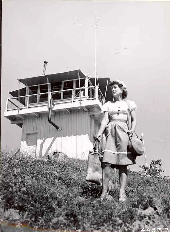
According to the Register, the peak has served for fire detection at least since 1921.1 That summer the lookout, John Hastie, reported 63 visitors between June 6 and August 31.2 In July 1937 a lookout named M. Brown spotted a barn fire in the Deer Flat district near Groveland, and a CCC crew held it to three acres of grassland.2
A 2012 annual report from the Forest Fire Lookout Association's Sierra-Nevada chapter says Pilot Peak was one of two Groveland district lookouts still in active use for fire detection, and that a Forest Service employee staffed it seven days a week.3 The same report says the district was upgrading the electrical system with solar panels and batteries, had installed a 1,200-gallon water tank with a shower, and had cut fuels around the site.3
The Register lists the Forest Service as administrator and gives a registration date of December 1, 2019.1 Do not confuse this with the other Pilot Peak. The Plumas National Forest lookout that the Register numbers 600 is a two-story hexagonal cab, built in 1976.4
The newest staffing or condition report I found is from 2012, so the lookout's present condition, staffing and public access are unconfirmed. Neither source I read gives a route for visitors.1,3
- Pilot Peak Lookout (Stanislaus National Forest), National Historic Lookout Register, http://nhlr.org/lookouts/us/ca/pilot-peak-lookout-stanislaus-national-forest/ (accessed 2026-10-08). ↩
- Pilot Peak, Forest Lookouts, California Lookouts, https://californialookouts.weebly.com/pilot-peak2.html (accessed 2026-10-08). ↩
- California Sierra and Nevada Chapter 2012 Annual Report, Forest Fire Lookout Association, CA Sierra-Nevada Area Chapter, https://firelookout.org/wp-content/uploads/2024/11/cr-ca-sn-nevada-2012.pdf (accessed 2026-10-08). ↩
- Pilot Peak Lookout, National Historic Lookout Register, http://nhlr.org/lookouts/us/ca/pilot-peak-lookout/ (accessed 2026-10-08). ↩
Photos
Photos keep their own rights and are shown with credit. Is one of these yours? You can ask for a different credit or for removal.
Where sources disagree
We show disagreements between sources instead of quietly picking one. If you know which is right, please tell us.
Sources disagree on the registers.
- NHLR: US 1394
- FFLA: US 600
Another source gives a different NHLR number; the register's own entry is used.
Sources
- National Historic Lookout Register (NHLR) (opens another site) Gave us: name, location, county, elevation, what it is built of, register numbers, agency, ownership, dates, photos, links National Historic Lookout Register (nhlr.org) · All rights reserved (American Resources, Inc.); facts extracted only, no prose copied. · retrieved 4 Oct 2026
- Forest Fire Lookout Association (FFLA) - US lookout lists (opens another site) Gave us: type, status, links Forest Fire Lookout Association (firelookout.org) · No licence stated; facts extracted only, no prose copied. · retrieved 8 Oct 2026
- Forest Fire Lookout Association chapter reports (opens another site) Gave us: dates, links Forest Fire Lookout Association, chapter and restoration-grant reports (firelookout.org) · No licence stated; facts only (dates, names, the kind of work done). Every note is our own wording and every event links to the FFLA report it comes from. Positions are copied from the NHLR, FFLOS and FFLA records. · retrieved 8 Oct 2026
- FOREST LOOKOUTS -- western US (Ron Kemnow's weebly sites) (opens another site) Gave us: links Ron Kemnow's Forest Lookouts sites (westlookouts, californialookouts, idaholookouts, montanalookouts, oregonlookouts and washingtonlookouts .weebly.com) · No licence stated; facts only (county, land manager, status word, coordinates where the page's own map widget gives them, township-range-section, height and design hints, links). The site's own newspaper quotes, citations and narrative are not reproduced. · retrieved 8 Oct 2026
- Firefinder research Gave us: summary, design, height, status, agency, staffing, dates, links, fact-check Firefinder research (sources cited in the story footnotes) · Our own research notes; each fact cites its source in the lookout's story
More about this lookout elsewhere
- NHLR register entry US 1394 (nhlr.org) (opens another site)
- NHLR register entry US 600 (nhlr.org) (opens another site)
- FFLA California lookout list (firelookout.org) (opens another site)
- Forest Fire Lookout Association chapter reports: work on Pilot Peak Lookout (Stanislaus National Forest) (opens another site)
- Pilot Peak on Forest Lookouts, western US (Ron Kemnow) (opens another site)
Firefinder takes facts (places, dates, numbers) from these sources and writes its own words. See all sources and licences.