Fire lookout · Del Norte County, California
Red Mountain Lookout (Del Norte County)
Also known as Red Mountain
1951 cooperative lookout on a Six Rivers NF ridge, one of six late 809R towers the register counts; staffed in fire season, and the ridge's radio site is being relocated.
- Standing
- Open to the public
- Verified
Visit & stay
Not rentable. As far as we know, this lookout cannot be booked for overnight stays.
Access
Open to the public. The register says the site is accessible to the public, about 6 miles from the nearest paved road. Staffed in fire season. No source confirms the cab can be climbed.
- Can you climb it?
- Unknown
- Road to the top?
- Unknown
- Trail
- About 6 miles from the nearest paved road per the register; no route or trail is described.
- Staffing
- Unknown
Facts
- Status
- Type
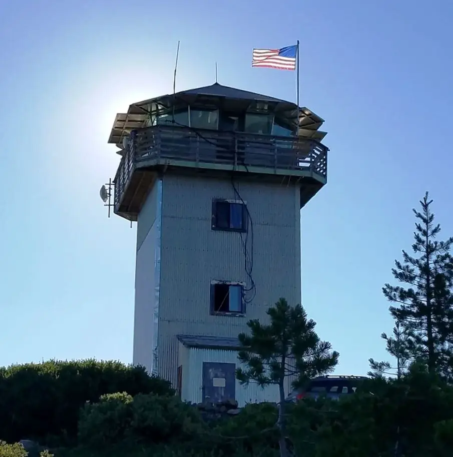
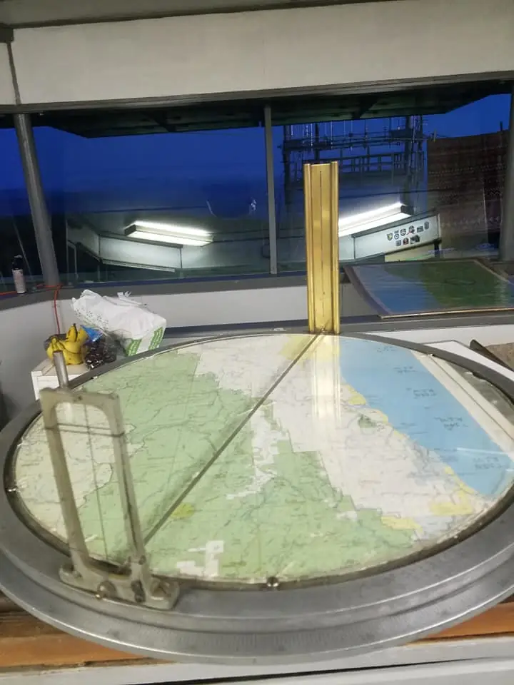
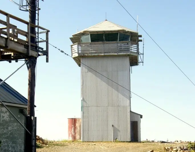
- Enclosed towerLate-style 809R enclosed tower, 30 ft to the cab floor; the register says only six such towers existThe design: CDF 809R
- Built of
- Not recorded
- Built
- 1951
- Height
- 30 ft (9.1 m)
- Elevation
- 4,260 ft (1,298 m)
- Agency
- California Department of Forestry and Fire Protection, Humboldt-Del Norte Unit (Cal Fire HUU)
- Land
- Unknown
- Location
- Del Norte County, California
- Coordinates
- 41.52425, −123.90805
- Registers
- This entry
- VerifiedResearched, then checked independently. Updated 8 Oct 2026.
- Firefinder id
us-ca-red-mountain-del-norte-county
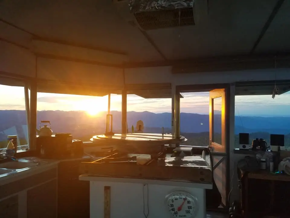
View from the cab
What you see from the cab: every ridge out to about 93 miles, the named peaks in sight, and other fire lookouts within view, worked out from terrain data in your browser.
Downloads about 3.5 MB of terrain data the first time.
Or see what it could see on the map: the ground in its line of sight.
History
Then and now
- 1951 BuiltFirst cooperative lookout in the Humboldt-Del Norte area, reported October 19, 1951; five companies and the Forest Service shared the costsSources: nhlr.org, californialookouts.weebly.com
- 1954 EventVandals stripped the cab windows of glass (Humboldt Standard, May 3, 1954); damage put at $250; four young men arrested and confessedSource: californialookouts.weebly.com
- No record between 1954 and 2019
- 2019 Added to the National Historic Lookout RegisterRegistered November 27, 2019Source: nhlr.org
- 2022 EventPermit for state communications facilities on the site expires December 31, 2022; state facilities must be removed then (NPS release dated December 29, 2017)Source: nps.gov
- 2025 EventState budget request (FY 2025-26) to relocate the Red Mountain communications siteSource: bcp.dof.ca.gov
- TodayStandingIt still stands, as far as our sources know.
Old maps of this spot
USGS topographic maps from the years a lookout stood may show it, often as a small symbol labelled “Lookout”. See the old topo maps around it on the Firefinder map, or find every scanned sheet of this spot on USGS TopoView (opens another site) (click the spot there to list them, with dates and downloads).
Story
Researched 8 Oct 2026, fact-checked.
The Red Mountain lookout stands on a ridge that runs roughly north to south, inside Six Rivers National Forest in Del Norte County.1 The register dates it to 1951.1 That October the Redwood Journal Press-Dispatch reported that the first cooperative fire lookout in the Humboldt-Del Norte area had been set up that year, with five companies and the Forest Service sharing the costs.2 The cab sits on a 30-foot tower of the 809R design, which the register says is believed to be exclusive to the California Department of Forestry (CDF). It also says only six late-style 30-foot 809R towers exist.1 A 1966 survey description puts the cab floor 30 feet above the ground.2
Vandals struck in May 1954.2 The Humboldt Standard reported that the station's windows had been stripped of all glass, with damage put at $250, and that four young men had been arrested and had confessed.2 The register says the lookout is staffed during fire season.1 I did not find a notable fire or a staffing list for this lookout in the sources I read.
By the time of the register, the ridge also held several communications vaults, radio towers and microwave facilities, which the register calls the only significant detractors from the property's overall integrity.1 A National Park Service release dated December 29, 2017, now archived, said state-owned facilities on the ridge must be removed when a Forest Service special-use permit expires on December 31, 2022.3 A state budget request for fiscal 2025-26 sought funding to relocate the communications site.4 None of these sources says what will happen to the lookout cab itself.
The register gives a registration date of November 27, 2019.1 It describes the site as accessible to the public, about six miles from the nearest paved road.1 I found no source saying whether the cab is open to climbing, so treat it as a working fire lookout and check with Cal Fire before you go.
- Red Mountain Lookout (Del Norte County), National Historic Lookout Register, http://nhlr.org/lookouts/us/ca/red-mountain-lookout-del-norte-county/ (accessed 2026-10-08). ↩
- Red Mountain, Forest Lookouts, https://californialookouts.weebly.com/red-mountain4.html (accessed 2026-10-08). ↩
- Park Seeks Comments On Proposed State Radio Tower, National Park Service, Redwood National and State Parks, https://www.nps.gov/redw/learn/news/radiotower.htm (accessed 2026-10-08). ↩
- Relocation of Red Mountain Communications Site, Revert and Fund New, California Department of Finance budget change proposal FY 2025-26, https://bcp.dof.ca.gov/2526/FY2526_ORG0690_BCP8304.pdf (accessed 2026-10-08). ↩
Photos
Photos keep their own rights and are shown with credit. Is one of these yours? You can ask for a different credit or for removal.
Sources
- National Historic Lookout Register (NHLR) (opens another site) Gave us: name, location, county, elevation, register numbers, agency, dates, photos, links National Historic Lookout Register (nhlr.org) · All rights reserved (American Resources, Inc.); facts extracted only, no prose copied. · retrieved 4 Oct 2026
- Forest Fire Lookout Association (FFLA) - US lookout lists (opens another site) Gave us: type, status, register numbers, links Forest Fire Lookout Association (firelookout.org) · No licence stated; facts extracted only, no prose copied. · retrieved 8 Oct 2026
- OpenStreetMap -- fire lookout structures (opens another site) Gave us: links © OpenStreetMap contributors · ODbL 1.0. (c) OpenStreetMap contributors. · retrieved 4 Oct 2026
- FOREST LOOKOUTS -- western US (Ron Kemnow's weebly sites) (opens another site) Gave us: links Ron Kemnow's Forest Lookouts sites (westlookouts, californialookouts, idaholookouts, montanalookouts, oregonlookouts and washingtonlookouts .weebly.com) · No licence stated; facts only (county, land manager, status word, coordinates where the page's own map widget gives them, township-range-section, height and design hints, links). The site's own newspaper quotes, citations and narrative are not reproduced. · retrieved 8 Oct 2026
- Firefinder research Gave us: summary, design, height, agency, access, visiting details, dates, links, fact-check Firefinder research (sources cited in the story footnotes) · Our own research notes; each fact cites its source in the lookout's story
More about this lookout elsewhere
- NHLR register entry US 1385 (nhlr.org) (opens another site)
- Park Seeks Comments On Proposed State Radio Tower (National Park Service, Redwood National and State Parks) (opens another site)
- Relocation of Red Mountain Communications Site, Revert and Fund New (FY 2025-26 budget change proposal) (California Department of Finance) (opens another site)
- FFLA California lookout list (firelookout.org) (opens another site)
- Red Mountain Lookout (Del Norte County) on YouTube (opens another site)
- Red Mountain on Forest Lookouts, western US (Ron Kemnow) (opens another site)
- OpenStreetMap way 990522291 (opens another site)
Firefinder takes facts (places, dates, numbers) from these sources and writes its own words. See all sources and licences.