Fire lookout · Butte County, California
Sawmill Peak Lookout
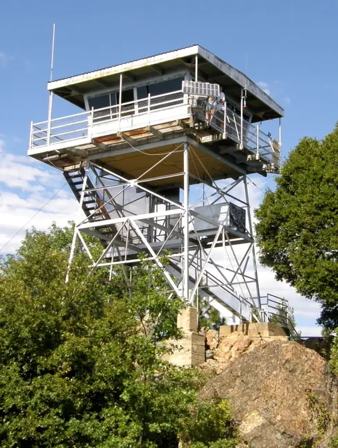
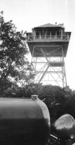
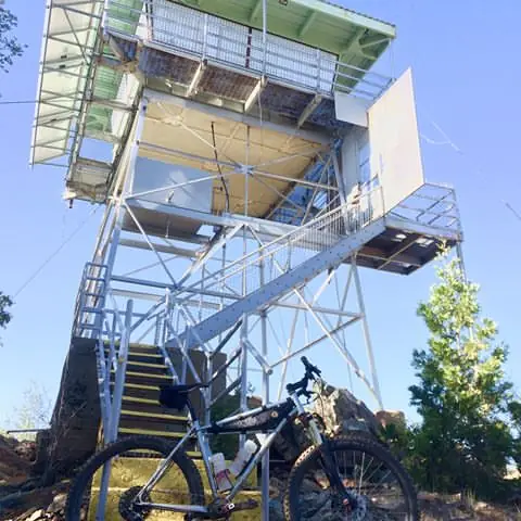
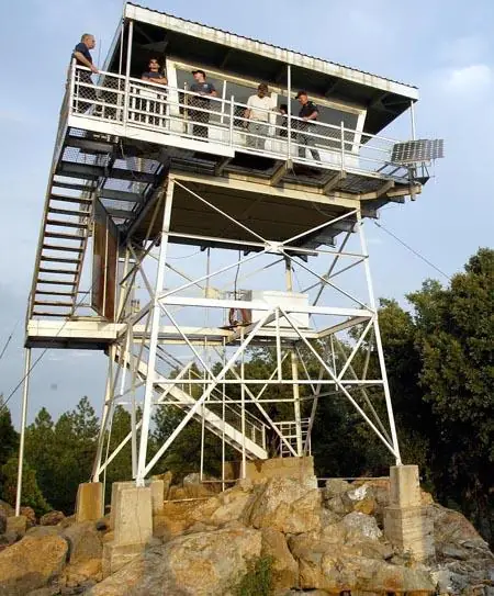
Butte County lookout outside Magalia; the register dates the tower to 1931 and its cab was later replaced. Current staffing is unconfirmed.
- Standing
- Access unknown
- Verified
Visit & stay
Not rentable. As far as we know, this lookout cannot be booked for overnight stays.
Access
Access unknown
We do not know the access rules. Check with the land manager before you go.
- Can you climb it?
- Unknown
- Road to the top?
- Unknown
- Staffing
- Unknown
Facts
- Status
- Type
- Cab on a tower30-foot K-brace steel tower; cab is CDF Plan 259, the first 732-6A style cabThe designs: CDF 732-6A, D-5 (4-AR), BC-301
- Built of
- Steel
- Built
- 1931
- Height
- Unknown
- Elevation
- 3,338 ft (1,017 m)
- Agency
- California Department of Forestry and Fire Protection (Cal Fire)
- Land
- Federal land
- Location
- Butte County, California
- Coordinates
- 39.81195, −121.55881
- Registers
- This entry
- VerifiedResearched, then checked independently. Updated 8 Oct 2026.
- Firefinder id
us-ca-sawmill-peak
View from the cab
What you see from the cab: every ridge out to about 93 miles, the named peaks in sight, and other fire lookouts within view, worked out from terrain data in your browser.
Downloads about 3.4 MB of terrain data the first time.
Or see what it could see on the map: the ground in its line of sight.
History
Then and now
- 1931 BuiltRegister build year; a 30-foot K-brace tower superseded a 1920s steel designSource: nhlr.org
- 1937 StaffedDave Reese, lookout at Sawmill Peak for six years, per a February 1937 obituarySource: californialookouts.weebly.com
- 1938 StaffedNeal Perdue stationed at Sawmill Peak; reported a broken water line as a possible fireSource: californialookouts.weebly.com
- 1939 RemovedOld lookout building removed by a CCC crew ahead of a new structure, per a March 1939 California Ranger itemSource: californialookouts.weebly.com
- No record between 1939 and 2019
- 2019 Added to the National Historic Lookout RegisterRegistered October 16, 2019 as US 1310, CA 133; nominated by Brad EellsSource: nhlr.org
- TodayStandingIt still stands, as far as our sources know.
Old maps of this spot
USGS topographic maps from the years a lookout stood may show it, often as a small symbol labelled “Lookout”. See the old topo maps around it on the Firefinder map, or find every scanned sheet of this spot on USGS TopoView (opens another site) (click the spot there to list them, with dates and downloads).
Story
Researched 8 Oct 2026, fact-checked.
The Sawmill Peak lookout stands in Butte County, California, outside the community of Magalia.1 The National Historic Lookout Register lists it as US 1310 and dates the lookout to 1931.2 The register places the site in the Lassen National Forest and names Cal Fire as its administrator. A Forest Service project page says the Plumas National Forest administers the site, so the sources disagree on who runs it.2,1
The register describes a 30-foot K-brace tower that superseded a steel design introduced in the 1920s.2 The register says fire destroyed the first wood cab, which used a USFS 4-AR design, but it gives no date.2 The replacement cab, plan BC-301, was supplanted by a CDF cab, plan 259, which the register calls the first 732-6A style cab built.2
Staffing records we could read are thin. A February 1937 obituary, reprinted on the Forest Lookouts site, calls Dave Reese a lookout at Sawmill Peak for six years.3 It also says he joined the Forest Service about nine years before, and if that timeline is right, he was on the peak before the register's 1931 date. The sources do not say whether an earlier lookout stood there, so we leave that open.3,2
A 1938 Lassen Advocate item names Neal Perdue as the lookout stationed at Sawmill Peak. He reported what looked like smoke four miles south, but it turned out to be a broken water line.3 In March 1939 a California Ranger item says residents reported the lookout building had vanished during a windy stretch. The item explains that a CCC crew had removed the old building the day before, ahead of installing a new lookout structure.3
The register's description, marked "MVT 10/91," refers to the existing cab, so it may not reflect the site today.2 A PG&E passive reflector also sits on the peak, and PG&E has asked the Forest Service to reissue its special use permit for a new 30-year term.1 We could not read the Butte County lookout page, so we do not know whether anyone staffs the lookout today, and we found no source on visitor access. Check with Cal Fire or the Forest Service before planning a visit.
- PG&E SUP Reissue Sawmill Peak Passive Reflector, Plumas National Forest project summary, USDA Forest Service, https://www.fs.usda.gov/r05/plumas/projects/61948 (accessed 2026-10-08). ↩
- Sawmill Peak Lookout, National Historic Lookout Register (nhlr.org), http://nhlr.org/lookouts/us/ca/sawmill-peak-lookout/ (accessed 2026-10-08). ↩
- Sawmill Peak, Forest Lookouts (californialookouts.weebly.com), https://californialookouts.weebly.com/sawmill-peak.html (accessed 2026-10-08). ↩
Photos
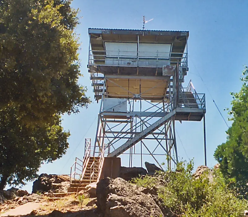
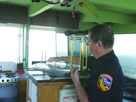
Photos keep their own rights and are shown with credit. Is one of these yours? You can ask for a different credit or for removal.
Sources
- National Historic Lookout Register (NHLR) (opens another site) Gave us: name, location, county, elevation, what it is built of, register numbers, agency, dates, photos, links National Historic Lookout Register (nhlr.org) · All rights reserved (American Resources, Inc.); facts extracted only, no prose copied. · retrieved 4 Oct 2026
- Forest Fire Lookout Association (FFLA) - US lookout lists (opens another site) Gave us: type, status, register numbers, links Forest Fire Lookout Association (firelookout.org) · No licence stated; facts extracted only, no prose copied. · retrieved 8 Oct 2026
- OpenStreetMap -- fire lookout structures (opens another site) Gave us: links © OpenStreetMap contributors · ODbL 1.0. (c) OpenStreetMap contributors. · retrieved 4 Oct 2026
- FOREST LOOKOUTS -- western US (Ron Kemnow's weebly sites) (opens another site) Gave us: ownership, links Ron Kemnow's Forest Lookouts sites (westlookouts, californialookouts, idaholookouts, montanalookouts, oregonlookouts and washingtonlookouts .weebly.com) · No licence stated; facts only (county, land manager, status word, coordinates where the page's own map widget gives them, township-range-section, height and design hints, links). The site's own newspaper quotes, citations and narrative are not reproduced. · retrieved 8 Oct 2026
- Firefinder research Gave us: summary, design, status, agency, dates, links, fact-check Firefinder research (sources cited in the story footnotes) · Our own research notes; each fact cites its source in the lookout's story
More about this lookout elsewhere
- NHLR register entry US 1310 (nhlr.org) (opens another site)
- PG&E SUP Reissue Sawmill Peak Passive Reflector (project #61948) (Plumas National Forest, USDA Forest Service) (opens another site)
- FFLA California lookout list (firelookout.org) (opens another site)
- Sawmill Peak on Forest Lookouts, western US (Ron Kemnow) (opens another site)
- OpenStreetMap node 12128355085 (opens another site)
Firefinder takes facts (places, dates, numbers) from these sources and writes its own words. See all sources and licences.