Fire lookout · Tulare County, California
Shadequarter Lookout
1964 state-built 809R fire tower in Tulare County; sources disagree on its closure (late 1970s or late 1980s), a 2018 assessment found it in surprisingly good condition apart from roof, siding and window damage, and it stands behind locked gates.
- Standing
- Restricted access
- Verified
Visit & stay
Not rentable. As far as we know, this lookout cannot be booked for overnight stays.
Access
Restricted access
Access is seasonal, gated or needs a permit. Check before you go. Not accessible to the general public; about 5 miles from paved road, behind locked gates (Register description, carries an MVT 10/91 note)
- Can you climb it?
- Unknown
- Road to the top?
- Unknown
- Staffing
- Unknown
Facts
- Status
- Type
- Enclosed tower809R building design with a 30 foot steel tower of three floors and a working cabThe design: CDF 809R
- Built of
- Not recorded
- Built
- 1964
- Height
- Unknown
- Elevation
- 4,381 ft (1,335 m)
- Agency
- California Department of Forestry and Fire Protection - Tulare Unit (Cal Fire TUU)
- Land
- Unknown
- Location
- Tulare County, California
- Coordinates
- 36.56730, −118.95669
- Registers
- This entry
- VerifiedResearched, then checked independently. Updated 8 Oct 2026.
- Firefinder id
us-ca-shadequarter
View from the cab
What you see from the cab: every ridge out to about 93 miles, the named peaks in sight, and other fire lookouts within view, worked out from terrain data in your browser.
Downloads about 3.3 MB of terrain data the first time.
Or see what it could see on the map: the ground in its line of sight.
History
Then and now
- 1964 BuiltBuilt by the state of California in 1964Source: nhlr.org
- No record between 1964 and 2017
- 2017 RestoredCAL FIRE began a refurbishment of the lookout; staffing plans not yet known. Report says it is a duplicate of the Boucher Hill tower in Palomar State Park.Source: firelookout.org
- 2018 Condition assessmentBuck Rock Foundation assessment visit: overall good condition apart from damage to roofing and siding and several broken windows; interior fire equipment removedSource: nhlr.org
- 2018 RestoredBuck Rock Foundation volunteers repaired the roof of the CAL FIRE lookout.Source: firelookout.org
- 2019 Added to the National Historic Lookout RegisterRegistered October 30, 2019 as US 1370, CA 193; nominated by Brad EellsSource: nhlr.org
- TodayStandingIt still stands, as far as our sources know.
Old maps of this spot
USGS topographic maps from the years a lookout stood may show it, often as a small symbol labelled “Lookout”. See the old topo maps around it on the Firefinder map, or find every scanned sheet of this spot on USGS TopoView (opens another site) (click the spot there to list them, with dates and downloads).
Story
Researched 8 Oct 2026, fact-checked.
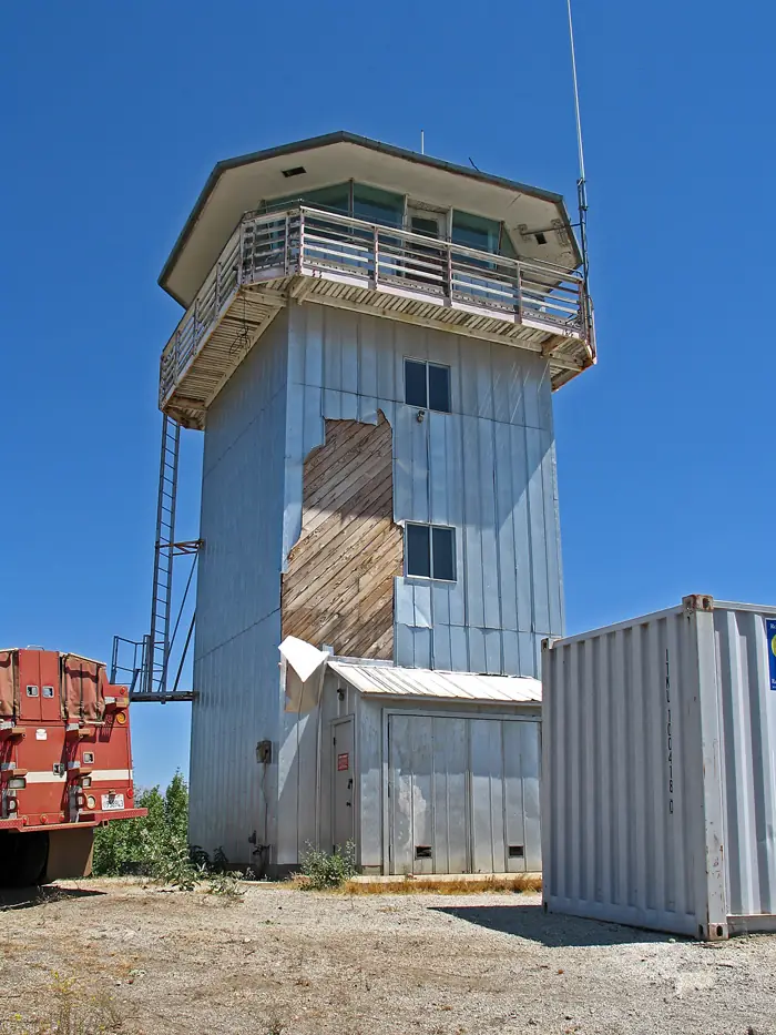
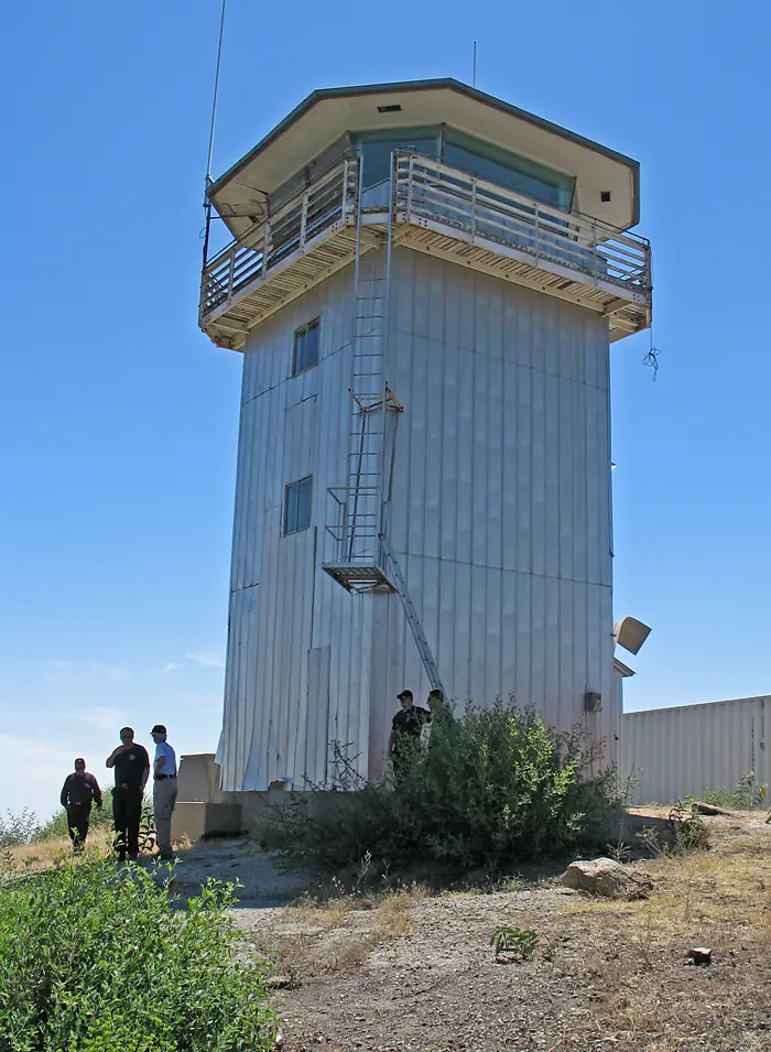
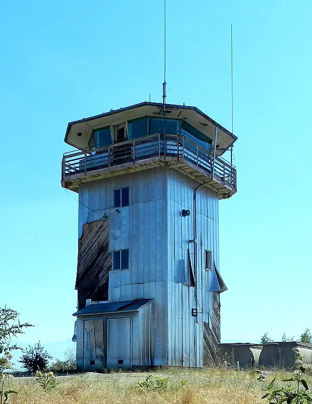
Shadequarter Lookout is a fire tower in Tulare County, California, that the state built in 1964.1 The Register says it follows the 809R building design, which it believes was used only by the California Department of Forestry. This one is a later version with some revisions, such as tilted plate glass and steel columns in the cab for roof support.1
Its steel tower has three floors under a working cab, and it helped watch much of the Kaweah River watershed.1 The sources I read do not name the individual fires it spotted.
The sources disagree about when it closed. A Buck Rock Foundation statement quoted on the Register page blames poor air quality and budget cuts for shutting the tower in the late 1980s.1 A 2008 photo note on Peakbagging says the tower was last occupied in the late 1970s.2
In 2018 the Buck Rock Foundation inspected the lookout and found it in better shape than expected overall, though the aluminum roofing and siding were damaged and several windows were broken.1 Most of the interior has gone, fire equipment included, but the firefinder and its base were kept.1 At that point CAL FIRE was focused on keeping the building intact while it weighed options for its future.1
The Register's description says the site is not open to the public, and that it sits roughly five miles from the nearest paved road, behind locked gates.1 The Register also places the lookout on private land in the Eshom Valley area. Peakbagging says the summit area is state property and most of the land around it is private, so the ownership picture is not settled.1,2 Peakbagging adds that a radio repeater uses the building and that Badger Fire Station checks on the structure to slow its decline.2 The FFLA lookout list still shows the tower as standing.3 Anyone curious should stay outside the locked gates.
- Shadequarter Lookout, National Historic Lookout Register (nhlr.org), http://nhlr.org/lookouts/us/ca/shadequarter-lookout/ (accessed 2026-10-08). ↩
- Shadequarter Lookout, California, Peakbagging, http://www.peakbagging.com/CALookoutPhotos/Shadequarter.html (accessed 2026-10-08). ↩
- California lookout list, Forest Fire Lookout Association, https://firelookout.org/lookouts/us/ca/ (accessed 2026-10-08). ↩
Photos
Photos keep their own rights and are shown with credit. Is one of these yours? You can ask for a different credit or for removal.
Sources
- National Historic Lookout Register (NHLR) (opens another site) Gave us: name, location, county, elevation, register numbers, agency, dates, photos, links National Historic Lookout Register (nhlr.org) · All rights reserved (American Resources, Inc.); facts extracted only, no prose copied. · retrieved 4 Oct 2026
- Forest Fire Lookout Association (FFLA) - US lookout lists (opens another site) Gave us: type, status, register numbers, links Forest Fire Lookout Association (firelookout.org) · No licence stated; facts extracted only, no prose copied. · retrieved 8 Oct 2026
- Forest Fire Lookout Association chapter reports (opens another site) Gave us: dates, links Forest Fire Lookout Association, chapter and restoration-grant reports (firelookout.org) · No licence stated; facts only (dates, names, the kind of work done). Every note is our own wording and every event links to the FFLA report it comes from. Positions are copied from the NHLR, FFLOS and FFLA records. · retrieved 8 Oct 2026
- FOREST LOOKOUTS -- western US (Ron Kemnow's weebly sites) (opens another site) Gave us: links Ron Kemnow's Forest Lookouts sites (westlookouts, californialookouts, idaholookouts, montanalookouts, oregonlookouts and washingtonlookouts .weebly.com) · No licence stated; facts only (county, land manager, status word, coordinates where the page's own map widget gives them, township-range-section, height and design hints, links). The site's own newspaper quotes, citations and narrative are not reproduced. · retrieved 8 Oct 2026
- Firefinder research Gave us: summary, design, status, agency, access, dates, links, fact-check Firefinder research (sources cited in the story footnotes) · Our own research notes; each fact cites its source in the lookout's story
More about this lookout elsewhere
- NHLR register entry US 1370 (nhlr.org) (opens another site)
- Shadequarter Lookout, California (Peakbagging) (opens another site)
- FFLA California lookout list (firelookout.org) (opens another site)
- Forest Fire Lookout Association chapter reports: work on Shadequarter Lookout (opens another site)
- Shadequarter on Forest Lookouts, western US (Ron Kemnow) (opens another site)
Firefinder takes facts (places, dates, numbers) from these sources and writes its own words. See all sources and licences.