Fire lookout · Shasta County, California
Sugarloaf Lookout
Also known as Sugarloaf Lockout, Sugar Loaf Mountain
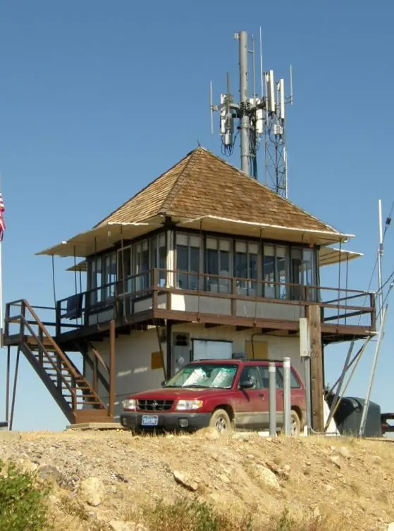
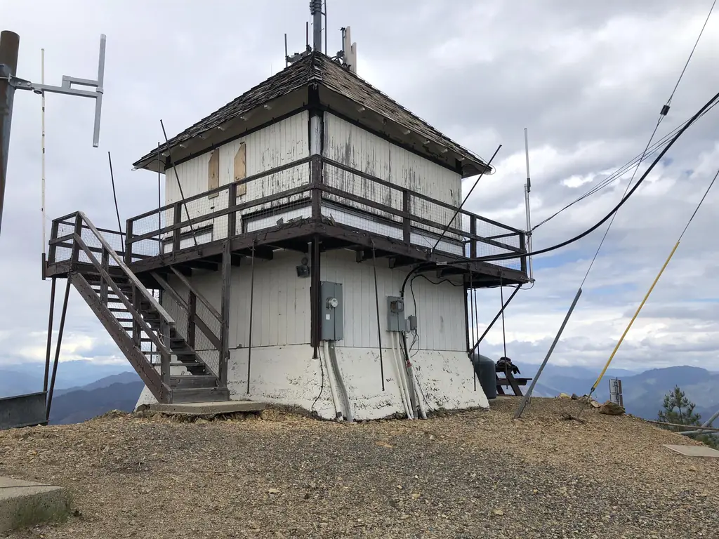
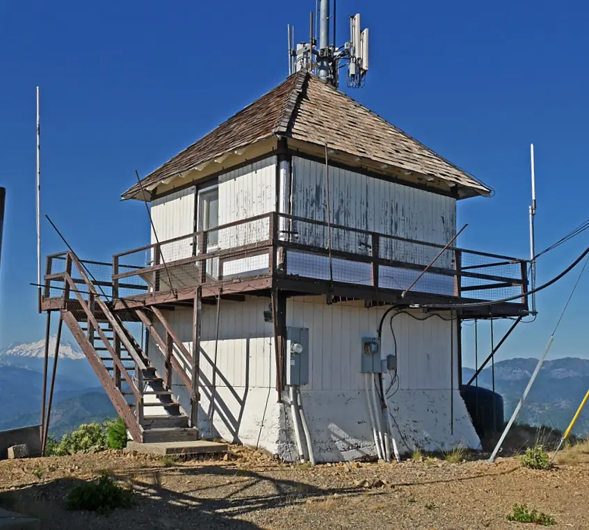
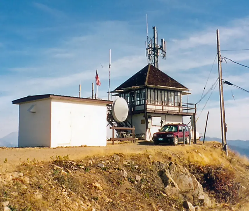
Shasta County cabin on an 8 ft concrete tower, built 1931 on Sugar Loaf Mountain; staffed in the 1930s-40s, closed in 1954, listed as standing today.
- Standing
- Access unknown
- Verified
Visit & stay
Not rentable. As far as we know, this lookout cannot be booked for overnight stays.
Access
Access unknown
We do not know the access rules. Check with the land manager before you go.
- Can you climb it?
- Unknown
- Road to the top?
- Unknown
- Staffing
- Unknown
Facts
- Status
- Type
- Two-story buildingCalifornia Region 5 Plan 4AR cabin on an 8 ft concrete towerThe design: D-5 (4-AR)
- Built of
- WoodGoing by its design; no source says so in words.
- Built
- 1931
- Height
- Unknown
- Elevation
- 3,944 ft (1,202 m)
- Agency
- US Forest Service - Shasta-Trinity National Forest
- Land
- Federal land
- Location
- Shasta County, California
- Coordinates
- 40.91444, −122.44491
- Registers
- This entry
- VerifiedResearched, then checked independently. Updated 8 Oct 2026.
- Firefinder id
us-ca-sugarloaf
View from the cab
What you see from the cab: every ridge out to about 93 miles, the named peaks in sight, and other fire lookouts within view, worked out from terrain data in your browser.
Downloads about 3.5 MB of terrain data the first time.
Or see what it could see on the map: the ground in its line of sight.
History
Then and now
- 1931 BuiltRegister 'Built' field: 1931Source: nhlr.org
- 1932 EventForest road crew moved to Doney Creek; a new road from the state highway to the lookout was to be builtSource: californialookouts.weebly.com
- 1935 First staffedClyde Norman accepted a lookout post; earliest staffing in the sources readSource: californialookouts.weebly.com
- 1941 StaffedLookout Harold D. Lenros and wife living at the station with their small sonSource: californialookouts.weebly.com
- 1944 FireFire north of Lamoine, about one acre, held by a Pollard crewSource: californialookouts.weebly.com
- 1944 StaffedMildred Jackson on duty, with her daughter, a cat and a dogSource: californialookouts.weebly.com
- 1954 ClosedClipping dated Nov 11, 1954 says the Forest Service closed it; it calls it the last of four Shasta-Trinity lookouts reopened the month beforeSource: californialookouts.weebly.com
- No record between 1954 and 2019
- 2019 Added to the National Historic Lookout RegisterDate Registered on NHLR page: October 27, 2019Source: nhlr.org
- TodayStandingIt still stands, as far as our sources know.
Old maps of this spot
USGS topographic maps from the years a lookout stood may show it, often as a small symbol labelled “Lookout”. See the old topo maps around it on the Firefinder map, or find every scanned sheet of this spot on USGS TopoView (opens another site) (click the spot there to list them, with dates and downloads).
Story
Researched 8 Oct 2026, fact-checked.
Sugarloaf Lookout stands on Sugar Loaf Mountain in Shasta County, California, on land the U.S. Forest Service manages as part of the Shasta-Trinity National Forest.1,2 The register gives its elevation as 3,944 feet (1,202 meters) and describes a California Region 5 Plan 4AR cabin perched on a concrete tower eight feet high.1
The register dates the cabin to 1931.1 In November 1932 a forest road crew was moved to Doney Creek, where a new road was to be built from the state highway up to the lookout.2
Staffing shows up in clippings from the Dunsmuir News, copied on the Kemnow site. Clyde Norman took a lookout post in 1935.2 By 1941 the paper described lookout Harold D. Lenros and his wife living at the station with their small son.2 In July 1944 Mildred Jackson of San Francisco was on duty, with her daughter, a cat and a dog for company.2 That September the paper said she was the first to report a one-acre fire north of Lamoine, and that a Pollard crew stopped it at that size.2
The Forest Service closed the lookout in November 1954. It had been one of four Shasta-Trinity lookouts reopened the month before because of warm weather, and the paper called Sugar Loaf the last of the four.2 The sources I read do not say whether anyone staffed it again.2
Today the FFLA California list shows the lookout as standing, and the register still lists it.3,1 The register's photo list includes a 2019 picture.1 I did not find a current access or rental notice in the sources I checked, so anyone planning a visit should contact the Forest Service first.
- Sugarloaf Lookout, National Historic Lookout Register, http://nhlr.org/lookouts/us/ca/sugarloaf-lookout/ (accessed 2026-10-08). ↩
- Sugarloaf - FOREST LOOKOUTS, Forest Lookouts (Ron Kemnow), https://californialookouts.weebly.com/sugarloaf.html (accessed 2026-10-08). ↩
- California Lookouts, Forest Fire Lookout Association, https://firelookout.org/lookouts/us/ca/ (accessed 2026-10-08). ↩
Photos
Photos keep their own rights and are shown with credit. Is one of these yours? You can ask for a different credit or for removal.
Sources
- National Historic Lookout Register (NHLR) (opens another site) Gave us: name, location, county, elevation, what it is built of, register numbers, agency, ownership, dates, photos, links National Historic Lookout Register (nhlr.org) · All rights reserved (American Resources, Inc.); facts extracted only, no prose copied. · retrieved 4 Oct 2026
- Forest Fire Lookout Association (FFLA) - US lookout lists (opens another site) Gave us: type, status, register numbers, links Forest Fire Lookout Association (firelookout.org) · No licence stated; facts extracted only, no prose copied. · retrieved 8 Oct 2026
- OpenStreetMap -- fire lookout structures (opens another site) Gave us: links © OpenStreetMap contributors · ODbL 1.0. (c) OpenStreetMap contributors. · retrieved 4 Oct 2026
- FOREST LOOKOUTS -- western US (Ron Kemnow's weebly sites) (opens another site) Gave us: links Ron Kemnow's Forest Lookouts sites (westlookouts, californialookouts, idaholookouts, montanalookouts, oregonlookouts and washingtonlookouts .weebly.com) · No licence stated; facts only (county, land manager, status word, coordinates where the page's own map widget gives them, township-range-section, height and design hints, links). The site's own newspaper quotes, citations and narrative are not reproduced. · retrieved 8 Oct 2026
- Firefinder research Gave us: summary, design, status, agency, dates, links, fact-check Firefinder research (sources cited in the story footnotes) · Our own research notes; each fact cites its source in the lookout's story
More about this lookout elsewhere
- NHLR register entry US 1349 (nhlr.org) (opens another site)
- FFLA California lookout list (firelookout.org) (opens another site)
- Sugar Loaf Mountain on Forest Lookouts, western US (Ron Kemnow) (opens another site)
- OpenStreetMap node 13429338779 (opens another site)
Firefinder takes facts (places, dates, numbers) from these sources and writes its own words. See all sources and licences.