Fire lookout · Idaho County, Idaho
Grave Point Lookout
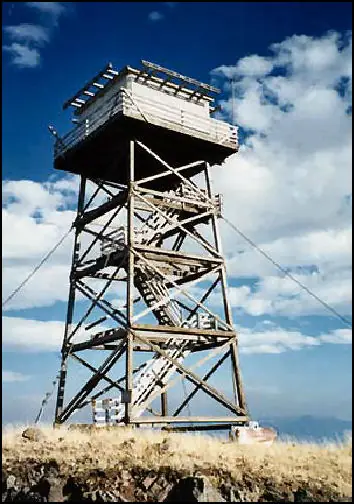
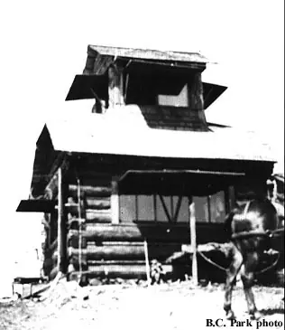
A 1924 log cupola cabin at a 1922 detection camp was replaced in 1954 by the current L-4 tower, now on emergency-use status overlooking Hells Canyon.
- Standing
- Restricted access
- Verified
Visit & stay
Not rentable. As far as we know, this lookout cannot be booked for overnight stays.
Access
Restricted access
Access is seasonal, gated or needs a permit. Check before you go. Easy drive-up access reported by visitors, but not a public rental; emergency-use Forest Service lookout.
- Can you climb it?
- Unknown
- Road to the top?
- Unknown
- Staffing
- Unknown
Facts
- Status
- Type
- Cab on a tower1936-model L-4 cab, 41-foot timber tower with catwalkThe designs: L-4, Cupola house
- Built of
- Wood
- Built
- 1924 sources disagree
- Height
- 41 ft (12.5 m)
- Elevation
- 5,630 ft (1,716 m)
- Agency
- U.S. Forest Service (Nez Perce National Forest)
- Land
- Federal land
- Location
- Idaho County, Idaho
- Coordinates
- 45.64222, −116.38083
- Registers
- This entry
- VerifiedResearched, then checked independently. Updated 8 Oct 2026.
- Firefinder id
us-id-grave-point
View from the cab
What you see from the cab: every ridge out to about 93 miles, the named peaks in sight, and other fire lookouts within view, worked out from terrain data in your browser.
Downloads about 3.7 MB of terrain data the first time.
Or see what it could see on the map: the ground in its line of sight.
History
Then and now
- 1922 EventFire detection camp first established at the site.Source: idahofirelookouts.com
- 1924 BuiltLog cupola cabin built.Sources: nhlr.org, firelookout.com, idahofirelookouts.com
- No record between 1924 and 1954
- 1954 Built'Built' field on NHLR detail pageSource: NHLR register entry
- 1954 Replaced by a new structureCurrent 41-foot timber tower with 1936-model L-4 cab and catwalk built, replacing the 1924 cupola cabin.Sources: nhlr.org, firelookout.com
- No record between 1954 and 1981
- 1981 StaffedStaffed by Kris Anderson.Source: idahofirelookouts.com
- No record between 1981 and 2009
- 2009 Added to the National Historic Lookout RegisterRegistered on the National Historic Lookout Register, April 24, 2009, as US 788.Source: nhlr.org
- TodayStandingIt still stands, as far as our sources know.
Old maps of this spot
USGS topographic maps from the years a lookout stood may show it, often as a small symbol labelled “Lookout”. See the old topo maps around it on the Firefinder map, or find every scanned sheet of this spot on USGS TopoView (opens another site) (click the spot there to list them, with dates and downloads).
Story
Researched 4 Oct 2026, fact-checked.
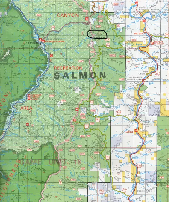
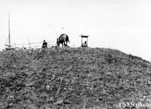
A fire detection camp was first set up at Grave Point in 1922, and two years later crews built a log cupola cabin on the site.1,2 That early cabin stood for three decades before the Nez Perce National Forest replaced it in 1954 with the 41-foot timber tower that's there now, topped with a 1936-model L-4 cab and catwalk.1 The lookout overlooks both the Salmon River and the Hells Canyon stretch of the Snake River, a vantage point that made it useful for more than just spotting smoke — for several years it was also used as a site for hacking falcons, a technique for releasing young raptors into the wild.1
Known staff include Kris Anderson, who worked the tower in 1981.3 Grave Point was added to the National Historic Lookout Register on April 24, 2009, as US 788.1
Today the tower is on emergency-use status rather than staffed every season, but by most accounts it's in sturdy shape.3 Visitors who have been there describe easy drive-up access even in winter, when conditions allow, and a wide western view across the Hells Canyon area; one group that visited suggested it would make a good addition to a lookout rental program with a bit of upkeep, though it is not currently listed as a rental.3 As with any Forest Service lookout, road and site conditions can change season to season, so checking current status with the Nez Perce-Clearwater National Forests before visiting is worthwhile.
- Grave Point Lookout, National Historic Lookout Register, http://nhlr.org/lookouts/us/id/grave-point-lookout/ (accessed 2026-10-04). ↩
- Grave Point Lookout, firelookout.com, https://www.firelookout.com/id/gravepoint.html (accessed 2026-10-04). ↩
- Grave Point Lookout, Idaho Fire Lookouts, https://www.idahofirelookouts.com/west-central/grave-point-lookout/ (accessed 2026-10-04). ↩
Photos
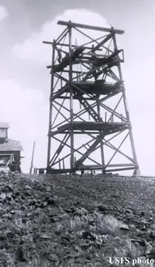
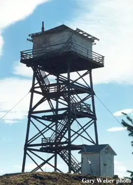
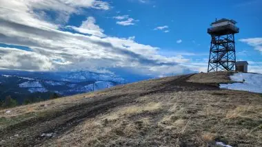
Photos keep their own rights and are shown with credit. Is one of these yours? You can ask for a different credit or for removal.
Where sources disagree
We show disagreements between sources instead of quietly picking one. If you know which is right, please tell us.
Sources disagree on the year it was built.
- NHLR: 1954
- firelookout.com -- Rex Kamstra's Forest Fire Lookout Page: 1924
Sources give different build years. Often one counts the first lookout on the site and another the structure there now.
Sources
- National Historic Lookout Register (NHLR) (opens another site) Gave us: name, location, county, elevation, what it is built of, register numbers, agency, ownership, dates, photos, links National Historic Lookout Register (nhlr.org) · All rights reserved (American Resources, Inc.); facts extracted only, no prose copied. · retrieved 4 Oct 2026
- Forest Fire Lookout Association (FFLA) - US lookout lists (opens another site) Gave us: type, status, register numbers, links Forest Fire Lookout Association (firelookout.org) · No licence stated; facts extracted only, no prose copied. · retrieved 8 Oct 2026
- firelookout.com -- Rex Kamstra's Forest Fire Lookout Page (opens another site) Gave us: design, photos, links firelookout.com · No licence stated on the site; facts only (coordinates, elevation, built/destroyed years, design, agency). Photos mirrored with the site's stated credit. · retrieved 4 Oct 2026
- Idaho Fire Lookouts (idahofirelookouts.com) (opens another site) Gave us: photos, links idahofirelookouts.com · No licence stated; facts only (coordinates, status/built/destroyed year parsed from each entry's short excerpt). Thumbnail photos mirrored with credit per the project's photo policy. · retrieved 4 Oct 2026
- OpenStreetMap -- fire lookout structures (opens another site) Gave us: links © OpenStreetMap contributors · ODbL 1.0. (c) OpenStreetMap contributors. · retrieved 4 Oct 2026
- FOREST LOOKOUTS -- western US (Ron Kemnow's weebly sites) (opens another site) Gave us: height, links Ron Kemnow's Forest Lookouts sites (westlookouts, californialookouts, idaholookouts, montanalookouts, oregonlookouts and washingtonlookouts .weebly.com) · No licence stated; facts only (county, land manager, status word, coordinates where the page's own map widget gives them, township-range-section, height and design hints, links). The site's own newspaper quotes, citations and narrative are not reproduced. · retrieved 8 Oct 2026
- Firefinder research Gave us: summary, design, status, agency, access, dates, links, fact-check Firefinder research (sources cited in the story footnotes) · Our own research notes; each fact cites its source in the lookout's story
More about this lookout elsewhere
- NHLR register entry US 788 (nhlr.org) (opens another site)
- FFLA Idaho lookout list (firelookout.org) (opens another site)
- Photos of staffed lookouts on Nez Perce/Clearwater National Forests (opens another site)
- Grave Point on firelookout.com (Rex Kamstra) (opens another site)
- Grave Point Lookout on idahofirelookouts.com (opens another site)
- Grave Point on Forest Lookouts, western US (Ron Kemnow) (opens another site)
- OpenStreetMap way 964663252 (opens another site)
Firefinder takes facts (places, dates, numbers) from these sources and writes its own words. See all sources and licences.