Fire lookout · Clearwater County, Idaho
Scurvy Mountain Lookout
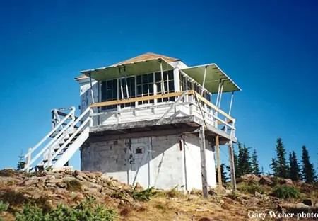
A 1917 platform lookout evolved into the 1952 L-4 cab standing today, staffed until 1978 and restored by volunteers into a rentable cabin.
- Standing
- Rentable
- Open to the public
- Verified
Visit & stay
You can rent this lookout for overnight stays through recreation.gov.
Rules
- Pack out all trash
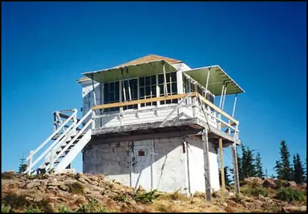
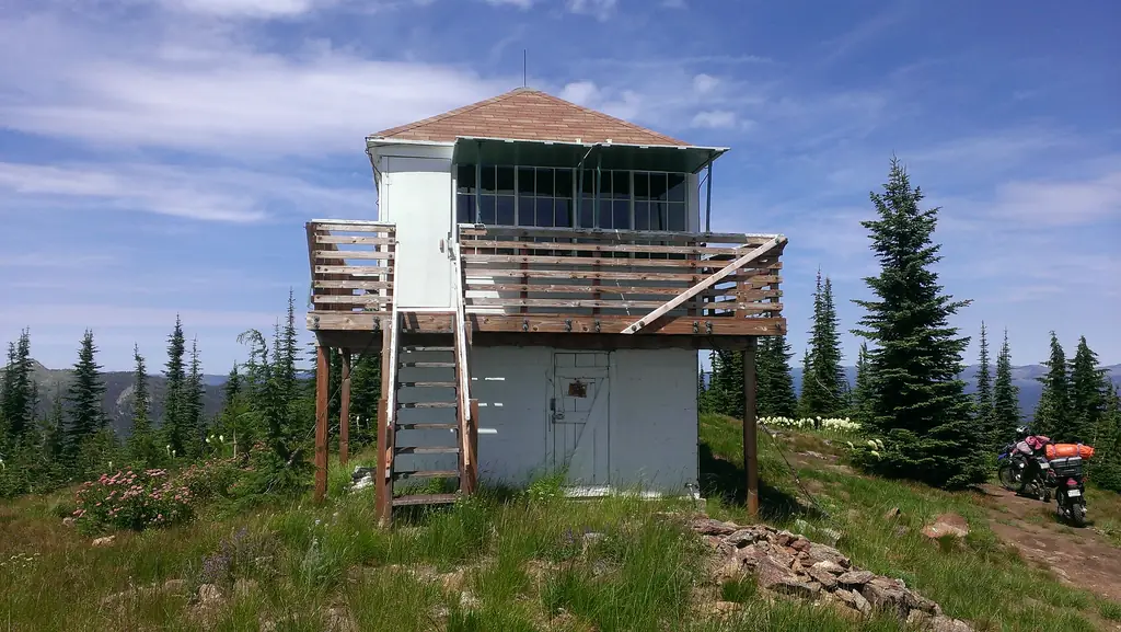
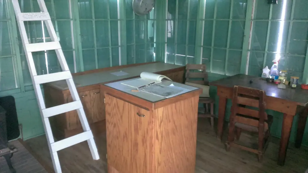
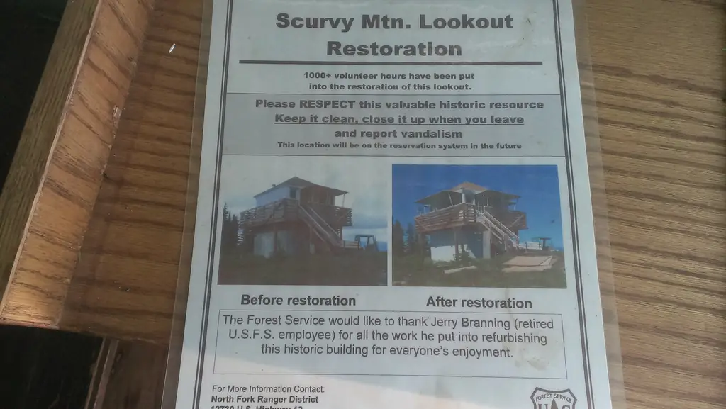
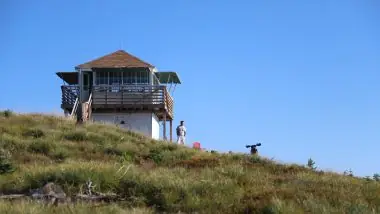
Overview The popular lookout is perched on Scurvy peak at the end of trail #524 overlooking the Moose buttes, Cayuse and Kelly Cr drainages and Scurvy Lake. The first lookout was a platform built in 1917 with a cabin added in 1935. The present cab was built in 1952 that was gradually restored by volunteers over a 10-year span and became an inclusion to the National Register of Historic lookouts in 2004. The trailhead to the cabin is not assessable with low clearance vehicles, and the 4 plus miles of trail from the trailhead to the cabin is a moderately difficult, multi-use trail with several steep grades. Guests must bring their own supplies and gear for a comfortable stay as there are no linens, cleaning supplies, or toiletries provided. Although assessable by OHV's less than 50" in width, the roads and trails leading to the cabin can be partially or fully blocked by debris or snowpack in the early season. Off trail/road motorized travel is strictly prohibited. Visitors are strongly advised to consult the forest website, as well as a map prior to reserving or traveling to the cabin and to call the district information desk with any questions. Recreation Due to its location, the lookout is an ideal base camp for those looking to reconnect with nature, or as a stopover for a variety of outdoor enthusiasts as they explore the district. The remote location combined with the open skyline and a 360-degree view is perfect for those who enjoy stargazing. There are also several other trails in the vicinity that offer connection to a host of recreation opportunities including berry picking, hiking, biking, sightseeing, and birding being the most popular. Recreate responsibly, be sure to check the regulations and rules to educate yourself before you recreate by visiting https://idfg.idaho.gov/ and https://www.fs.usda.gov/news/nezperceclearwater/news-events for up-to-date information. Facilities The restored lookout is comprised of a 12’ x 12’ wooden “cab” surrounded by a catwalk on a 8’ high cinderblock structure. One bed, a small table with a couple chairs, two countertops that contain cabinets, a small modern wood stove, and a pit toilet outhouse are the only amenities provided. The closest water source is a small spring approximately 1/2 mile from the lookout on trail 524 (about 100 yards towards the lookout from the 524/531 trail junction 25 yards off trail 524 on the downhill side) that requires treatment before consumption. Guests are required to pick up after their pets/stock, pack out their trash, and clean the cabin before they check-out with the provided broom under the “Leave it Cleaner than when you arrived” and the “Pack it in Pack it out” policies so everyone may enjoy their stay. Natural Features The low profile 10’ high lookout cab is positioned in a clearing on top of Scurvy mountain’s 6600’ peak. The vantage point provides guests with a panoramic view of the surrounding area that include the Cayuse Cr and Weitas Cr drainages to the South, Cook Mountain in the west, a broadside of the Moose Cr Buttes to the north, the Bitterroot Mountains, and Scurvy Lake to the east. The area boasts a wide diversity of wildlife and birds, so visitors never know what to expect while enjoying the scenery, but mule deer, mountain lion, black bear, elk, Mountain Bluebird, Mountain Jay, Raven, and Tanager are the most common. The unhindered view of the sunsets and rises on the horizon can be quite spectacular, as is the stargazing on a clear evening or the extraordinary fall colors back dropped with mountains capped by advancing snow late in the season are sites to behold. Nearby Attractions The North Fork Ranger District prides itself on the diversity of world class recreational opportunities ranging from bird/wildlife watching, big game hunting, whitewater rafting, leisurely floats, secluded backpacking/equestrian trails into the high mountain backcountry, to motorized OHV trail systems providing unique experiences that draw visitors from around the world and all walks of life.
Book on recreation.gov (opens recreation.gov)
Rental details from recreation.gov, checked 12 Oct 2026. Rules, fees and seasons change, so confirm on the booking page before you go. Data source: ridb.recreation.gov
Access
Open to the public. Reached via Trail #524, 4+ miles, moderately difficult; trailhead needs higher-clearance vehicle; OHVs under 50in width permitted on approach.
- Can you climb it?
- No
- Road to the top?
- No, you have to hike
- Trail
- 4+ mile moderately difficult multi-use trail from trailhead; can be blocked by debris/snow early season.
- Staffing
- Unknown
Facts
- Status
- Type
- Two-story buildingL-4 (two-story, concrete block, without outriggers)The design: L-4
- Built of
- WoodGoing by its design; no source says so in words.
- Built
- 1917 sources disagree
- Height
- 6,636 ft (2022.7 m)
- Elevation
- 6,636 ft (2,023 m)
- Agency
- U.S. Forest Service, Nez Perce-Clearwater National Forests (Clearwater NF)
- Land
- Federal land
- Location
- Clearwater County, Idaho
- Coordinates
- 46.68940, −115.13442
- Registers
- This entry
- VerifiedResearched, then checked independently. Updated 12 Oct 2026.
- Firefinder id
us-id-scurvy-mountain
View from the cab
What you see from the cab: every ridge out to about 93 miles, the named peaks in sight, and other fire lookouts within view, worked out from terrain data in your browser.
Downloads about 3.8 MB of terrain data the first time.
Or see what it could see on the map: the ground in its line of sight.
History
Then and now
- 1917 BuiltFirst lookout: a platform tower.Source: nhlr.org
- 1923 AlteredLog cabin added, per Idaho Fire Lookouts (NHLR and firelookout.com instead place a cabin addition in 1935).Source: idahofirelookouts.com
- 1935 AlteredNHLR and firelookout.com record a cabin addition in 1935; Idaho Fire Lookouts instead describes a separate L-4 cab built this year.Sources: nhlr.org, firelookout.com
- No record between 1935 and 1952
- 1952 Built'Built' field on NHLR detail pageSource: NHLR register entry
- 1952 RebuiltPresent two-story concrete-block L-4 cab built.Sources: nhlr.org, idahofirelookouts.com, firelookout.com
- No record between 1952 and 1978
- 1978 Last staffedStaffed until 1978, when placed on emergency status.Source: nhlr.org
- No record between 1978 and 2004
- 2004 Added to the National Historic Lookout RegisterAdded to the National Historic Lookout Register, March 2, 2004.Sources: nhlr.org, recreation.gov
- TodayStandingIt still stands, as far as our sources know.
Old maps of this spot
USGS topographic maps from the years a lookout stood may show it, often as a small symbol labelled “Lookout”. See the old topo maps around it on the Firefinder map, or find every scanned sheet of this spot on USGS TopoView (opens another site) (click the spot there to list them, with dates and downloads).
Story
Researched 4 Oct 2026, fact-checked.
The first lookout on Scurvy Mountain was a simple platform, raised in 1917 on the Clearwater National Forest.1 A cabin followed, though sources differ on when: the National Historic Lookout Register says 1935, while Idaho Fire Lookouts gives 1923 for the cabin and 1935 for a separate L-4 cab.1,2 Either way, the structure that stands today came later: a two-story, concrete-block L-4 cab (without outriggers) built in 1952, set on an 8-foot cinderblock base.1,3,4
The mountain's name has nothing to do with the lookout itself. According to local history recorded by Idaho Fire Lookouts, it comes from two fur trappers, George Gorman and Clayton Shoecraft, who holed up here through the winter of 1907 while on the run from a possible murder charge in Montana. Without fresh fruit or vegetables, they came down with scurvy; their graves are said to lie near the airstrip at Cayuse Creek.2
The lookout was staffed into 1978, when it was shifted to emergency status rather than fully decommissioned.1 From there it fell into disrepair, and local volunteers spent roughly a decade restoring it.1,4 That work paid off in 2004, when Scurvy Mountain Lookout was added to the National Historic Lookout Register.1
Today the cabin sits at the end of Trail #524, above Scurvy Lake with views over the Moose Buttes, Cayuse, and Kelly Creek drainages.4 It's available through the Forest Service's Recreation Rental program on a first-come, first-served basis.2,4 Getting there isn't casual: the trailhead itself needs a higher-clearance vehicle, and the approach is four-plus miles of moderately difficult, multi-use trail with steep sections; the route can also be reached by OHVs under 50 inches wide, though it may be blocked by debris or snow early in the season.4 The 12x12-foot wooden cab, surrounded by a catwalk, sleeps on a single bed with a small wood stove, a table, and a pit toilet outside; the nearest water is an untreated spring about half a mile down the trail.4
- Scurvy Mountain Lookout, National Historic Lookout Register, http://nhlr.org/lookouts/us/id/scurvy-mountain-lookout/ (accessed 2026-10-04). ↩
- Scurvy Mountain Lookout, Idaho Fire Lookouts, https://www.idahofirelookouts.com/st-joe-clearwater-region/scurvy-mountain-lookout/ (accessed 2026-10-04). ↩
- Scurvy Mountain Lookout Tower, firelookout.com, https://www.firelookout.com/id/scurvymtn.html (accessed 2026-10-04). ↩
- Scurvy Mountain Lookout, Recreation.gov, https://www.recreation.gov/camping/campgrounds/10322605 (accessed 2026-10-04). ↩
Photos
Photos keep their own rights and are shown with credit. Is one of these yours? You can ask for a different credit or for removal.
Where sources disagree
We show disagreements between sources instead of quietly picking one. If you know which is right, please tell us.
Sources disagree on the year it was built.
- NHLR: 1952
- firelookout.com -- Rex Kamstra's Forest Fire Lookout Page: 1917
- recreation.gov: 1952
Sources give different build years. Often one counts the first lookout on the site and another the structure there now.
Sources
- National Historic Lookout Register (NHLR) (opens another site) Gave us: name, location, county, elevation, register numbers, agency, dates, photos, links National Historic Lookout Register (nhlr.org) · All rights reserved (American Resources, Inc.); facts extracted only, no prose copied. · retrieved 4 Oct 2026
- Forest Fire Lookout Association (FFLA) - US lookout lists (opens another site) Gave us: type, status, register numbers, links Forest Fire Lookout Association (firelookout.org) · No licence stated; facts extracted only, no prose copied. · retrieved 8 Oct 2026
- Recreation Information Database (recreation.gov) (opens another site) Gave us: ownership, access, rental details, links Data source: ridb.recreation.gov · Public data from the US government · retrieved 12 Oct 2026
- Recreation Information Database (recreation.gov) (opens another site) Data source: ridb.recreation.gov · Public data from the US government · retrieved 12 Oct 2026
- Forest Fire Lookout Association: lookout rentals (opens another site) Gave us: rental details, links Forest Fire Lookout Association rentals list (firelookout.org) · No licence stated; facts extracted only (state, name, booking link, manager, closure note), no prose copied. The FFLA says it is not involved in managing any rental program. · retrieved 12 Oct 2026
- firelookout.com -- Rex Kamstra's Forest Fire Lookout Page (opens another site) Gave us: what it is built of, design, photos, links firelookout.com · No licence stated on the site; facts only (coordinates, elevation, built/destroyed years, design, agency). Photos mirrored with the site's stated credit. · retrieved 4 Oct 2026
- Idaho Fire Lookouts (idahofirelookouts.com) (opens another site) Gave us: photos, links idahofirelookouts.com · No licence stated; facts only (coordinates, status/built/destroyed year parsed from each entry's short excerpt). Thumbnail photos mirrored with credit per the project's photo policy. · retrieved 4 Oct 2026
- FOREST LOOKOUTS -- western US (Ron Kemnow's weebly sites) (opens another site) Gave us: links Ron Kemnow's Forest Lookouts sites (westlookouts, californialookouts, idaholookouts, montanalookouts, oregonlookouts and washingtonlookouts .weebly.com) · No licence stated; facts only (county, land manager, status word, coordinates where the page's own map widget gives them, township-range-section, height and design hints, links). The site's own newspaper quotes, citations and narrative are not reproduced. · retrieved 8 Oct 2026
- Firefinder research Gave us: summary, design, height, status, agency, access, visiting details, dates, links, fact-check Firefinder research (sources cited in the story footnotes) · Our own research notes; each fact cites its source in the lookout's story
More about this lookout elsewhere
- NHLR register entry US 540 (nhlr.org) (opens another site)
- Recreation.gov listing (opens another site)
- FFLA Idaho lookout list (firelookout.org) (opens another site)
- FFLA lookout rentals list (firelookout.org) (opens another site)
- Photos of staffed lookouts on Nez Perce/Clearwater National Forests (opens another site)
- Scurvy Mtn. on firelookout.com (Rex Kamstra) (opens another site)
- Scurvy Mountain Lookout on idahofirelookouts.com (opens another site)
- Scurvy Mountain on Forest Lookouts, western US (Ron Kemnow) (opens another site)
Firefinder takes facts (places, dates, numbers) from these sources and writes its own words. See all sources and licences.