Fire lookout · Idaho County, Idaho
Sourdough Peak Lookout
Also known as Sourdough Lookout
1927 Nez Perce-plan log cabin with cupola in Idaho County; last manned 1969, restored 1994-95, drive-up and still standing.
- Standing
- Open to the public
- Verified
Visit & stay
Not rentable. As far as we know, this lookout cannot be booked for overnight stays.
Access
Open to the public. Drive-up site on an unpaved forest road. A 2023 visit report describes graffiti carved inside the cabin. No closure notice found in the sources read.
- Can you climb it?
- Unknown
- Road to the top?
- Yes, you can drive up
- Trail
- 19.5 miles of unpaved NF-492 from Santiam Road; 4x4 recommended; not plowed in winter.
- Staffing
- Not staffed (as of 1969)
Facts
- Status
- Type
- Ground-level cabNez Perce log lookout house plan (L-3 type), modified to 15x15 ftThe design: Cupola house
- Built of
- Logs
- Built
- 1927
- Height
- Unknown
- Elevation
- 6,755 ft (2,059 m)
- Agency
- U.S. Forest Service
- Land
- Federal land
- Location
- Idaho County, Idaho
- Coordinates
- 45.72664, −115.81511
- Registers
- This entry
- VerifiedResearched, then checked independently. Updated 8 Oct 2026.
- Firefinder id
us-id-sourdough-peak
View from the cab
What you see from the cab: every ridge out to about 93 miles, the named peaks in sight, and other fire lookouts within view, worked out from terrain data in your browser.
Downloads about 3.6 MB of terrain data the first time.
Or see what it could see on the map: the ground in its line of sight.
History
Then and now
- 1927 BuiltConstructed using the Nez Perce log lookout house plan. The builder changed the 16x14 blueprint to 15x15 ft and added windows.Sources: nhlr.org, idahofirelookouts.com, firelookout.com
- No record between 1927 and 1969
- 1969 AbandonedFirelookout.com and Dangerous Roads say abandoned in 1969. Sources differ on the label; see resolved_conflicts.Sources: firelookout.com, dangerousroads.org
- 1969 Last staffedIdaho Fire Lookouts: last year manned, then placed on emergency status.Source: idahofirelookouts.com
- No record between 1969 and 1994
- 1994 RestoredRestored 1994-95 by the Nez Perce National Forest as a Passport in Time project using volunteers and Forest Service staff.Source: nhlr.org
- 1996 Added to the National Historic Lookout RegisterRegistered with the National Historic Lookout Register on November 25, 1996.Source: nhlr.org
- No record between 1996 and 2017
- 2017 RestoredRepainted by a volunteer.Source: firelookout.org
- TodayStandingIt still stands, as far as our sources know.
Old maps of this spot
USGS topographic maps from the years a lookout stood may show it, often as a small symbol labelled “Lookout”. See the old topo maps around it on the Firefinder map, or find every scanned sheet of this spot on USGS TopoView (opens another site) (click the spot there to list them, with dates and downloads).
Story
Researched 8 Oct 2026, fact-checked.
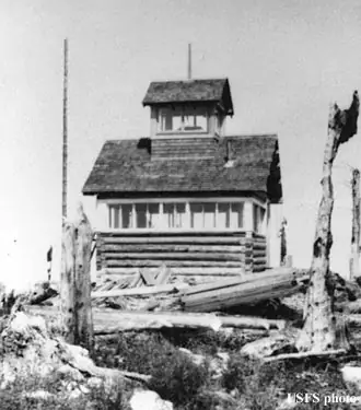
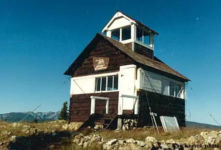
Sourdough Peak Lookout is a log cabin with a cupola on a summit of roughly 6,800 feet in Idaho County, within the Nez Perce National Forest.1,2 It was constructed in 1927 using the Nez Perce log lookout house plan, but the builder changed the planned 16-by-14-foot structure to 15 by 15 feet and added windows all around.3
From 1919 through 1931, 20 log cabin lookouts with cupolas were built on the Forest. Sourdough Peak is the only one left on the Forest today.4
The lookout was last manned in 1969. Idaho Fire Lookouts says that was the last year it was staffed, after which it went on emergency status.2 Firelookout.com and Dangerous Roads both say it was abandoned in 1969, so the sources differ on how to describe that change.1,5 Idaho Fire Lookouts says its staffing record for the lookout is not yet documented.2
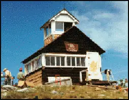
The Nez Perce National Forest restored the cabin in 1994 and 1995 as a Passport in Time project, with volunteers working alongside Forest Service staff.3 The National Historic Lookout Register recorded the site on November 25, 1996.3
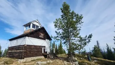
Idaho Fire Lookouts lists the site as drive-up, with emergency status.2 A visit it reported in September 2023 found the cabin and grounds holding up reasonably well, though two windows were broken and mouse droppings covered the building.2 The writer lingered at least an hour over the graffiti carved inside.2
The road in is NF-492 (Santiam-Sourdough Road). It is unpaved, runs 19.5 miles from Santiam Road, is not plowed in winter, and a 4x4 is recommended.5
- Sourdough Peak Fire Lookout Cabin, Forest Fire Lookout (Rex Kamstra), https://www.firelookout.com/id/sourdough.html (accessed 2026-10-08). ↩
- Sourdough Lookout, Idaho Fire Lookouts, https://www.idahofirelookouts.com/selway-region/sourdough-lookout/ (accessed 2026-10-08). ↩
- Sourdough Peak Lookout, National Historic Lookout Register, http://nhlr.org/lookouts/us/id/sourdough-peak-lookout/ (accessed 2026-10-08). ↩
- Nez Perce National Forest Lookout Facts, U.S. Forest Service, https://www.fs.usda.gov/media/259200 (accessed 2026-10-08). ↩
- How to drive the unpaved road to the lookout at Sourdough Peak in Idaho, Dangerous Roads, https://www.dangerousroads.org/north-america/usa/6780-sourdough-peak.html (accessed 2026-10-08). ↩
Photos
Photos keep their own rights and are shown with credit. Is one of these yours? You can ask for a different credit or for removal.
Sources
- National Historic Lookout Register (NHLR) (opens another site) Gave us: name, location, county, elevation, what it is built of, register numbers, agency, ownership, dates, photos, links National Historic Lookout Register (nhlr.org) · All rights reserved (American Resources, Inc.); facts extracted only, no prose copied. · retrieved 4 Oct 2026
- Forest Fire Lookout Association (FFLA) - US lookout lists (opens another site) Gave us: type, status, register numbers, links Forest Fire Lookout Association (firelookout.org) · No licence stated; facts extracted only, no prose copied. · retrieved 8 Oct 2026
- firelookout.com -- Rex Kamstra's Forest Fire Lookout Page (opens another site) Gave us: dates, photos, links firelookout.com · No licence stated on the site; facts only (coordinates, elevation, built/destroyed years, design, agency). Photos mirrored with the site's stated credit. · retrieved 4 Oct 2026
- Idaho Fire Lookouts (idahofirelookouts.com) (opens another site) Gave us: photos, links idahofirelookouts.com · No licence stated; facts only (coordinates, status/built/destroyed year parsed from each entry's short excerpt). Thumbnail photos mirrored with credit per the project's photo policy. · retrieved 4 Oct 2026
- Forest Fire Lookout Association chapter reports (opens another site) Gave us: dates, links Forest Fire Lookout Association, chapter and restoration-grant reports (firelookout.org) · No licence stated; facts only (dates, names, the kind of work done). Every note is our own wording and every event links to the FFLA report it comes from. Positions are copied from the NHLR, FFLOS and FFLA records. · retrieved 8 Oct 2026
- OpenStreetMap -- fire lookout structures (opens another site) Gave us: access, links © OpenStreetMap contributors · ODbL 1.0. (c) OpenStreetMap contributors. · retrieved 4 Oct 2026
- Firefinder research Gave us: summary, design, status, agency, access, staffing, visiting details, dates, links, fact-check Firefinder research (sources cited in the story footnotes) · Our own research notes; each fact cites its source in the lookout's story
More about this lookout elsewhere
- NHLR register entry US 167 (nhlr.org) (opens another site)
- Nez Perce National Forest Lookout Facts (U.S. Forest Service) (opens another site)
- How to drive the unpaved road to the lookout at Sourdough Peak in Idaho (Dangerous Roads) (opens another site)
- FFLA Idaho lookout list (firelookout.org) (opens another site)
- Forest Fire Lookout Association chapter reports: work on Sourdough Peak Lookout (opens another site)
- Sourdough Peak on firelookout.com (Rex Kamstra) (opens another site)
- Sourdough Lookout on idahofirelookouts.com (opens another site)
- OpenStreetMap way 900178017 (opens another site)
Firefinder takes facts (places, dates, numbers) from these sources and writes its own words. See all sources and licences.