Fire lookout · Rowan County, Kentucky
Hickory Flats Fire Tower
A Rowan County, Kentucky tower dated to 1934 (builder disputed), abandoned, damaged by arson in 2008, restored, and now rented for overnight stays by the Route 377 fire department.
- Standing
- Open to the public
- Verified
Visit & stay
Not rentable. As far as we know, this lookout cannot be booked for overnight stays.
Access
Open to the public. Hike in on foot past a vehicle gate; overnight stays are booked online through Morehead-Rowan County Tourism
- Can you climb it?
- Yes
- Road to the top?
- No, you have to hike
- Trail
- About 1.2 miles on foot past a vehicle gate, per The Outbound
- Staffing
- Unknown
Facts
- Status
- Type
- Cab on a tower80-foot steel Aermotor tower with a 7x7 cab (register says metal cab; county says wooden)The design: Aermotor
- Built of
- Steel
- Built
- 1934
- Height
- 80 ft (24.4 m)
- Elevation
- 1,339 ft (408 m)
- Agency
- Route 377 Volunteer Fire Department
- Land
- Federal land
- Location
- Rowan County, Kentucky
- Coordinates
- 38.34133, −83.39473
- Registers
- This entry
- VerifiedResearched, then checked independently. Updated 8 Oct 2026.
- Firefinder id
us-ky-hickory-flats
View from the cab
What you see from the cab: every ridge out to about 93 miles, the named peaks in sight, and other fire lookouts within view, worked out from terrain data in your browser.
Downloads about 3.3 MB of terrain data the first time.
Or see what it could see on the map: the ground in its line of sight.
History
Then and now
- 1934 BuiltWooden tower; county credits the CCC, while the register credits the U.S. Forest ServiceSources: rcky.us, rcky.us
- 1935 Replaced by a new structureReplaced with steel, per the county tower pageSource: rcky.us
- No record between 1935 and 1975
- 1975 AbandonedMid-1970s per the county news post (approximate year); the county tower page says the Forest Service stopped using it in the 1960sSources: rcky.us, rcky.us
- No record between 1975 and 2002
- 2002 Added to the National Historic Lookout RegisterRegistered November 12, 2002 as US 447, KY 4Source: nhlr.org
- 2008 FireDamaged in arson on December 3, 2008Source: rcky.us
- 2022 Opened as a rentalVisit report of October 18, 2022 says the tower is now available for rentalSource: nhlr.org
- TodayStandingIt still stands, as far as our sources know.
Old maps of this spot
USGS topographic maps from the years a lookout stood may show it, often as a small symbol labelled “Lookout”. See the old topo maps around it on the Firefinder map, or find every scanned sheet of this spot on USGS TopoView (opens another site) (click the spot there to list them, with dates and downloads).
Story
Researched 8 Oct 2026, fact-checked.
Hickory Flats Fire Tower stands in Rowan County, Kentucky, and the Route 377 Volunteer Fire Department administers the site.1 It stands off Cranston Road (KY 377), along Elk Lick Road.2
Sources disagree on who built it. The register says the U.S. Forest Service built it on the Cumberland National Forest, later renamed Daniel Boone.1 The county says the Civilian Conservation Corps built a wooden tower in 1934 and replaced it with steel in 1935.2,3
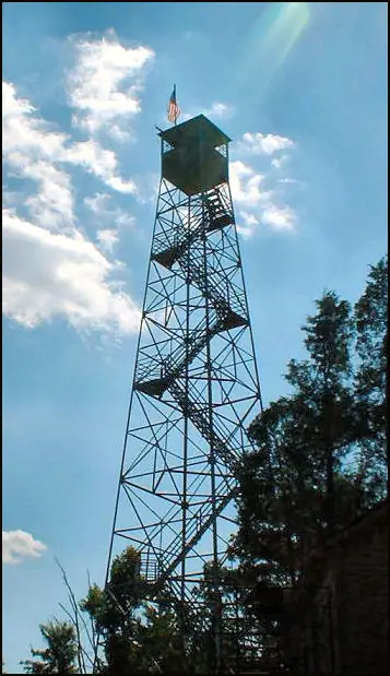
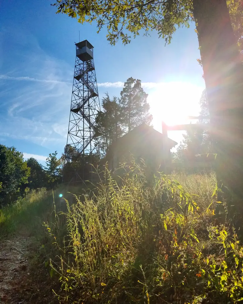
The register describes an 80-foot steel Aermotor tower with a 7-by-7 metal cab.1 The county calls the cab wooden and gives the height as 80 feet, but one county news post says 35 feet.2,3 Inside the 200-square-foot cab were a wood stove, two cots and an Osborne fire finder.2 Towers used that instrument together: a second tower's bearing was used to fix where a fire was.2 The tower sits on about six-tenths of an acre that Jim Gitz of Muncie, Indiana, donated.2
The register's visit reports list the tower as not staffed in 2008 and 2016, and as sometimes staffed in 2022.1 A 2016 visit noted that the glass needed replacing, though the overall condition was rated good.1
Sources differ on when fire lookout use ended. The county's tower page says the Forest Service stopped using the tower in the 1960s.2 The news post dates the end of lookout work to the mid-1970s, when planes had taken over, and says the tower was then abandoned.3 When the tower left service, the National Forest land was exchanged, and the register says the tower was nearly forgotten.1 Arson damaged the tower on December 3, 2008.3 It was later restored to serve as an overlook.3
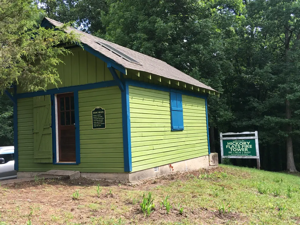
The register lists a November 12, 2002 registration as US 447, KY 4, nominated by Danny Blevins.1 The register also says the site was being transferred to the Hwy 377 Rural Fire District.1 A visit report dated October 18, 2022 says the tower was now available for rental.1 The county says overnight stays are booked online and that guests hike in to reach the tower.3 The Outbound describes a 1.2-mile hike past a vehicle gate, where foot traffic is welcome on Daniel Boone National Forest land.4 It also says visitors are welcome to climb the steps to the top.4
- Hickory Flats Fire Tower, National Historic Lookout Register, http://nhlr.org/lookouts/us/ky/hickory-flats-fire-tower/ (accessed 2026-10-08). ↩
- Rowan County Fire Towers, Rowan County, Kentucky, https://www.rcky.us/rowan-county-fire-towers (accessed 2026-10-08). ↩
- Hickory Flats Fire Tower Open!, Rowan County, Kentucky, https://www.rcky.us/news/fire-tower-open (accessed 2026-10-08). ↩
- Hike to Hickory Flats Firetower, The Outbound, https://www.theoutbound.com/kentucky/hiking/hike-to-hickory-flats-firetower (accessed 2026-10-08). ↩
Photos
Photos keep their own rights and are shown with credit. Is one of these yours? You can ask for a different credit or for removal.
Sources
- National Historic Lookout Register (NHLR) (opens another site) Gave us: name, location, county, elevation, type, what it is built of, status, register numbers, agency, dates, photos, links National Historic Lookout Register (nhlr.org) · All rights reserved (American Resources, Inc.); facts extracted only, no prose copied. · retrieved 4 Oct 2026
- FOREST LOOKOUTS -- eastern US (easternuslookouts.weebly.com) (opens another site) Gave us: ownership, links easternuslookouts.weebly.com · No licence stated; facts only (county, coordinates where the page's own map widget gives them, status, height, design hints, register links). The site's own historical quotes, newspaper citations and narrative are not reproduced. · retrieved 8 Oct 2026
- OpenStreetMap -- fire lookout structures (opens another site) Gave us: links © OpenStreetMap contributors · ODbL 1.0. (c) OpenStreetMap contributors. · retrieved 4 Oct 2026
- Firefinder research Gave us: summary, design, height, agency, access, visiting details, dates, links, fact-check Firefinder research (sources cited in the story footnotes) · Our own research notes; each fact cites its source in the lookout's story
More about this lookout elsewhere
- NHLR register entry US 447 (nhlr.org) (opens another site)
- NHLR register entry (nhlr.org) (opens another site)
- Rowan County Fire Towers (Rowan County, Kentucky (rcky.us)) (opens another site)
- Hickory Flats Fire Tower Open! (Rowan County, Kentucky (rcky.us)) (opens another site)
- Hike to Hickory Flats Firetower (The Outbound) (opens another site)
- Hickory Flats (easternuslookouts.weebly.com) (opens another site)
- OpenStreetMap node 358614074 (opens another site)
Firefinder takes facts (places, dates, numbers) from these sources and writes its own words. See all sources and licences.