Fire lookout · Worcester County, Massachusetts
Ashburnham Tower Site
Also known as Mount Watatic
Built 1916 on Mount Watatic (Ashburnham/Ashby, MA); hurricanes felled towers in 1938 and 1950, closed 1979, removed and sold 1996; summit now conservation land.
- Gone
- Open to the public
- Verified
Gone: The lookout no longer stands. Only the site is left. Tower taken down and sold in 1996; no source describes what remains of the footings.
Visit & stay
Gone: site only. The lookout no longer stands, so there is nothing to climb or rent. You may still be able to visit the site.
Access
Open to the public. Summit is protected conservation land crossed by the Wapack and Midstate trails; no tower stands to climb.
- Road to the top?
- Unknown
- Trail
- The Wapack Trail and the Midstate Trail both cross the mountain.
Facts
- Status
- Type
- Cab on a towerOriginal tower of 40 or 48 ft with fire-escape stairs; steel Aermotor-style tower from 1939, replaced by an Aermotor MC-39 style tower in 1951The design: Aermotor MC-39
- Built of
- Not recorded
- Built
- 1916
- Height
- 40 ft (12.2 m)
- Elevation
- 1,590 ft (485 m)
- Agency
- Massachusetts State Forester (state fire tower #31)
- Land
- Unknown
- Location
- Worcester County, Massachusetts
- Coordinates
- 42.69811, −71.89400
- Registers
- This entry
- VerifiedResearched, then checked independently. Updated 9 Oct 2026.
- Firefinder id
us-ma-ashburnham
View from the cab
What the lookout saw from its cab: every ridge out to about 93 miles, the named peaks in sight, and other fire lookouts within view, worked out from terrain data in your browser.
This lookout is gone. The view is reconstructed from its recorded site and its recorded height.
Downloads about 3.4 MB of terrain data the first time.
Or see what it could see on the map: the ground in its line of sight.
History
Then and now
- 1916 BuiltUnder construction by June 1916 and erected that season per the 1917 state report; firetower.org dates it 1917.Sources: firetower.org, easternuslookouts.weebly.com
- 1918 StaffedLookout in charge of the station; season finished by October.Source: easternuslookouts.weebly.com
- No record between 1918 and 1938
- 1938 DestroyedOriginal tower destroyed in the Great New England Hurricane, September 1938.Sources: firetower.org, easternuslookouts.weebly.com
- 1939 RebuiltSteel Aermotor-style replacement built by Civilian Conservation Corps crews.Source: firetower.org
- 1941 FireAshburnham forest fire: lookout reported it under control in April; AP reports said 2,000 more acres burned. It flared again in September, according to word from the tower.Source: easternuslookouts.weebly.com
- 1950 DestroyedSteel tower blown down and destroyed in a hurricane wind.Source: firetower.org
- 1951 Replaced by a new structureNew Aermotor MC-39 style tower built.Source: firetower.org
- 1960 AlteredNew cab built.Source: firetower.org
- No record between 1960 and 1979
- 1979 ClosedClosed at the end of the 1979 fire season.Source: firetower.org
- No record between 1979 and 1996
- 1996 RemovedTower removed and sold to a Connecticut resident.Sources: firetower.org, en.wikipedia.org
- 2000 EventSummit sold to Industrial Communications and Electronics for a planned 150-foot cellular tower and access road.Source: en.wikipedia.org
- 2002 EventAshby Land Trust, Ashburnham Conservation Trust, both towns and two state agencies bought the mountain for $2,500,000; about 281 acres protected.Source: en.wikipedia.org
- 2008 Added to the Former Fire Lookout Sites RegisterRegistered on the Former Fire Lookout Sites Register as US 2, MA 2.Source: firetower.org
- TodayGoneThe lookout no longer stands. Only the site is left.
Old maps of this spot
USGS topographic maps from the years a lookout stood may show it, often as a small symbol labelled “Lookout”. See the old topo maps around it on the Firefinder map, or find every scanned sheet of this spot on USGS TopoView (opens another site) (click the spot there to list them, with dates and downloads).
Story
Researched 10 Oct 2026, fact-checked.
Mount Watatic lies in Ashburnham and Ashby, Massachusetts, just south of the New Hampshire border.1 From about 1916 until 1979 the state operated a fire lookout on the mountain.2,3 Brush fires were the concern behind it.2 In November 1913 a company said brush fires had troubled it and offered to contribute to the plan.2
In March 1916 an article to appropriate $100 toward a fire lookout on the mountain was adopted.2 By June 1916 work on a fire tower there was underway.2 The state report for 1917 later described a 40-foot tower with fire-escape stairs and said two miles of telephone line had gone in.2 Firetower.org gives a different picture: a 48-foot tower built in 1917, with one mile of phone line.3 The sources disagree on height, line length and year, so this story follows the state report.
G.E. Walker ran the lookout in 1918, and by October he had wrapped up his work and gone home for the winter.2
In April 1941 the lookout said the smoke had eased and the fire seemed under control, but Associated Press reports said another 2,000 acres had burned.2 That September the Ashburnham forest fire flared up again, according to word from the tower.2
The Great New England Hurricane destroyed the original lookout in September 1938.3,2 The Civilian Conservation Corps built a new steel tower in 1939.3 Hurricane winds brought that one down in 1950. A replacement in the Aermotor MC-39 style went up in 1951, and a new cab was built in 1960.3
The station shut down when the 1979 fire season ended.3 A Connecticut resident bought the tower when it was taken down in 1996.3,1
In 2000 the summit was sold to a company that planned a 150-foot cellular tower and a road up the mountain.1 In 2002 two towns, two land trusts and two state agencies bought the mountain for $2,500,000.1 The purchase protected roughly 281 acres, the summit among them.1
Today the summit is protected land, and two long-distance trails, the Wapack and the Midstate, run across the mountain.1 The tower itself has been gone since 1996.1 No source we found describes what, if anything, remains of its footings on the summit.
- Mount Watatic, Wikipedia, https://en.wikipedia.org/wiki/Mount_Watatic (accessed 2026-10-10). ↩
- Mount Watatic, Forest Lookouts, https://easternuslookouts.weebly.com/mount-watatic.html (accessed 2026-10-10). ↩
- Ashburnham Tower Site, Former Fire Lookout Sites Register, http://firetower.org/lookouts/us/ma/ashburnham-tower-site/ (accessed 2026-10-10). ↩
Photos
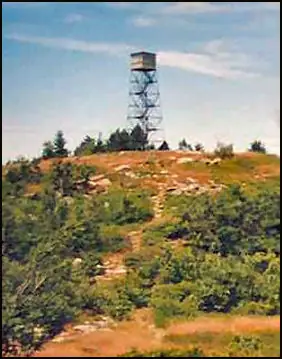
Photos keep their own rights and are shown with credit. Is one of these yours? You can ask for a different credit or for removal.
Sources
- Former Fire Lookout Sites Register (FFLOS) (opens another site) Gave us: name, location, county, elevation, status, register numbers, dates, photos, links Former Fire Lookout Sites Register (firetower.org) · All rights reserved (American Resources, Inc.); facts extracted only, no prose copied. · retrieved 4 Oct 2026
- FOREST LOOKOUTS -- eastern US (easternuslookouts.weebly.com) (opens another site) Gave us: type, height, links easternuslookouts.weebly.com · No licence stated; facts only (county, coordinates where the page's own map widget gives them, status, height, design hints, register links). The site's own historical quotes, newspaper citations and narrative are not reproduced. · retrieved 8 Oct 2026
- Firefinder research Gave us: summary, design, height, status, agency, access, visiting details, dates, links, fact-check Firefinder research (sources cited in the story footnotes) · Our own research notes; each fact cites its source in the lookout's story
More about this lookout elsewhere
- FFLOS register entry US 2 (firetower.org) (opens another site)
- Mount Watatic (Wikipedia) (opens another site)
- Mount Watatic (easternuslookouts.weebly.com) (opens another site)
Firefinder takes facts (places, dates, numbers) from these sources and writes its own words. See all sources and licences.