Fire lookout · Dorchester County, Maryland
Church Creek Forestry Tower
Also known as Church Creek
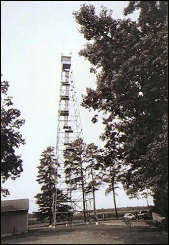
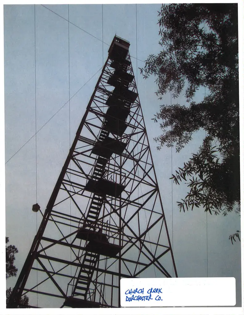
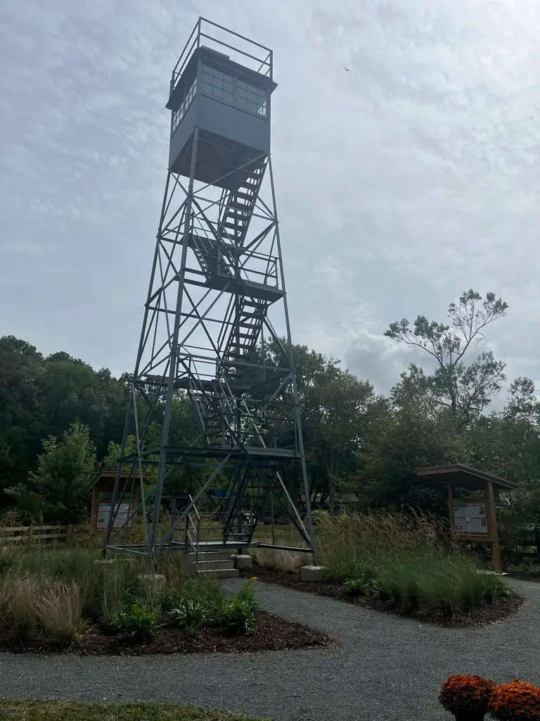
Dorchester County, MD tower built 1932, decommissioned about 1978 and dismantled in 2018; its top 40 feet was restored at the DNR Church Creek field office, open to the public but not for climbing.
- Moved
- Open to the public
- Verified
The lookout that stood here was moved. Now at the Church Creek Display
Moved: The structure was moved. The map shows where it stands now; the timeline says where it came from.
Visit & stay
Not rentable. As far as we know, this lookout cannot be booked for overnight stays.
Access
Open to the public. Small park with interpretive panels and an accessible parking area; a Maryland Historic Trust agreement required the tower be opened to the public (ACEC). The register says the restored tower is not open for climbing.
- Can you climb it?
- No
- Road to the top?
- Yes, you can drive up
- Trail
- Tower is less than 200 feet off Golden Hill Road, with ADA accessible parking (ACEC)
- Staffing
- Unknown
Facts
- Status
- sources disagree
- Type
- Cab on a tower120-foot steel tower (1932 notice); Aermotor tower with 7 by 7 foot metal cab and rooftop catwalk (NHLR); restored top 40 feet keptThe design: Aermotor
- Built of
- SteelGoing by its design; no source says so in words.
- Built
- 1932
- Height
- 120 ft (36.6 m)
- Elevation
- 4 ft (1 m)
- Agency
- Maryland DNR Forest Service (NHLR); DNR Church Creek Forestry Field Office (ACEC)
- Land
- Federal land
- Location
- Dorchester County, Maryland
- Coordinates
- 38.62328, −76.13468 sources disagree
- Registers
- This entry
- VerifiedResearched, then checked independently. Updated 9 Oct 2026.
- Firefinder id
us-md-church-creek-forestry
View from the cab
What you see from the cab: every ridge out to about 93 miles, the named peaks in sight, and other fire lookouts within view, worked out from terrain data in your browser.
The structure was moved. This view is from the position Firefinder shows for this record, at its recorded height.
Downloads about 3.4 MB of terrain data the first time.
Or see what it could see on the map: the ground in its line of sight.
History
Then and now
- 1932 BuiltConstructed by the Maryland Forest Service as a 120-foot tower; 1932 notice gives a site 4 feet above sea levelSources: nhlr.org, acecmw.org, easternuslookouts.weebly.com
- No record between 1932 and 1978
- 1978 AbandonedDecommissioned circa 1978 as fire detection technology advanced, then stood idle for about 40 years (ACEC)Source: acecmw.org
- No record between 1978 and 2007
- 2007 Added to the National Historic Lookout RegisterRegistered June 17, 2007 as US 696, MD 3Source: nhlr.org
- 2018 RemovedDismantled in 2018 for deteriorating and unsafe conditions; DNR kept the top 40 feet, including the cab, for restorationSource: acecmw.org
- 2024 RestoredRestored top 40 feet renovated as an educational display at the DNR Church Creek Forestry Field Office; the register says work was complete as of 2024. The ACEC project ran from Nov 1, 2022 to Oct 31, 2024Sources: nhlr.org, acecmw.org
- Date unknown MovedThe lookout was moved to the Church Creek Display.Source: FFLA
- TodayMovedThe structure was moved. The map shows where it stands now; the timeline says where it came from.
Old maps of this spot
USGS topographic maps from the years a lookout stood may show it, often as a small symbol labelled “Lookout”. See the old topo maps around it on the Firefinder map, or find every scanned sheet of this spot on USGS TopoView (opens another site) (click the spot there to list them, with dates and downloads).
Story
Researched 9 Oct 2026, fact-checked.
The Maryland Forest Service built the Church Creek Forestry Tower in 1932, in Dorchester County, Maryland.1 A 1932 notice quoted by Forest Lookouts describes a 120-foot steel tower about two miles south of Church Creek, on a site only 4 feet above sea level.2 The notice says the concrete abutments had to be sunk about two feet below sea level, since southwestern Dorchester County has no hills and the site was so low.2
The tower stayed in service for over 40 years.3 It was decommissioned around 1978, as fire detection technology advanced.3 The register's description, however, says it "is used in emergencies," which does not match that date.1 We found no names of the people who staffed it, and no notable fire it watched.
The tower then stood idle for about 40 years, until it was dismantled in 2018 because it had decayed and become unsafe.3 DNR saved the top 40 feet, cab included, for restoration.3 Under a key agreement with the Maryland Historic Trust, the tower had to be made open to visitors.3 By 2024 the state had reduced the tower to 40 feet and renovated it as an educational display.1
The sources do not agree on how far the tower moved. A 2007 state report places the tower 2.2 miles south of the town of Church Creek.4 The register places it at the Church Creek Forestry station.1 The restored top now stands at the DNR Church Creek Forestry Field Office.3 We could not tell whether the tower was moved far or rebuilt near where it stood. The register's map point may not match the state report, so check it before using it for directions.1,4
Today the field office grounds include a small park with information panels around the tower, plus an accessible parking area.3 The tower is less than 200 feet off Golden Hill Road.3 The register says the restored tower is not open for climbing, so please do not climb it.1 Firelookout.org lists the original Church Creek site as gone, and lists the display tower as standing.5
- Church Creek Forestry Tower, National Historic Lookout Register, http://nhlr.org/lookouts/us/md/church-creek-forestry-tower/ (accessed 2026-10-09). ↩
- Church Creek - FOREST LOOKOUTS, Forest Lookouts, https://easternuslookouts.weebly.com/church-creek.html (accessed 2026-10-09). ↩
- Church Creek Fire Tower Restoration, ACEC/MW 2024-2025 Engineering Excellence Awards entry form, https://www.acecmw.org/files/AMT-Church%20Creek%20Fire%20Tower%20Restoration_Final.pdf (accessed 2026-10-09). ↩
- Forestry Towers and Forestry Tower Properties: A Resource Document, Maryland Department of Natural Resources, https://dnr.maryland.gov/forests/documents/fire/Fire_Tower_Report.pdf (accessed 2026-10-09). ↩
- Maryland lookouts list, Firelookout.org, https://firelookout.org/lookouts/us/md/ (accessed 2026-10-09). ↩
Photos
Photos keep their own rights and are shown with credit. Is one of these yours? You can ask for a different credit or for removal.
Where sources disagree
We show disagreements between sources instead of quietly picking one. If you know which is right, please tell us.
Sources disagree on the location by 17 km (10 mi).
- NHLR: 38.62328, −76.13468
- FFLA: 38.47420, −76.14273
They share a register number.
The map uses the position from NHLR.
Sources disagree on whether it still stands.
- FFLA: Gone
- NHLR: Standing
NHLR lists lookouts that were standing when registered.
Sources
- National Historic Lookout Register (NHLR) (opens another site) Gave us: name, location, county, elevation, what it is built of, register numbers, agency, ownership, dates, photos, links National Historic Lookout Register (nhlr.org) · All rights reserved (American Resources, Inc.); facts extracted only, no prose copied. · retrieved 4 Oct 2026
- Forest Fire Lookout Association (FFLA) - US lookout lists (opens another site) Gave us: type, status, register numbers, links Forest Fire Lookout Association (firelookout.org) · No licence stated; facts extracted only, no prose copied. · retrieved 8 Oct 2026
- FOREST LOOKOUTS -- eastern US (easternuslookouts.weebly.com) (opens another site) Gave us: height, links easternuslookouts.weebly.com · No licence stated; facts only (county, coordinates where the page's own map widget gives them, status, height, design hints, register links). The site's own historical quotes, newspaper citations and narrative are not reproduced. · retrieved 8 Oct 2026
- Firefinder research Gave us: summary, design, agency, access, visiting details, dates, links, fact-check Firefinder research (sources cited in the story footnotes) · Our own research notes; each fact cites its source in the lookout's story
More about this lookout elsewhere
- NHLR register entry US 696 (nhlr.org) (opens another site)
- NHLR register entry US 696 (nhlr.org) (opens another site)
- NHLR register entry (nhlr.org) (opens another site)
- Church Creek Fire Tower Restoration (ACEC/MW 2024-2025 Engineering Excellence Awards entry form) (American Council of Engineering Companies of Metropolitan Washington) (opens another site)
- Forestry Towers and Forestry Tower Properties: A Resource Document (Maryland Department of Natural Resources, Public Lands Policy and Planning (April 2007)) (opens another site)
- FFLA Maryland lookout list (firelookout.org) (opens another site)
- Church Creek (easternuslookouts.weebly.com) (opens another site)
Firefinder takes facts (places, dates, numbers) from these sources and writes its own words. See all sources and licences.