Fire lookout · Manistee County, Michigan
Udell Lookout Tower
The last fire lookout tower standing in the Huron-Manistee National Forest, built in 1936 and no longer open for climbing.
- Standing
- Restricted access
- Verified
Visit & stay
Not rentable. As far as we know, this lookout cannot be booked for overnight stays.
Access
Restricted access
Access is seasonal, gated or needs a permit. Check before you go. Site reachable by forest road but tower is not climbable; no NHLR plaque, access roads poorly signed and unreliable by GPS
- Can you climb it?
- No
- Road to the top?
- Unknown
- Trail
- Off Forest Road 5207 near Wellston, Michigan; visit reports warn mapped/GPS routes can be wrong
- Staffing
- Not staffed (as of 2020)
Facts
- Status
- Type
- Cab on a towerPrefabricated steel-angle tower on concrete pedestals, enclosed hip-roofed steel cabThe design: Aermotor
- Built of
- SteelGoing by its design; no source says so in words.
- Built
- 1936
- Height
- 100 ft (30.5 m)
- Elevation
- 1,031 ft (314 m)
- Agency
- Huron-Manistee National Forest, Manistee Ranger District
- Land
- Federal land
- Location
- Manistee County, Michigan
- Coordinates
- 44.20744, −86.09972
- Registers
- This entry
- VerifiedResearched, then checked independently. Updated 8 Oct 2026.
- Firefinder id
us-mi-udell
View from the cab
What you see from the cab: every ridge out to about 93 miles, the named peaks in sight, and other fire lookouts within view, worked out from terrain data in your browser.
Downloads about 3.8 MB of terrain data the first time.
Or see what it could see on the map: the ground in its line of sight.
History
Then and now
- 1936 BuiltBuilt under a 1936 fire control plan, three years after the Manistee National Forest's 1933 creation; the NHLR's own description text instead gives 1940 and credits the CCC, but this conflicts with Wikipedia and the NRHP period of significance (1925-1949, with 1936 marked as the key year)Sources: en.wikipedia.org, npgallery.nps.gov
- No record between 1936 and 1991
- 1991 Added to the National Historic Lookout RegisterRegistered July 1, 1991 as US 12 / MI 1Source: nhlr.org
- 1996 Listed on the National Register of Historic PlacesListed on the National Register of Historic Places August 22, 1996, reference 95001013, for engineering and conservation significanceSource: npgallery.nps.gov
- TodayStandingIt still stands, as far as our sources know.
Old maps of this spot
USGS topographic maps from the years a lookout stood may show it, often as a small symbol labelled “Lookout”. See the old topo maps around it on the Firefinder map, or find every scanned sheet of this spot on USGS TopoView (opens another site) (click the spot there to list them, with dates and downloads).
Story
Researched 4 Oct 2026, fact-checked.
A steel tower in the Manistee pines
The Udell Lookout Tower stands in the Manistee Ranger District of the Huron-Manistee National Forest, off Forest Road 5207 near Wellston, Michigan. The Manistee National Forest had only been created in 1933 when, in 1936, a fire control plan for the area called for the tower's construction.1,2 The National Historic Lookout Register's page for the tower gives a different year in its summary description, saying it was "constructed by the CCC in 1940"; the earlier date is the one backed by Wikipedia and by the National Register of Historic Places' own period of significance for the site, which runs 1925–1949 with 1936 marked as the key year.3,1,2
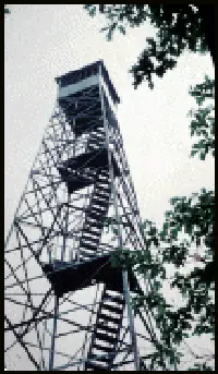
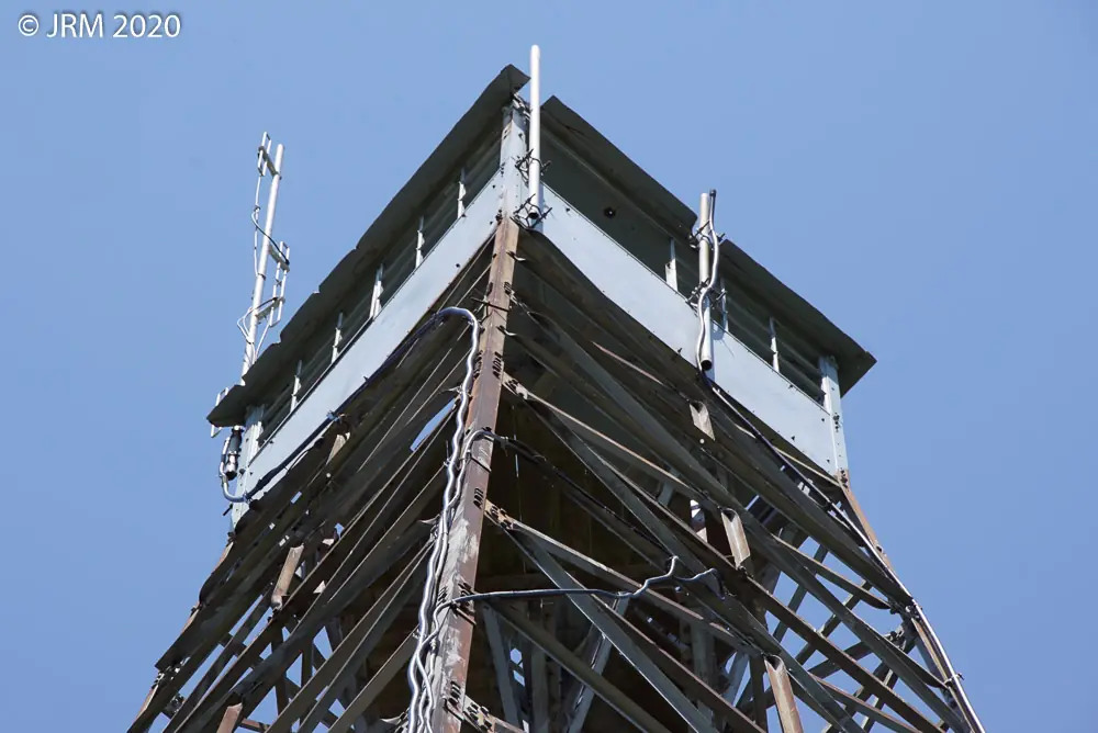
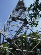
It is a 100-foot steel skeleton tower, its angle-iron frame bolted together and galvanized against rust, resting on four concrete piers. At the top sits a boxy cab under a hipped roof, sheet-steel on the outside, with a wood floor and glass on all four sides so a lookout could scan the horizon in every direction. A house and garage were built for the site not long after the tower, then hauled off elsewhere roughly a decade later.1
Udell worked as a fire lookout into the 1960s, when the Forest Service leaned more on aerial patrols and ground towers like this one lost their job.1 It is now the last fire lookout tower standing in the Huron-Manistee National Forest.3,1 The National Historic Lookout Register added it in 1991 as US 12 / MI 1, and the National Register of Historic Places listed it on August 22, 1996, citing its engineering and its place in the conservation history of the forest.3,2
The tower is not kept open for climbing. Register visit reports from 2019 and 2020 describe the lower flights of stairs removed and the base wrapped in barbed wire, with the remaining wood and glass in poor shape, and graffiti visible from the ground.3 A small interpretive sign stands at the site, though the tower itself carries no register plaque, and visitors note that the access roads are easy to lose on a GPS.3 A Forest Service communications tower stands about a hundred yards off but does not encroach on the site.3 Udell is unstaffed, and whether any volunteer program covers it is unclear.3
- "Udell Lookout Tower", Wikipedia, https://en.wikipedia.org/wiki/Udell_Lookout_Tower (accessed 2026-10-04). ↩
- National Register of Historic Places listing detail, NPGallery, https://npgallery.nps.gov/AssetDetail/NRIS/95001013 (accessed 2026-10-04). ↩
- "Udell Lookout Tower", National Historic Lookout Register, http://nhlr.org/lookouts/us/mi/udell-lookout-tower/ (accessed 2026-10-04). ↩
Photos

Photos keep their own rights and are shown with credit. Is one of these yours? You can ask for a different credit or for removal.
Sources
- National Historic Lookout Register (NHLR) (opens another site) Gave us: name, location, county, elevation, status, register numbers, agency, ownership, dates, photos, links National Historic Lookout Register (nhlr.org) · All rights reserved (American Resources, Inc.); facts extracted only, no prose copied. · retrieved 4 Oct 2026
- FOREST LOOKOUTS -- eastern US (easternuslookouts.weebly.com) (opens another site) Gave us: what it is built of, design, links easternuslookouts.weebly.com · No licence stated; facts only (county, coordinates where the page's own map widget gives them, status, height, design hints, register links). The site's own historical quotes, newspaper citations and narrative are not reproduced. · retrieved 8 Oct 2026
- Wikidata -- US fire lookout towers (Q748998 and subclasses) (opens another site) Gave us: height, register numbers, dates, photos, links Wikidata · CC0 1.0 (Wikidata). Images keep their own Commons licence/credit. · retrieved 4 Oct 2026
- OpenStreetMap -- fire lookout structures (opens another site) Gave us: type, register numbers, links © OpenStreetMap contributors · ODbL 1.0. (c) OpenStreetMap contributors. · retrieved 4 Oct 2026
- Firefinder research Gave us: summary, design, height, status, agency, access, staffing, visiting details, dates, links, fact-check Firefinder research (sources cited in the story footnotes) · Our own research notes; each fact cites its source in the lookout's story
More about this lookout elsewhere
- NHLR register entry US 12 (nhlr.org) (opens another site)
- National Register of Historic Places listing detail, ref 95001013 (NPGallery, National Park Service) (opens another site)
- Wikipedia: Udell Lookout Tower (opens another site)
- Udell (easternuslookouts.weebly.com) (opens another site)
- Wikidata item Q29791599 (opens another site)
- OpenStreetMap node 354001535 (opens another site)
Firefinder takes facts (places, dates, numbers) from these sources and writes its own words. See all sources and licences.