Fire lookout · Missoula County, Montana
Mineral Peak Lookout
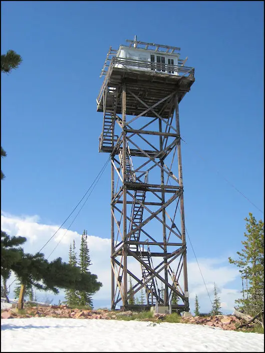
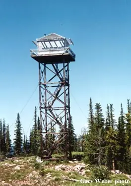
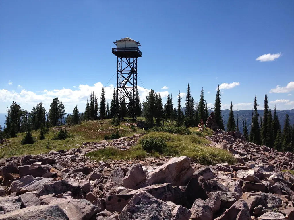
A 1957 L-4 lookout house on a 53-ft tower north of Missoula, vacant since its 2005-2012 restoration and now a stop for hikers and backpackers.
- Standing
- Open to the public
- Verified
Visit & stay
Not rentable. As far as we know, this lookout cannot be booked for overnight stays.
Access
Open to the public. Hikers and backpackers visit the site and some stay in the house. No closure was found in the sources read. The nomination says difficult access and the tower's perceived danger kept it out of the rental program.
- Can you climb it?
- Unknown
- Road to the top?
- Unknown
- Trail
- The site was first reached only by pack trail; a 13-mile road from Gold Creek was built later. Current road condition was not confirmed.
- Staffing
- Unknown
Facts
- Status
- Type
- Cab on a tower1936-pattern L-4 lookout house on a 53-ft timber towerThe design: L-4
- Built of
- Wood
- Built
- 1957
- Height
- 53 ft (16.2 m)
- Elevation
- 7,326 ft (2,233 m)
- Agency
- U.S. Forest Service, Lolo National Forest (Missoula Ranger District)
- Land
- Federal land
- Location
- Missoula County, Montana
- Coordinates
- 47.00264, −113.81262
- Registers
- This entry
- VerifiedResearched, then checked independently. Updated 8 Oct 2026.
- Firefinder id
us-mt-mineral-peak
View from the cab
What you see from the cab: every ridge out to about 93 miles, the named peaks in sight, and other fire lookouts within view, worked out from terrain data in your browser.
Downloads about 3.9 MB of terrain data the first time.
Or see what it could see on the map: the ground in its line of sight.
History
Then and now
- 1935 EventEarlier pole tower with an L-4 cab, dated 1935 by firelookout.com and by the nomination citing Kresek. The NHLR gives 1936 for the kit.Sources: firelookout.com, npgallery.nps.gov
- No record between 1935 and 1957
- 1957 BuiltLolo National Forest built the current 1936-pattern L-4 house, replacing the earlier lookout.Sources: nhlr.org, npgallery.nps.gov
- 1957 First staffedManned as a primary lookout point from 1957 to 1967.Sources: npgallery.nps.gov, historicmt.org
- 1967 StaffedOne of twenty-six lookouts the Lolo forest planned to man for the 1967 fire season.Source: npgallery.nps.gov
- 1968 EventInspection found few first-discovery fires (average 1.4 for 1958-1967); site downgraded to an emergency lookout.Sources: npgallery.nps.gov, historicmt.org
- 1974 StaffedManned only during extreme fire danger; began to deteriorate.Source: historicmt.org
- 1980 EventSat vacant with little or no maintenance until about 2005.Sources: npgallery.nps.gov, historicmt.org
- No record between 1980 and 1997
- 1997 Added to the National Historic Lookout RegisterRegistered on the National Historic Lookout Register, March 1, 1997.Source: nhlr.org
- 2005 EventChapter grant application to move the cab to a shorter tower was unsuccessful; the tower is considered unsafe and the structure was identified for disposal.Source: firelookout.org
- 2005 RestoredMissoula Ranger District began restoration after an inspection found the tower in stable condition.Sources: npgallery.nps.gov, historicmt.org
- 2006 Condition assessmentChapter helped assess the feasibility of restoring the 53-ft L-4 tower; a decision was then made to proceed.Source: firelookout.org
- 2006 RestoredPreliminary restoration tasks were carried out after the decision to proceed with the project.Source: firelookout.org
- 2007 RestoredRestoration of the 53-ft L-4 tower began; several planned tasks were postponed to 2008 because of fire activity.Source: firelookout.org
- 2008 RestoredWindows removed in 2006 for restoration at the Region 1 Historic Preservation Team shop; reinstalled July and August 2008.Source: npgallery.nps.gov
- 2009 EventFirst FFLA Restoration Grant of 2009 ($500) awarded for continued restoration; used to pay climbers to tighten bolts and treat the whole tower with preservative.Sources: firelookout.org, firelookout.org
- 2009 RestoredWeek-long project: certified climbers re-tightened all tower bolts and applied preservative; refurbished door installed. Paid by chapter funds and an FFLA grant.Sources: firelookout.org, firelookout.org, firelookout.org
- 2012 RestoredRegional preservation team and volunteers installed a new sawn cedar shingle roof.Source: npgallery.nps.gov
- 2018 Listed on the National Register of Historic PlacesListed on the National Register of Historic Places (NRIS 100002042), date listed January 29, 2018.Source: npgallery.nps.gov
- TodayStandingIt still stands, as far as our sources know.
Old maps of this spot
USGS topographic maps from the years a lookout stood may show it, often as a small symbol labelled “Lookout”. See the old topo maps around it on the Firefinder map, or find every scanned sheet of this spot on USGS TopoView (opens another site) (click the spot there to list them, with dates and downloads).
Story
Researched 8 Oct 2026, fact-checked.
Mineral Peak Lookout stands on the peak of the same name in the Lolo National Forest, beside the Rattlesnake Wilderness north of Missoula, Montana.1,2
The summit had a lookout before this one.1 Firelookout.com says a crow's nest gave way to a pole tower with an L-4 cab in 1935.3 According to the nomination, the Lolo National Forest put up the current 1936-pattern L-4 house in 1957 in place of that earlier cab.2 The kit came from a Portland company, and the crew used the old cab as quarters while they worked.2
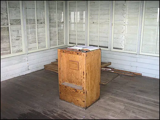
Before the road was built, the site could be reached only by pack trail.2 A Forest Service crew then bulldozed a thirteen-mile road from Gold Creek to the top.4 The house is 14 feet square and sits on a 53-foot timber tower.2
The lookout was a primary post from 1957 through 1967.4 In 1967 the forest counted it among twenty-six lookouts to be manned that season.2 A 1968 inspection found that the average number of first-discovery fires seen from the peak between 1958 and 1967 was only 1.4.2 After that inspection, the Forest Service reclassified the site as an emergency lookout, and by 1974 it was staffed only in extreme fire danger.4
Between about 1980 and 2005 the house stood empty and got little upkeep.2 Restoration began in 2005 after an inspection found the tower stable.2 In 2006 the windows and door went to the Region 1 Historic Preservation Team shop, and the windows were back in place in July and August 2008.2 In 2012 a regional preservation team and volunteers put on a new cedar shingle roof.2
The National Historic Lookout Register registered it on March 1, 1997.1 The National Register of Historic Places listed it on January 29, 2018.2
An early bid to rent the house through the forest's cabin program was discouraged, the nomination says, because the access was hard and the tower seemed risky.2 When the nomination was written, hikers and backpackers were visiting it, and some of them stayed in the house.2 The nomination is dated November 2017, so the present-day picture may have changed since.2
The sources do not agree on every detail. The NHLR gives the elevation as 7,326 feet, the nomination says 7,447 feet, and firelookout.com says 6,704 feet.1,2,3 Firelookout.com also places the lookout in Flathead County, while the NHLR and the nomination say Missoula County.3,1,2 The NHLR dates the kit that topped the tower to 1936, where firelookout.com gives 1935 for the cab.1,3
- Mineral Peak Lookout, National Historic Lookout Register, http://nhlr.org/lookouts/us/mt/mineral-peak-lookout/ (accessed 2026-10-08). ↩
- Mineral Peak Lookout, National Register of Historic Places Registration Form, National Park Service, https://npgallery.nps.gov/GetAsset/df79f153-e24b-4e8c-a21f-57d5c88275a4 (accessed 2026-10-08). ↩
- Mineral Peak Fire Lookout Tower, Fire Lookout, https://www.firelookout.com/mt/mineralpk.html (accessed 2026-10-08). ↩
- Mineral Peak Lookout, Historic Montana, https://historicmt.org/items/show/2694?tour=82&index=11 (accessed 2026-10-08). ↩
Photos

Photos keep their own rights and are shown with credit. Is one of these yours? You can ask for a different credit or for removal.
Sources
- National Historic Lookout Register (NHLR) (opens another site) Gave us: name, location, county, elevation, what it is built of, register numbers, agency, ownership, dates, photos, links National Historic Lookout Register (nhlr.org) · All rights reserved (American Resources, Inc.); facts extracted only, no prose copied. · retrieved 4 Oct 2026
- Forest Fire Lookout Association (FFLA) - US lookout lists (opens another site) Gave us: type, status, register numbers, links Forest Fire Lookout Association (firelookout.org) · No licence stated; facts extracted only, no prose copied. · retrieved 8 Oct 2026
- firelookout.com -- Rex Kamstra's Forest Fire Lookout Page (opens another site) Gave us: design, dates, photos, links firelookout.com · No licence stated on the site; facts only (coordinates, elevation, built/destroyed years, design, agency). Photos mirrored with the site's stated credit. · retrieved 4 Oct 2026
- Forest Fire Lookout Association chapter reports (opens another site) Gave us: dates, links Forest Fire Lookout Association, chapter and restoration-grant reports (firelookout.org) · No licence stated; facts only (dates, names, the kind of work done). Every note is our own wording and every event links to the FFLA report it comes from. Positions are copied from the NHLR, FFLOS and FFLA records. · retrieved 8 Oct 2026
- Wikidata -- US fire lookout towers (Q748998 and subclasses) (opens another site) Gave us: register numbers, photos, links Wikidata · CC0 1.0 (Wikidata). Images keep their own Commons licence/credit. · retrieved 4 Oct 2026
- OpenStreetMap -- fire lookout structures (opens another site) Gave us: links © OpenStreetMap contributors · ODbL 1.0. (c) OpenStreetMap contributors. · retrieved 4 Oct 2026
- FOREST LOOKOUTS -- western US (Ron Kemnow's weebly sites) (opens another site) Gave us: links Ron Kemnow's Forest Lookouts sites (westlookouts, californialookouts, idaholookouts, montanalookouts, oregonlookouts and washingtonlookouts .weebly.com) · No licence stated; facts only (county, land manager, status word, coordinates where the page's own map widget gives them, township-range-section, height and design hints, links). The site's own newspaper quotes, citations and narrative are not reproduced. · retrieved 8 Oct 2026
- Firefinder research Gave us: summary, design, height, status, agency, access, visiting details, dates, links, fact-check Firefinder research (sources cited in the story footnotes) · Our own research notes; each fact cites its source in the lookout's story
More about this lookout elsewhere
- NHLR register entry US 209 (nhlr.org) (opens another site)
- Mineral Peak Lookout, National Register of Historic Places Registration Form (National Park Service) (opens another site)
- Mineral Peak Lookout (Historic Montana) (opens another site)
- FFLA Montana lookout list (firelookout.org) (opens another site)
- Forest Fire Lookout Association chapter reports: work on Mineral Peak Lookout (opens another site)
- Mineral Peak on firelookout.com (Rex Kamstra) (opens another site)
- Mineral Peak on Forest Lookouts, western US (Ron Kemnow) (opens another site)
- Wikidata item Q86928762 (opens another site)
- OpenStreetMap way 1327378941 (opens another site)
Firefinder takes facts (places, dates, numbers) from these sources and writes its own words. See all sources and licences.