Fire lookout · Grafton County, New Hampshire
Smarts Mountain Lookout
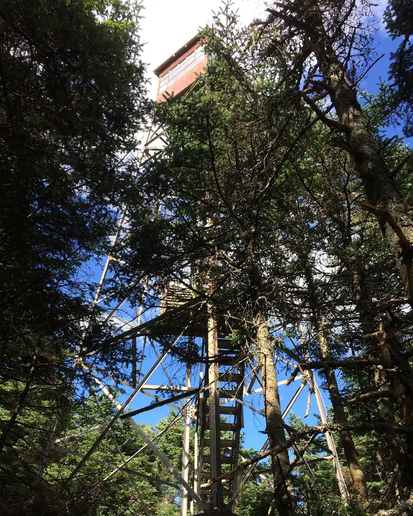
1939 41-foot steel fire tower on the Appalachian Trail in the White Mountain National Forest; closed in 2014, restored and reopened in 2016; unstaffed since.
- Standing
- Open to the public
- Verified
Visit & stay
Not rentable. As far as we know, this lookout cannot be booked for overnight stays.
Access
Open to the public. Closed in 2014; reopened by the Forest Service after 2016 repairs. A 2020 Valley News photo caption says it is open to anyone willing to climb its steps. No 2025-26 notice found.
- Can you climb it?
- Yes
- Road to the top?
- Unknown
- Trail
- About four miles of Appalachian Trail from the Lyme-Dorchester Road trailhead, up the Lambert Ridge Trail.
- Staffing
- Not staffed (as of 2016)
Facts
- Status
- Type
- Cab on a tower41-foot steel tower with a 7 by 7 foot cab, built from an International Derrick kitThe design: IDECO
- Built of
- Steel
- Built
- 1915
- Height
- 41 ft (12.5 m)
- Elevation
- 3,200 ft (975 m)
- Agency
- U.S. Forest Service
- Land
- Federal land
- Location
- Grafton County, New Hampshire
- Coordinates
- 43.82566, −72.03184 sources disagree
- Registers
- This entry
- VerifiedResearched, then checked independently. Updated 8 Oct 2026.
- Firefinder id
us-nh-smarts-mountain
View from the cab
What you see from the cab: every ridge out to about 93 miles, the named peaks in sight, and other fire lookouts within view, worked out from terrain data in your browser.
Downloads about 4.2 MB of terrain data the first time.
Or see what it could see on the map: the ground in its line of sight.
History
Then and now
- 1915 BuiltFirst lookout on the summit, established by the New Hampshire Forestry CommissionSources: nhlr.org, willhiteweb.com
- 1922 EventLookout temporarily discontinued except for emergency useSource: willhiteweb.com
- No record between 1922 and 1939
- 1939 BuiltCurrent 41-foot steel tower. The register credits the NH Forestry Commission; Willhite says the CCC built it with Forest Service funds after the 1938 hurricaneSources: nhlr.org, willhiteweb.com, easternuslookouts.weebly.com
- 1942 StaffedOut of service; Dartmouth Outing Club leased it from the state for one dollar a year and staffed it during high fire dangerSource: willhiteweb.com
- No record between 1942 and 1957
- 1957 StaffedStation reopened by act of the NH Legislature; Willhite says staffed to 1980Source: willhiteweb.com
- No record between 1957 and 1973
- 1973 Last staffedWillhite gives 1973 as the last year of active service; the same page also says staffed to 1980Source: willhiteweb.com
- 1980 EventSite transferred to the NH Department of Public Works and Highways (Willhite)Source: willhiteweb.com
- 1994 RestoredRefurbished by the Dartmouth Outing Club with U.S. Forest Service fundsSource: willhiteweb.com
- 1996 Added to the National Historic Lookout RegisterRegistered January 19, 1996; nominated by Iris Baird, FFLASource: nhlr.org
- No record between 1996 and 2014
- 2014 Condition assessmentChapter visitor on August 30 found three of four guy cables not functional, a long-standing problemSource: firelookout.org
- 2014 ClosedThe Forest announced in August 2014 that the tower was closed until critical repairs could be madeSource: firelookout.org
- 2016 RestoredHistoriCorps replaced the roof and installed lightning protection in June 2016; the Forest Service reopened the tower to the publicSources: nhlr.org, firelookout.org
- TodayStandingIt still stands, as far as our sources know.
Old maps of this spot
USGS topographic maps from the years a lookout stood may show it, often as a small symbol labelled “Lookout”. See the old topo maps around it on the Firefinder map, or find every scanned sheet of this spot on USGS TopoView (opens another site) (click the spot there to list them, with dates and downloads).
Story
Researched 8 Oct 2026, fact-checked.
A fire lookout went up on Smarts Mountain in 1915, when the New Hampshire Forestry Commission established the site.1,2 The register describes it as the mountain's earliest lookout.2
The steel tower that stands now dates from 1939.2,3 Sources disagree about who built it. The register credits the Forestry Commission and says federal emergency money paid for it after the 1938 hurricane.2 Willhite's history says the Civilian Conservation Corps built it with Forest Service funds, in response to fire danger after the Great New England Hurricane of 1938.1 The tower stands 41 feet high, with a 7-by-7-foot cab, and Willhite says it came as a kit from the International Derrick Company.1
In 1922 the lookout was scaled back to emergency use only, and by 1942 the Dartmouth Outing Club was renting the tower from the state for a dollar a year and staffing it when fire danger ran high.1 The station reopened in 1957.1 Willhite gives 1973 as the final year of active duty, but the same page also says the tower was staffed to 1980.1 In 1980 the site passed to the state Department of Public Works and Highways, according to Willhite.1 In 1994 the Dartmouth Outing Club refurbished the tower with Forest Service money.1 The register lists the U.S. Forest Service as administrator, and a 2014 chapter report says the Forest acquired the tower as part of an Appalachian Trail land purchase.2,4
In August 2014 the Forest announced the tower would stay shut to visitors until urgent repairs were done.4 A chapter visitor who went up on August 30 found no reason for the closure other than an ongoing problem: three of the four guy cables had been out of service since the Forest took over the tower.4
In 2016 HistoriCorps workers replaced the roof and added lightning protection, and the Forest Service brought the tower back open to visitors.5 The register's visit report from August 2016 praised the tower after its June restoration, and noted that it was no longer staffed.2 That report also said the kiosk signs in the parking lot were wrong: they still listed the tower as closed.2
A 2020 Valley News photo caption says anyone willing to climb the steps can go up.6 The ascent is all Appalachian Trail, about four miles from the Lyme-Dorchester Road trailhead, and it begins on the Lambert Ridge Trail.6 I found no notice from 2025 or 2026, so check with the White Mountain National Forest before you go.
- Smarts Mountain Lookout, Willhite Web (Appalachian Trail lookouts), https://willhiteweb.com/appalachian_trail/fire_lookouts/smarts_mountain/dartmouth_061.htm (accessed 2026-10-08). ↩
- Smarts Mountain Lookout, National Historic Lookout Register, http://nhlr.org/lookouts/us/nh/smarts-mountain-lookout/ (accessed 2026-10-08). ↩
- Smarts Mountain, Forest Lookouts, https://easternuslookouts.weebly.com/smarts-mountain.html (accessed 2026-10-08). ↩
- New Hampshire chapter report 2014, Forest Fire Lookout Association, https://firelookout.org/wp-content/uploads/2024/11/cr-nh-2014.pdf (accessed 2026-10-08). ↩
- New Hampshire chapter report 2016, Forest Fire Lookout Association, https://firelookout.org/wp-content/uploads/2024/11/cr-nh-2016.pdf (accessed 2026-10-08). ↩
- Trail Trials: On Smarts Mountain, in a through-hiker's wake, Valley News, https://vnews.com/?p=89781 (accessed 2026-10-08). ↩
Photos
Photos keep their own rights and are shown with credit. Is one of these yours? You can ask for a different credit or for removal.
Where sources disagree
We show disagreements between sources instead of quietly picking one. If you know which is right, please tell us.
Sources disagree on the location by 500 m.
- NHLR: 43.82566, −72.03184
- FFLA: 43.82545, −72.03809
They share a register number.
The map uses the position from NHLR.
Sources
- National Historic Lookout Register (NHLR) (opens another site) Gave us: name, location, county, elevation, what it is built of, register numbers, agency, ownership, dates, photos, links National Historic Lookout Register (nhlr.org) · All rights reserved (American Resources, Inc.); facts extracted only, no prose copied. · retrieved 4 Oct 2026
- Forest Fire Lookout Association (FFLA) - US lookout lists (opens another site) Gave us: type, status, register numbers, links Forest Fire Lookout Association (firelookout.org) · No licence stated; facts extracted only, no prose copied. · retrieved 8 Oct 2026
- FOREST LOOKOUTS -- eastern US (easternuslookouts.weebly.com) (opens another site) Gave us: height, links easternuslookouts.weebly.com · No licence stated; facts only (county, coordinates where the page's own map widget gives them, status, height, design hints, register links). The site's own historical quotes, newspaper citations and narrative are not reproduced. · retrieved 8 Oct 2026
- Forest Fire Lookout Association chapter reports (opens another site) Gave us: dates, links Forest Fire Lookout Association, chapter and restoration-grant reports (firelookout.org) · No licence stated; facts only (dates, names, the kind of work done). Every note is our own wording and every event links to the FFLA report it comes from. Positions are copied from the NHLR, FFLOS and FFLA records. · retrieved 8 Oct 2026
- Firefinder research Gave us: summary, design, height, agency, access, staffing, visiting details, dates, links, fact-check Firefinder research (sources cited in the story footnotes) · Our own research notes; each fact cites its source in the lookout's story
More about this lookout elsewhere
- NHLR register entry US 157 (nhlr.org) (opens another site)
- New Hampshire chapter report 2014 (Forest Fire Lookout Association) (opens another site)
- Smarts Mountain Lookout (Willhite Web (Appalachian Trail lookouts)) (opens another site)
- Trail Trials: On Smarts Mountain, in a through-hiker's wake (Valley News) (opens another site)
- FFLA New Hampshire lookout list (firelookout.org) (opens another site)
- Forest Fire Lookout Association chapter reports: work on Smarts Mountain Lookout (opens another site)
- Smarts Mountain (easternuslookouts.weebly.com) (opens another site)
Firefinder takes facts (places, dates, numbers) from these sources and writes its own words. See all sources and licences.