Fire lookout · Warren County, New Jersey
Catfish Fire Tower
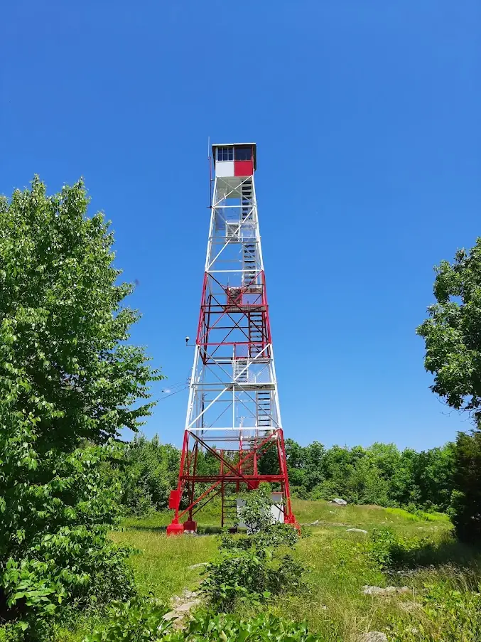
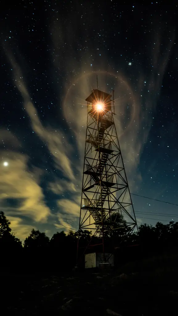
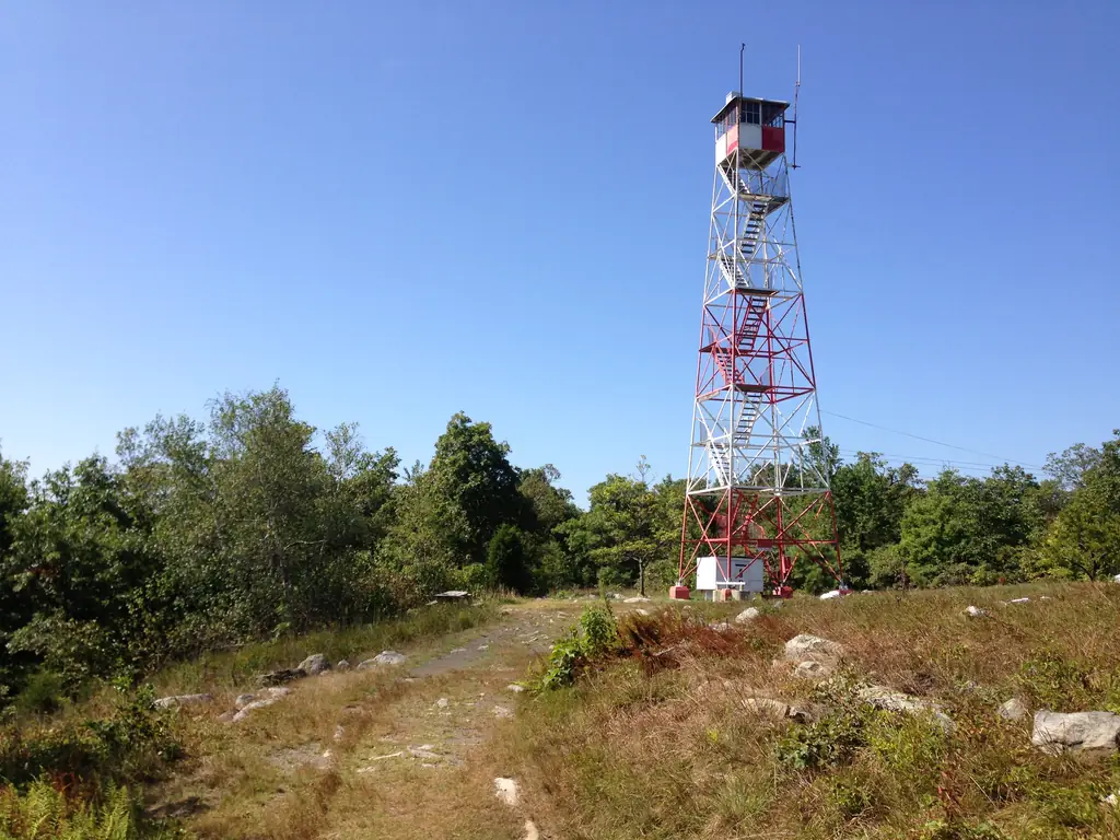
A 60-ft steel fire tower on Kittatinny Mountain near Catfish Pond, opened in 1922, rebuilt in 1993 and repainted in 2022; staffed in fire weather and reached on foot.
- Standing
- Open to the public
- Verified
Visit & stay
Not rentable. As far as we know, this lookout cannot be booked for overnight stays.
Access
Open to the public. Reached on foot along the Appalachian Trail; a fire road from Millbrook Road joins the route. A 2018 visit report saw no trail signage on the Appalachian Trail.
- Can you climb it?
- Unknown
- Road to the top?
- Unknown
- Trail
- About a 2-mile hike, per a 2018 visit report. A 2018 report found no trail signage on the Appalachian Trail in either direction.
- Staffing
- Unknown
Facts
- Status
- Type
- Cab on a tower7 x 7 ft cab on a 60-ft Aermotor LS-40 steel towerThe design: Aermotor LS-40
- Built of
- Not recorded
- Built
- 1922
- Height
- 59 ft (18.0 m)
- Elevation
- 1,555 ft (474 m)
- Agency
- New Jersey Forest Fire Service (tower within Delaware Water Gap National Recreation Area)
- Land
- State land
- Location
- Warren County, New Jersey
- Coordinates
- 41.04758, −74.97245
- Registers
- This entry
- VerifiedResearched, then checked independently. Updated 8 Oct 2026.
- Firefinder id
us-nj-catfish
View from the cab
What you see from the cab: every ridge out to about 93 miles, the named peaks in sight, and other fire lookouts within view, worked out from terrain data in your browser.
Downloads about 3.5 MB of terrain data the first time.
Or see what it could see on the map: the ground in its line of sight.
History
Then and now
- 1922 BuiltSteel tower opened near Catfish Pond in July 1922; the NHLR says it replaced an earlier wooden tower.Sources: nhlr.org, easternuslookouts.weebly.com
- 1923 EventState FY1923 report: a connecting telephone line of about eight miles of new line was built to the tower.Source: easternuslookouts.weebly.com
- 1924 First staffedNorman Maring employed as watchman, per the Easton Free Press in August 1924. First named staffer in the sources read; earlier staffing was not checked.Source: easternuslookouts.weebly.com
- No record between 1924 and 1993
- 1993 RebuiltThe 7 x 7 ft cab was rebuilt on the existing 60-ft Aermotor LS-40 tower.Source: nhlr.org
- 1997 Added to the National Historic Lookout RegisterRegistered on the National Historic Lookout Register, December 15, 1997.Source: nhlr.org
- No record between 1997 and 2022
- 2022 EventRepainted in May 2022 for the 100th anniversary; interior repairs were planned.Source: nhlr.org
- TodayStandingIt still stands, as far as our sources know.
Old maps of this spot
USGS topographic maps from the years a lookout stood may show it, often as a small symbol labelled “Lookout”. See the old topo maps around it on the Firefinder map, or find every scanned sheet of this spot on USGS TopoView (opens another site) (click the spot there to list them, with dates and downloads).
Story
Researched 8 Oct 2026, fact-checked.
Catfish Fire Tower stands on Kittatinny Mountain in Warren County, New Jersey, on the Appalachian Trail inside the Delaware Water Gap National Recreation Area.1,2 The 1922 papers also called the summit Blue Mountain.2
The state's forest fire service opened a new 60-foot steel tower near Catfish Pond in July 1922.2 The NHLR says it replaced an earlier wooden tower.1 A telephone line was built to the site as well, which the state's annual report calls eight miles of new line.2 A July 1922 newspaper put the tower about five miles west of Blairstown, while the state's annual report said about seven.2
By August 1924, the Easton Free Press reported that 1,023 people had visited the tower since it went up in 1922, and it named Norman Maring as the watchman.2
According to the NHLR, a Forest Fire Observer is posted to the tower when fire danger is elevated, and the full-time observer post is vacant.1 Two 2018 visit reports differ: one found no staff present, and another found a man in the tower during the day.1
The cab was rebuilt in 1993 on the same 60-foot Aermotor LS-40 tower.1 Wikipedia lists the tower at 60 feet (18 m).3 It was repainted in May 2022 for its 100th anniversary, and a 2018 visit noted warped angle iron on two landings but otherwise sound steel.1
The NHLR registered it on December 15, 1997.1 Hikers reach it on foot, and a 2018 visitor called the walk about two miles.1 A fire road from Millbrook Road joins the route, and a 2018 visit report found no trail signage.1
- Catfish Fire Tower, National Historic Lookout Register, http://nhlr.org/lookouts/us/nj/catfish-fire-tower/ (accessed 2026-10-08). ↩
- Catfish, Forest Lookouts (newspaper and state report transcriptions), https://easternuslookouts.weebly.com/catfish.html (accessed 2026-10-08). ↩
- List of New Jersey Forest Fire Service fire towers, Wikipedia, https://en.wikipedia.org/wiki/List_of_New_Jersey_Forest_Fire_Service_fire_towers (accessed 2026-10-08). ↩
Photos


Photos keep their own rights and are shown with credit. Is one of these yours? You can ask for a different credit or for removal.
Sources
- National Historic Lookout Register (NHLR) (opens another site) Gave us: name, location, county, elevation, type, status, register numbers, agency, dates, photos, links National Historic Lookout Register (nhlr.org) · All rights reserved (American Resources, Inc.); facts extracted only, no prose copied. · retrieved 4 Oct 2026
- Wikipedia: List of New Jersey Forest Fire Service fire towers (opens another site) Gave us: height, ownership, photos, links Wikipedia (NJFFS fire tower list) · CC BY-SA 4.0 (Wikipedia). Facts only (register numbers, elevation, height, division, coordinates); article prose/notes not reproduced. Photos are Wikimedia Commons files, each with its own licence on its file page. · retrieved 4 Oct 2026
- FOREST LOOKOUTS -- eastern US (easternuslookouts.weebly.com) (opens another site) Gave us: links easternuslookouts.weebly.com · No licence stated; facts only (county, coordinates where the page's own map widget gives them, status, height, design hints, register links). The site's own historical quotes, newspaper citations and narrative are not reproduced. · retrieved 8 Oct 2026
- Wikidata -- US fire lookout towers (Q748998 and subclasses) (opens another site) Gave us: photos, links Wikidata · CC0 1.0 (Wikidata). Images keep their own Commons licence/credit. · retrieved 4 Oct 2026
- OpenStreetMap -- fire lookout structures (opens another site) Gave us: links © OpenStreetMap contributors · ODbL 1.0. (c) OpenStreetMap contributors. · retrieved 4 Oct 2026
- Firefinder research Gave us: summary, design, height, status, agency, access, visiting details, dates, links, fact-check Firefinder research (sources cited in the story footnotes) · Our own research notes; each fact cites its source in the lookout's story
More about this lookout elsewhere
- NHLR register entry US 247 (nhlr.org) (opens another site)
- Catfish Station (Wikipedia (List of New Jersey Forest Fire Service fire towers)) (opens another site)
- Catfish (easternuslookouts.weebly.com) (opens another site)
- Wikidata item Q86868098 (opens another site)
- OpenStreetMap node 357736052 (opens another site)
Firefinder takes facts (places, dates, numbers) from these sources and writes its own words. See all sources and licences.