Fire lookout · Columbia County, New York
Washburn Mountain Tower Site
Washburn Mountain's Aermotor fire tower, first raised on Alander Mountain in 1928, moved to Beebe Hill in the 1960s; Wikipedia calls the Beebe Hill tower defunct and unsafe.
- Gone
- Access unknown
- Verified
Gone: The lookout no longer stands. Only the site is left. Left the Washburn Mountain site in 1963-64; the tower now stands on Beebe Hill, defunct and deemed unsafe per Wikipedia
Visit & stay
Gone: site only. The lookout no longer stands, so there is nothing to climb or rent.
Access
Access unknown
We do not know the access rules. Check with the land manager before you go.
- Road to the top?
- Unknown
Facts
- Status
- Type
- Cab on a towerAermotor LS-40, 60 ft steel towerThe design: Aermotor LS-40
- Built of
- SteelGoing by its design; no source says so in words.
- Built
- 1928
- Height
- 60 ft (18.3 m)
- Elevation
- 1,497 ft (456 m)
- Agency
- Taconic State Park Commission, later NY Forest Fire Control
- Land
- Unknown
- Location
- Columbia County, New York
- Coordinates
- 42.10661, −73.51553 sources disagree
- Registers
- This entry
- VerifiedResearched, then checked independently. Updated 9 Oct 2026.
- Firefinder id
us-ny-washburn-mountain
View from the cab
What the lookout saw from its cab: every ridge out to about 93 miles, the named peaks in sight, and other fire lookouts within view, worked out from terrain data in your browser.
This lookout is gone. The view is reconstructed from its recorded site and its recorded height.
Downloads about 3.8 MB of terrain data the first time.
Or see what it could see on the map: the ground in its line of sight.
History
Then and now
- 1928 BuiltErected on Alander Mountain, just over the Massachusetts line, by the Taconic State Park CommissionSources: firetower.org, en.wikipedia.org
- 1930 MovedTower dismantled after the area burned and the landowner asked for its removal; stored (location disputed)Sources: firetower.org, en.wikipedia.org
- 1933 RebuiltRe-erected on Washburn Mountain; Wikipedia dates the rebuild to late 1932Sources: firetower.org, en.wikipedia.org
- 1935 EventOperation turned over to Forest Fire Control about 1935Source: firetower.org
- No record between 1935 and 1963
- 1963 MovedDismantled and carried by helicopter to Beebe Hill; Wikipedia gives 1964Sources: firetower.org, easternuslookouts.weebly.com, en.wikipedia.org
- 1965 RebuiltTower being set up atop Beebe Hill; a 1965 Berkshire Eagle item says construction was underwaySource: easternuslookouts.weebly.com
- No record between 1965 and 1987
- 1987 Last staffedBeebe Hill tower remained in operation until 1987Source: en.wikipedia.org
- 1997 EventLocal residents, the Forest Fire Lookout Association and DEC begin efforts to restore the towerSource: en.wikipedia.org
- 2009 Added to the Former Fire Lookout Sites RegisterWashburn Mountain site registered with FFLOS on October 6, 2009 (US 545)Source: firetower.org
- No record between 2009 and 2024
- 2024 Condition assessmentState forest website deemed the Beebe Hill tower unsafe as of late 2024Source: en.wikipedia.org
- TodayGoneThe lookout no longer stands. Only the site is left. When it came down is not recorded.
Old maps of this spot
USGS topographic maps from the years a lookout stood may show it, often as a small symbol labelled “Lookout”. See the old topo maps around it on the Firefinder map, or find every scanned sheet of this spot on USGS TopoView (opens another site) (click the spot there to list them, with dates and downloads).
Story
Researched 9 Oct 2026, fact-checked.
Washburn Mountain, in Columbia County, was the site of a fire lookout tower from 1932 to 1964.1 The tower first went up in 1928 on Alander Mountain, just inside Massachusetts, when the Taconic State Park Commission erected it.2,3
After a 1930 fire burned the area, the landowner requested the tower's removal, and park staff took it down.2,1 Sources disagree on where it was stored.2,1 The Former Fire Lookout Sites register says a park facility at High Falls, while Wikipedia says High Valley Farm.2,1 It went back up on Washburn Mountain in 1933.2 Wikipedia dates the rebuild to late 1932, with operation starting in 1933.1
Forest Fire Control took over its operation about 1935, and the tower was actively used until 1963.2 In 1963 it was dismantled and carried away by helicopter to Beebe Hill.2,4 The dates differ.1,5 Wikipedia gives 1964, and a 1965 newspaper item says the tower came down in Copake Falls the fall before, with construction of a tower atop Beebe Hill underway.1,5
On Beebe Hill's summit, at 1,726 feet, the tower stood in what is now Beebe Hill State Forest. The tower stayed in service until 1987.3 In 1997 local residents, the Forest Fire Lookout Association and the state Department of Environmental Conservation began efforts to restore the tower and open a trail network to it.3
Wikipedia calls the Beebe Hill tower defunct and reports that the state forest's website considered it unsafe as of late 2024.3 The Department of Environmental Conservation page for the two state forests describes "a fire tower that is open to the public."6 These accounts disagree, so check with the Department before going up, and do not climb a tower that is closed or unsafe.
On Washburn Mountain itself, we found no source that says what, if anything, is left of the 1933 site. Wikipedia says the tower is still on Beebe Hill.1
- Washburn Mountain, Wikipedia, https://en.wikipedia.org/wiki/Washburn_Mountain (accessed 2026-10-09). ↩
- Washburn Mountain Tower Site, Former Fire Lookout Sites, http://firetower.org/lookouts/us/ny/washburn-mountain-tower-site/ (accessed 2026-10-09). ↩
- Beebe Hill State Forest, Wikipedia, https://en.wikipedia.org/wiki/Beebe_Hill_State_Forest (accessed 2026-10-09). ↩
- Washburn Mountain, Forest Lookouts, https://easternuslookouts.weebly.com/washburn-mountain.html (accessed 2026-10-09). ↩
- Beebe Hill, Forest Lookouts, https://easternuslookouts.weebly.com/beebe-hill.html (accessed 2026-10-09). ↩
- Beebe Hill and Harvey Mountain State Forests, New York State Department of Environmental Conservation, https://dec.ny.gov/places/beebe-hill-and-harvey-mt-state-forests (accessed 2026-10-09). ↩
Photos
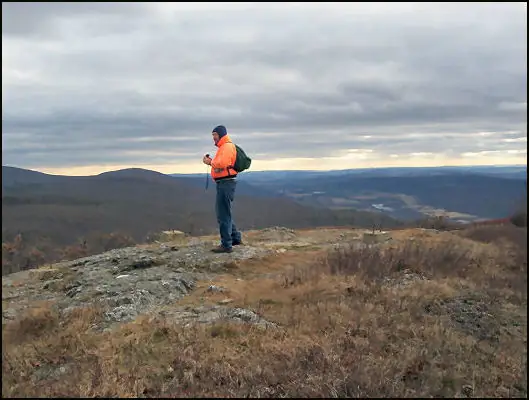
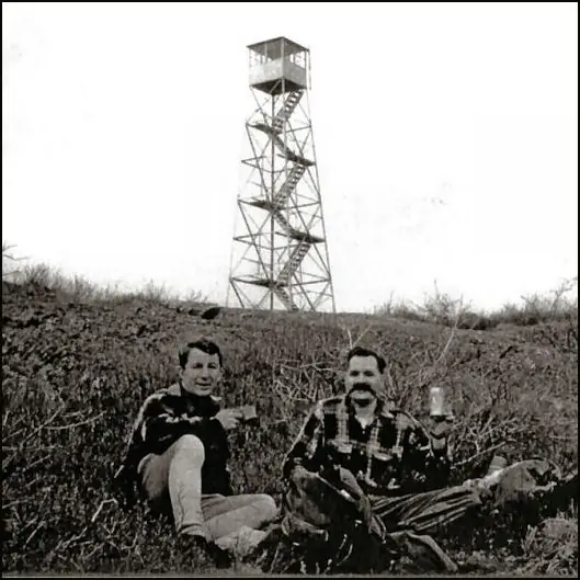
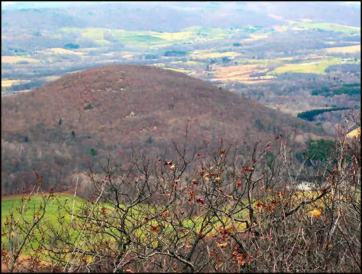
Photos keep their own rights and are shown with credit. Is one of these yours? You can ask for a different credit or for removal.
Where sources disagree
We show disagreements between sources instead of quietly picking one. If you know which is right, please tell us.
Sources disagree on the location by 7.4 km (4.6 mi).
- FFLA: 42.10661, −73.51553
- FFLOS: 42.04007, −73.51620
They share a register number.
The map uses the position from FFLA.
Sources
- Former Fire Lookout Sites Register (FFLOS) (opens another site) Gave us: name, county, elevation, register numbers, dates, photos, links Former Fire Lookout Sites Register (firetower.org) · All rights reserved (American Resources, Inc.); facts extracted only, no prose copied. · retrieved 4 Oct 2026
- Forest Fire Lookout Association (FFLA) - US lookout lists (opens another site) Gave us: location, type, status, register numbers, links Forest Fire Lookout Association (firelookout.org) · No licence stated; facts extracted only, no prose copied. · retrieved 8 Oct 2026
- FOREST LOOKOUTS -- eastern US (easternuslookouts.weebly.com) (opens another site) Gave us: what it is built of, design, height, links easternuslookouts.weebly.com · No licence stated; facts only (county, coordinates where the page's own map widget gives them, status, height, design hints, register links). The site's own historical quotes, newspaper citations and narrative are not reproduced. · retrieved 8 Oct 2026
- Firefinder research Gave us: summary, design, height, status, agency, staffing, dates, links, fact-check Firefinder research (sources cited in the story footnotes) · Our own research notes; each fact cites its source in the lookout's story
More about this lookout elsewhere
- FFLOS register entry US 545 (firetower.org) (opens another site)
- Beebe Hill (Forest Lookouts) (opens another site)
- Beebe Hill State Forest (Wikipedia) (opens another site)
- Washburn Mountain (Wikipedia) (opens another site)
- Beebe Hill and Harvey Mountain State Forests (New York State Department of Environmental Conservation) (opens another site)
- FFLA New York lookout list (firelookout.org) (opens another site)
- Washburn Mountain (easternuslookouts.weebly.com) (opens another site)
Firefinder takes facts (places, dates, numbers) from these sources and writes its own words. See all sources and licences.