Fire lookout · Douglas County, Oregon
Acker Rock Lookout
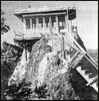
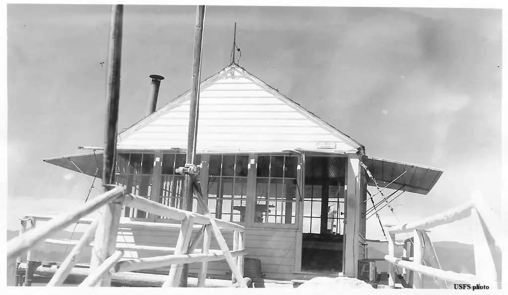
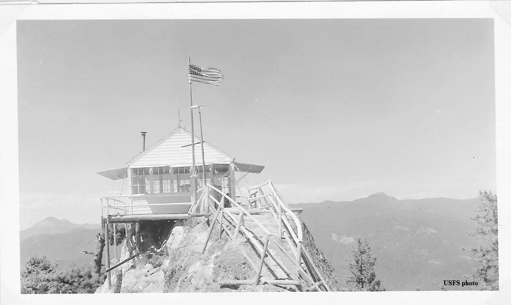
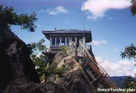
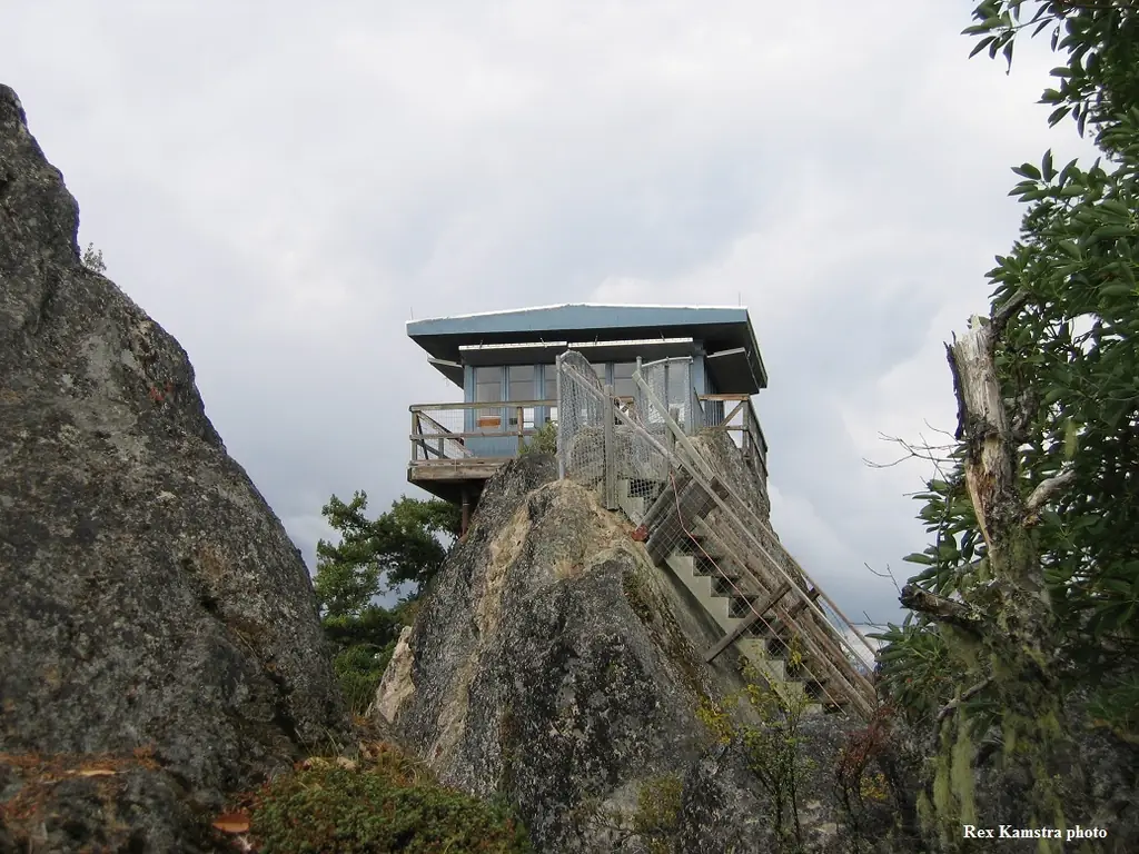
A 1934 L-4 lookout on this cliff-top site was replaced in 1964 by a helicopter-placed R-6 groundhouse, one of only two surviving lookouts on the Tiller Ranger District.
- Standing
- Rentable
- Open to the public
- Verified
Visit & stay
You can rent this lookout for overnight stays through recreation.gov.
- Season
- August 1st thru November 15th
- Fee
- $40
- Getting there
- High Clearance four-wheel or all-wheel drive vehicles are recommended for travel to this site, and guests must bring several of their own amenities.
Overview Perched atop the edge of a rocky cliff in the Umpqua National Forest, Acker Rock Lookout offers visitors a unique lodging experience with spectacular panoramic views of the South Umpqua watershed in southwest Oregon. Still used in active fire detection today, the lookout was placed on the rocky cliff via helicopter in the 1960's. Before the advent of airplane surveillance for fire detection, there were more than a dozen lookouts on the Tiller Ranger District. Today Acker Rock and Pickett Butte are the only remaining lookouts on the District. The lookout tower is generally available for reservation from August 1st thru November 15th (depending on snow). High Clearance four-wheel or all-wheel drive vehicles are recommended for travel to this site, and guests must bring several of their own amenities. The lookout is not rented during the winter months due to wind and snow weight restrictions on the building. Visitors should keep in mind everything must be packed in via a moderately steep 0.4-mile hike along a forested trail to reach the lookout. Recreation The panorama includes landmarks on the Rogue-Umpqua Divide; on a clear day you can see mountains on the Willamette, Rogue, and Deschutes River watersheds and Crater Lake Rim. Overlooking the Umpqua River and several of its tributaries, the lookout is a delightful setting for hiking, birding and wildlife viewing. Seasonal changes envelope the area as snowmelt gives rise to spring flowers and vivid autumn colors bring with it numerous recreation opportunities. For a day trip, guests may enjoy a scenic drive along a portion of the 172-mile Rogue-Umpqua National Scenic Byway or a mountain hike into the Rogue Umpqua Divide wilderness on over 100 miles of trail. Facilities The 12-foot by 12-foot, one-room lookout is furnished with a single bed, a small table and chair, and is equipped with a propane fueled wall heater, lanterns, cooking stove with oven and a refrigerator (propane is provided). A composting toilet is located at the lookout site. There is no water at the site, so visitors must bring plenty for drinking, cooking and washing. Potable water is available at a spigot in front of the Tiller Ranger Station office (45 minute drive). Guests must supply their own food, cooking utensils, sleeping bags, sleeping pads, towels, dish soap, matches, cooking gear, toilet paper and garbage bags. Although propane lighting is available, bringing an additional light source is recommended. Natural Features Unique volcanic and sedimentary rock outcroppings and dense conifer forests define the landscape, giving way to sub-alpine meadows and summer wildflowers in the higher elevations. The rock formation on which the lookout building sits is itself a magnificent feature. Sheer cliffs drop off for several hundred feet on the west and south sides. The translation of the word "Umpqua," meaning "thundering waters," defines the area. High mountain lakes, heart-stopping rapids, peaceful ponds and thundering waterfalls await visitor. Nearby Attractions Opportunities for fishing are within 10 miles of the lookout.
Book on recreation.gov (opens recreation.gov)
Rental details from recreation.gov, checked 12 Oct 2026. Rules, fees and seasons change, so confirm on the booking page before you go. Data source: ridb.recreation.gov
Access
Open to the public. High-clearance 4WD/AWD vehicle to trailhead, then a moderately steep 0.4-mile hike in; not rented in winter due to wind/snow load.
- Can you climb it?
- Yes
- Road to the top?
- No, you have to hike
- Trail
- 0.4-mile forested trail from the trailhead to the lookout.
- Staffing
- Unknown
Facts
- Status
- Built of
- WoodGoing by its design; no source says so in words.
- Built
- 1934 sources disagree
- Height
- Unknown
- Elevation
- 3,974 ft (1,211 m)
- Agency
- U.S. Forest Service, Umpqua National Forest
- Land
- Federal land
- Location
- Douglas County, Oregon
- Coordinates
- 43.05196, −122.64612
- Registers
- This entry
- VerifiedResearched, then checked independently. Updated 12 Oct 2026.
- Firefinder id
us-or-acker-rock
View from the cab
What you see from the cab: every ridge out to about 93 miles, the named peaks in sight, and other fire lookouts within view, worked out from terrain data in your browser.
Downloads about 4.0 MB of terrain data the first time.
Or see what it could see on the map: the ground in its line of sight.
History
Then and now
- 1934 BuiltFirst lookout on the site, an L-4 cab.Sources: nhlr.org, firelookout.com
- No record between 1934 and 1964
- 1964 Built'Built' field on NHLR detail pageSource: NHLR register entry
- 1964 Replaced by a new structureL-4 replaced by the present R-6 flat-roofed groundhouse, reportedly placed by helicopter.Sources: nhlr.org, firelookout.com, recreation.gov
- No record between 1964 and 2000
- 2000 Added to the National Historic Lookout RegisterAdded to the National Historic Lookout Register, September 1, 2000.Source: nhlr.org
- TodayStandingIt still stands, as far as our sources know.
Old maps of this spot
USGS topographic maps from the years a lookout stood may show it, often as a small symbol labelled “Lookout”. See the old topo maps around it on the Firefinder map, or find every scanned sheet of this spot on USGS TopoView (opens another site) (click the spot there to list them, with dates and downloads).
Story
Researched 4 Oct 2026, fact-checked.
Acker Rock sits on a high rock formation roughly 2,000 feet above the valley floor in the Umpqua National Forest's Tiller Ranger District, a perch that made it an obvious spot for fire detection.1 The first lookout there was an L-4 cab built in 1934.1,2 It was replaced in 1964 by the flat-roofed R-6 groundhouse that still stands today, a 12-by-12-foot one-room cabin set directly on the rock.1,2 According to the Forest Service's own rental listing, that structure was lifted onto the cliff by helicopter sometime in the 1960s, consistent with the 1964 replacement date.3
The Tiller Ranger District once had more than a dozen staffed lookouts; today only Acker Rock and Pickett Butte remain.1,3 Both nominally stay in service for fire spotting, though like most surviving lookouts, aerial surveillance has taken over most of that work.3
Acker Rock is part of the recreation rental program and is generally available from August 1 through November 15, weather and snow permitting; it isn't rented in winter because of wind and snow-load concerns for the building.3 Reaching the lookout requires a high-clearance, four-wheel or all-wheel-drive vehicle to the trailhead, followed by a moderately steep 0.4-mile hike in, so everything guests need has to be carried.3 Inside, the single room holds a bed, small table and chair, a propane heater, lanterns, a propane stove and oven, and a refrigerator; there's no water on site, so visitors bring their own or fill up at the Tiller Ranger Station on the way in.3 The lookout is listed on the National Historic Lookout Register, added September 1, 2000.4
- Acker Rock Lookout, National Historic Lookout Register, http://nhlr.org/lookouts/us/or/acker-rock-lookout/ (accessed 2026-10-04). ↩
- Acker Rock Fire Lookout Cabin, firelookout.com, https://www.firelookout.com/or/ackerrock.html (accessed 2026-10-04). ↩
- Acker Rock Lookout, Recreation.gov, https://www.recreation.gov/camping/campgrounds/233322 (accessed 2026-10-04). ↩
- Acker Rock Lookout, National Historic Lookout Register, http://nhlr.org/lookouts/us/or/acker-rock-lookout/ (accessed 2026-10-04). ↩
Photos
Photos keep their own rights and are shown with credit. Is one of these yours? You can ask for a different credit or for removal.
Where sources disagree
We show disagreements between sources instead of quietly picking one. If you know which is right, please tell us.
Sources disagree on the year it was built.
- NHLR: 1964
- firelookout.com -- Rex Kamstra's Forest Fire Lookout Page: 1934
- Every Lookout in Oregon (Cheryl Hill): 1964
Sources give different build years. Often one counts the first lookout on the site and another the structure there now.
Sources
- National Historic Lookout Register (NHLR) (opens another site) Gave us: name, location, county, elevation, register numbers, agency, dates, photos, links National Historic Lookout Register (nhlr.org) · All rights reserved (American Resources, Inc.); facts extracted only, no prose copied. · retrieved 4 Oct 2026
- Forest Fire Lookout Association (FFLA) - US lookout lists (opens another site) Gave us: type, status, register numbers, links Forest Fire Lookout Association (firelookout.org) · No licence stated; facts extracted only, no prose copied. · retrieved 8 Oct 2026
- Recreation Information Database (recreation.gov) (opens another site) Gave us: ownership, access, rental details, links Data source: ridb.recreation.gov · Public data from the US government · retrieved 12 Oct 2026
- Forest Fire Lookout Association: lookout rentals (opens another site) Gave us: rental details, links Forest Fire Lookout Association rentals list (firelookout.org) · No licence stated; facts extracted only (state, name, booking link, manager, closure note), no prose copied. The FFLA says it is not involved in managing any rental program. · retrieved 12 Oct 2026
- firelookout.com -- Rex Kamstra's Forest Fire Lookout Page (opens another site) Gave us: what it is built of, design, photos, links firelookout.com · No licence stated on the site; facts only (coordinates, elevation, built/destroyed years, design, agency). Photos mirrored with the site's stated credit. · retrieved 4 Oct 2026
- FOREST LOOKOUTS -- western US (Ron Kemnow's weebly sites) (opens another site) Gave us: links Ron Kemnow's Forest Lookouts sites (westlookouts, californialookouts, idaholookouts, montanalookouts, oregonlookouts and washingtonlookouts .weebly.com) · No licence stated; facts only (county, land manager, status word, coordinates where the page's own map widget gives them, township-range-section, height and design hints, links). The site's own newspaper quotes, citations and narrative are not reproduced. · retrieved 8 Oct 2026
- Every Lookout in Oregon (Cheryl Hill) (opens another site) Gave us: register numbers, links Every Lookout in Oregon (Cheryl Hill, cherylhill.net) · No licence stated; facts only (name, agency, elevation, year built, design and height, status word, links). Posts' narrative and photos are not reproduced. · retrieved 8 Oct 2026
- Firefinder research Gave us: summary, design, status, agency, access, visiting details, dates, links, fact-check Firefinder research (sources cited in the story footnotes) · Our own research notes; each fact cites its source in the lookout's story
More about this lookout elsewhere
- NHLR register entry US 355 (nhlr.org) (opens another site)
- NHLR register entry (nhlr.org) (opens another site)
- Recreation.gov listing (opens another site)
- Recreation.gov listing (opens another site)
- FFLA Oregon lookout list (firelookout.org) (opens another site)
- FFLA lookout rentals list (firelookout.org) (opens another site)
- Acker Rock on firelookout.com (Rex Kamstra) (opens another site)
- Acker Rock on Forest Lookouts, western US (Ron Kemnow) (opens another site)
- Acker Rock on Every Lookout in Oregon (Cheryl Hill) (opens another site)
Firefinder takes facts (places, dates, numbers) from these sources and writes its own words. See all sources and licences.