Fire lookout · Coos County, Oregon
Bald Knob Lookout
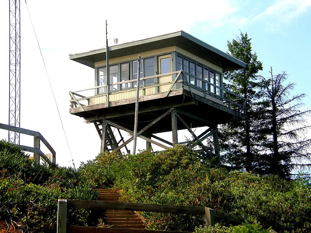
A 1914 Siskiyou National Forest lookout rebuilt in 1963 after storm damage, with a WWII stint as an Aircraft Warning Service post, now rented out by the Forest Service.
- Standing
- Rentable
- Open to the public
- Verified
Visit & stay
You can rent this lookout for overnight stays through recreation.gov.
- Fee
- $65.00
Overview Bald Knob Lookout is perched atop Bald Knob at an elevation of 3,630 feet in the Rogue River-Siskiyou National Forest. The lookout offers visitors a unique lodging experience and panoramic views of the surrounding area. Originally developed in 1931 as a lookout site, Bald Knob served as an Aircraft Warning Service (AWS) observation station between 1942 and 1944. The Forest Service removed and replaced the original with the present flat top structure in 1963. The lookout tower is available for reservations from Memorial Day through October, and guests must bring several of their own amenities to ensure a safe and comfortable stay. Recreation Hiking, birding, and wildlife viewing are popular among guests to this lookout. Seasonal changes envelope the area as snow melt gives rise to spring time flowers, and vivid autumn colors welcome a landscape blanketed with snow. The Panther Ridge Trail is accessible from the facility and follows an historic Native American travel corridor. Approximately 95% of this trail is within the Wild Rogue Wilderness, and is closed to any kind of motorized vehicles or equipment. The trail travels under magnificent stands of old-growth timber and through rhododendron and scrub oak undergrowth. Another notable trail is the nearby Coquille River Falls Trail. The hike switches back and forth through a virgin stand of undisturbed Douglas-fir, hemlock, and Port-Orford cedar trees, ending at the Coquille River Falls. Learn more about the geology of waterfalls along the Coquille River. Facilities The 16 x 16 foot one-room flat top cabin's furnishings include a single bed and a small table and chairs. Due to recent vandalism to propane tank and winter storm damage, there will be no propane heat, stove, refrigerator, and lights available until the next 2026 season. Outside amenities include a picnic table and campfire ring. A primitive vault toilet is located approximately 100 feet from the tower. There is no water on site, so visitors must bring plenty of their own for drinking, cooking and washing. Guests must also supply their own food, cooking utensils, sleeping bags, sleeping pads, towels, dish soap, matches, cooking gear, toilet paper and garbage bags. Please bring your own light source. The site has sufficient space for one small tent, but strong winds could blow a tent off the mountain unless adequately weighted down inside. Natural Features Visitors to the Bald Knob Lookout will be treated to spectacular views overlooking Eden Valley to the north, the Rogue River to the south, and the forests beyond. The unique character of the landscapes comprising the Rogue River-Siskiyou National Forest has led to over 340,000 acres of the Forest to be preserved as a designated wilderness area, and over 200 miles of streams as National Wild and Scenic Rivers. Diverse landscapes provide habitat for a wide range of wildlife, from spotted owls and bull elk to salamanders and sandhill cranes. These species, along with many others, depend on the undeveloped wilderness, undisturbed wetlands, clean streams, and diverse forests to live. Nearby Attractions Visit Crater Lake National Park and learn about its unique natural and cultural history. Reaching depths of 1,943 feet, Crater Lake is the deepest lake in the United States and one of the ten deepest lakes in the world. Experience 172 miles of diverse river and mountain landscapes along the Rogue-Umpqua National Scenic Byway. Travel from rolling oak-covered hills and towering coniferous forests, to roaring white water rapids and incised inter-canyon lava flows. The highway travels alongside the Upper Rogue and North Umpqua Wild and Scenic Rivers that contain world-class fisheries.
Book on recreation.gov (opens recreation.gov)
Rental details from recreation.gov, checked 19 Oct 2026. Rules, fees and seasons change, so confirm on the booking page before you go. Data source: ridb.recreation.gov
Access
Open to the public. available for nightly rental via Recreation.gov
- Can you climb it?
- Yes
- Road to the top?
- No, you have to hike
- Trail
- reached via Forest Service roads 33/3348/5520/5520-020; cabin has no water, and as of 2026 no propane heat, stove, or lights pending repairs
- Staffing
- Unknown
Facts
- Status
- Built of
- Wood
- Also served as
- Aircraft Warning Service postDuring the Second World War it was staffed to spot and report aircraft.
- Built
- 1914 sources disagree
- Height
- 20 ft (6.1 m)
- Elevation
- 3,447 ft (1,051 m)
- Agency
- US Forest Service - Siskiyou National Forest
- Land
- Federal land
- Location
- Coos County, Oregon
- Coordinates
- 42.69357, −124.03995 sources disagree
- Registers
- This entry
- VerifiedResearched, then checked independently. Updated 19 Oct 2026.
- Firefinder id
us-or-bald-knob
View from the cab
What you see from the cab: every ridge out to about 93 miles, the named peaks in sight, and other fire lookouts within view, worked out from terrain data in your browser.
Downloads about 3.5 MB of terrain data the first time.
Or see what it could see on the map: the ground in its line of sight.
History
Then and now
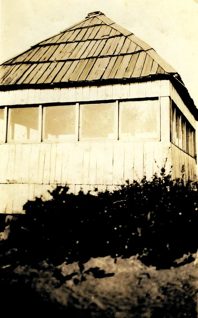
- 1914 BuiltGuard T.D. Land completed a shake shelter and lookout building, cost 25 cents in nails for the shelterSource: oregonlookouts.weebly.com
- No record between 1914 and 1942
- 1942 EventActivated September 29, 1942 as Aircraft Warning Service station 'George 6-3,' reporting to the Roseburg Filter CenterSources: nhlr.org, oregonlookouts.weebly.com
- No record between 1942 and 1962
- 1962 DestroyedColumbus Day Storm (Oct 12, 1962) badly damaged the lookout houseSource: oregonlookouts.weebly.com
- 1963 Built'Built' field on NHLR detail pageSource: NHLR register entry
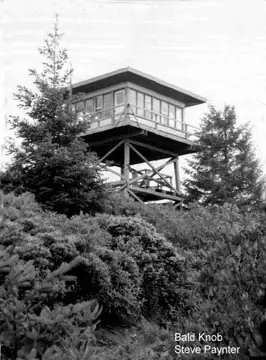
- 1963 Rebuilt20-foot tower with R-6 flat-roof cab constructedSources: nhlr.org, oregonlookouts.weebly.com
- 1972 Staffednewlywed couple Everett and Sue Deniston reported staffing the lookout in September 1972Source: oregonlookouts.weebly.com
- No record between 1972 and 2022
- 2022 Added to the National Historic Lookout Registerregistered May 11, 2022 as US 1572, OR 131Source: nhlr.org
- TodayStandingIt still stands, as far as our sources know.
Old maps of this spot
USGS topographic maps from the years a lookout stood may show it, often as a small symbol labelled “Lookout”. See the old topo maps around it on the Firefinder map, or find every scanned sheet of this spot on USGS TopoView (opens another site) (click the spot there to list them, with dates and downloads).
Story
Researched 4 Oct 2026, fact-checked.
Bald Knob sits above the South Fork Coquille River on the Siskiyou National Forest in Coos County, Oregon, and people have kept watch from it for well over a century.1,2 The first structure went up in 1914, when Guard T.D. Land built a shelter, installed a map and sighting device, and cut a trail to connect with the Coquille River Trail.3 Materials for that first shelter ran just 25 cents, spent entirely on nails.3 Within weeks it was already doing its job: in August 1914 the lookout reported thirteen fires, twelve of them outside the forest boundary.3
Bald Knob was staffed on and off for decades after that, usually by a single guard who also strung and repaired the telephone line down the mountain. Oregon's first female forest-service lookout worked right there: a July 1917 item in a Curry County newspaper reported that Martha Price of Illahe had been "appointed fire lookout" on Bald Knob itself, and the Price family held various Siskiyou lookout posts for years.3 The job had its hazards and its tedium in equal measure — guards fought cougars, chased down smoke through gaps in haze, and got cabin fever waiting on the mountain.3
The lookout took on a second life during World War II. Beginning September 29, 1942, Bald Knob operated as Aircraft Warning Service station "George 6-3," reporting to the Roseburg Filter Center; the AWS used the existing Forest Service facilities rather than building anything new.1,3 When that service ended, the Forest Service kept the site for fire detection.3
The original cabin didn't survive into the modern era: the Columbus Day Storm of October 1962 badly damaged the lookout house, and the following year crews replaced it with the structure that stands today — a 20-foot wood tower topped by an R-6 flat-roofed cab.1,3 It was staffed into at least the early 1970s; a 1972 newspaper item placed newlyweds Everett and Sue Deniston at the Bald Knob lookout that September.3
Bald Knob was added to the National Historic Lookout Register on May 11, 2022, as US 1572.1 Today the Forest Service rents the cabin out through Recreation.gov, though the site has no water and, as of this writing, no propane heat, stove, or lights due to vandalism and winter storm damage, with repairs expected by the 2026 season.2
- Bald Knob Lookout, National Historic Lookout Register, http://nhlr.org/lookouts/us/or/bald-knob-lookout/ (accessed 2026-10-04). ↩
- Bald Knob Lookout, Recreation.gov, https://www.recreation.gov/camping/campgrounds/234155 (accessed 2026-10-04). ↩
- Bald Knob, Oregon Lookouts, https://oregonlookouts.weebly.com/bald-knob.html (accessed 2026-10-04). ↩
Photos
Photos keep their own rights and are shown with credit. Is one of these yours? You can ask for a different credit or for removal.
Where sources disagree
We show disagreements between sources instead of quietly picking one. If you know which is right, please tell us.
Sources disagree on the location by 980 m.
- NHLR: 42.69357, −124.03995
- recreation.gov: 42.69400, −124.02800
The map uses the position from NHLR.
Sources disagree on the year it was built.
- NHLR: 1963
- firelookout.com -- Rex Kamstra's Forest Fire Lookout Page: 1931
- Every Lookout in Oregon (Cheryl Hill): 1963
Sources give different build years. Often one counts the first lookout on the site and another the structure there now.
Sources
- National Historic Lookout Register (NHLR) (opens another site) Gave us: name, location, county, elevation, what it is built of, wartime use, register numbers, agency, dates, photos, links National Historic Lookout Register (nhlr.org) · All rights reserved (American Resources, Inc.); facts extracted only, no prose copied. · retrieved 4 Oct 2026
- Forest Fire Lookout Association (FFLA) - US lookout lists (opens another site) Gave us: type, status, register numbers, links Forest Fire Lookout Association (firelookout.org) · No licence stated; facts extracted only, no prose copied. · retrieved 8 Oct 2026
- Recreation Information Database (recreation.gov) (opens another site) Gave us: ownership, access, rental details, links Data source: ridb.recreation.gov · Public data from the US government · retrieved 19 Oct 2026
- Forest Fire Lookout Association: lookout rentals (opens another site) Gave us: rental details, links Forest Fire Lookout Association rentals list (firelookout.org) · No licence stated; facts extracted only (state, name, booking link, manager, closure note), no prose copied. The FFLA says it is not involved in managing any rental program. · retrieved 19 Oct 2026
- firelookout.com -- Rex Kamstra's Forest Fire Lookout Page (opens another site) Gave us: design, photos, links firelookout.com · No licence stated on the site; facts only (coordinates, elevation, built/destroyed years, design, agency). Photos mirrored with the site's stated credit. · retrieved 4 Oct 2026
- FOREST LOOKOUTS -- western US (Ron Kemnow's weebly sites) (opens another site) Gave us: height Ron Kemnow's Forest Lookouts sites (westlookouts, californialookouts, idaholookouts, montanalookouts, oregonlookouts and washingtonlookouts .weebly.com) · No licence stated; facts only (county, land manager, status word, coordinates where the page's own map widget gives them, township-range-section, height and design hints, links). The site's own newspaper quotes, citations and narrative are not reproduced. · retrieved 8 Oct 2026
- Every Lookout in Oregon (Cheryl Hill) (opens another site) Gave us: links Every Lookout in Oregon (Cheryl Hill, cherylhill.net) · No licence stated; facts only (name, agency, elevation, year built, design and height, status word, links). Posts' narrative and photos are not reproduced. · retrieved 8 Oct 2026
- Firefinder research Gave us: summary, design, height, status, agency, access, visiting details, dates, links, fact-check Firefinder research (sources cited in the story footnotes) · Our own research notes; each fact cites its source in the lookout's story
More about this lookout elsewhere
- NHLR register entry US 1572 (nhlr.org) (opens another site)
- Recreation.gov listing (opens another site)
- Recreation.gov listing (opens another site)
- FFLA Oregon lookout list (firelookout.org) (opens another site)
- FFLA lookout rentals list (firelookout.org) (opens another site)
- Bald Knob Lookout - Forest Lookouts Page (opens another site)
- Bald Knob on firelookout.com (Rex Kamstra) (opens another site)
- Bald Knob on Every Lookout in Oregon (Cheryl Hill) (opens another site)
Firefinder takes facts (places, dates, numbers) from these sources and writes its own words. See all sources and licences.