Fire lookout · Grant County, Oregon
Bone Point Lookout
A 1920s cupola, a 1930s wood tower and a 1947 steel tower came before the present 1961 all-steel tower, now kept for emergency use.
- Standing
- Access unknown
- Verified
Visit & stay
Not rentable. As far as we know, this lookout cannot be booked for overnight stays.
Access
Access unknown
We do not know the access rules. Check with the land manager before you go.
- Can you climb it?
- Unknown
- Road to the top?
- Unknown
- Trail
- The final road is rough; a 2016 visitor stopped about 0.2 miles along it and walked the rest.
- Staffing
- Unknown
Facts
- Status
- Type
- Cab on a tower30-foot all-steel live-in tower (present structure, 1961)The design: Cupola house
- Built of
- Steel
- Built
- 1947 sources disagree
- Height
- 30 ft (9.1 m)
- Elevation
- 4,517 ft (1,377 m)
- Agency
- Oregon Department of Forestry (administers); U.S. Forest Service (cooperator)
- Land
- Federal land
- Location
- Grant County, Oregon
- Coordinates
- 44.98547, −119.03026
- Registers
- This entry
- VerifiedResearched, then checked independently. Updated 8 Oct 2026.
- Firefinder id
us-or-bone-point
View from the cab
What you see from the cab: every ridge out to about 93 miles, the named peaks in sight, and other fire lookouts within view, worked out from terrain data in your browser.
Downloads about 3.7 MB of terrain data the first time.
Or see what it could see on the map: the ground in its line of sight.
History
Then and now
- 1930 EventSix miles of forest telephone line completed, connecting the Dale ranger station with the new Bone Point lookout station.Source: oregonlookouts.weebly.com
- 1932 StaffedKeith Jenson listed as known lookout personnel.Source: firelookout.com
- 1942 FireA small lightning fire was reported from Bone Point in July 1942.Source: oregonlookouts.weebly.com
- 1947 Built30-foot steel live-in tower placed at Bone Point, one of ten surplus towers the state bought from World War II airfields (c.1947).Sources: nhlr.org, firelookout.com, oregonlookouts.weebly.com
- 1954 AlteredLookout cab sealed with plywood and painted inside; rock blasted near the top to widen the access road for supply trips.Source: oregonlookouts.weebly.com
- 1954 StaffedLouise Stuart listed as known lookout personnel.Source: firelookout.com
- 1961 Built'Built' field on NHLR detail pageSource: NHLR register entry
- 1961 Replaced by a new structureThe present 30-foot all-steel live-in tower replaced the 1947 steel tower; NHLR gives 1961 as the build year.Sources: nhlr.org, firelookout.com
- No record between 1961 and 2003
- 2003 Last staffedLast staffed in August 2003 for a brief period of heavy lightning, though not regularly staffed for years before.Sources: nhlr.org, cherylhill.net
- 2014 EventForest Service Bone Point Repeater Placement project would move the radio repeater from the lookout building to a ground-level equipment building; decision signed August 14, 2014; project marked completed (move date not stated).Source: fs.usda.gov
- 2016 Condition assessmentA blog visitor found the cab in no shape to live in and labelled the site abandoned.Source: cherylhill.net
- 2022 Added to the National Historic Lookout RegisterRegistered on the National Historic Lookout Register, June 8, 2022.Source: nhlr.org
- TodayStandingIt still stands, as far as our sources know.
Old maps of this spot
USGS topographic maps from the years a lookout stood may show it, often as a small symbol labelled “Lookout”. See the old topo maps around it on the Firefinder map, or find every scanned sheet of this spot on USGS TopoView (opens another site) (click the spot there to list them, with dates and downloads).
Story
Researched 8 Oct 2026, fact-checked.
Bone Point sits on a summit in Grant County, about 12 miles south-southwest of Ukiah, at roughly 4,500 feet.1,2,3 The tower standing there now is the fourth tower at the site.1
A cupola cabin went up in the 1920s, followed in the 1930s by a 40-foot wooden tower with living quarters.1,2 In April 1930 a six-mile forest telephone line was completed to the new lookout station, linking it to the Dale ranger station, according to a Maupin Times notice that the Oregon Lookouts site reproduced.4 Around 1947 the state bought surplus towers left over from World War II airfields, and one 30-foot steel tower was placed at Bone Point.4,1,2 A 1946 Coast and Geodetic Survey data sheet places the site in the Whitman National Forest, while the more recent sources name the Umatilla.4,1,2
The present 30-foot all-steel live-in tower replaced that steel tower in 1961, and both the registry and firelookout.com date the current structure to that year.1,2 The sources do not say why the earlier structures were replaced.1,2
Known lookout personnel are sparse. Firelookout.com names Keith Jenson in 1932 and Louise Stuart in 1954.2 On July 2, 1942, a minor lightning fire was reported from Bone Point.4 In 1954 the cab was sealed with plywood and painted inside, and rock near the top was blasted to widen the road and make it safer for supply trips.4 The tower was last staffed in August 2003, when it was briefly brought back during heavy lightning, even though it had not been regularly staffed for years.3,1
The sources do not say what became of the cupola cabin, the wooden tower or the 1947 steel tower.1,2 A Forest Service project planned to move the radio repeater out of the lookout building and into a separate ground-level building meant to shelter the equipment. The decision was signed August 14, 2014, and the project is marked completed.5
The National Historic Lookout Register added Bone Point on June 8, 2022, and says the tower remains for emergency use.1 The Oregon Department of Forestry administers it.1,2 A 2016 blog listed the site as abandoned, which conflicts with the later registry note, so I have followed the registry.3 Public access and rental are not described in any source I found.1,2,3 The 2016 visitor stopped about 0.2 miles along the final road because it was too rough, walked the rest, and found the cab unfit for habitation.3
- Bone Point Lookout, National Historic Lookout Register, http://nhlr.org/lookouts/us/or/bone-point-lookout/ (accessed 2026-10-08). ↩
- Bone Point Fire Lookout Tower, firelookout.com, https://www.firelookout.com/or/bonept.html (accessed 2026-10-08). ↩
- Bone Point - Every Lookout in Oregon, cherylhill.net, https://cherylhill.net/firelookouts/2016/06/17/bone-point/ (accessed 2026-10-08). ↩
- Bone Point - FOREST LOOKOUTS, Oregon Lookouts, https://oregonlookouts.weebly.com/bone-point.html (accessed 2026-10-08). ↩
- Bone Point Repeater Placement project, U.S. Forest Service, Umatilla National Forest, https://www.fs.usda.gov/r06/umatilla/projects/45231 (accessed 2026-10-08). ↩
Photos
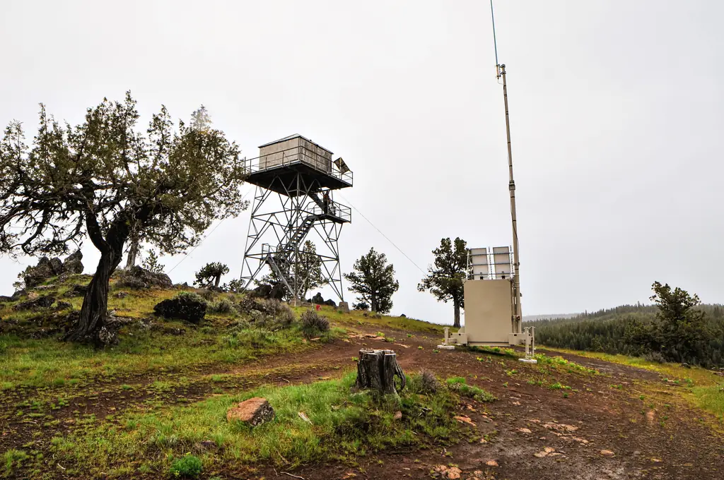
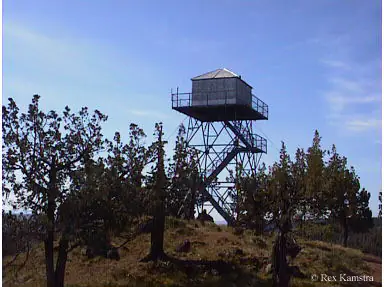
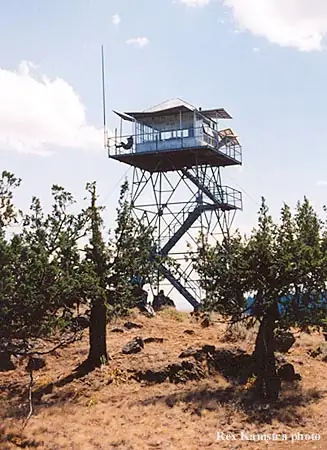
Photos keep their own rights and are shown with credit. Is one of these yours? You can ask for a different credit or for removal.
Where sources disagree
We show disagreements between sources instead of quietly picking one. If you know which is right, please tell us.
Sources disagree on the year it was built.
- NHLR: 1961
- firelookout.com -- Rex Kamstra's Forest Fire Lookout Page: 1947
- Every Lookout in Oregon (Cheryl Hill): 1961
Sources give different build years. Often one counts the first lookout on the site and another the structure there now.
Sources
- National Historic Lookout Register (NHLR) (opens another site) Gave us: name, location, county, elevation, what it is built of, register numbers, agency, dates, photos, links National Historic Lookout Register (nhlr.org) · All rights reserved (American Resources, Inc.); facts extracted only, no prose copied. · retrieved 4 Oct 2026
- Forest Fire Lookout Association (FFLA) - US lookout lists (opens another site) Gave us: type, status, register numbers, links Forest Fire Lookout Association (firelookout.org) · No licence stated; facts extracted only, no prose copied. · retrieved 8 Oct 2026
- firelookout.com -- Rex Kamstra's Forest Fire Lookout Page (opens another site) Gave us: ownership, photos, links firelookout.com · No licence stated on the site; facts only (coordinates, elevation, built/destroyed years, design, agency). Photos mirrored with the site's stated credit. · retrieved 4 Oct 2026
- FOREST LOOKOUTS -- western US (Ron Kemnow's weebly sites) (opens another site) Gave us: height, links Ron Kemnow's Forest Lookouts sites (westlookouts, californialookouts, idaholookouts, montanalookouts, oregonlookouts and washingtonlookouts .weebly.com) · No licence stated; facts only (county, land manager, status word, coordinates where the page's own map widget gives them, township-range-section, height and design hints, links). The site's own newspaper quotes, citations and narrative are not reproduced. · retrieved 8 Oct 2026
- Every Lookout in Oregon (Cheryl Hill) (opens another site) Gave us: links Every Lookout in Oregon (Cheryl Hill, cherylhill.net) · No licence stated; facts only (name, agency, elevation, year built, design and height, status word, links). Posts' narrative and photos are not reproduced. · retrieved 8 Oct 2026
- Firefinder research Gave us: summary, design, height, status, agency, visiting details, dates, links, fact-check Firefinder research (sources cited in the story footnotes) · Our own research notes; each fact cites its source in the lookout's story
More about this lookout elsewhere
- NHLR register entry US 1600 (nhlr.org) (opens another site)
- Bone Point Repeater Placement project (U.S. Forest Service, Umatilla National Forest) (opens another site)
- FFLA Oregon lookout list (firelookout.org) (opens another site)
- Bone Point on firelookout.com (Rex Kamstra) (opens another site)
- Bone Point on Forest Lookouts, western US (Ron Kemnow) (opens another site)
- Bone Point on Every Lookout in Oregon (Cheryl Hill) (opens another site)
Firefinder takes facts (places, dates, numbers) from these sources and writes its own words. See all sources and licences.