Fire lookout · Grant County, Oregon
Dixie Butte Lookout
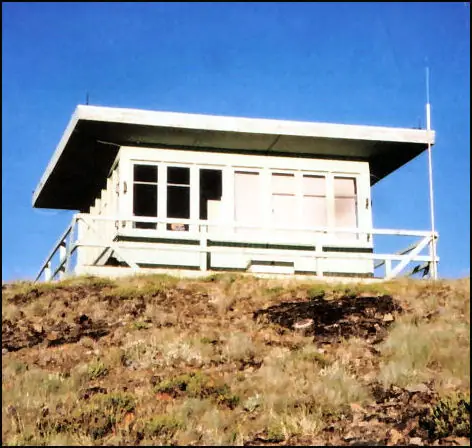
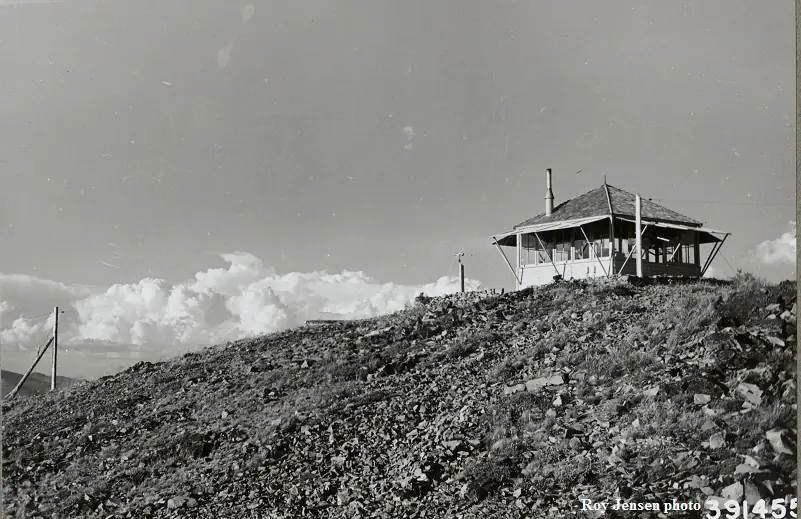
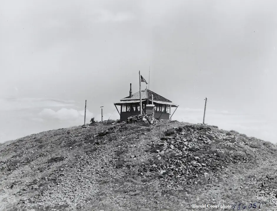
Dixie Butte R-6 ground cab (1968) in the Malheur National Forest, built after a 1967 windstorm; staffed in summer, reached by rough Forest Road 2610.
- Standing
- Open to the public
- Verified
Visit & stay
Not rentable. As far as we know, this lookout cannot be booked for overnight stays.
Access
Open to the public. Reached by rough Forest Road 2610. No closure or permit requirement found in the pages read. The cab is staffed in summer and in active service.
- Can you climb it?
- Unknown
- Road to the top?
- Yes, you can drive up
- Trail
- Forest Road 2610 is rough and rocky; high-clearance vehicles recommended for washouts and gullies. A 2024 visitor drove about four miles and walked the rest. Check with the Prairie City Ranger District before a visit.
- Staffing
- Staffed during fire season
Facts
- Status
- Type
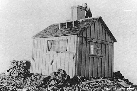
- Ground-level cab15 by 15 foot R-6 flat-top ground cab (present); earlier L-4 ground house from 1935The designs: L-4, R-6, D-6
- Built of
- WoodGoing by its design; no source says so in words.
- Built
- 1921 sources disagree
- Height
- 12 ft (3.7 m)
- Elevation
- 7,511 ft (2,289 m)
- Agency
- U.S. Forest Service, Malheur National Forest (Prairie City Ranger District)
- Land
- Federal land
- Location
- Grant County, Oregon
- Coordinates
- 44.58295, −118.62582
- Registers
- This entry
- VerifiedResearched, then checked independently. Updated 8 Oct 2026.
- Firefinder id
us-or-dixie-butte
View from the cab
What you see from the cab: every ridge out to about 93 miles, the named peaks in sight, and other fire lookouts within view, worked out from terrain data in your browser.
Downloads about 3.5 MB of terrain data the first time.
Or see what it could see on the map: the ground in its line of sight.
History
Then and now
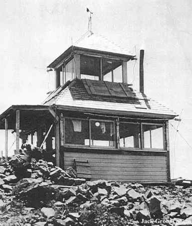
- 1911 EventCabin with a rooftop platform built around 1911; a lookout on the butte was connected by telephone to the central officeSources: cherylhill.net, oregonlookouts.weebly.com
- 1916 FireObserver spotted smoke 45 miles to the southwest and phoned the location to the John Day office; found to be a small slash fireSource: oregonlookouts.weebly.com
- 1921 BuiltNew lookout building completed, reported by Independence Enterprise as best equipped on the reserveSource: oregonlookouts.weebly.com
- 1935 Replaced by a new structureL-4 ground house replaced the cupola cabin of the early 1920sSource: nhlr.org
- No record between 1935 and 1967
- 1967 EventWindstorm damaged the structure in the fall of 1967Source: trailsoffroad.com
- 1968 Built'Built' field on NHLR detail pageSource: NHLR register entry
- 1968 Replaced by a new structurePresent R-6 flat-top cab built, replacing the damaged structureSources: trailsoffroad.com, nhlr.org, firelookout.com
- No record between 1968 and 2006
- 2006 Added to the National Historic Lookout RegisterRegistered March 15, 2006 as US 657, OR 108Source: nhlr.org
- TodayStandingIt still stands, as far as our sources know.
Old maps of this spot
USGS topographic maps from the years a lookout stood may show it, often as a small symbol labelled “Lookout”. See the old topo maps around it on the Firefinder map, or find every scanned sheet of this spot on USGS TopoView (opens another site) (click the spot there to list them, with dates and downloads).
Story
Researched 8 Oct 2026, fact-checked.
Dixie Butte overlooks Prairie City from the eastern end of the John Day Valley.1 The lookout sits in the Malheur National Forest, in Grant County, Oregon.2 A cabin with a rooftop platform went up on the summit around 1911.3 That same year a lookout there was connected by telephone to the central office.4
A new lookout building was finished in August 1921, and one newspaper called it the best equipped on the reserve.4 The L-4 ground house that replaced the cupola cabin of the early 1920s dates to 1935.2 A windstorm damaged that structure in the fall of 1967, and the present cabin followed in 1968.1,2
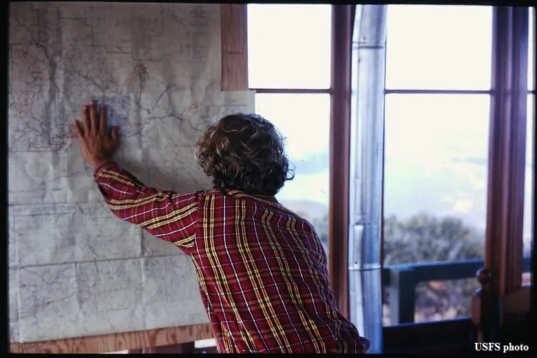
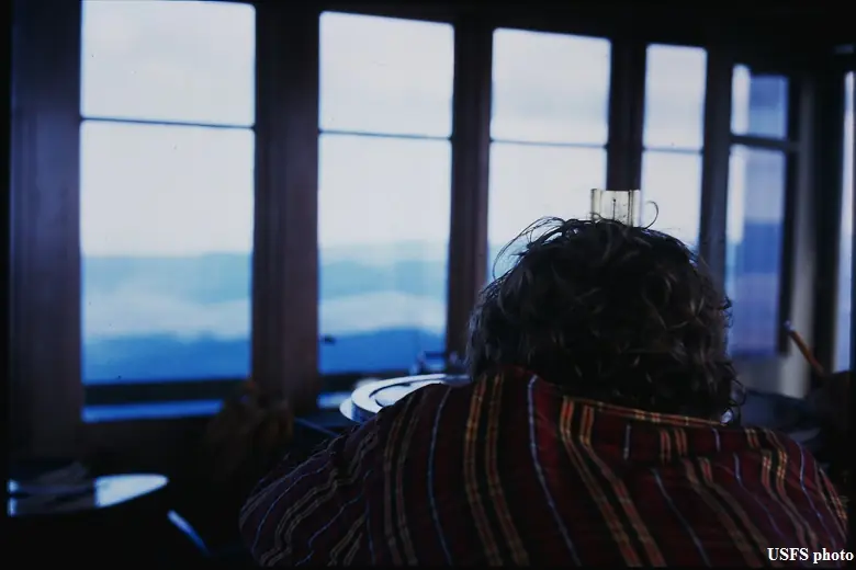
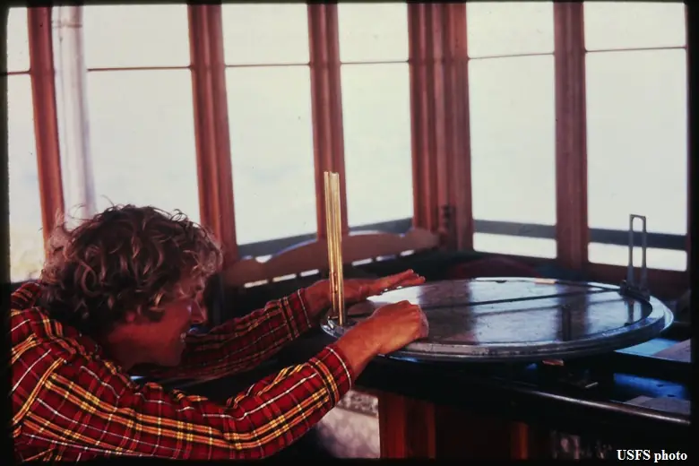
The cab is staffed each summer, according to one lookout history site.5 Cheryl Hill visited in July 2024 and spoke with the lookout on duty.3
In August 1916 the lookout reported four forest fires in two days, and crews were sent out from Sumpter to fight them.4 A second 1916 report says an observer spotted smoke 45 miles away and phoned the fire's location to the John Day office.4
The register says the present cabin remains in active service.2
Forest Road 2610 is rough and rocky, and one guide recommends high-clearance vehicles because of washouts and gullies.1,3 In 2024 Cheryl Hill drove about four miles of it and walked the rest.3 The Malheur National Forest's rental list names one lookout, Fall Mountain, and Dixie Butte is not on it.6
Sources disagree on the elevation. The register gives 7,511 feet, while two other pages give 7,592 feet.2,5,3
Before a visit, check with the Prairie City Ranger District, since the cab is in active use.2
- Dixie Butte Lookout, Trails Offroad (trailsoffroad.com), https://www.trailsoffroad.com/US/oregon/scout-routes/4072-dixie-butte-lookout (accessed 2026-10-08). ↩
- Dixie Butte Lookout, National Historic Lookout Register (nhlr.org), http://nhlr.org/lookouts/us/or/dixie-butte-lookout/ (accessed 2026-10-08). ↩
- Dixie Butte - Every Lookout in Oregon, Cheryl Hill (cherylhill.net), https://cherylhill.net/firelookouts/2024/07/18/dixie-butte/ (accessed 2026-10-08). ↩
- Dixie Butte, Forest Lookouts (oregonlookouts.weebly.com), https://oregonlookouts.weebly.com/dixie-butte.html (accessed 2026-10-08). ↩
- Dixie Butte Fire Lookout Cabin, Rex's Forest Fire Lookout Page (firelookout.com), https://www.firelookout.com/or/dixiebutte.html (accessed 2026-10-08). ↩
- Malheur National Forest Cabin Rentals, U.S. Forest Service (fs.usda.gov), https://www.fs.usda.gov/r06/malheur/recreation/cabin-rentals (accessed 2026-10-08). ↩
Photos
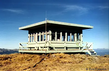
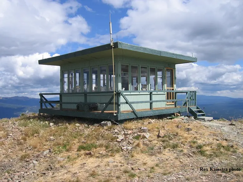
Photos keep their own rights and are shown with credit. Is one of these yours? You can ask for a different credit or for removal.
Where sources disagree
We show disagreements between sources instead of quietly picking one. If you know which is right, please tell us.
Sources disagree on the year it was built.
- NHLR: 1968
- firelookout.com -- Rex Kamstra's Forest Fire Lookout Page: 1920
- Every Lookout in Oregon (Cheryl Hill): 1968
Sources give different build years. Often one counts the first lookout on the site and another the structure there now.
Sources
- National Historic Lookout Register (NHLR) (opens another site) Gave us: name, location, county, elevation, register numbers, agency, ownership, dates, photos, links National Historic Lookout Register (nhlr.org) · All rights reserved (American Resources, Inc.); facts extracted only, no prose copied. · retrieved 4 Oct 2026
- Forest Fire Lookout Association (FFLA) - US lookout lists (opens another site) Gave us: type, status, register numbers, links Forest Fire Lookout Association (firelookout.org) · No licence stated; facts extracted only, no prose copied. · retrieved 8 Oct 2026
- firelookout.com -- Rex Kamstra's Forest Fire Lookout Page (opens another site) Gave us: what it is built of, design, staffing, photos, links firelookout.com · No licence stated on the site; facts only (coordinates, elevation, built/destroyed years, design, agency). Photos mirrored with the site's stated credit. · retrieved 4 Oct 2026
- FOREST LOOKOUTS -- western US (Ron Kemnow's weebly sites) (opens another site) Gave us: height, links Ron Kemnow's Forest Lookouts sites (westlookouts, californialookouts, idaholookouts, montanalookouts, oregonlookouts and washingtonlookouts .weebly.com) · No licence stated; facts only (county, land manager, status word, coordinates where the page's own map widget gives them, township-range-section, height and design hints, links). The site's own newspaper quotes, citations and narrative are not reproduced. · retrieved 8 Oct 2026
- Every Lookout in Oregon (Cheryl Hill) (opens another site) Gave us: register numbers, links Every Lookout in Oregon (Cheryl Hill, cherylhill.net) · No licence stated; facts only (name, agency, elevation, year built, design and height, status word, links). Posts' narrative and photos are not reproduced. · retrieved 8 Oct 2026
- Firefinder research Gave us: summary, design, status, agency, access, visiting details, dates, links, fact-check Firefinder research (sources cited in the story footnotes) · Our own research notes; each fact cites its source in the lookout's story
More about this lookout elsewhere
- NHLR register entry US 657 (nhlr.org) (opens another site)
- NHLR register entry (nhlr.org) (opens another site)
- Dixie Butte Lookout (Trails Offroad (trailsoffroad.com)) (opens another site)
- Malheur National Forest Cabin Rentals (U.S. Forest Service (fs.usda.gov)) (opens another site)
- FFLA Oregon lookout list (firelookout.org) (opens another site)
- Dixie Butte on firelookout.com (Rex Kamstra) (opens another site)
- Dixie Butte on Forest Lookouts, western US (Ron Kemnow) (opens another site)
- Dixie Butte on Every Lookout in Oregon (Cheryl Hill) (opens another site)
Firefinder takes facts (places, dates, numbers) from these sources and writes its own words. See all sources and licences.