Fire lookout · Jackson County, Oregon
Dutchman Peak Lookout
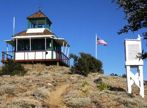
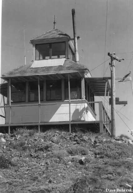
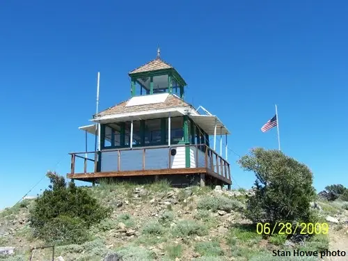
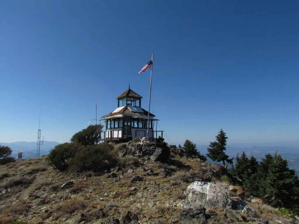
A 1927 D-6 cupola lookout on Dutchman Peak in the Rogue River National Forest, described as the last original cupola lookout still in use, with a 1937 CCC garage.
- Standing
- Open to the public
- Verified
Visit & stay
Not rentable. As far as we know, this lookout cannot be booked for overnight stays.
Access
Open to the public. Reached by road in summer; a stop on the Mt. Ashland Loop Road. Whether the cabin interior is open to visitors is not confirmed. Ask the Applegate Ranger District.
- Can you climb it?
- Unknown
- Road to the top?
- Yes, you can drive up
- Trail
- A short distance from the Pacific Crest Trail
- Staffing
- Staffed during fire season (as of 2017)
Facts
- Status
- Type
- Ground-level cabD-6 cupola cabin, standard wood-frame structureThe design: D-6
- Built of
- WoodGoing by its design; no source says so in words.
- Also served as
- Aircraft Warning Service postDuring the Second World War it was staffed to spot and report aircraft.
- Built
- 1927
- Height
- Unknown
- Elevation
- 7,364 ft (2,245 m)
- Agency
- U.S. Forest Service
- Land
- Federal land
- Location
- Jackson County, Oregon
- Coordinates
- 42.04345, −122.89145
- Registers
- This entry
- VerifiedResearched, then checked independently. Updated 8 Oct 2026.
- Firefinder id
us-or-dutchman-peak
View from the cab
What you see from the cab: every ridge out to about 93 miles, the named peaks in sight, and other fire lookouts within view, worked out from terrain data in your browser.
Downloads about 3.5 MB of terrain data the first time.
Or see what it could see on the map: the ground in its line of sight.
History
Then and now
- 1927 BuiltBuilt as a D-6 cupola lookout; the nomination says a worker posted in summer 1927 most likely built itSources: nhlr.org, firelookout.com, npgallery.nps.gov
- 1937 EventCCC crew of five built a garage and woodshed below the lookoutSource: npgallery.nps.gov
- 1942 AlteredCCC garage converted to a residence for Aircraft Warning Service observersSource: npgallery.nps.gov
- No record between 1942 and 1991
- 1991 Added to the National Historic Lookout RegisterRegistered August 2, 1991 as US 19, OR 5; nominated by Barbara Mumblo, USFSSource: nhlr.org
- 1999 RestoredForest Service historic preservation team repaired the foundation and installed a new roofSource: npgallery.nps.gov
- 2000 Listed on the National Register of Historic PlacesNational Register record dated December 29, 2000 (NRHP 00000509)Source: npgallery.nps.gov
- No record between 2000 and 2015
- 2015 EventFFLA restoration grant awarded to start work on the shutters and living quarters; amount not stated.Source: firelookout.org
- TodayStandingIt still stands, as far as our sources know.
Old maps of this spot
USGS topographic maps from the years a lookout stood may show it, often as a small symbol labelled “Lookout”. See the old topo maps around it on the Firefinder map, or find every scanned sheet of this spot on USGS TopoView (opens another site) (click the spot there to list them, with dates and downloads).
Story
Researched 8 Oct 2026, fact-checked.
Dutchman Peak Lookout sits on the summit of Dutchman Peak in the Rogue River National Forest, near the California–Oregon line, about 13 miles southwest of Ashland.1,2,3 The 1927 cabin is a D-6 cupola design of conventional wood-frame construction.2,3 Rangers keep watch for fires from a cupola that rises above the cabin roof.4
In the summer of 1927 the Applegate Ranger District put a worker on the peak, while the ownership of the land was still being debated.3 According to the nomination, that worker, Alex Schichtl, probably put up the structure with at least one helper.3 Schichtl apparently spent each summer there until about 1937, and his supplies came in by pack string along a rough trail.3
A five-person Civilian Conservation Corps crew built a garage and woodshed just below the lookout in 1937.3 By then the Ashland/Applegate Loop Road, built in 1935 and 1936, gave vehicles access to the summit.3 Robert L. "Slim" Dowell took over lookout duties in 1938 and came back each summer for the duration of World War II.3 In 1942 the Forest Service repurposed the CCC garage as a home for Aircraft Warning Service observers, and Dowell and his wife served as spotters that year and in 1943.3
A Forest Service historic preservation team fixed the foundation and put on a new roof in 1999.3 The lookout entered the National Historic Lookout Register on August 2, 1991, as US 19 (OR 5), with Barbara Mumblo of the Forest Service as nominator.1 Its National Register of Historic Places record is dated December 29, 2000.5
A 2017 Jefferson Public Radio feature said the lookout can be reached by road in summer and sits not far from the Pacific Crest Trail. It also noted that an original Osborne firefinder, a 360-degree map invented in 1911, is still in place.4 A firelookout.com page, which is undated, says the lookout is still staffed in summer.2 The register says the lookout is a go-to stop for drivers on the Mt. Ashland Loop Road and for Pacific Crest hikers.1 Sources give the summit elevation as anywhere from 7,364 to 7,418 feet.1,2,3,4
I did not find a 2025 or 2026 staffing schedule. Before visiting, ask the Applegate Ranger District about the current season and whether the cabin is open to the public.
- Dutchman Peak Lookout, National Historic Lookout Register (nhlr.org), http://nhlr.org/lookouts/us/or/dutchman-peak-lookout/ (accessed 2026-10-08). ↩
- Dutchman's Peak Fire Lookout Cabin, firelookout.com, https://www.firelookout.com/or/dutchmanspeak.html (accessed 2026-10-08). ↩
- Dutchman Peak Lookout, National Register of Historic Places nomination (NRHP 00000509), NPGallery PDF, https://npgallery.nps.gov/GetAsset/8502b9d6-ee55-4d0a-af09-525555fa68f7 (accessed 2026-10-08). ↩
- "Last Cupola Lookout Tower Tops Dutchman Peak," Jefferson Public Radio, As It Was, https://www.ijpr.org/show/as-it-was/2017-03-07/last-cupola-lookout-tower-tops-dutchman-peak (accessed 2026-10-08). ↩
- Dutchman Peak Lookout, National Register of Historic Places, NPGallery asset detail, https://npgallery.nps.gov/AssetDetail/NRIS/00000509 (accessed 2026-10-08). ↩
Photos

Photos keep their own rights and are shown with credit. Is one of these yours? You can ask for a different credit or for removal.
Sources
- National Historic Lookout Register (NHLR) (opens another site) Gave us: name, location, county, elevation, register numbers, agency, ownership, dates, photos, links National Historic Lookout Register (nhlr.org) · All rights reserved (American Resources, Inc.); facts extracted only, no prose copied. · retrieved 4 Oct 2026
- Forest Fire Lookout Association (FFLA) - US lookout lists (opens another site) Gave us: type, status, register numbers, links Forest Fire Lookout Association (firelookout.org) · No licence stated; facts extracted only, no prose copied. · retrieved 8 Oct 2026
- firelookout.com -- Rex Kamstra's Forest Fire Lookout Page (opens another site) Gave us: what it is built of, wartime use, design, dates, photos, links firelookout.com · No licence stated on the site; facts only (coordinates, elevation, built/destroyed years, design, agency). Photos mirrored with the site's stated credit. · retrieved 4 Oct 2026
- Forest Fire Lookout Association chapter reports (opens another site) Gave us: dates, links Forest Fire Lookout Association, chapter and restoration-grant reports (firelookout.org) · No licence stated; facts only (dates, names, the kind of work done). Every note is our own wording and every event links to the FFLA report it comes from. Positions are copied from the NHLR, FFLOS and FFLA records. · retrieved 8 Oct 2026
- Wikidata -- US fire lookout towers (Q748998 and subclasses) (opens another site) Gave us: register numbers, photos, links Wikidata · CC0 1.0 (Wikidata). Images keep their own Commons licence/credit. · retrieved 4 Oct 2026
- OpenStreetMap -- fire lookout structures (opens another site) Gave us: links © OpenStreetMap contributors · ODbL 1.0. (c) OpenStreetMap contributors. · retrieved 4 Oct 2026
- FOREST LOOKOUTS -- western US (Ron Kemnow's weebly sites) (opens another site) Gave us: links Ron Kemnow's Forest Lookouts sites (westlookouts, californialookouts, idaholookouts, montanalookouts, oregonlookouts and washingtonlookouts .weebly.com) · No licence stated; facts only (county, land manager, status word, coordinates where the page's own map widget gives them, township-range-section, height and design hints, links). The site's own newspaper quotes, citations and narrative are not reproduced. · retrieved 8 Oct 2026
- Every Lookout in Oregon (Cheryl Hill) (opens another site) Gave us: links Every Lookout in Oregon (Cheryl Hill, cherylhill.net) · No licence stated; facts only (name, agency, elevation, year built, design and height, status word, links). Posts' narrative and photos are not reproduced. · retrieved 8 Oct 2026
- Firefinder research Gave us: summary, design, agency, access, staffing, visiting details, dates, links, fact-check Firefinder research (sources cited in the story footnotes) · Our own research notes; each fact cites its source in the lookout's story
More about this lookout elsewhere
- NHLR register entry US 19 (nhlr.org) (opens another site)
- Dutchman Peak Lookout, National Register of Historic Places nomination (NRHP 00000509) (National Park Service, NPGallery) (opens another site)
- Dutchman Peak Lookout, NPGallery asset detail (National Park Service, NPGallery) (opens another site)
- Last Cupola Lookout Tower Tops Dutchman Peak (Jefferson Public Radio, As It Was) (opens another site)
- FFLA Oregon lookout list (firelookout.org) (opens another site)
- Forest Fire Lookout Association chapter reports: work on Dutchman Peak Lookout (opens another site)
- Dutchmans Peak on firelookout.com (Rex Kamstra) (opens another site)
- Dutchman's Peak on Forest Lookouts, western US (Ron Kemnow) (opens another site)
- Dutchman Peak on Every Lookout in Oregon (Cheryl Hill) (opens another site)
- Wikidata item Q86925413 (opens another site)
- OpenStreetMap way 821254587 (opens another site)
Firefinder takes facts (places, dates, numbers) from these sources and writes its own words. See all sources and licences.