Fire lookout · Douglas County, Oregon
Hershberger Lookout
Also known as Hershberger Mountain, Hershberger Mt.
A 1925 D-6 cupola lookout on the Rogue River National Forest, used as a WWII aircraft warning post, NRHP-listed in 2000, and still standing but not regularly staffed.
- Standing
- Open to the public
- Verified
Visit & stay
Not rentable. As far as we know, this lookout cannot be booked for overnight stays.
Access
Open to the public. Reached via Forest Roads 6510, 6515 and 530 north of Union Creek, OR; rough road, high-clearance recommended, short hike at end
- Can you climb it?
- Yes
- Road to the top?
- No, you have to hike
- Trail
- Short hike from end of FR 530
- Staffing
- Unknown
Facts
- Status
- Type
- Ground-level cabD-6 cupolaThe design: D-6
- Built of
- WoodGoing by its design; no source says so in words.
- Built
- 1925
- Height
- Unknown
- Elevation
- 6,081 ft (1,854 m)
- Agency
- U.S. Forest Service (Rogue River National Forest)
- Land
- Federal land
- Location
- Douglas County, Oregon
- Coordinates
- 43.03339, −122.45477
- Registers
- This entry
- VerifiedResearched, then checked independently. Updated 8 Oct 2026.
- Firefinder id
us-or-hershberger
View from the cab
What you see from the cab: every ridge out to about 93 miles, the named peaks in sight, and other fire lookouts within view, worked out from terrain data in your browser.
Downloads about 3.7 MB of terrain data the first time.
Or see what it could see on the map: the ground in its line of sight.
History
Then and now
- 1913 EventDistrict fire plan proposes a lookout line to Hershberger MountainSource: oregonlookouts.weebly.com
- 1917 EventEarlier camp on the mountain predates the lookout structureSource: firelookout.com
- 1925 BuiltD-6 cupola lookout house constructedSources: nhlr.org, en.wikipedia.org, firelookout.com
- No record between 1925 and 1943
- 1943 EventEnd of the period of significance for fire-detection use (1925-1943) per NRHP nomination; served as WWII aircraft warning stationSources: npgallery.nps.gov, hikingproject.com
- No record between 1943 and 1991
- 1991 Added to the National Historic Lookout RegisterDate registered per NHLR detail page: October 15, 1991Source: NHLR register entry
- 1991 EventRefurbished in the 1980s per onX/Hiking Project summary (exact year not specified)Source: hikingproject.com
- 2000 Listed on the National Register of Historic PlacesListed on National Register of Historic Places, December 29, 2000Sources: en.wikipedia.org, npgallery.nps.gov
- 2004 AlteredA gate was installed at the site in an effort to stop vandalism.Source: firelookout.org
- 2012 RestoredRefurbished with new roof, shutters, glass, and paintSources: hikingproject.com, oregonlookouts.weebly.com
- TodayStandingIt still stands, as far as our sources know.
Old maps of this spot
USGS topographic maps from the years a lookout stood may show it, often as a small symbol labelled “Lookout”. See the old topo maps around it on the Firefinder map, or find every scanned sheet of this spot on USGS TopoView (opens another site) (click the spot there to list them, with dates and downloads).
Story
Researched 4 Oct 2026, fact-checked.
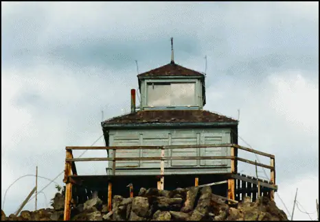
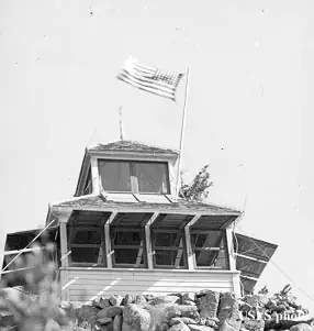
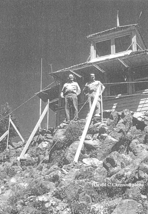
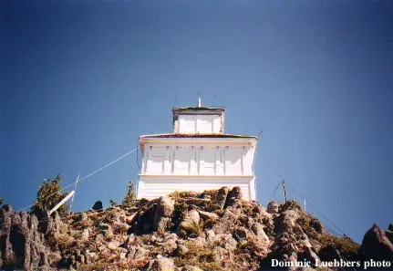
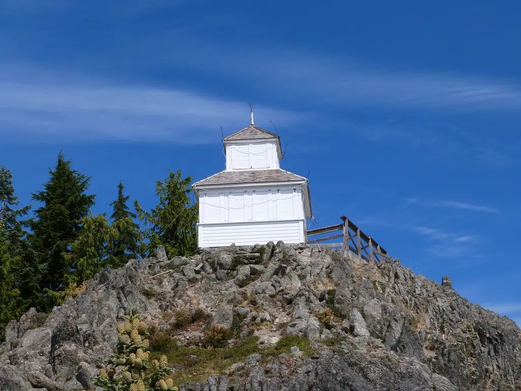
Rogue River National Forest managers first talked about putting a lookout on Hershberger Mountain as early as 1913, when a fire-detection line was proposed to the peak as part of a district fire plan.1 A camp existed on the mountain by 1917, and the lookout house itself, a D-6 cupola-style cabin, was built in 1925.2,3 The design was standard for the Forest Service's District Six (later renamed Region Six, the source of the "D-6" label) lookouts built in Oregon and Washington in the 1920s: a wood-frame ground cabin with a hipped, wood-shingled roof and a second-story cupola that held the fire-spotting station and an Osborne firefinder alidade.3,4 Downstairs held the furnishings needed to live there, a stove, table, cupboards and a bed, with a hinged ladder in the ceiling connecting that living space to the fire-spotting post above.4
During the Second World War the lookout did double duty as an aircraft warning station, part of the home-front network watching Pacific coast skies.5 Its official period of historic significance for fire detection on the Rogue River runs from 1925 to 1943, and the Forest Service's own records list it as vacant in more recent decades rather than staffed year-round.4 A second, smaller structure on the site, a privy, has been described as long abandoned and badly deteriorated.4
Hershberger was listed on the National Register of Historic Places on December 29, 2000, as part of a multiple-property nomination covering Forest Service historic structures on the Rogue River National Forest.2,4 It was refurbished once in the 1980s, and again in 2012, when crews gave it a new roof, shutters, glass, paint and other repairs.5,1 The plank catwalk now wrapping three sides of the cupola is a later addition, replacing an earlier two-sided version built in the 1960s.4
Today the lookout still sees occasional use by the Forest Service and is listed on the National Historic Lookout Register, though it has not been actively staffed in recent years.6,5 It sits above the Upper Rogue River with views toward Crater Lake, Mount Thielsen, Mount Bailey, Mount McLoughlin and, on clear days, Mount Shasta.5 Reaching it means following Forest Roads 6510, 6515 and 530 north of Union Creek, Oregon, a rough, pothole-prone route best suited to a high-clearance vehicle, ending in a short hike to the structure.5
- Hershberger Mountain, Forest Lookouts (Oregon Lookouts), https://oregonlookouts.weebly.com/hershberger-mountain.html (accessed 2026-10-04). ↩
- Hershberger Mountain Lookout, Wikipedia, https://en.wikipedia.org/wiki/Hershberger_Mountain_Lookout (accessed 2026-10-04). ↩
- Hershberger Mtn. Fire Lookout Cabin, firelookout.com, https://www.firelookout.com/or/hershberger.html (accessed 2026-10-04). ↩
- National Register of Historic Places Registration Form, U.S. Forest Service Historic Structures on the Rogue River National Forest MPS (NRHP #00000507), https://npgallery.nps.gov/GetAsset/NRHP/00000507_text (accessed 2026-10-04). ↩
- Hershberger Mountain Fire Lookout, Prospect, Oregon, Hiking Project (onX), https://www.hikingproject.com/gem/1051/hershberger-mountain-fire-lookout (accessed 2026-10-04). ↩
- Hershberger Lookout, National Historic Lookout Register, http://nhlr.org/lookouts/us/or/hershberger-lookout/ (accessed 2026-10-04). ↩
Photos

Photos keep their own rights and are shown with credit. Is one of these yours? You can ask for a different credit or for removal.
Sources
- National Historic Lookout Register (NHLR) (opens another site) Gave us: name, location, county, elevation, register numbers, agency, ownership, dates, photos, links National Historic Lookout Register (nhlr.org) · All rights reserved (American Resources, Inc.); facts extracted only, no prose copied. · retrieved 4 Oct 2026
- Forest Fire Lookout Association (FFLA) - US lookout lists (opens another site) Gave us: type, status, register numbers, links Forest Fire Lookout Association (firelookout.org) · No licence stated; facts extracted only, no prose copied. · retrieved 8 Oct 2026
- firelookout.com -- Rex Kamstra's Forest Fire Lookout Page (opens another site) Gave us: what it is built of, design, dates, photos, links firelookout.com · No licence stated on the site; facts only (coordinates, elevation, built/destroyed years, design, agency). Photos mirrored with the site's stated credit. · retrieved 4 Oct 2026
- Forest Fire Lookout Association chapter reports (opens another site) Gave us: dates, links Forest Fire Lookout Association, chapter and restoration-grant reports (firelookout.org) · No licence stated; facts only (dates, names, the kind of work done). Every note is our own wording and every event links to the FFLA report it comes from. Positions are copied from the NHLR, FFLOS and FFLA records. · retrieved 8 Oct 2026
- Wikidata -- US fire lookout towers (Q748998 and subclasses) (opens another site) Gave us: register numbers, photos, links Wikidata · CC0 1.0 (Wikidata). Images keep their own Commons licence/credit. · retrieved 4 Oct 2026
- OpenStreetMap -- fire lookout structures (opens another site) Gave us: links © OpenStreetMap contributors · ODbL 1.0. (c) OpenStreetMap contributors. · retrieved 4 Oct 2026
- FOREST LOOKOUTS -- western US (Ron Kemnow's weebly sites) (opens another site) Gave us: links Ron Kemnow's Forest Lookouts sites (westlookouts, californialookouts, idaholookouts, montanalookouts, oregonlookouts and washingtonlookouts .weebly.com) · No licence stated; facts only (county, land manager, status word, coordinates where the page's own map widget gives them, township-range-section, height and design hints, links). The site's own newspaper quotes, citations and narrative are not reproduced. · retrieved 8 Oct 2026
- Every Lookout in Oregon (Cheryl Hill) (opens another site) Gave us: register numbers, links Every Lookout in Oregon (Cheryl Hill, cherylhill.net) · No licence stated; facts only (name, agency, elevation, year built, design and height, status word, links). Posts' narrative and photos are not reproduced. · retrieved 8 Oct 2026
- Firefinder research Gave us: summary, design, status, agency, access, visiting details, dates, links, fact-check Firefinder research (sources cited in the story footnotes) · Our own research notes; each fact cites its source in the lookout's story
More about this lookout elsewhere
- NHLR register entry US 21 (nhlr.org) (opens another site)
- National Register of Historic Places Registration Form (NRHP #00000507) (National Park Service / U.S. Forest Service) (opens another site)
- Hershberger Mountain Fire Lookout, Prospect, Oregon (Hiking Project (onX)) (opens another site)
- FFLA Oregon lookout list (firelookout.org) (opens another site)
- Forest Fire Lookout Association chapter reports: work on Hershberger Lookout (opens another site)
- Wikipedia: Hershberger Mountain Lookout (opens another site)
- Hershberger Mtn. on firelookout.com (Rex Kamstra) (opens another site)
- Hershberger Mountain on Forest Lookouts, western US (Ron Kemnow) (opens another site)
- Hershberger Mountain on Every Lookout in Oregon (Cheryl Hill) (opens another site)
- Wikidata item Q16892279 (opens another site)
- OpenStreetMap node 3153409600 (opens another site)
Firefinder takes facts (places, dates, numbers) from these sources and writes its own words. See all sources and licences.