Fire lookout · Deschutes County, Oregon
Lava Butte Lookout
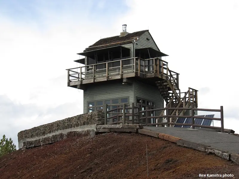
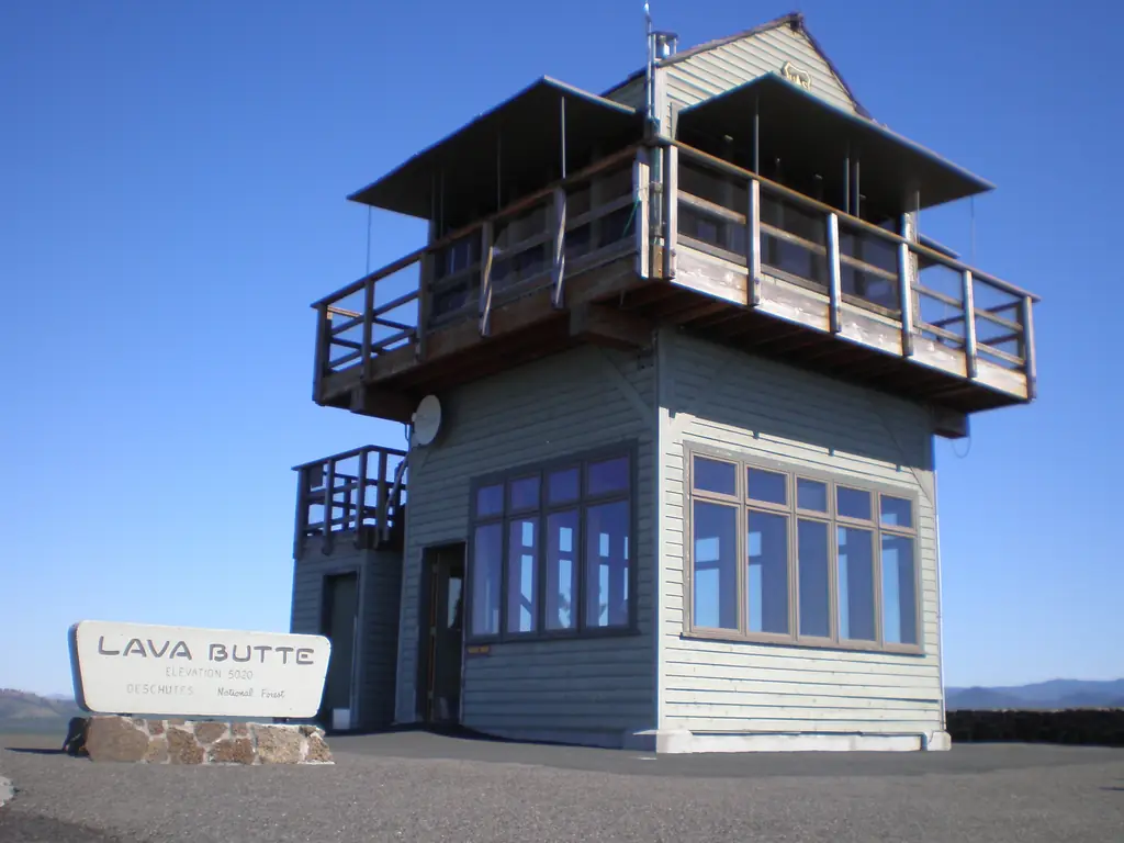
A Forest Service lookout on a Deschutes cinder cone, first built in 1931; the 1998 reproduction has a visitor center and is reached by shuttle in summer.
- Standing
- Open to the public
- Verified
Visit & stay
Not rentable. As far as we know, this lookout cannot be booked for overnight stays.
Access
Open to the public. First floor is a visitor center. Summer shuttle runs from the Lava Lands Visitor Center. The sources read do not say whether the cab itself is open to visitors.
- Can you climb it?
- Unknown
- Road to the top?
- Unknown
- Trail
- Shuttle runs up Red Cinder Road from early May to mid October; hiking the road is possible all year; a rim trail about 0.35 miles long circles the top.
- Staffing
- Unknown
Facts
- Status
- Type
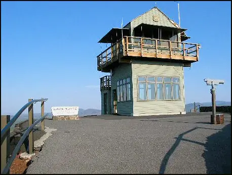
- Two-story building1998 reproduction of a gable-roofed L-4 cab with catwalk; first floor is a visitor centerThe designs: L-4, R-6
- Built of
- WoodGoing by its design; no source says so in words.
- Built
- 1931
- Height
- 500 ft (152.4 m)
- Elevation
- 4,958 ft (1,511 m)
- Agency
- U.S. Forest Service
- Land
- Federal land
- Location
- Deschutes County, Oregon
- Coordinates
- 43.91785, −121.35633
- Registers
- This entry
- VerifiedResearched, then checked independently. Updated 8 Oct 2026.
- Firefinder id
us-or-lava-butte
View from the cab
What you see from the cab: every ridge out to about 93 miles, the named peaks in sight, and other fire lookouts within view, worked out from terrain data in your browser.
Downloads about 4.0 MB of terrain data the first time.
Or see what it could see on the map: the ground in its line of sight.
History
Then and now
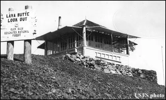
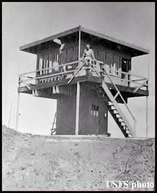
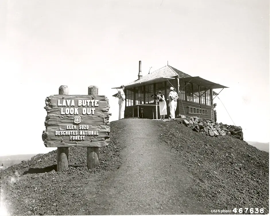
- 1931 BuiltFirst Forest Service lookout on the summit, an L-4 groundhouseSources: en.wikipedia.org, firelookout.com, nhlr.org
- 1933 EventSteep single-lane road built up the cone to the summitSource: en.wikipedia.org
- No record between 1933 and 1957
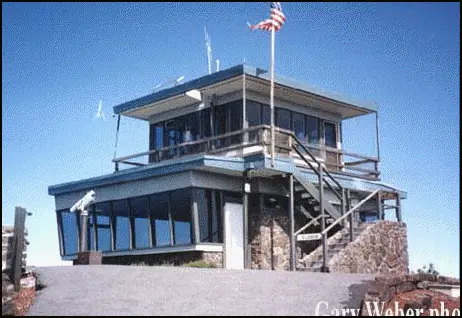
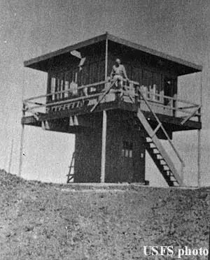
- 1957 Replaced by a new structureLarger lookout with a slant-window flat-top cab replaced the 1931 towerSources: en.wikipedia.org, firelookout.com, nhlr.org
- 1962 AlteredEnlarged to hold a small visitor center and museum on the first floor (Wikipedia). Firelookout.com dates the first-floor expansion to 1960Sources: en.wikipedia.org, firelookout.com
- No record between 1962 and 1997
- 1997 RemovedStructure dismantled to make way for a new lookout and visitor centerSource: firelookout.com
- 1998 Built'Built' field on NHLR detail pageSource: NHLR register entry
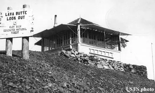
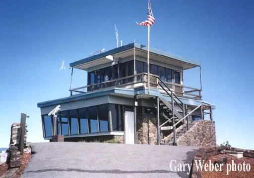
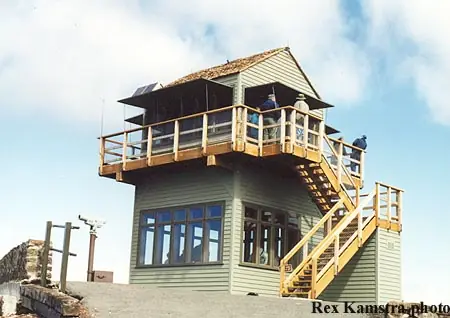
- 1998 RebuiltCurrent third structure on the site, a reproduction of a gable-roofed L-4 cab with catwalkSources: en.wikipedia.org, firelookout.com, nhlr.org
- 2003 Added to the National Historic Lookout RegisterRegistered on the National Historic Lookout Register as Number 100Source: nhlr.org
- TodayStandingIt still stands, as far as our sources know.
Old maps of this spot
USGS topographic maps from the years a lookout stood may show it, often as a small symbol labelled “Lookout”. See the old topo maps around it on the Firefinder map, or find every scanned sheet of this spot on USGS TopoView (opens another site) (click the spot there to list them, with dates and downloads).
Story
Researched 8 Oct 2026, fact-checked.
Lava Butte is a cinder cone in central Oregon, about nine miles south-southwest of Bend.1,2 The Forest Service built the first fire lookout on its summit in 1931, an L-4 groundhouse.1,2,3 In early 1933 a steep, single-lane road was built up the cone to the summit.1
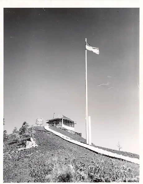
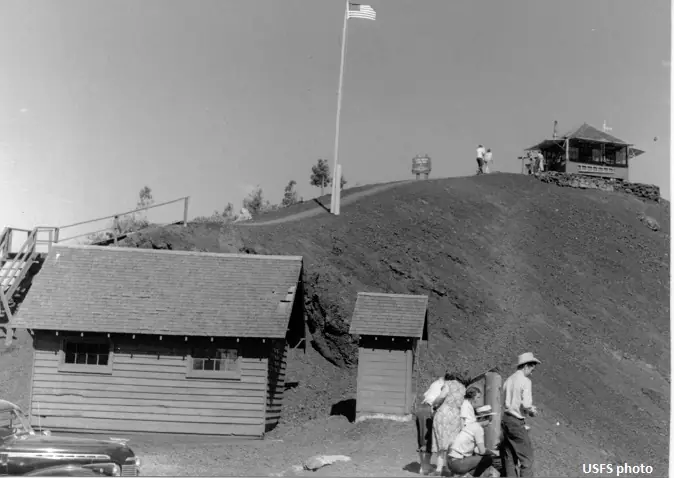
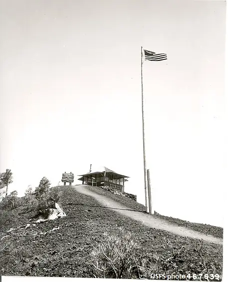
Sources differ on the years that followed. The register says the 1957 replacement had a slant-window flat-top cab with a visitor center downstairs.3 Firelookout.com describes a two-story flat cab that year and dates the first-floor visitor-center expansion to 1960.2 Wikipedia says the 1957 lookout was enlarged in 1962 to hold a small visitor center and museum.1
That structure came down in 1997 to clear the way for a new lookout and visitor center.2 The current tower, the third on the site, went up in 1998 as a gable-roofed L-4 reproduction with a catwalk.3,1,2
The register listed the lookout on September 2, 2003, as its Number 100, and noted that Oregon became the first state to reach 100 stations.3 The register also says it is among the most visited lookouts in the country.3 Firelookout.com also says Lava Butte has been the first place to report more fires on the Deschutes than all other lookouts there.2
None of the three pages says who staffs the tower or whether anyone is posted there now.1,2,3
Today the register describes the station as a visitor center for the Lavalands National Monument, while Wikipedia places the butte within the Newberry National Volcanic Monument.3,1 Between early May and mid-October, a shuttle takes visitors from the Lava Lands Visitor Center up Red Cinder Road to the lookout.1 Hiking the road is an option all year, and a rim trail about 0.35 miles long circles the top.1 Check the shuttle dates with the Forest Service before you go, since the dates here come from an encyclopedia.
- Lava Butte, Wikipedia, https://en.wikipedia.org/wiki/Lava_Butte (accessed 2026-10-08). ↩
- Lava Butte Fire Lookout Tower, Firelookout.com, https://www.firelookout.com/or/lavabutte.html (accessed 2026-10-08). ↩
- Lava Butte Lookout, National Historic Lookout Register, http://nhlr.org/lookouts/us/or/lava-butte-lookout/ (accessed 2026-10-08). ↩
Photos

Photos keep their own rights and are shown with credit. Is one of these yours? You can ask for a different credit or for removal.
Sources
- National Historic Lookout Register (NHLR) (opens another site) Gave us: name, location, county, elevation, register numbers, agency, ownership, dates, photos, links National Historic Lookout Register (nhlr.org) · All rights reserved (American Resources, Inc.); facts extracted only, no prose copied. · retrieved 4 Oct 2026
- Forest Fire Lookout Association (FFLA) - US lookout lists (opens another site) Gave us: type, status, register numbers, links Forest Fire Lookout Association (firelookout.org) · No licence stated; facts extracted only, no prose copied. · retrieved 8 Oct 2026
- firelookout.com -- Rex Kamstra's Forest Fire Lookout Page (opens another site) Gave us: what it is built of, design, photos, links firelookout.com · No licence stated on the site; facts only (coordinates, elevation, built/destroyed years, design, agency). Photos mirrored with the site's stated credit. · retrieved 4 Oct 2026
- Wikidata -- US fire lookout towers (Q748998 and subclasses) (opens another site) Gave us: photos, links Wikidata · CC0 1.0 (Wikidata). Images keep their own Commons licence/credit. · retrieved 4 Oct 2026
- FOREST LOOKOUTS -- western US (Ron Kemnow's weebly sites) (opens another site) Gave us: height, links Ron Kemnow's Forest Lookouts sites (westlookouts, californialookouts, idaholookouts, montanalookouts, oregonlookouts and washingtonlookouts .weebly.com) · No licence stated; facts only (county, land manager, status word, coordinates where the page's own map widget gives them, township-range-section, height and design hints, links). The site's own newspaper quotes, citations and narrative are not reproduced. · retrieved 8 Oct 2026
- Every Lookout in Oregon (Cheryl Hill) (opens another site) Gave us: links Every Lookout in Oregon (Cheryl Hill, cherylhill.net) · No licence stated; facts only (name, agency, elevation, year built, design and height, status word, links). Posts' narrative and photos are not reproduced. · retrieved 8 Oct 2026
- Firefinder research Gave us: summary, design, agency, access, visiting details, dates, links, fact-check Firefinder research (sources cited in the story footnotes) · Our own research notes; each fact cites its source in the lookout's story
More about this lookout elsewhere
- NHLR register entry US 508 (nhlr.org) (opens another site)
- Lava Butte (Wikipedia) (opens another site)
- FFLA Oregon lookout list (firelookout.org) (opens another site)
- Lava Butte on firelookout.com (Rex Kamstra) (opens another site)
- Lava Butte on Forest Lookouts, western US (Ron Kemnow) (opens another site)
- Lava Butte on Every Lookout in Oregon (Cheryl Hill) (opens another site)
- Wikidata item Q86925500 (opens another site)
Firefinder takes facts (places, dates, numbers) from these sources and writes its own words. See all sources and licences.