Fire lookout · Luzerne County, Pennsylvania
Dry Hill Land
Also known as Dry Land Hill
Built in 1921 on State Game Lands #91 and staffed for decades, including by a teenage watcher known as "Honey" from 1922; whether it still stands after a reported 2018 replacement is unresolved.
- Standing
- Access unknown
- Verified
Visit & stay
Not rentable. As far as we know, this lookout cannot be booked for overnight stays.
Access
Access unknown
We do not know the access rules. Check with the land manager before you go.
- Can you climb it?
- Unknown
- Road to the top?
- Unknown
- Staffing
- Unknown
Facts
- Status
- sources disagree
- Type
- Cab on a towerAermotorThe design: Aermotor
- Built of
- SteelGoing by its design; no source says so in words.
- Built
- 1921
- Height
- 80 ft (24.4 m)
- Elevation
- Unknown
- Agency
- Pennsylvania Department of Forests and Waters
- Land
- State land
- Location
- Luzerne County, Pennsylvania
- Coordinates
- 41.15110, −75.65500
- Registers
- Not on a lookout register
- This entry
- VerifiedResearched, then checked independently. Updated 8 Oct 2026.
- Firefinder id
us-pa-dry-hill-land
View from the cab
What you see from the cab: every ridge out to about 93 miles, the named peaks in sight, and other fire lookouts within view, worked out from terrain data in your browser.
Downloads about 3.7 MB of terrain data the first time.
Or see what it could see on the map: the ground in its line of sight.
History
Then and now
- 1921 BuiltAermotor Windmill Company tower erected; later record attributes the district to the Pennsylvania Department of Forests and Waters.Sources: arcgis.com, easternuslookouts.weebly.com
- 1922 First staffedA fifteen-year-old watcher known locally as "Honey" was appointed by district forester R. Lynn Emmerick.Source: easternuslookouts.weebly.com
- No record between 1922 and 1955
- 1955 Last staffedLast staffing on record: watcher Peter Dubinsky, operating from a site a local paper placed on the "Conlon Estate" near Bear Creek.Source: easternuslookouts.weebly.com
- No record between 1955 and 2018
- 2018 Replaced by a new structureStoryMap states the original tower was replaced this year; conflicts with a separate source marking the tower removed.Source: arcgis.com
- TodayStandingIt still stands, as far as our sources know.
Old maps of this spot
USGS topographic maps from the years a lookout stood may show it, often as a small symbol labelled “Lookout”. See the old topo maps around it on the Firefinder map, or find every scanned sheet of this spot on USGS TopoView (opens another site) (click the spot there to list them, with dates and downloads).
Story
Researched 4 Oct 2026, fact-checked.
Dry Hill Land
Dry Hill Land tower stands on State Game Lands #91 in Luzerne County, Pennsylvania, in what was once the Lackawanna forest fire district overseen by the Pennsylvania Department of Forests and Waters.1 The Aermotor Windmill Company built the original tower here in 1921.2
For decades the job of watching from it stayed close to one family. In 1922, at age fifteen, a young woman known locally as "Honey" was appointed tower watcher by R. Lynn Emmerick, then district forester for the Lackawanna District — making her, by a 1949 newspaper's account, "the only woman in the State at present holding such a job."1 Her post sat 1,921 feet above sea level by one 1949 account and 1,931 feet by a 1948 one, about five and a half miles east of Bear Creek village and three miles from the Lehigh River, and it covered ground in five counties: Luzerne, Lackawanna, Monroe, Delaware and Carbon.1
The tower kept working through the 1940s and 50s. In 1946 it was one of eleven towers across the five-county district being inspected and repaired ahead of fall fire season.1 In August 1948 the district announced it would operate the tower starting that October, with Mrs. Jennie Bempkins of Buck Township in charge.1 By 1955 the watcher was Peter Dubinsky, working from a site a local paper placed on the "Conlon Estate" near Bear Creek; from there he could spot fires around Bear Creek and Thornhurst that the Penobscot and Tark Hill towers couldn't see, and on a clear day sight as far as "Goulsboro."1
What happened to the tower after that is unclear, and the two sources behind this page disagree. A Pennsylvania fire-tower StoryMap says the original 1921 tower was replaced in 2018, with a tower (now given as 80 feet tall, though the same entry also calls it "the 60 foot tower") still on the site today.2 A register of eastern lookout histories, by contrast, marks Dry Land Hill simply "Removed," with no date given.1 It isn't clear whether that refers to the 1921 structure coming down ahead of its 2018 replacement, or to the site being cleared altogether — so whether anything currently stands at Dry Hill Land is genuinely unresolved.
There is nothing in either source about current access, staffing, or whether the site can be visited.
- "Dry Land Hill", Forest Lookouts (easternuslookouts.weebly.com), https://easternuslookouts.weebly.com/dry-land-hill.html (accessed 2026-10-04). ↩
- "Fire Towers of Pennsylvania" StoryMap, Shawn Lesitsky, Esri ArcGIS StoryMaps, https://www.arcgis.com/apps/MapSeries/index.html?appid=ed47c97ebe7246868ce8ef3e7139a0b4 (accessed 2026-10-04). ↩
Photos
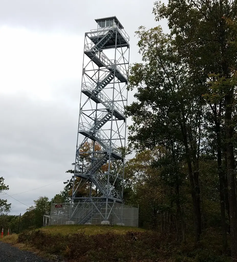
Photos keep their own rights and are shown with credit. Is one of these yours? You can ask for a different credit or for removal.
Where sources disagree
We show disagreements between sources instead of quietly picking one. If you know which is right, please tell us.
Sources disagree on whether it still stands.
- Fire Towers of Pennsylvania (ArcGIS StoryMap, Shawn Lesitsky): Standing
- FOREST LOOKOUTS -- eastern US (easternuslookouts.weebly.com): Gone
Sources
- Fire Towers of Pennsylvania (ArcGIS StoryMap, Shawn Lesitsky) (opens another site) Gave us: name, county, type, what it is built of, design, height, status, agency, ownership, dates, photos, links Pennsylvania fire towers StoryMap (ArcGIS) · No licence stated; facts only (county, agency, built year, height, builder). · retrieved 4 Oct 2026
- FOREST LOOKOUTS -- eastern US (easternuslookouts.weebly.com) (opens another site) Gave us: location, links easternuslookouts.weebly.com · No licence stated; facts only (county, coordinates where the page's own map widget gives them, status, height, design hints, register links). The site's own historical quotes, newspaper citations and narrative are not reproduced. · retrieved 8 Oct 2026
- Firefinder research Gave us: summary, design, agency, dates, links, fact-check Firefinder research (sources cited in the story footnotes) · Our own research notes; each fact cites its source in the lookout's story
More about this lookout elsewhere
- Fire Towers of Pennsylvania StoryMap (Shawn Lesitsky) (opens another site)
- Dry Land Hill (easternuslookouts.weebly.com) (opens another site)
Firefinder takes facts (places, dates, numbers) from these sources and writes its own words. See all sources and licences.