Fire lookout · Franklin County, Pennsylvania
Mount Dunlap Fire Tower
Also known as Blue Ridge
An 80-ft steel tower built by CCC crews in 1936 on Mount Dunlap, Franklin County; now fenced off and used for radio equipment.
- Standing
- Restricted access
- Verified
Visit & stay
Not rentable. As far as we know, this lookout cannot be booked for overnight stays.
Access
Restricted access
Access is seasonal, gated or needs a permit. Check before you go. Closed off by a fence; used for communications equipment. Owned by Washington Township since 2004.
- Can you climb it?
- No
- Road to the top?
- Unknown
- Trail
- The Appalachian Trail passes a bit below the summit.
- Staffing
- Unknown
Facts
- Status
- Type
- Cab on a tower80-ft steel lookout tower, Aermotor MC-39 per the register (1936)The design: Aermotor MC-39
- Built of
- SteelGoing by its design; no source says so in words.
- Built
- 1936
- Height
- 80 ft (24.4 m)
- Elevation
- 1,701 ft (519 m)
- Agency
- Washington Township
- Land
- Unknown
- Location
- Franklin County, Pennsylvania
- Coordinates
- 39.72583, −77.48747
- Registers
- This entry
- VerifiedResearched, then checked independently. Updated 8 Oct 2026.
- Firefinder id
us-pa-mount-dunlap
View from the cab
What you see from the cab: every ridge out to about 93 miles, the named peaks in sight, and other fire lookouts within view, worked out from terrain data in your browser.
Downloads about 3.4 MB of terrain data the first time.
Or see what it could see on the map: the ground in its line of sight.
History
Then and now
- 1926 First staffedState forest service begins using the knob as a lookout; early observations from birch trees at the summitSource: willhiteweb.com
- 1930 EventBoy Scout troop builds a log cabin for the state forest fire wardenSource: willhiteweb.com
- 1936 BuiltSteel tower erected by CCC crews from Camp S-70 at the Old Forge; purchased with emergency conservation work fundsSources: nhlr.org, easternuslookouts.weebly.com, willhiteweb.com
- 1937 EventCCC builds access roads and a stone observer cabin about 100 feet from the towerSource: willhiteweb.com
- 1944 StaffedLookout named as Harlan BenchoffSource: willhiteweb.com
- 1945 FireTowerman spots a forest fire said to have destroyed about 75 acres of timberland in Mt. Alto State Forest; the item is credited to The Morning Herald, not the Waynesboro paperSource: easternuslookouts.weebly.com
- No record between 1945 and 1963
- 1963 StaffedLookout named as Harold NaugleSource: willhiteweb.com
- 1966 EventState offers the stone cabin at the site for sale and asks that it be demolished and removed by July 1, 1966Source: willhiteweb.com
- 1973 EventTower not staffed in fall 1973 because the Snowy Mountain lookout was back in serviceSource: willhiteweb.com
- No record between 1973 and 1993
- 1993 EventTower serves as a communications tower for Washington TownshipSource: willhiteweb.com
- 2004 EventWashington Township buys the tower and about an acre from a church that used it for a radio antennaSource: willhiteweb.com
- 2014 Added to the National Historic Lookout RegisterRegistered on the National Historic Lookout Register as US 985Source: nhlr.org
- TodayStandingIt still stands, as far as our sources know.
Old maps of this spot
USGS topographic maps from the years a lookout stood may show it, often as a small symbol labelled “Lookout”. See the old topo maps around it on the Firefinder map, or find every scanned sheet of this spot on USGS TopoView (opens another site) (click the spot there to list them, with dates and downloads).
Story
Researched 8 Oct 2026, fact-checked.
The tower sits on Mount Dunlap, a knob near Blue Ridge Summit in Washington Township, Franklin County.1 The state forest service took up the knob as a fire-watch site in 1926, and early observers worked from birch trees at the summit.2 A troop of Boy Scouts constructed a log cabin for the fire warden of the state forest in 1930.2
The steel tower followed in 1936. CCC crews from a camp in Old Forge, outside Waynesboro, built it, and the U.S. Forest Service bought it with emergency conservation work funds.3,1,2 Newspapers that year called it 80 feet tall, and the register gives the same height for its Aermotor MC-39 design.3,1 The sources do not agree on the height. A Penn State mapping page says 90 feet, and a Coast and Geodetic Survey team reportedly estimated 110 feet.2,4
Jesse Thompson, a state fire warden based at Blue Ridge Summit, was named to run the new tower.1 He stayed on for many years.2 In 1937 CCC crews built roads to the site and a stone observer's cabin roughly 100 feet from the tower.2
A Waynesboro paper reported more than seventy-five people at the tower on one Sunday in October 1939.1 Later lookouts included Harlan Benchoff in 1944 and Harold Naugle in 1963.2
In November 1945 a towerman spotted a forest fire, which The Morning Herald said had burned roughly 75 acres of woodland.1 In 1966 the state offered the two-story stone cabin at the site for sale and asked that it be removed.2
In 1973 a 19-year-old from Waynesboro died after a fall from the tower.2 That fall the tower went unstaffed, because the Snowy Mountain lookout to the north was back in service.2
In 1993 the tower carried communications gear for Washington Township.2 In 2004 the township bought the tower and an acre around it from a church that had used the tower as an antenna site.2 The National Historic Lookout Register lists the tower with a registration date of January 7, 2014.3
Today the register says the tower carries communications equipment and is fenced off.3 The Appalachian Trail runs just below the summit.2 Please do not climb the fenced tower.
- Blue Ridge (Mt Dunlap), Forest Lookouts, https://easternuslookouts.weebly.com/blue-ridge-mt-dunlap.html (accessed 2026-10-08). ↩
- Mt. Dunlop Blue Ridge Lookout Tower, WillhiteWeb.com, https://willhiteweb.com/appalachian_trail/fire_lookouts/mt_dunlop/blue_ridge_tower_042.htm (accessed 2026-10-08). ↩
- Mount Dunlap Fire Tower, National Historic Lookout Register, http://nhlr.org/lookouts/us/pa/mount-dunlap-fire-tower/ (accessed 2026-10-08). ↩
- Mount Dunlap, Penn State Mont Alto mapping project, https://sites.psu.edu/montaltomapping/2015/11/11/mount-dunlap/ (accessed 2026-10-08). ↩
Photos
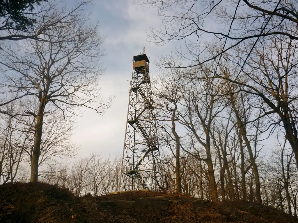
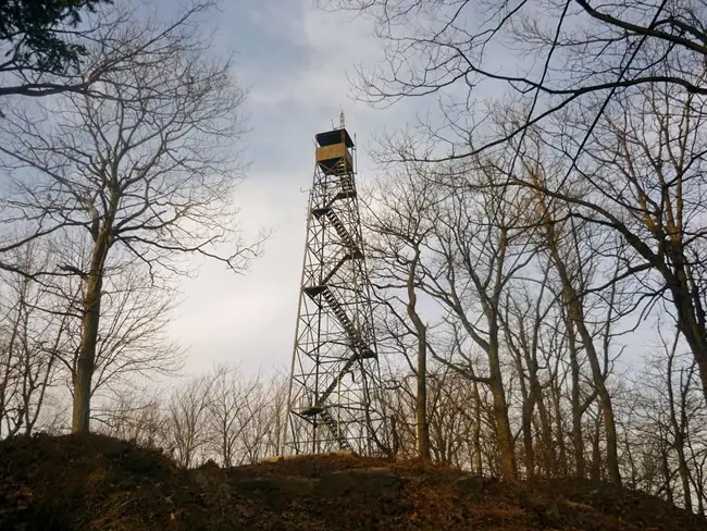
Photos keep their own rights and are shown with credit. Is one of these yours? You can ask for a different credit or for removal.
Sources
- National Historic Lookout Register (NHLR) (opens another site) Gave us: name, location, county, elevation, type, what it is built of, status, register numbers, agency, dates, photos, links National Historic Lookout Register (nhlr.org) · All rights reserved (American Resources, Inc.); facts extracted only, no prose copied. · retrieved 4 Oct 2026
- Fire Towers of Pennsylvania (ArcGIS StoryMap, Shawn Lesitsky) (opens another site) Gave us: height, photos, links Pennsylvania fire towers StoryMap (ArcGIS) · No licence stated; facts only (county, agency, built year, height, builder). · retrieved 4 Oct 2026
- FOREST LOOKOUTS -- eastern US (easternuslookouts.weebly.com) (opens another site) Gave us: links easternuslookouts.weebly.com · No licence stated; facts only (county, coordinates where the page's own map widget gives them, status, height, design hints, register links). The site's own historical quotes, newspaper citations and narrative are not reproduced. · retrieved 8 Oct 2026
- OpenStreetMap -- fire lookout structures (opens another site) Gave us: links © OpenStreetMap contributors · ODbL 1.0. (c) OpenStreetMap contributors. · retrieved 4 Oct 2026
- Firefinder research Gave us: summary, design, height, agency, access, visiting details, dates, links, fact-check Firefinder research (sources cited in the story footnotes) · Our own research notes; each fact cites its source in the lookout's story
More about this lookout elsewhere
- NHLR register entry US 985 (nhlr.org) (opens another site)
- Mt. Dunlop Blue Ridge Lookout Tower (WillhiteWeb.com) (opens another site)
- Mount Dunlap (Penn State Mont Alto mapping project) (opens another site)
- Fire Towers of Pennsylvania StoryMap (Shawn Lesitsky) (opens another site)
- Blue Ridge (easternuslookouts.weebly.com) (opens another site)
- OpenStreetMap node 357364481 (opens another site)
Firefinder takes facts (places, dates, numbers) from these sources and writes its own words. See all sources and licences.