Fire lookout · Lycoming County, Pennsylvania
Pump Station Fire Tower
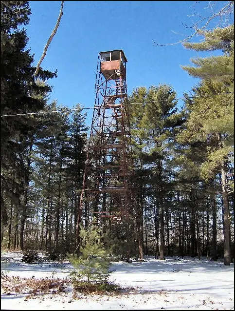
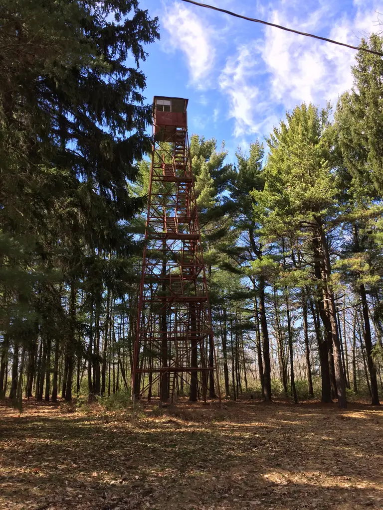
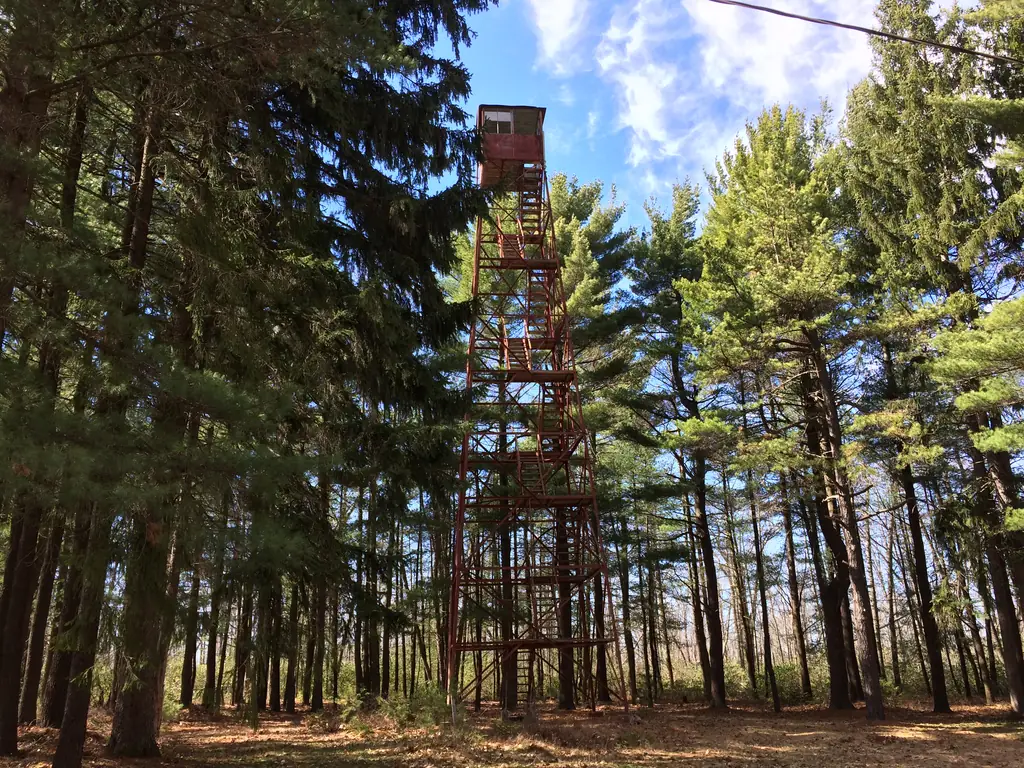
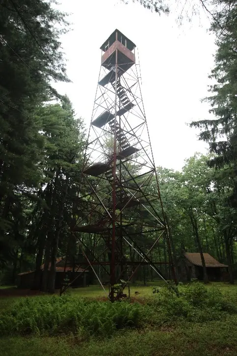
A 1919 steel Aermotor tower in Tiadaghton State Forest, replacing a 1914 wood-and-tree lookout, found intact but decaying and unstaffed in a 2017 inspection.
- Standing
- Access unknown
- Verified
Visit & stay
Not rentable. As far as we know, this lookout cannot be booked for overnight stays.
Access
Access unknown
We do not know the access rules. Check with the land manager before you go. No NHLR sign or directional markers; unmarked and easy to miss. A nearby former observer's cabin is privately leased -- treat it as private, not public forest land.
- Can you climb it?
- Yes
- Road to the top?
- Unknown
- Staffing
- Not staffed (as of 2017)
Facts
- Status
- Type
- Cab on a towerAermotorThe design: Aermotor
- Built of
- Steel
- Built
- 1914 sources disagree
- Height
- 60 ft (18.3 m)
- Elevation
- 2,148 ft (655 m)
- Agency
- Pennsylvania Bureau of Forestry
- Land
- State land
- Location
- Lycoming County, Pennsylvania
- Coordinates
- 41.46583, −77.57157
- Registers
- This entry
- VerifiedResearched, then checked independently. Updated 8 Oct 2026.
- Firefinder id
us-pa-pump
View from the cab
What you see from the cab: every ridge out to about 93 miles, the named peaks in sight, and other fire lookouts within view, worked out from terrain data in your browser.
Downloads about 3.7 MB of terrain data the first time.
Or see what it could see on the map: the ground in its line of sight.
History
Then and now
- 1914 BuiltOriginal wood-and-tree lookout on this site, later replacedSources: nhlr.org, arcgis.com
- 1919 BuiltCurrent 60-ft steel Aermotor tower erected for $939, replacing the 1914 wood-and-tree towerSources: nhlr.org, arcgis.com
- No record between 1919 and 1935
- 1935 RebuiltObserver's cabin atop the tower replacedSource: nhlr.org
- No record between 1935 and 2016
- 2016 Added to the National Historic Lookout RegisterRegistered July 24, 2016, nominated by Henry IsenbergSource: nhlr.org
- TodayStandingIt still stands, as far as our sources know.
Old maps of this spot
USGS topographic maps from the years a lookout stood may show it, often as a small symbol labelled “Lookout”. See the old topo maps around it on the Firefinder map, or find every scanned sheet of this spot on USGS TopoView (opens another site) (click the spot there to list them, with dates and downloads).
Story
Researched 4 Oct 2026, fact-checked.
Pump Station Fire Tower stands in Tiadaghton State Forest in Lycoming County, Pennsylvania, at roughly 655 meters elevation.1,2 The tower now on the site is not the first: a wood-and-tree lookout went up here in 1914, and in 1919 the Pennsylvania Bureau of Forestry replaced it with the 60-foot (18-meter) steel tower that still stands today, built by the Aermotor Windmill Company at a cost of $939.1,2 The observer's cabin atop the tower was rebuilt in 1935.1
For years the tower would have been staffed through fire seasons by state lookout observers watching for smoke, though no source here records who held the post or when staffing ended. By the time Jack Kelley climbed up to inspect it for the National Historic Lookout Register in April 2017, the tower had gone unstaffed for at least a decade.1 Kelley described it as "intact but decayed": broken glass scattered across a shaky cab floor, a map table reduced to a few boards, and faint inscriptions from the 1920s still visible on the cab walls under fallen debris.1 Tree growth has closed in around the cab, blocking most of the views the tower was built for.1
The site carries no sign identifying it and nothing marks the way in, so a visitor unfamiliar with the location would likely walk past it.1 A former observer's cabin near the tower is part of a leasing program and may be occupied; it is private, not open forest land, and should be treated as such.1 The tower itself was added to the National Historic Lookout Register, nominated by Henry Isenberg, in July 2016.1 As of the most recent inspection on file it remains standing but deteriorating.1
- Pump Station Fire Tower, National Historic Lookout Register (nhlr.org), http://nhlr.org/lookouts/us/pa/pump-station-fire-tower/ (accessed 2026-10-04). ↩
- Fire Towers of Pennsylvania (StoryMap), Shawn Lesitsky, Esri ArcGIS StoryMaps, https://www.arcgis.com/apps/MapSeries/index.html?appid=ed47c97ebe7246868ce8ef3e7139a0b4 (accessed 2026-10-04). ↩
Photos
Photos keep their own rights and are shown with credit. Is one of these yours? You can ask for a different credit or for removal.
Where sources disagree
We show disagreements between sources instead of quietly picking one. If you know which is right, please tell us.
Sources disagree on the year it was built.
- NHLR: 1919
- Fire Towers of Pennsylvania (ArcGIS StoryMap, Shawn Lesitsky): 1914
Sources give different build years. Often one counts the first lookout on the site and another the structure there now.
Sources
- National Historic Lookout Register (NHLR) (opens another site) Gave us: name, location, county, elevation, type, what it is built of, status, register numbers, agency, dates, photos, links National Historic Lookout Register (nhlr.org) · All rights reserved (American Resources, Inc.); facts extracted only, no prose copied. · retrieved 4 Oct 2026
- Fire Towers of Pennsylvania (ArcGIS StoryMap, Shawn Lesitsky) (opens another site) Gave us: design, height, ownership, photos, links Pennsylvania fire towers StoryMap (ArcGIS) · No licence stated; facts only (county, agency, built year, height, builder). · retrieved 4 Oct 2026
- FOREST LOOKOUTS -- eastern US (easternuslookouts.weebly.com) (opens another site) Gave us: links easternuslookouts.weebly.com · No licence stated; facts only (county, coordinates where the page's own map widget gives them, status, height, design hints, register links). The site's own historical quotes, newspaper citations and narrative are not reproduced. · retrieved 8 Oct 2026
- OpenStreetMap -- fire lookout structures (opens another site) Gave us: links © OpenStreetMap contributors · ODbL 1.0. (c) OpenStreetMap contributors. · retrieved 4 Oct 2026
- Firefinder research Gave us: summary, design, height, status, agency, access, staffing, visiting details, dates, links, fact-check Firefinder research (sources cited in the story footnotes) · Our own research notes; each fact cites its source in the lookout's story
More about this lookout elsewhere
- NHLR register entry US 1085 (nhlr.org) (opens another site)
- Fire Towers of Pennsylvania StoryMap (Shawn Lesitsky) (opens another site)
- Pump Station (easternuslookouts.weebly.com) (opens another site)
- OpenStreetMap node 3014639285 (opens another site)
Firefinder takes facts (places, dates, numbers) from these sources and writes its own words. See all sources and licences.