Fire lookout · Pennington County, South Dakota
Black Elk Peak (Harney Peak) Lookout
Also known as Harney Peak (Black Elk Peak), Black Elk (Harney) Peak, Black Elk Peak Lookout Tower, Harney Peak Lookout Tower
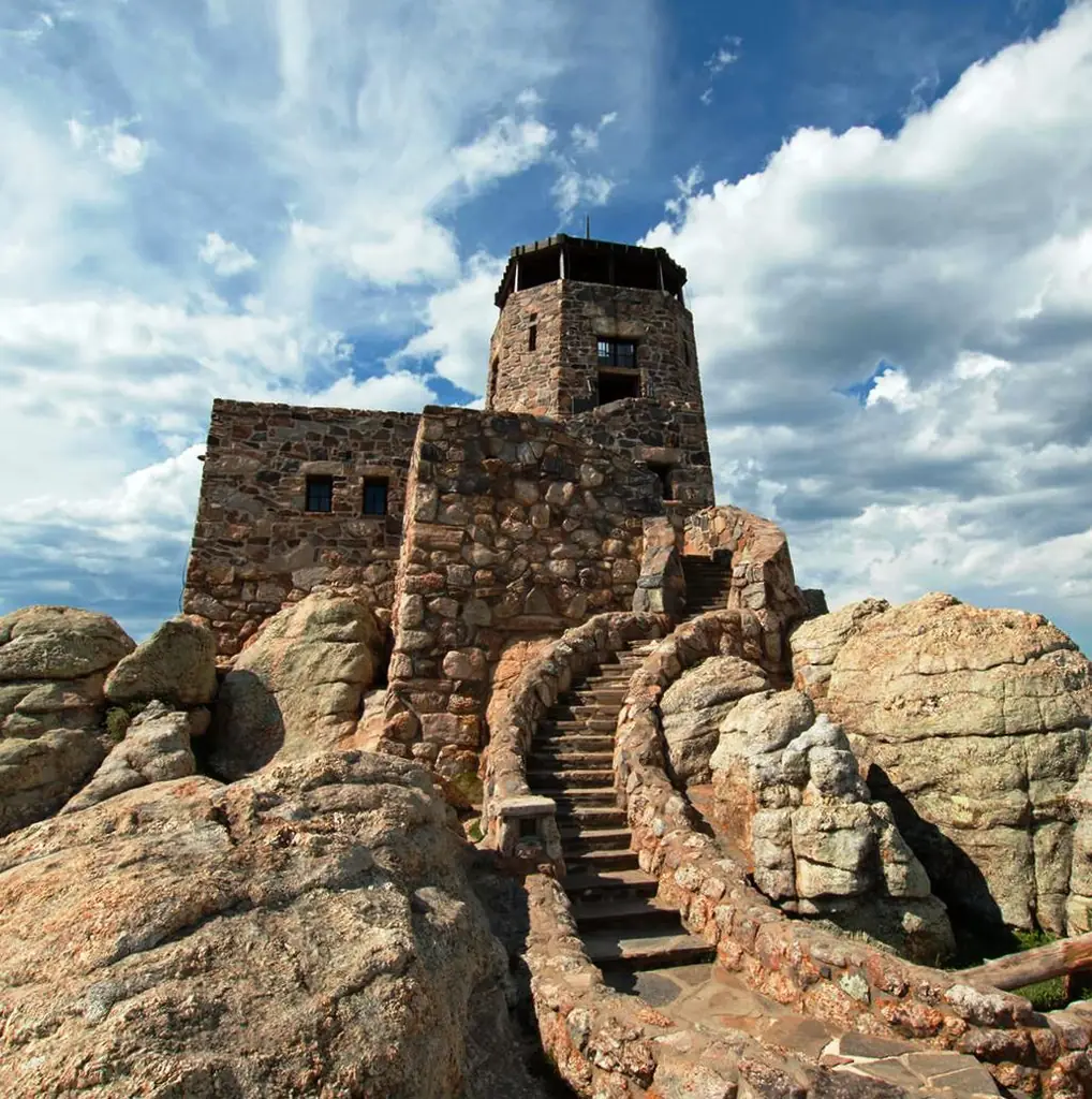
CCC-built stone fire lookout on the highest point in South Dakota, staffed from 1911 until 1967, now a heavily visited wilderness landmark renamed Black Elk Peak in 2016.
- Standing
- Open to the public
- Verified
Visit & stay
Not rentable. As far as we know, this lookout cannot be booked for overnight stays.
Access
Open to the public. Reached by trail; heavily visited (about 40,000 visitors/year), not rentable or staffed.
- Can you climb it?
- Yes
- Road to the top?
- No, you have to hike
- Trail
- Reached by hiking trails from several Black Hills trailheads; the tower structure can be visited/climbed by the public.
- Staffing
- Unknown
Facts
- Status
- Type
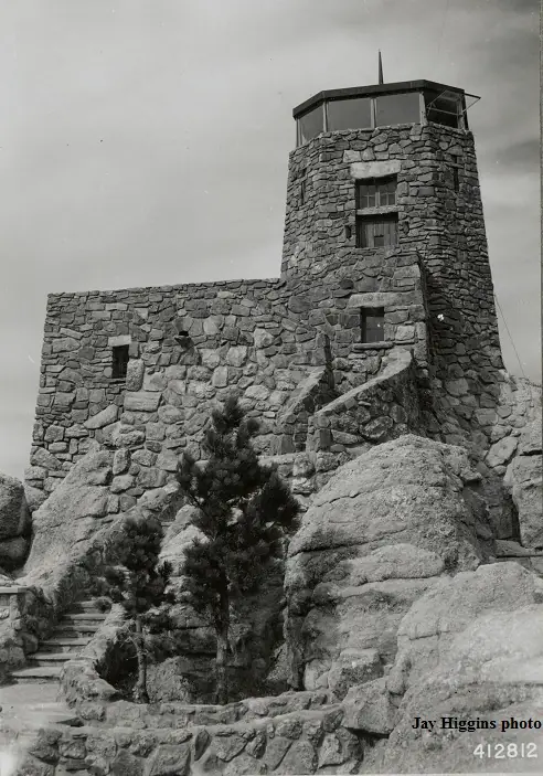
- Three-story buildingThree-story stone and wood tower, architect-designedThe design: Stone lookouts
- Built of
- Stone
- Built
- 1911 sources disagree
- Height
- 36 ft (11.0 m)
- Elevation
- 7,102 ft (2,165 m)
- Agency
- U.S. Forest Service
- Land
- Federal land
- Location
- Pennington County, South Dakota
- Coordinates
- 43.86568, −103.53089
- Registers
- This entry
- VerifiedResearched, then checked independently. Updated 8 Oct 2026.
- Firefinder id
us-sd-black-elk-peak-harney-peak
View from the cab
What you see from the cab: every ridge out to about 93 miles, the named peaks in sight, and other fire lookouts within view, worked out from terrain data in your browser.
Downloads about 3.9 MB of terrain data the first time.
Or see what it could see on the map: the ground in its line of sight.
History
Then and now
- 1911 BuiltSource: firelookout.com -- Rex Kamstra's Forest Fire Lookout Page
- 1911 First staffedFire detection began on the peak using an alidade.Source: firelookout.com
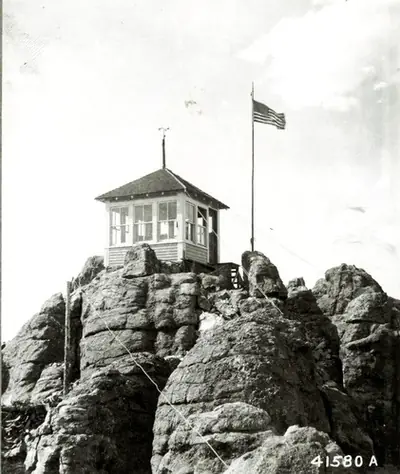
- 1919 BuiltA 12x12 ft log cabin added just below the summit.Source: firelookout.com
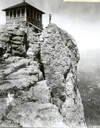
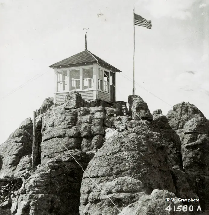
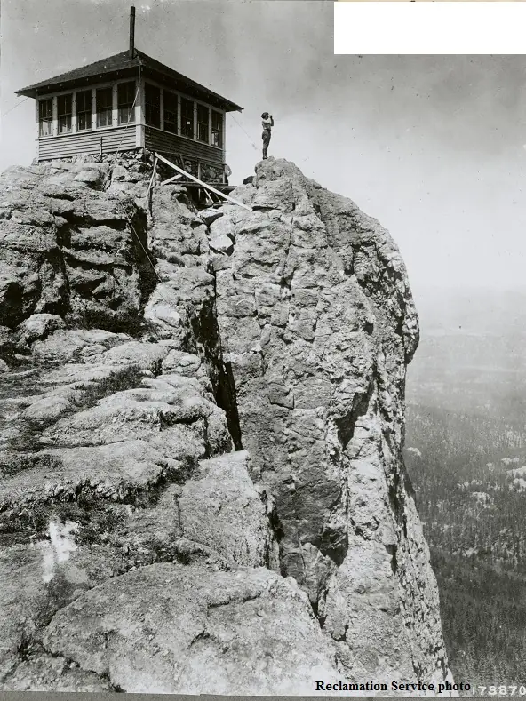
- 1920 BuiltA 12x12 ft wooden cab constructed on the summit.Source: firelookout.com
- 1921 AlteredSummit cab enlarged to 16x16 ft.Source: firelookout.com
- No record between 1921 and 1938
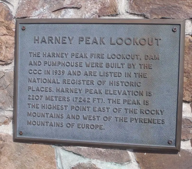
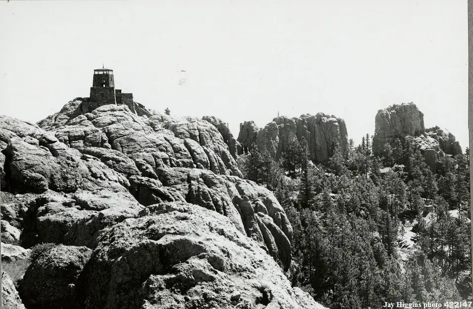
- 1938 RebuiltPresent three-story stone and wood tower completed by the CCC (NHLR gives 1938; firelookout.com gives construction 1939-1940).Sources: nhlr.org, firelookout.com
- 1939 StaffedHoward Culver recorded as lookout.Source: firelookout.com
- No record between 1939 and 1967
- 1967 Last staffedLast staffed for fire detection.Sources: nhlr.org, firelookout.com
- No record between 1967 and 1991
- 1991 Added to the National Historic Lookout RegisterAdded to the National Historic Lookout Register, June 13, 1991.Source: nhlr.org
- No record between 1991 and 2016
- 2016 EventPeak renamed from Harney Peak to Black Elk Peak by the U.S. Board on Geographic Names.Source: nhlr.org
- TodayStandingIt still stands, as far as our sources know.
Old maps of this spot
USGS topographic maps from the years a lookout stood may show it, often as a small symbol labelled “Lookout”. See the old topo maps around it on the Firefinder map, or find every scanned sheet of this spot on USGS TopoView (opens another site) (click the spot there to list them, with dates and downloads).
Story
Researched 4 Oct 2026, fact-checked.
This summit in South Dakota's Black Hills is the highest point in the state and the highest ground east of the Rocky Mountains, and fire watchers have been using it since 1911, when the first setup was just an alidade for sighting smoke.1,2 A 12-by-12-foot log cabin went up just below the summit in 1919, then a wooden cab was built right on top the following year and enlarged to 16 by 16 feet in 1921.2 None of that early wood survives. The stone tower that still stands today is a Civilian Conservation Corps project, designed by an architect specifically for the site, built over roughly two to three years and finished around 1938 to 1940 depending on the source.1,2 Howard Culver is recorded as one of its lookouts in 1939.2
The tower kept watch for fire until it was staffed for the last time in 1967.1 It still stands, cared for today by the Custer Ranger District of the Black Hills National Forest, and now sits inside a designated wilderness area.1
The mountain's name has its own recent history. Formerly known as Harney Peak, it was renamed Black Elk Peak by the U.S. Board on Geographic Names in 2016.1
Despite the remote, wilderness setting, the peak is heavily visited: about 40,000 people make the hike up each year.1 The old lookout tower is not rented out or staffed, but the summit remains heavily visited, reached by trail through the Black Hills National Forest.1
- Black Elk Peak (Harney Peak) Lookout, National Historic Lookout Register, http://nhlr.org/lookouts/us/sd/black-elk-peak-harney-peak-lookout/ (accessed 2026-10-04). ↩
- Harney (Black Elk) Peak Lookout, firelookout.com, https://www.firelookout.com/sd/harneypeak.html (accessed 2026-10-04). ↩
Photos
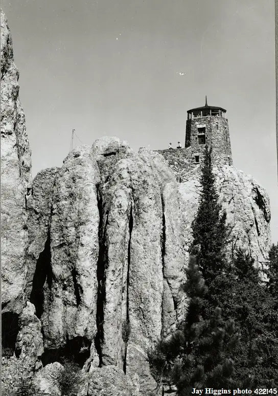
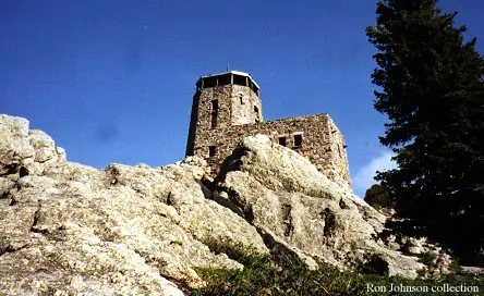
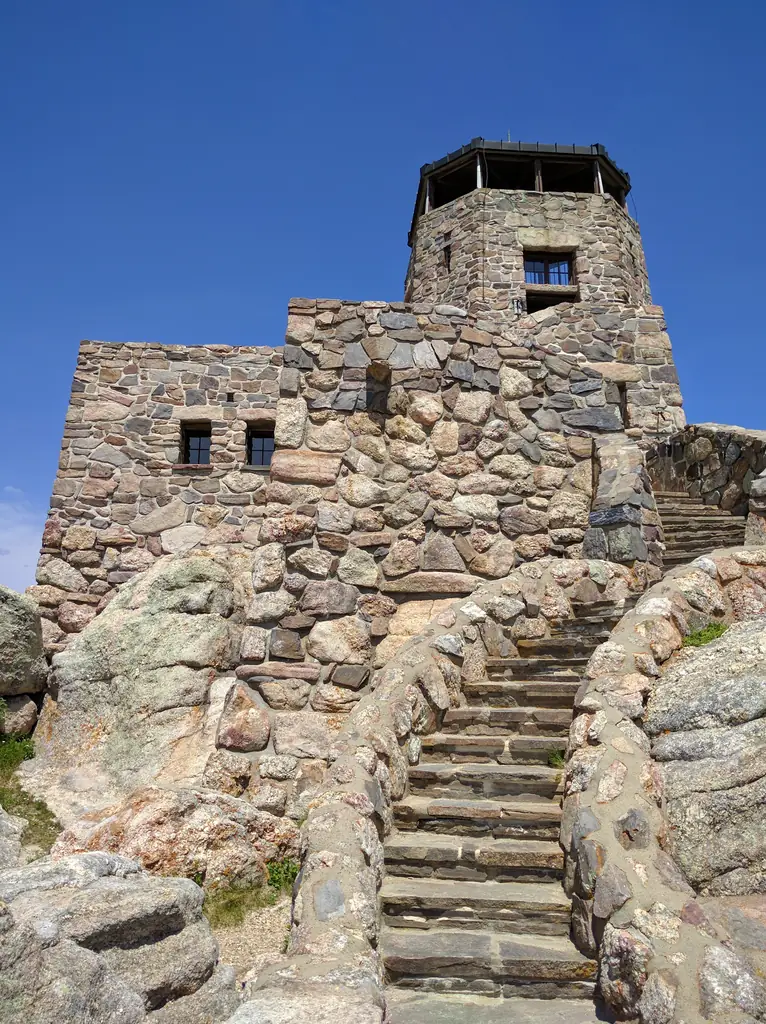

Photos keep their own rights and are shown with credit. Is one of these yours? You can ask for a different credit or for removal.
Where sources disagree
We show disagreements between sources instead of quietly picking one. If you know which is right, please tell us.
Sources disagree on the year it was built.
- firelookout.com -- Rex Kamstra's Forest Fire Lookout Page: 1911
- Wikidata: 1938
Sources give different build years. Often one counts the first lookout on the site and another the structure there now.
Sources
- National Historic Lookout Register (NHLR) (opens another site) Gave us: name, location, county, elevation, register numbers, agency, ownership, dates, photos, links National Historic Lookout Register (nhlr.org) · All rights reserved (American Resources, Inc.); facts extracted only, no prose copied. · retrieved 4 Oct 2026
- Forest Fire Lookout Association (FFLA) - US lookout lists (opens another site) Gave us: type, what it is built of, status, register numbers, links Forest Fire Lookout Association (firelookout.org) · No licence stated; facts extracted only, no prose copied. · retrieved 8 Oct 2026
- firelookout.com -- Rex Kamstra's Forest Fire Lookout Page (opens another site) Gave us: dates, photos, links firelookout.com · No licence stated on the site; facts only (coordinates, elevation, built/destroyed years, design, agency). Photos mirrored with the site's stated credit. · retrieved 4 Oct 2026
- Wikidata -- US fire lookout towers (Q748998 and subclasses) (opens another site) Gave us: height, register numbers, photos, links Wikidata · CC0 1.0 (Wikidata). Images keep their own Commons licence/credit. · retrieved 4 Oct 2026
- OpenStreetMap -- fire lookout structures (opens another site) Gave us: links © OpenStreetMap contributors · ODbL 1.0. (c) OpenStreetMap contributors. · retrieved 4 Oct 2026
- FOREST LOOKOUTS -- western US (Ron Kemnow's weebly sites) (opens another site) Ron Kemnow's Forest Lookouts sites (westlookouts, californialookouts, idaholookouts, montanalookouts, oregonlookouts and washingtonlookouts .weebly.com) · No licence stated; facts only (county, land manager, status word, coordinates where the page's own map widget gives them, township-range-section, height and design hints, links). The site's own newspaper quotes, citations and narrative are not reproduced. · retrieved 8 Oct 2026
- Firefinder research Gave us: summary, design, height, status, agency, access, visiting details, dates, links, fact-check Firefinder research (sources cited in the story footnotes) · Our own research notes; each fact cites its source in the lookout's story
More about this lookout elsewhere
- NHLR register entry US 18 (nhlr.org) (opens another site)
- FFLA South Dakota lookout list (firelookout.org) (opens another site)
- 2016 Rapid City Journal article about renaming of Harney Peak (by Seth Tupper) (opens another site)
- Black Hills National Forest lookout towers map (opens another site)
- Black Elk (Harney Peak) Lookout - Forest Lookouts Page (opens another site)
- Black Elk (Harney) Peak on firelookout.com (Rex Kamstra) (opens another site)
- Wikidata item Q86927783 (opens another site)
- OpenStreetMap way 683526804 (opens another site)
Firefinder takes facts (places, dates, numbers) from these sources and writes its own words. See all sources and licences.