Fire lookout · McNairy County, Tennessee
Ramer Fire Tower
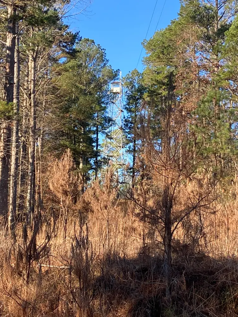
Aermotor-style tower in McNairy County, registered in 2022 and listed as standing; build date and model not stated.
- Standing
- Private land
- Verified
Private land
No public access. Please do not trespass; view it only from public land. The register says it appears to be on private property; not verified on the ground.
Visit & stay
Not rentable. As far as we know, this lookout cannot be booked for overnight stays.
Access
Private land. See the warning at the top of this page.
- Can you climb it?
- Unknown
- Road to the top?
- Unknown
- Staffing
- Unknown
Facts
- Status
- Type
- Cab on a towerAermotor style (model not named)The design: Aermotor
- Built of
- SteelGoing by its design; no source says so in words.
- Built
- Unknown
- Height
- Unknown
- Elevation
- 645 ft (197 m)
- Agency
- Tennessee Division of Forestry
- Land
- Unknown
- Location
- McNairy County, Tennessee
- Coordinates
- 35.08500, −88.71345
- Registers
- This entry
- VerifiedResearched, then checked independently. Updated 9 Oct 2026.
- Firefinder id
us-tn-ramer
View from the cab
What you see from the cab: every ridge out to about 93 miles, the named peaks in sight, and other fire lookouts within view, worked out from terrain data in your browser.
Downloads about 3.0 MB of terrain data the first time.
Or see what it could see on the map: the ground in its line of sight.
History
Then and now
- 1976 EventListed on the Division's 1976 tower list as district-tower 8-20Source: tnlandforms.us
- No record between 1976 and 2014
- 2014 Condition assessmentListed as extant in a count of Tennessee fire towers as of March 26, 2014Source: npgallery.nps.gov
- 2022 Added to the National Historic Lookout RegisterRegistered with the National Historic Lookout Register on December 30, 2022Source: nhlr.org
- TodayStandingIt still stands, as far as our sources know.
Old maps of this spot
USGS topographic maps from the years a lookout stood may show it, often as a small symbol labelled “Lookout”. See the old topo maps around it on the Firefinder map, or find every scanned sheet of this spot on USGS TopoView (opens another site) (click the spot there to list them, with dates and downloads).
Story
Researched 9 Oct 2026, fact-checked.
The National Historic Lookout Register describes the Ramer Fire Tower in McNairy County as an Aermotor-style tower, registered on December 30, 2022.1 It gives the elevation as 645 feet and names the Tennessee Division of Forestry as administrator.1 The register gives no build date and does not name a model.1
Two Division designs, the LS-40 and the MC-39, were among its most widely built types, but the register does not say which design this tower follows.2,1
Tennessee Landforms lists it as Ramer, numbered 8-20 and standing.3 That number comes from the same 1976 list of Division towers.3 A March 2014 count of surviving Division towers, published in a National Register study, also lists a Ramer tower in McNairy County.2
The register says the tower seems to sit on private land.1 Landforms also notes that many towers are gone and most sites are now private land.3 We found no published history of its construction, staffing or fires. Because the land appears to be private, this story does not suggest visiting or climbing it.1
- Ramer Fire Tower, National Historic Lookout Register, http://nhlr.org/lookouts/us/tn/ramer-fire-tower/ (accessed 2026-10-09). ↩
- Tennessee Division of Forestry Fire Lookout Towers, 1933 to 1975, National Park Service (NPGallery), https://npgallery.nps.gov/pdfhost/docs/NRHP/Text/64501237.pdf (accessed 2026-10-09). ↩
- Tennessee Lookout Towers, Tennessee Landforms, https://tnlandforms.us/towers/ (accessed 2026-10-09). ↩
Photos
Photos keep their own rights and are shown with credit. Is one of these yours? You can ask for a different credit or for removal.
Sources
- National Historic Lookout Register (NHLR) (opens another site) Gave us: name, location, county, elevation, what it is built of, status, register numbers, agency, dates, photos, links National Historic Lookout Register (nhlr.org) · All rights reserved (American Resources, Inc.); facts extracted only, no prose copied. · retrieved 4 Oct 2026
- tnlandforms.us fire lookout towers (Tom Dunigan) -- GA, NC, TN (opens another site) Gave us: type, links tnlandforms.us (Tom Dunigan) · No licence stated; facts only (coordinates, county, elevation, NGS/GFC/BLL register cross-references, status where given). · retrieved 4 Oct 2026
- Firefinder research Gave us: summary, design, agency, access, dates, links, fact-check Firefinder research (sources cited in the story footnotes) · Our own research notes; each fact cites its source in the lookout's story
More about this lookout elsewhere
- NHLR register entry US 1711 (nhlr.org) (opens another site)
- Tennessee Division of Forestry Fire Lookout Towers, 1933 to 1975 (National Register multiple property documentation form) (National Park Service, NPGallery) (opens another site)
- Ramer (tnlandforms.us (Tom Dunigan)) (opens another site)
Firefinder takes facts (places, dates, numbers) from these sources and writes its own words. See all sources and licences.