Fire lookout · Whatcom County, Washington
Desolation Peak Lookout
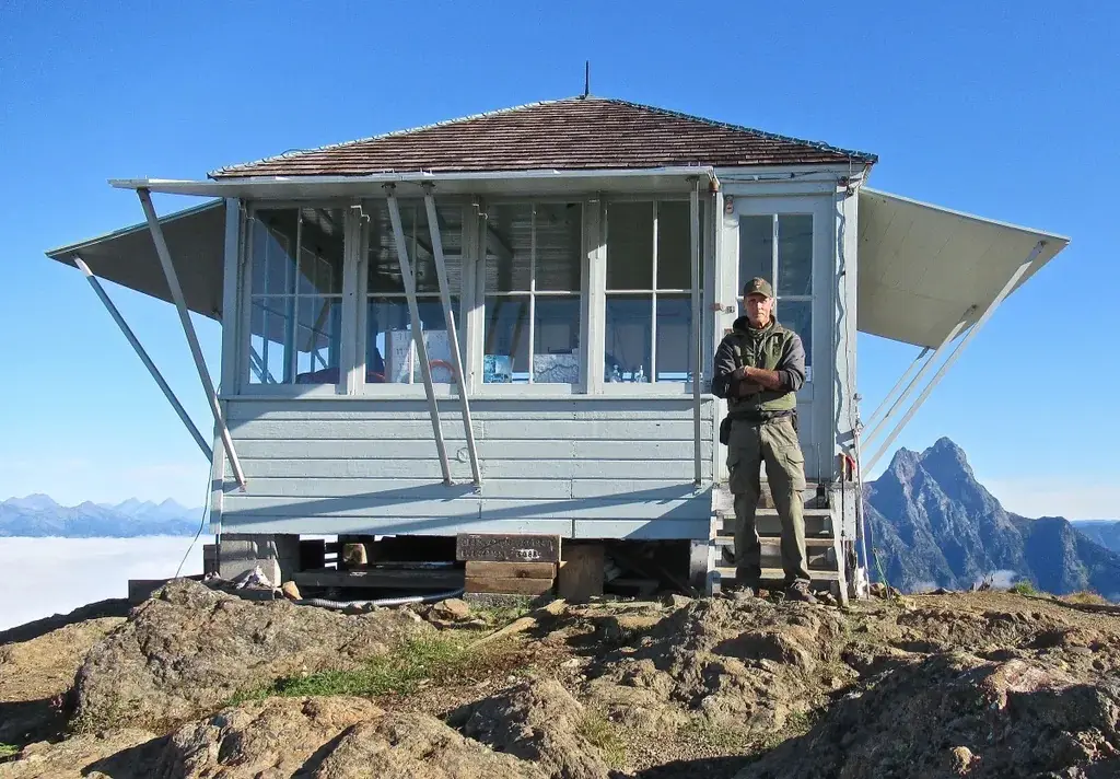
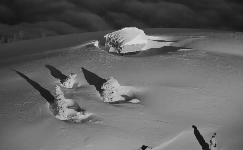
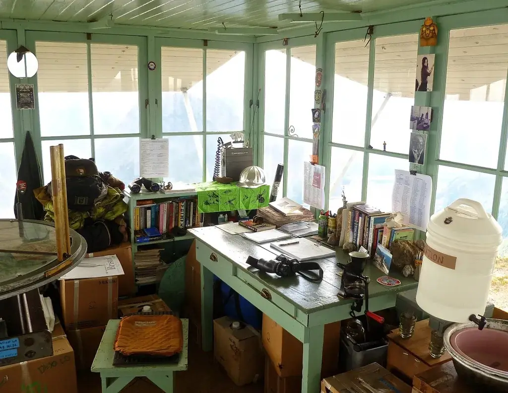
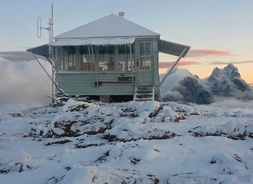
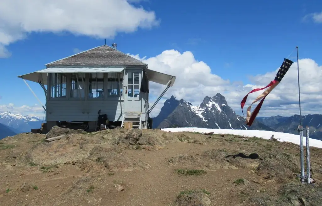
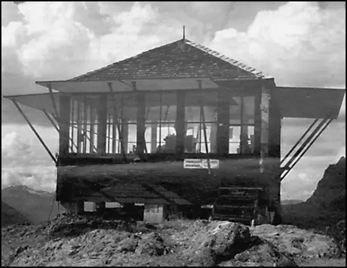
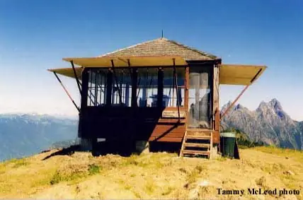
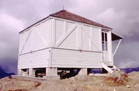
A 1932 Forest Service L-4 cabin on Desolation Peak, now an active North Cascades National Park lookout with a seasonal watchman; Kerouac spent summer 1956 there.
- Standing
- Restricted access
- Verified
Visit & stay
Not rentable. As far as we know, this lookout cannot be booked for overnight stays.
Access
Restricted access
Access is seasonal, gated or needs a permit. Check before you go. Active NPS lookout with a resident watchman; sources describe the hike but none says visitors may enter the cabin
- Can you climb it?
- Unknown
- Road to the top?
- No, you have to hike
- Trail
- No road to the summit. NHLR: 23 mi from nearest road, or 13 mi up Ross Lake plus 7 mi of trail. Seattle Times: 4.7-mile trail from Ross Lake. Wikipedia: 15 mi from nearest road.
- Staffing
- Staffed during fire season (as of undated (Seattle Times profile))
Facts
- Status
- Type
- Ground-level cabL-4 ground cabin, 14 x 14 ft, no catwalkThe design: L-4
- Built of
- Wood
- Built
- 1932
- Height
- Unknown
- Elevation
- 5,982 ft (1,823 m)
- Agency
- National Park Service (North Cascades National Park); built by the U.S. Forest Service, Mount Baker National Forest
- Land
- Federal land
- Location
- Whatcom County, Washington
- Coordinates
- 48.91116, −121.01612
- Registers
- This entry
- VerifiedResearched, then checked independently. Updated 8 Oct 2026.
- Firefinder id
us-wa-desolation-peak
View from the cab
What you see from the cab: every ridge out to about 93 miles, the named peaks in sight, and other fire lookouts within view, worked out from terrain data in your browser.
Downloads about 4.1 MB of terrain data the first time.
Or see what it could see on the map: the ground in its line of sight.
History
Then and now
- 1932 BuiltBuilt by the Forest Service; NPS inventory form credits USFS employee Oscar Banner. Seattle Times and firelookout.com also give 1932. NHLR gives 1933 (see resolved_conflicts)Sources: npshistory.com, seattletimes.com, firelookout.com
- No record between 1932 and 1956
- 1956 StaffedJack Kerouac spent 63 days as the lookout during the summerSources: en.wikipedia.org, seattletimes.com
- No record between 1956 and 1980
- 1980 AlteredNew roof installed by the NPSSource: npshistory.com
- No record between 1980 and 1998
- 1998 Added to the National Historic Lookout RegisterRegistered on the National Historic Lookout Register on May 20, 1998Source: nhlr.org
- TodayStandingIt still stands, as far as our sources know.
Old maps of this spot
USGS topographic maps from the years a lookout stood may show it, often as a small symbol labelled “Lookout”. See the old topo maps around it on the Firefinder map, or find every scanned sheet of this spot on USGS TopoView (opens another site) (click the spot there to list them, with dates and downloads).
Story
Researched 8 Oct 2026, fact-checked.
Desolation Peak Lookout stands on a summit just east of Ross Lake, about six miles south of the Canadian border, deep inside North Cascades National Park.1 The Forest Service built the cabin in 1932, and a National Park Service inventory form credits USFS employee Oscar Banner with its construction.2 The National Historic Lookout Register gives 1933 instead, while the Seattle Times and firelookout.com both say 1932.3,1,4 This story uses 1932, which the inventory form also gives.2
The cabin is a 14-by-14-foot L-4 design with no catwalk.3 The Seattle Times reports that its materials were carried in by pack horses and mules up a steep trail from Ross Lake.1
Firelookout.com says the lookout is staffed in the summer.4 When the Seattle Times profiled fire watchman Jim Henterly, he was in his seventh consecutive season there. The article is undated in the copy used here, so that count may be out of date.1 As the paper describes it, his job is to watch for smoke, pinpoint where it is, and direct firefighters to it.1
The best-known name tied to the lookout is Jack Kerouac, who served as its fire lookout for 63 days in summer 1956.5 The NPS inventory form ties Kerouac's book Desolation Angels to that summer.2
The Forest Service later passed the site to the National Park Service, and the lookout now sits inside North Cascades National Park.3 The NPS put a new roof on the cabin in 1980.2 The National Historic Lookout Register registered it on May 20, 1998.3
The register says the lookout remains active under the NPS.3 Access is by trail, and the sources disagree on the distance. The register lists a 23-mile trip from the nearest road, or 13 miles on Ross Lake plus 7 miles of trail.3 The Seattle Times gives a 4.7-mile trail from Ross Lake.1 Wikipedia gives 15 miles from the nearest road.5 Check with North Cascades National Park before planning around the cabin itself.
- "93 fire lookout towers remain in WA. Here's what it's like working and living in one", The Seattle Times, https://www.seattletimes.com/life/outdoors/93-fire-lookout-towers-remain-in-wa-heres-what-its-like-working-and-living-in-one/ (accessed 2026-10-08). ↩
- Desolation Peak Lookout, historic inventory form, National Park Service (npshistory.com), https://www.npshistory.com/publications/noca/pi-desolation-peak-lookout.pdf (accessed 2026-10-08). ↩
- Desolation Peak Lookout, National Historic Lookout Register (nhlr.org), http://nhlr.org/lookouts/us/wa/desolation-peak-lookout/ (accessed 2026-10-08). ↩
- Desolation Peak Fire Lookout Cabin, firelookout.com, https://www.firelookout.com/wa/desolation.html (accessed 2026-10-08). ↩
- Desolation Peak (Washington), Wikipedia, https://en.wikipedia.org/wiki/Desolation_Peak_%28Washington%29 (accessed 2026-10-08). ↩
Photos

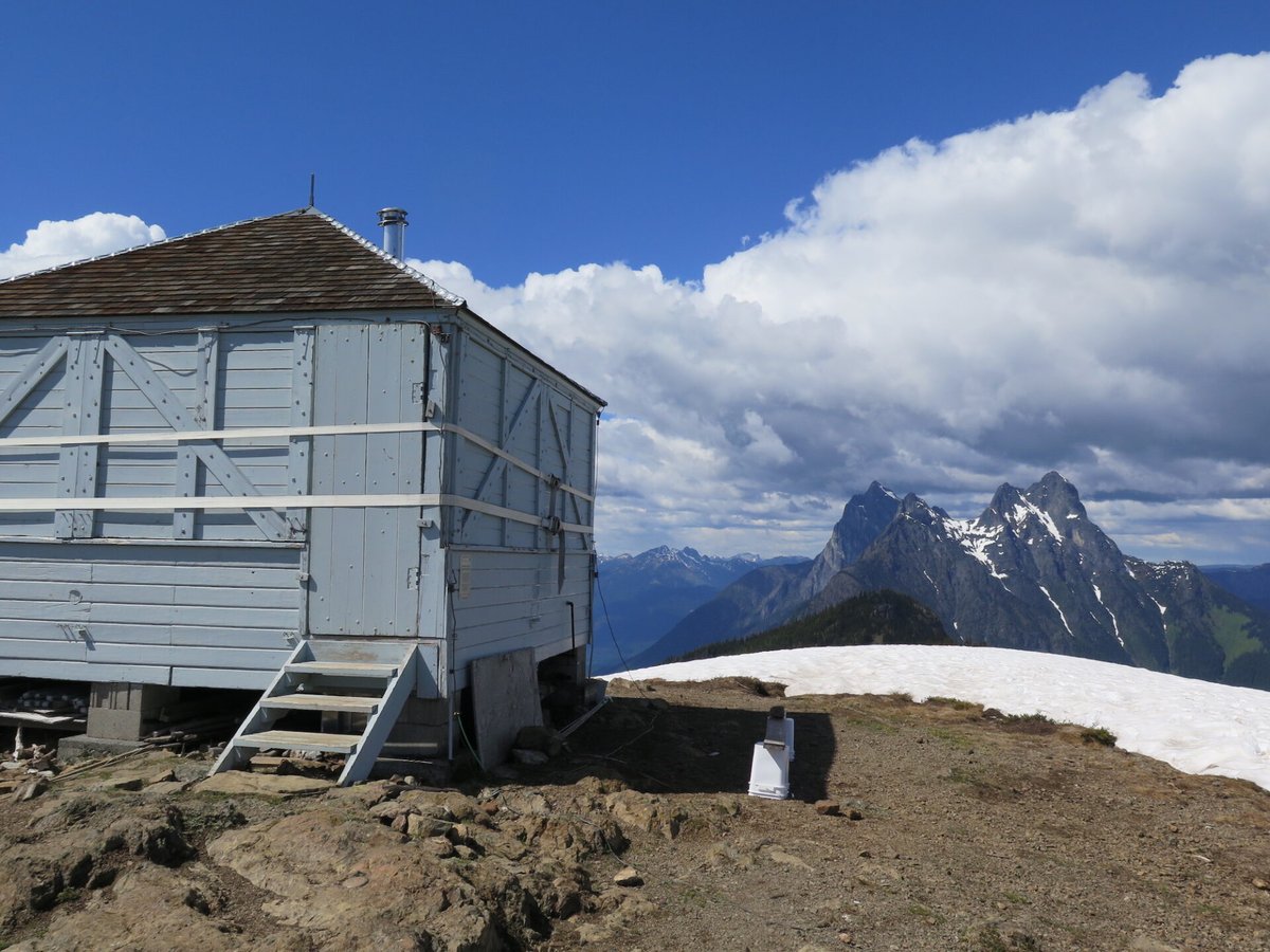
Photos keep their own rights and are shown with credit. Is one of these yours? You can ask for a different credit or for removal.
Sources
- National Historic Lookout Register (NHLR) (opens another site) Gave us: name, location, county, elevation, register numbers, agency, dates, photos, links National Historic Lookout Register (nhlr.org) · All rights reserved (American Resources, Inc.); facts extracted only, no prose copied. · retrieved 4 Oct 2026
- Forest Fire Lookout Association (FFLA) - US lookout lists (opens another site) Gave us: type, status, register numbers, links Forest Fire Lookout Association (firelookout.org) · No licence stated; facts extracted only, no prose copied. · retrieved 8 Oct 2026
- firelookout.com -- Rex Kamstra's Forest Fire Lookout Page (opens another site) Gave us: design, ownership, dates, photos, links firelookout.com · No licence stated on the site; facts only (coordinates, elevation, built/destroyed years, design, agency). Photos mirrored with the site's stated credit. · retrieved 4 Oct 2026
- Wikidata -- US fire lookout towers (Q748998 and subclasses) (opens another site) Gave us: register numbers, photos, links Wikidata · CC0 1.0 (Wikidata). Images keep their own Commons licence/credit. · retrieved 4 Oct 2026
- OpenStreetMap -- fire lookout structures (opens another site) Gave us: what it is built of, register numbers, access, links © OpenStreetMap contributors · ODbL 1.0. (c) OpenStreetMap contributors. · retrieved 4 Oct 2026
- FOREST LOOKOUTS -- western US (Ron Kemnow's weebly sites) (opens another site) Gave us: links Ron Kemnow's Forest Lookouts sites (westlookouts, californialookouts, idaholookouts, montanalookouts, oregonlookouts and washingtonlookouts .weebly.com) · No licence stated; facts only (county, land manager, status word, coordinates where the page's own map widget gives them, township-range-section, height and design hints, links). The site's own newspaper quotes, citations and narrative are not reproduced. · retrieved 8 Oct 2026
- TrailChick: Washington State Fire Lookouts (opens another site) Gave us: photos, links TrailChick (trailchick.com) · No licence stated; facts only (county, land manager, coordinates, elevation, lookout type, years built). The guide's text is not reproduced; its card photos are listed with credit to TrailChick, for the project's photo mirroring. · retrieved 8 Oct 2026
- WillhiteWeb.com: Washington Fire Lookouts (opens another site) Gave us: links WillhiteWeb.com · No licence stated; names and page links only (the site's photos and text are not reproduced). · retrieved 8 Oct 2026
- Firefinder research Gave us: summary, design, status, agency, access, staffing, visiting details, dates, links, fact-check Firefinder research (sources cited in the story footnotes) · Our own research notes; each fact cites its source in the lookout's story
More about this lookout elsewhere
- NHLR register entry US 272 (nhlr.org) (opens another site)
- 93 fire lookout towers remain in WA. Here's what it's like working and living in one (The Seattle Times) (opens another site)
- Desolation Peak Lookout, historic inventory form (National Park Service (npshistory.com)) (opens another site)
- Desolation Peak (Washington) (Wikipedia) (opens another site)
- FFLA Washington lookout list (firelookout.org) (opens another site)
- Desolation Peak on firelookout.com (Rex Kamstra) (opens another site)
- Desolation Peak on Forest Lookouts, western US (Ron Kemnow) (opens another site)
- Desolation Peak in the TrailChick Washington lookout guide (opens another site)
- Desolation Peak on WillhiteWeb.com Washington Fire Lookouts (opens another site)
- Wikidata item Q86926339 (opens another site)
- OpenStreetMap way 985379362 (opens another site)
Firefinder takes facts (places, dates, numbers) from these sources and writes its own words. See all sources and licences.