Fire lookout · Garfield County, Washington
Diamond Peak Lookout Site (Umatilla NF)
Also known as Diamond Peak
Garfield County, WA L-4 tower on Diamond Peak (Umatilla NF), dated 1931 or 1937 by sources, removed about 1960; no remains described, reached by trail.
- Gone
- Open to the public
- Verified
Gone: The lookout no longer stands. Only the site is left. Removed about 1960; no lookout remains described on the summit
Visit & stay
Gone: site only. The lookout no longer stands, so there is nothing to climb or rent. You may still be able to visit the site.
Access
Open to the public. Mount Misery Trail from the FR-4030 trailhead; part of it not maintained; summit just inside the Wenaha-Tucannon Wilderness (WillhiteWeb, undated trip report)
- Road to the top?
- No, you have to hike
- Trail
- Under 1 mile to the summit, 500 feet of gain; trail runs just under a mile to a saddle, and trees may block the unmaintained section (WillhiteWeb)
Facts
- Status
- Type
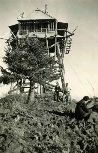
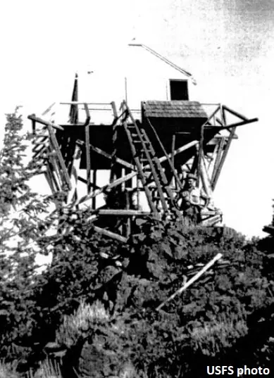
- Cab on a towerL-4 tower with a 14 x 14 cab on a 20-foot round timber towerThe design: L-4
- Built of
- Not recorded
- Built
- 1931
- Height
- 20 ft (6.1 m)
- Elevation
- 6,397 ft (1,950 m)
- Agency
- U.S. Forest Service
- Land
- Federal land
- Location
- Garfield County, Washington
- Coordinates
- 46.11560, −117.53991
- Registers
- This entry
- VerifiedResearched, then checked independently. Updated 9 Oct 2026.
- Firefinder id
us-wa-diamond-peak-umatilla-nf
View from the cab
What the lookout saw from its cab: every ridge out to about 93 miles, the named peaks in sight, and other fire lookouts within view, worked out from terrain data in your browser.
This lookout is gone. The view is reconstructed from its recorded site and its recorded height.
Downloads about 3.7 MB of terrain data the first time.
Or see what it could see on the map: the ground in its line of sight.
History
Then and now
- 1929 StaffedLookout on duty in 1929, per an account headed September 1929 and quoted by WillhiteWeb (the incident it describes is dated July 27 in the text): he reported a snake bite and rescuers found him wellSource: willhiteweb.com
- 1931 BuiltHouse built in 1931 per FireLookout.com and WillhiteWeb; the register gives 1937Sources: firelookout.com, willhiteweb.com
- 1932 StaffedErnie Colwell finished the house while on duty there as lookout dispatcherSource: willhiteweb.com
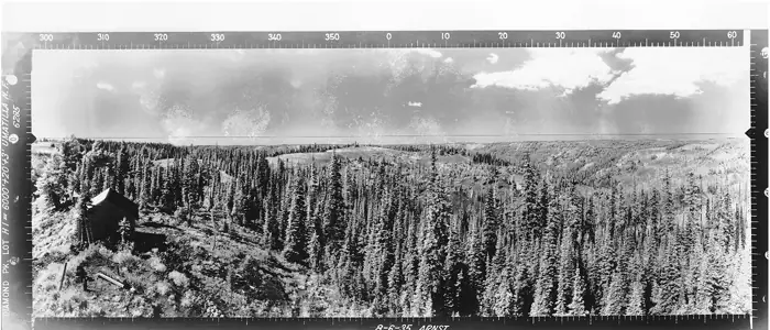
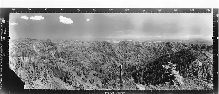
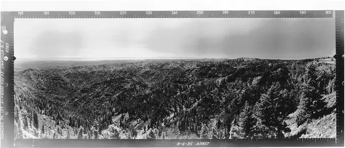
- 1935 EventNational Archives panorama photos of the lookout taken August 6, 1935Sources: firetower.org, washingtonlookouts.weebly.com
- No record between 1935 and 1960
- 1960 RemovedRemoved about 1960 per the register, FireLookout.com and WillhiteWebSources: firetower.org, firelookout.com, willhiteweb.com
- No record between 1960 and 2012
- 2012 Added to the Former Fire Lookout Sites RegisterRegistered December 17, 2012 as FFLOS US 1533Source: firetower.org
- TodayGoneThe lookout no longer stands. Only the site is left.
Old maps of this spot
USGS topographic maps from the years a lookout stood may show it, often as a small symbol labelled “Lookout”. See the old topo maps around it on the Firefinder map, or find every scanned sheet of this spot on USGS TopoView (opens another site) (click the spot there to list them, with dates and downloads).
Story
Researched 9 Oct 2026, fact-checked.
Diamond Peak is one of the higher named peaks in the Blue Mountains, in Garfield County, Washington, on the Umatilla National Forest.1,2,3 The register and FireLookout.com put it at 6,397 feet (1,950 meters), while WillhiteWeb's hiking figures give 6,379 feet.1,2,3
Sources disagree on when the lookout went up. The register says 1937, while FireLookout.com and WillhiteWeb say 1931.1,2,3 WillhiteWeb says a crew of forest staff built the house in 1931, and that Ernie Colwell completed it in 1932 while working there as the lookout dispatcher.3 The structure was a 14-by-14 cab on a 20-foot timber tower, according to a Umatilla National Forest inventory.3,4 National Archives panoramas of the Diamond Peak Lookout were taken on August 6, 1935.1,4
An account that WillhiteWeb quotes, headed September 1929, describes a night call for help.3 The lookout had called in to say a snake had bitten him.3 Rescuers reached him around one in the morning and found him well.3 The rescuers concluded a yellowjacket had bitten him, but the lookout insisted it was a snake.3
The register and FireLookout.com both say the tower came down around 1960, and WillhiteWeb says it was likely removed about then.1,2,3 A photo in the register's gallery is labeled 1953.1
No source we read describes lookout remains on the summit today. WillhiteWeb mentions only a small antenna used for communications and a survey marker at the top.3 The route follows the Mount Misery Trail from a trailhead reached by FR-4030.3 The trail covers just under a mile to a saddle and then continues to the summit.3 WillhiteWeb warns that one section is unmaintained and that trees may lie across the trail.3 The summit falls only barely within the Wenaha-Tucannon Wilderness.3
- Diamond Peak Lookout Site (Umatilla NF), Former Fire Lookout Sites Register, http://firetower.org/lookouts/us/wa/diamond-peak-lookout-site-umatilla-nf/ (accessed 2026-10-09). ↩
- Diamond Peak Fire Lookout Tower, FireLookout.com, http://www.firelookout.com/wa/diamondpeakumf.html (accessed 2026-10-09). ↩
- Diamond Peak Lookout Site & Garfield County Highpoint, WillhiteWeb.com, https://www.willhiteweb.com/washington_fire_lookouts/diamond_peak_lookout/garfield_county_highpoint_051.htm (accessed 2026-10-09). ↩
- Diamond Peak, Forest Lookouts (Washington), https://washingtonlookouts.weebly.com/diamond-peak.html (accessed 2026-10-09). ↩
Photos
Photos keep their own rights and are shown with credit. Is one of these yours? You can ask for a different credit or for removal.
Sources
- Former Fire Lookout Sites Register (FFLOS) (opens another site) Gave us: name, location, county, elevation, register numbers, agency, ownership, dates, photos, links Former Fire Lookout Sites Register (firetower.org) · All rights reserved (American Resources, Inc.); facts extracted only, no prose copied. · retrieved 4 Oct 2026
- Forest Fire Lookout Association (FFLA) - US lookout lists (opens another site) Gave us: type, status, register numbers, links Forest Fire Lookout Association (firelookout.org) · No licence stated; facts extracted only, no prose copied. · retrieved 8 Oct 2026
- firelookout.com -- Rex Kamstra's Forest Fire Lookout Page (opens another site) Gave us: links firelookout.com · No licence stated on the site; facts only (coordinates, elevation, built/destroyed years, design, agency). Photos mirrored with the site's stated credit. · retrieved 4 Oct 2026
- FOREST LOOKOUTS -- western US (Ron Kemnow's weebly sites) (opens another site) Gave us: height, links Ron Kemnow's Forest Lookouts sites (westlookouts, californialookouts, idaholookouts, montanalookouts, oregonlookouts and washingtonlookouts .weebly.com) · No licence stated; facts only (county, land manager, status word, coordinates where the page's own map widget gives them, township-range-section, height and design hints, links). The site's own newspaper quotes, citations and narrative are not reproduced. · retrieved 8 Oct 2026
- Firefinder research Gave us: summary, design, height, status, agency, access, staffing, visiting details, dates, links, fact-check Firefinder research (sources cited in the story footnotes) · Our own research notes; each fact cites its source in the lookout's story
More about this lookout elsewhere
- FFLOS register entry US 1533 (firetower.org) (opens another site)
- Diamond Peak Lookout Site & Garfield County Highpoint (WillhiteWeb.com) (opens another site)
- FFLA Washington lookout list (firelookout.org) (opens another site)
- Diamond Peak on firelookout.com (Rex Kamstra) (opens another site)
- Diamond Peak on Forest Lookouts, western US (Ron Kemnow) (opens another site)
- firelookout.com page (Rex Kamstra) (opens another site)
Firefinder takes facts (places, dates, numbers) from these sources and writes its own words. See all sources and licences.