Fire lookout · Snohomish County, Washington
Evergreen Mountain Lookout
A 1935 L-4 cab staffed into the early 1980s, scarred by a 1967 fire just short of its walls, now a Recreation.gov rental reached by a long trail.
- Standing
- Rentable
- Open to the public
- Verified
Visit & stay
You can rent this lookout for overnight stays through recreation.gov.
- Fee
- Evergreen Mt Lookout is closed for the season due to an on going wildfire. Contact Rec.gov for a refund
- Getting there
- The lookout tower is located in the Wild Sky Wilderness and must be accessed via a steep, scenic hike on the Evergreen Lookout Trail .
Rules
- Clean the cabin before leaving
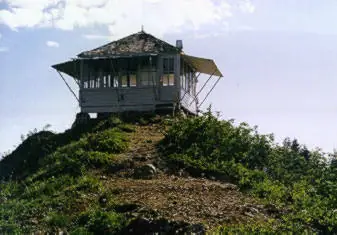
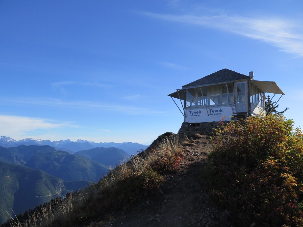
Overview Perched atop its namesake mountain at an elevation of 5,587 feet, Evergreen Mountain Lookout was built in 1935 for detecting wildfires. During fire season, lookouts stayed in the cabin, watching for lightning strikes and forest fires in the Skykomish drainage. Once the lookout located a fire or smoke, he or she would radio to the Skykomish Ranger Station and give local landmarks to help firefighters locate the fire quickly. During World War II, Evergreen Mountain Lookout was used as an Aircraft Warning Station, and then remained an active fire tower until the early 1980s. During volunteer restoration efforts in the 1990s, the lookout was placed on the National Register of Historic Places. The lookout tower is located in the Wild Sky Wilderness and must be accessed via a steep, scenic hike on the Evergreen Lookout Trail . Some amenities are provided, but guests should be prepared to pack in many of their own supplies. Recreation Hiking, birding and wildlife viewing are popular activities around the lookout. Guests access the lookout via the Evergreen Lookout Trail that climbs steeply through the old Evergreen Mountain Burn of 1967. Hikers enter dense forest, where the grade eases a bit upon reaching a small saddle below the lookout. At this point, the trail ascends again to reach the building. The trail is noted for wildflowers, scenery and wildlife. Facilities The 14x14-ft. lookout cabin sleeps four and is furnished with one twin-sized bed and mattress, three extra mattresses, a table and chairs, propane stove, two battery powered lanterns, a cooking pot, dishes and a coffee pot. A primitive vault toilet is located several hundred feet down the ridge from the lookout. There is no water or heat at the site. Guests must bring water for drinking, cooking and washing. Guests must also bring flashlights, sleeping bags, towels, dish soap, matches, a first aid kit, toilet paper and garbage bags. All trash and food must be packed out, and guests are expected to clean the cabin before leaving. Natural Features On a clear day, guests at Evergreen Mountain Lookout see views of Glacier Peak, Mt. Daniels, Keyes Peak, Columbia Glacier, Mt. Rainier and parts of the Henry M. Jackson Wilderness. Remains of the last big fire spotted on Evergreen Mountain in 1967 are still evident on the rocky south face of the ridge to within several hundred feet of the lookout. Evergreen Mountain Lookout is situated within the Wild Sky Wilderness area. Wildlife is abundant, and guests may catch a glimpse of black bears, bobcat, elk or bald eagle. Wolves are making a comeback to the area, but they are usually heard and not seen.
Noted: Maintenance Closure 2026
This comes from the Forest Fire Lookout Association’s rentals list. Check with the manager or the booking page before you plan a stay.
Book on recreation.gov (opens recreation.gov)
Rental details from recreation.gov, checked 19 Oct 2026. The closure note comes from the Forest Fire Lookout Association’s rentals list. Rules, fees and seasons change, so confirm on the booking page before you go. Data source: ridb.recreation.gov
Access
Open to the public. Overnight rental via Recreation.gov; trail access only after a road washout cut off vehicle access. Listing as of 2026-10-04 showed the access road washed out by winter flooding, with repairs hoped for by the 2027 rental season.
- Can you climb it?
- Unknown
- Road to the top?
- Unknown
- Staffing
- Not staffed (as of early 1980s)
Facts
- Status
- Type
- Ground-level cabL-4 ground cabThe design: L-4
- Built of
- Wood
- Also served as
- Aircraft Warning Service postDuring the Second World War it was staffed to spot and report aircraft.
- Built
- 1935
- Height
- 14 ft (4.3 m)
- Elevation
- 5,483 ft (1,671 m)
- Agency
- U.S. Forest Service
- Land
- Federal land
- Location
- Snohomish County, Washington
- Coordinates
- 47.83643, −121.26374
- Registers
- This entry
- VerifiedResearched, then checked independently. Updated 19 Oct 2026.
- Firefinder id
us-wa-evergreen-mountain
View from the cab
What you see from the cab: every ridge out to about 93 miles, the named peaks in sight, and other fire lookouts within view, worked out from terrain data in your browser.
Downloads about 4.3 MB of terrain data the first time.
Or see what it could see on the map: the ground in its line of sight.
History
Then and now
- 1934 EventSite prepared: telephone line run, trees topped for the view, cab lumber staged on the summit.Source: willhiteweb.com
- 1935 Built14x14-ft L-4 ground cab built by the U.S. Forest Service.Sources: nhlr.org, firelookout.com
- 1940 StaffedEllis and Faye Ogilvie staffed the lookout together in the 1940s, after meeting by radio while posted at separate lookouts.Source: willhiteweb.com
- 1942 EventUsed as a WWII Aircraft Warning Service site.Sources: nhlr.org, willhiteweb.com
- No record between 1942 and 1980
- 1980 Last staffedRegular fire-season staffing ended in the early 1980s.Sources: firelookout.com, willhiteweb.com
- 1987 Listed on the National Register of Historic PlacesListed on the National Register of Historic Places July 14, 1987, under a multiple-property listing for Mt. Baker-Snoqualmie fire lookouts (nominating party not stated on the NPGallery asset page). Conflicts with willhiteweb.com and Recreation.gov, which both attribute NRHP listing to the 1990s restoration.Source: npgallery.nps.gov
- 1997 Added to the National Historic Lookout RegisterRegistered on the National Historic Lookout Register, nominated by Ray Kresek.Source: nhlr.org
- 2000 RestoredRestoration work finished.Source: willhiteweb.com
- No record between 2000 and 2024
- 2024 RestoredMajor repairs led by FFLA volunteers.Source: firelookout.org
- TodayStandingIt still stands, as far as our sources know.
Old maps of this spot
USGS topographic maps from the years a lookout stood may show it, often as a small symbol labelled “Lookout”. See the old topo maps around it on the Firefinder map, or find every scanned sheet of this spot on USGS TopoView (opens another site) (click the spot there to list them, with dates and downloads).
Story
Researched 4 Oct 2026, fact-checked.
Evergreen Mountain sits on a ridge of the Mt. Baker-Snoqualmie National Forest in Snohomish County, about ten miles northwest of Stevens Pass.1,2 By 1934 the U.S. Forest Service had already run a telephone line to the site and cleared trees to open the view, with cab lumber piled on the summit waiting to go up; the 14-by-14-foot L-4 ground cab itself was built in 1935.3,1 At the time it was one of only two intact lookouts left standing on what was then the old Snoqualmie National Forest.1
During fire season a lookout watched the Skykomish drainage for lightning strikes and smoke, then radioed landmarks back to the Skykomish Ranger Station so crews could find a fire quickly.4 In the 1940s, Ellis and Faye Ogilvie staffed the tower together; the two had first met over the radio while posted at separate lookouts, married, and later worked Evergreen Mountain as a pair.3 During World War II the cab doubled as an Aircraft Warning Service post, watching the sky as well as the ridgelines.1,3
In 1967, loggers working the mountain's south side accidentally started what became known as the Evergreen Fire. It burned across the rocky south face of the ridge and stopped only a few hundred feet short of the lookout; the scar is still visible on that slope today.3,5 Regular fire-season staffing continued after that and ran until the early 1980s, when the lookout was retired from active duty.2,3
Evergreen Mountain Lookout was listed on the National Register of Historic Places on July 14, 1987, as part of a multiple-property group of Mt. Baker-Snoqualmie fire lookouts.6 Recreation.gov's current listing for the site instead describes the lookout as being "placed on the National Register of Historic Places" during volunteer restoration work in the 1990s7 — the two accounts disagree by about a decade, and this story cannot resolve which is right. What is clear is that a road washout eventually cut off vehicle access, leaving only a long trail approach, and that the Seattle Area Explorer Scout Search and Rescue Group adopted the lookout in 1990, with the Seattle Mountaineers and Quest School pitching in; the 141st Army Reserve Aviation Battalion airlifted restoration materials to the site, and the work was finished by 2000.1,3 Washington's National Historic Lookout Register separately records the lookout as registered on February 15, 1997, nominated by Ray Kresek — a different listing from the NRHP one above.1
Sources also differ on the mountain's elevation: the National Historic Lookout Register gives 5,483 feet (1,671 m), while Recreation.gov's description of the site gives 5,587 feet.1,7
Evergreen Mountain Lookout still stands and is open to the public as an overnight rental through Recreation.gov, reached by a trail that climbs through the old 1967 burn scar before easing at a saddle below the cab.7 The cabin sleeps four on one bed and three extra mattresses, has a propane stove but no water or heat, and renters are asked to pack out their trash and clean the cabin before leaving.7 As of this writing the listing shows the access road washed out by winter flooding, with the Skykomish Ranger District hoping for repairs in time for the 2027 rental season, so anyone planning a visit should check Recreation.gov directly first.7
- Evergreen Mountain Lookout, National Historic Lookout Register (nhlr.org), http://nhlr.org/lookouts/us/wa/evergreen-mountain-lookout/ (accessed 2026-10-04). ↩
- Evergreen Mtn. Fire Lookout Cabin, firelookout.com, https://www.firelookout.com/wa/evergreen.html (accessed 2026-10-04). ↩
- Evergreen Mountain Trail and Lookout, willhiteweb.com, http://www.willhiteweb.com/washington/evergreen_mountain_trail/lookout_135.htm (accessed 2026-10-04). ↩
- Evergreen Mt Lookout, Recreation.gov campground listing #234178, https://www.recreation.gov/camping/campgrounds/234178 (accessed 2026-10-04). ↩
- Evergreen Mt Lookout, Recreation.gov campground listing #234178 ("Natural Features" section), https://www.recreation.gov/camping/campgrounds/234178 (accessed 2026-10-04). ↩
- Evergreen Mountain Lookout, NPGallery Asset Detail, National Register of Historic Places, National Park Service, https://npgallery.nps.gov/AssetDetail/NRIS/87001187 (accessed 2026-10-04). ↩
- Evergreen Mt Lookout, Recreation.gov campground listing #234178, https://www.recreation.gov/camping/campgrounds/234178 (accessed 2026-10-04). ↩
Photos
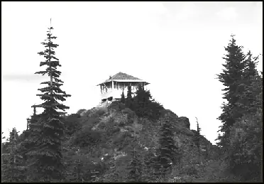
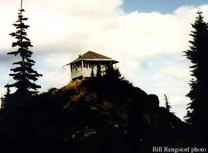
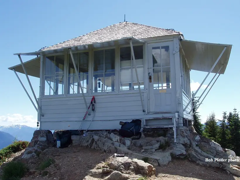
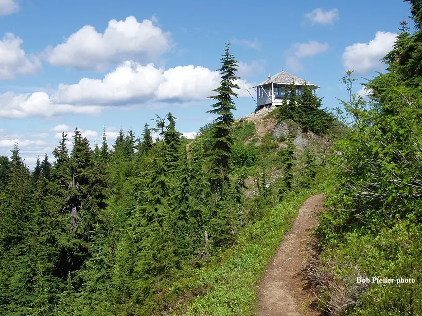

Photos keep their own rights and are shown with credit. Is one of these yours? You can ask for a different credit or for removal.
Sources
- National Historic Lookout Register (NHLR) (opens another site) Gave us: name, location, county, elevation, wartime use, register numbers, agency, dates, photos, links National Historic Lookout Register (nhlr.org) · All rights reserved (American Resources, Inc.); facts extracted only, no prose copied. · retrieved 4 Oct 2026
- Forest Fire Lookout Association (FFLA) - US lookout lists (opens another site) Gave us: type, status, register numbers, links Forest Fire Lookout Association (firelookout.org) · No licence stated; facts extracted only, no prose copied. · retrieved 8 Oct 2026
- Recreation Information Database (recreation.gov) (opens another site) Gave us: ownership, access, rental details, links Data source: ridb.recreation.gov · Public data from the US government · retrieved 19 Oct 2026
- Forest Fire Lookout Association: lookout rentals (opens another site) Gave us: rental details, links Forest Fire Lookout Association rentals list (firelookout.org) · No licence stated; facts extracted only (state, name, booking link, manager, closure note), no prose copied. The FFLA says it is not involved in managing any rental program. · retrieved 19 Oct 2026
- firelookout.com -- Rex Kamstra's Forest Fire Lookout Page (opens another site) Gave us: design, dates, photos, links firelookout.com · No licence stated on the site; facts only (coordinates, elevation, built/destroyed years, design, agency). Photos mirrored with the site's stated credit. · retrieved 4 Oct 2026
- Forest Fire Lookout Association chapter reports (opens another site) Gave us: dates, links Forest Fire Lookout Association, chapter and restoration-grant reports (firelookout.org) · No licence stated; facts only (dates, names, the kind of work done). Every note is our own wording and every event links to the FFLA report it comes from. Positions are copied from the NHLR, FFLOS and FFLA records. · retrieved 8 Oct 2026
- Wikidata -- US fire lookout towers (Q748998 and subclasses) (opens another site) Gave us: register numbers, photos, links Wikidata · CC0 1.0 (Wikidata). Images keep their own Commons licence/credit. · retrieved 4 Oct 2026
- OpenStreetMap -- fire lookout structures (opens another site) Gave us: what it is built of, register numbers, links © OpenStreetMap contributors · ODbL 1.0. (c) OpenStreetMap contributors. · retrieved 4 Oct 2026
- FOREST LOOKOUTS -- western US (Ron Kemnow's weebly sites) (opens another site) Gave us: links Ron Kemnow's Forest Lookouts sites (westlookouts, californialookouts, idaholookouts, montanalookouts, oregonlookouts and washingtonlookouts .weebly.com) · No licence stated; facts only (county, land manager, status word, coordinates where the page's own map widget gives them, township-range-section, height and design hints, links). The site's own newspaper quotes, citations and narrative are not reproduced. · retrieved 8 Oct 2026
- TrailChick: Washington State Fire Lookouts (opens another site) Gave us: height, photos, links TrailChick (trailchick.com) · No licence stated; facts only (county, land manager, coordinates, elevation, lookout type, years built). The guide's text is not reproduced; its card photos are listed with credit to TrailChick, for the project's photo mirroring. · retrieved 8 Oct 2026
- WillhiteWeb.com: Washington Fire Lookouts (opens another site) Gave us: links WillhiteWeb.com · No licence stated; names and page links only (the site's photos and text are not reproduced). · retrieved 8 Oct 2026
- Firefinder research Gave us: summary, design, status, agency, access, staffing, dates, links, fact-check Firefinder research (sources cited in the story footnotes) · Our own research notes; each fact cites its source in the lookout's story
More about this lookout elsewhere
- NHLR register entry US 206 (nhlr.org) (opens another site)
- NHLR register entry (nhlr.org) (opens another site)
- Recreation.gov listing (opens another site)
- Evergreen Mountain Lookout, NRIS 87001187 (NPGallery Asset Detail, National Register of Historic Places, National Park Service) (opens another site)
- FFLA Washington lookout list (firelookout.org) (opens another site)
- FFLA lookout rentals list (firelookout.org) (opens another site)
- Forest Fire Lookout Association chapter reports: work on Evergreen Mountain Lookout (opens another site)
- Evergreen Mtn. on firelookout.com (Rex Kamstra) (opens another site)
- Evergreen Mountain on Forest Lookouts, western US (Ron Kemnow) (opens another site)
- Evergreen Mountain in the TrailChick Washington lookout guide (opens another site)
- Evergreen Mountain on WillhiteWeb.com Washington Fire Lookouts (opens another site)
- Wikidata item Q86925448 (opens another site)
- OpenStreetMap way 372549452 (opens another site)
Firefinder takes facts (places, dates, numbers) from these sources and writes its own words. See all sources and licences.