Fire lookout · Snohomish County, Washington
Heybrook Lookout
A low-elevation Cascades lookout near Index, WA, rebuilt in 1964 with an experimental helicopter-delivered cab; now a Forest Service rental.
- Standing
- Rentable
- Open to the public
- Verified
Visit & stay
You can rent this lookout for overnight stays through recreation.gov.
- Fee
- Heybrook Lookut is now open for resevationsfor the 2023 season. There is no pay and scan
Rules
- Clean the cabin before leaving
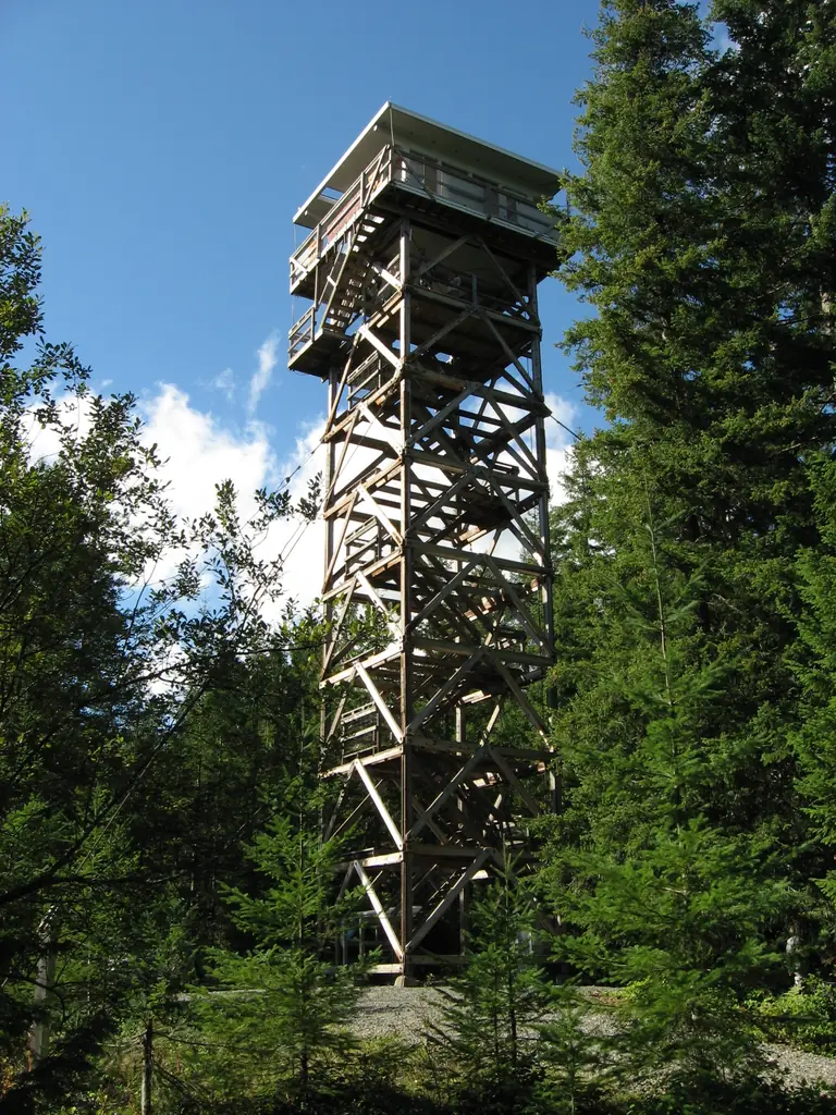
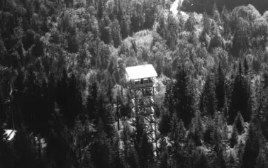
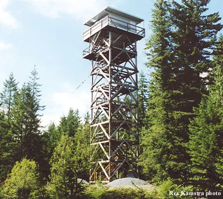
Overview The Heybrook Lookout sits atop its namesake ridge at 1,700 feet. The lookout itself rises 67 feet above the ridgeline and provides spectacular views of breathtaking glacial peaks surrounding the valley. The first Heybrook fire lookout was a simple tent platform built in 1925. The Forest Service replaced it seven years later with a 45-foot log leg tower, with a ground-level cabin intended as sleeping quarters for fire rangers; however, rampant rodents eventually drove the rangers up into the tower where they lived until a 67-foot lookout was built in 1964. Heybrook Lookout is one of only 106 lookouts left in Washington State. Recreation Hiking, birding and wildlife viewing are popular activities around the lookout. Facilities The 14 x14-ft. lookout cabin sleeps four and is furnished with one twin-sized bed with mattress, two additional floor mattresses, a table and chairs, propane stove, pot, pan, silverware, coffee pot and battery operated lanterns. A primitive vault toilet is located several hundred feet down the ridge from the lookout. There is a picnic table at the bottom of the tower. There is no water at the site. Guests must bring water for drinking, cooking and washing. Guests must also bring flashlights, sleeping bags, towels, dish soap, matches, a first aid kit, toilet paper and garbage bags. All trash and food must be packed out, and guests are expected to clean the cabin before leaving Natural Features On a clear day, guests at Heybrook Lookout see views of Mount Index and Bridal Veil Falls, Mount Baring, Mount Persis and the Wild Sky Wilderness. Wildlife is abundant, and guests may catch a glimpse of black bears, bobcat, elk or bald eagle. Wolves are making a comeback to the area, but they are usually heard and not seen. Contact Info For facility specific information, please call (360) 677-2414. Nearby Attractions Deception Falls Picnic Area, Lake Serene/Bridal Veil Falls hikes, and the Iron Goat historic interpretive trail.
Book on recreation.gov (opens recreation.gov)
Rental details from recreation.gov, checked 19 Oct 2026. Rules, fees and seasons change, so confirm on the booking page before you go. Data source: ridb.recreation.gov
Access
Open to the public. Open to hikers; cab rented overnight via recreation.gov.
- Can you climb it?
- Yes
- Road to the top?
- Unknown
- Trail
- About 3 miles round trip, moderate difficulty, some rocky footing
- Staffing
- Staffed by volunteers (as of 2025)
Facts
- Status
- Type
- Cab on a towerExperimental 1963 Forest Products Laboratory cab (visually similar to, but not, an R-6 flattop); current structure built 1964The designs: R-6, L-4
- Built of
- Wood
- Built
- 1925 sources disagree
- Height
- 45 ft (13.7 m)
- Elevation
- 1,618 ft (493 m)
- Agency
- USDA Forest Service (Mt. Baker-Snoqualmie National Forest)
- Land
- Federal land
- Location
- Snohomish County, Washington
- Coordinates
- 47.81047, −121.52512 sources disagree
- Registers
- This entry
- VerifiedResearched, then checked independently. Updated 19 Oct 2026.
- Firefinder id
us-wa-heybrook
View from the cab
What you see from the cab: every ridge out to about 93 miles, the named peaks in sight, and other fire lookouts within view, worked out from terrain data in your browser.
Downloads about 4.1 MB of terrain data the first time.
Or see what it could see on the map: the ground in its line of sight.
History
Then and now
- 1925 BuiltFirst lookout: a tent platformSources: firelookout.com, recreation.gov
- 1932 Rebuilt45-foot log tower with L-4 cab and ground-level sleeping roomSource: recreation.gov
- 1932 Replaced by a new structureA 45-ft tower with an L-4 cab replaced it.Source: mountaineers.org
- No record between 1932 and 1964
- 1964 RebuiltCurrent timber tower (~63-67 ft) with experimental Forest Products Laboratory cabSources: nhlr.org, firelookout.com
- 1964 Replaced by a new structureA 67-ft tower with a flat-roofed cab replaced the L-4.Source: mountaineers.org
- 1970 AbandonedForest Service stopped staffing itSource: firelookout.com
- No record between 1970 and 1996
- 1996 RestoredThe Everett Mountaineers began an eight-year restoration under a cost-share agreement with the Forest Service, starting by taking down the decayed hut.Source: mountaineers.org
- 1998 RestoredVolunteers rebuilt the cab in the late 1990s, putting it back in usable shapeSource: firelookout.com
- 2002 RestoredA hut rebuilt to the original plans in a ranger-station car park was hoisted onto the tower; work finished by year end and was accepted in January 2003.Source: mountaineers.org
- 2004 RestoredRestoration nearly finished: site work (gravel and topsoil) done, only a table and shutter-storage devices left before the rental program opens.Source: firelookout.org
- 2015 Added to the National Historic Lookout RegisterRegistered January 3, 2015 as US 1094, WA 60Source: nhlr.org
- TodayStandingIt still stands, as far as our sources know.
Old maps of this spot
USGS topographic maps from the years a lookout stood may show it, often as a small symbol labelled “Lookout”. See the old topo maps around it on the Firefinder map, or find every scanned sheet of this spot on USGS TopoView (opens another site) (click the spot there to list them, with dates and downloads).
Story
Researched 4 Oct 2026, fact-checked.
Heybrook Lookout stands on a low ridge above the Skykomish River valley near Index, Washington — one of the lowest-elevation lookout sites in the Washington Cascades.1 The Forest Service put up the first structure here in 1925, a simple tent platform.1,2 Seven years later it was replaced by a 45-foot log tower with an L-4 cab and a ground-level room meant as sleeping quarters for the fire rangers; rodents reportedly overran the room and drove the rangers up into the tower itself.2
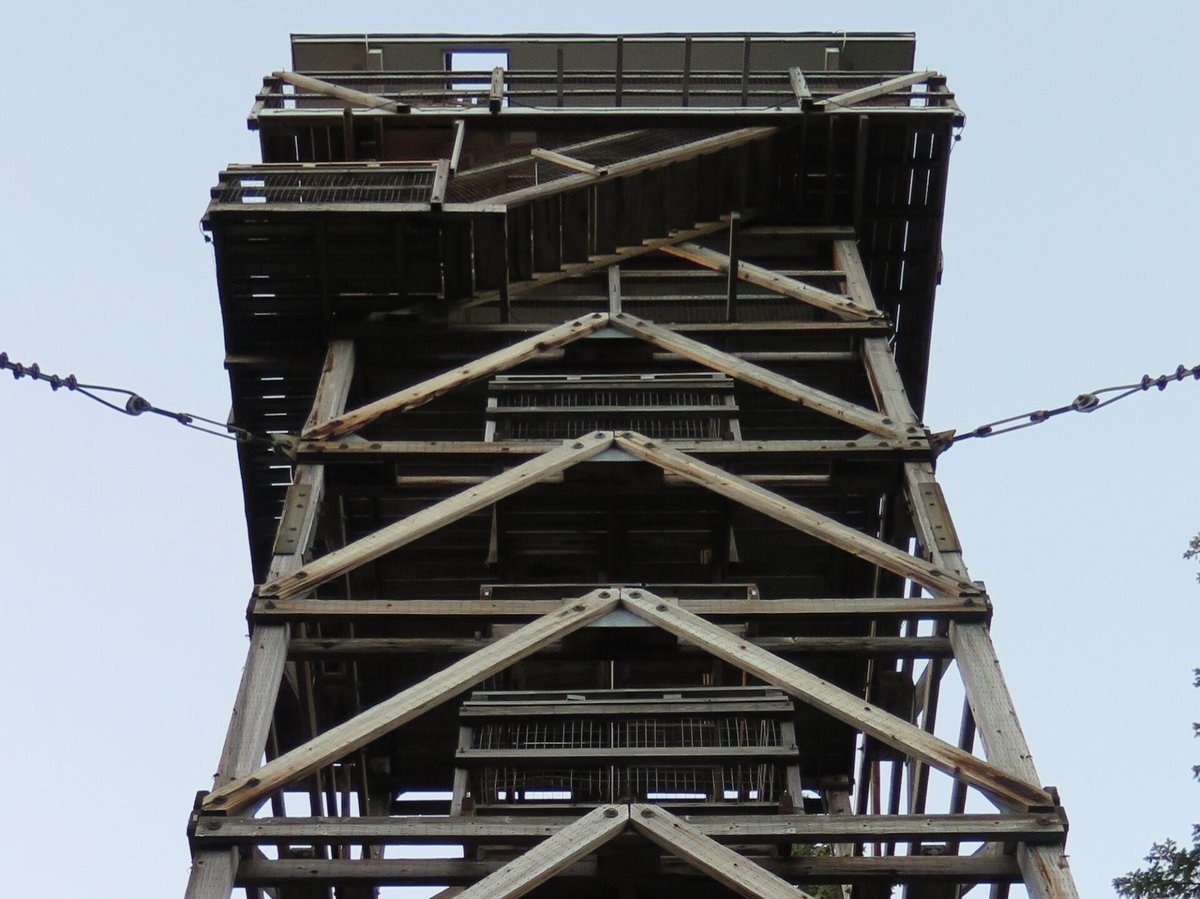
In 1964 the agency rebuilt the tower again, raising the roughly 63-to-67-foot timber structure that still stands.3,1 Its cab looks like the Forest Service's standard Region 6 "flattop" design, but it isn't one: Region 6 engineers had it designed in 1963 by the Forest Products Laboratory as a lighter, prefabricated cab that could be flown to remote sites by helicopter, much as the older L-4 cabs had once been packed in by mule train.3 The design was apparently never repeated elsewhere.3
Because the site has held three structures, sources disagree on a single "built" date — some giving 1925, others 1964 — depending on whether they mean the first lookout or the one standing today.1,3
The Forest Service abandoned Heybrook as a staffed lookout in 1970.1 It sat empty until local volunteers rebuilt the cab in the late 1990s and put it back into usable shape; a volunteer group still helps care for it.1,3
The National Historic Lookout Register added Heybrook on January 3, 2015, as US 1094, WA 60.3
Heybrook is open to the public today. The hike to it is a roughly three-mile round trip with some rocky footing but is considered only moderately difficult.3 The Forest Service rents the cab out overnight through its Recreation Rental program, and the lookout remains in good condition.1,3 On a clear day, visitors can see Mount Index, Mount Persis and the Wild Sky Wilderness from its windows.2
- Heybrook Lookout Tower, firelookout.com (Rex Kamstra), https://www.firelookout.com/wa/heybrook.html (accessed 2026-10-04). ↩
- Heybrook Lookout, Recreation.gov, https://www.recreation.gov/camping/campgrounds/269838 (accessed 2026-10-04). ↩
- Heybrook Lookout, National Historic Lookout Register, http://nhlr.org/lookouts/us/wa/heybrook-lookout/ (accessed 2026-10-04). ↩
Photos
Photos keep their own rights and are shown with credit. Is one of these yours? You can ask for a different credit or for removal.
Where sources disagree
We show disagreements between sources instead of quietly picking one. If you know which is right, please tell us.
Sources disagree on the location by 790 m.
- NHLR: 47.81047, −121.52512
- recreation.gov: 47.80840, −121.53520
The map uses the position from NHLR.
Sources disagree on the year it was built.
- firelookout.com -- Rex Kamstra's Forest Fire Lookout Page: 1925
- recreation.gov: 1964
- OpenStreetMap: 1964
- TrailChick: Washington State Fire Lookouts: 1964
- The Mountaineers, Everett Branch: 1925
Sources give different build years. Often one counts the first lookout on the site and another the structure there now.
Sources
- National Historic Lookout Register (NHLR) (opens another site) Gave us: name, location, county, elevation, what it is built of, register numbers, dates, photos, links National Historic Lookout Register (nhlr.org) · All rights reserved (American Resources, Inc.); facts extracted only, no prose copied. · retrieved 4 Oct 2026
- Forest Fire Lookout Association (FFLA) - US lookout lists (opens another site) Gave us: type, status, register numbers, links Forest Fire Lookout Association (firelookout.org) · No licence stated; facts extracted only, no prose copied. · retrieved 8 Oct 2026
- Recreation Information Database (recreation.gov) (opens another site) Gave us: agency, ownership, access, rental details, links Data source: ridb.recreation.gov · Public data from the US government · retrieved 19 Oct 2026
- Forest Fire Lookout Association: lookout rentals (opens another site) Gave us: rental details, links Forest Fire Lookout Association rentals list (firelookout.org) · No licence stated; facts extracted only (state, name, booking link, manager, closure note), no prose copied. The FFLA says it is not involved in managing any rental program. · retrieved 19 Oct 2026
- firelookout.com -- Rex Kamstra's Forest Fire Lookout Page (opens another site) Gave us: design, height, staffing, dates, photos, links firelookout.com · No licence stated on the site; facts only (coordinates, elevation, built/destroyed years, design, agency). Photos mirrored with the site's stated credit. · retrieved 4 Oct 2026
- The Mountaineers, Everett Branch (opens another site) Gave us: dates, links The Mountaineers, Everett Branch (mountaineers.org) · No licence stated; facts only (dates, names, the kind of work done). Every note is our own wording and every event links to the Mountaineers page it comes from. Positions are copied from the NHLR records. · retrieved 8 Oct 2026
- Forest Fire Lookout Association chapter reports (opens another site) Gave us: dates, links Forest Fire Lookout Association, chapter and restoration-grant reports (firelookout.org) · No licence stated; facts only (dates, names, the kind of work done). Every note is our own wording and every event links to the FFLA report it comes from. Positions are copied from the NHLR, FFLOS and FFLA records. · retrieved 8 Oct 2026
- OpenStreetMap -- fire lookout structures (opens another site) Gave us: register numbers, links © OpenStreetMap contributors · ODbL 1.0. (c) OpenStreetMap contributors. · retrieved 4 Oct 2026
- FOREST LOOKOUTS -- western US (Ron Kemnow's weebly sites) (opens another site) Gave us: links Ron Kemnow's Forest Lookouts sites (westlookouts, californialookouts, idaholookouts, montanalookouts, oregonlookouts and washingtonlookouts .weebly.com) · No licence stated; facts only (county, land manager, status word, coordinates where the page's own map widget gives them, township-range-section, height and design hints, links). The site's own newspaper quotes, citations and narrative are not reproduced. · retrieved 8 Oct 2026
- TrailChick: Washington State Fire Lookouts (opens another site) Gave us: photos, links TrailChick (trailchick.com) · No licence stated; facts only (county, land manager, coordinates, elevation, lookout type, years built). The guide's text is not reproduced; its card photos are listed with credit to TrailChick, for the project's photo mirroring. · retrieved 8 Oct 2026
- WillhiteWeb.com: Washington Fire Lookouts (opens another site) Gave us: links WillhiteWeb.com · No licence stated; names and page links only (the site's photos and text are not reproduced). · retrieved 8 Oct 2026
- Firefinder research Gave us: summary, design, agency, access, staffing, visiting details, dates, links, fact-check Firefinder research (sources cited in the story footnotes) · Our own research notes; each fact cites its source in the lookout's story
More about this lookout elsewhere
- NHLR register entry US 1094 (nhlr.org) (opens another site)
- Recreation.gov listing (opens another site)
- FFLA Washington lookout list (firelookout.org) (opens another site)
- FFLA lookout rentals list (firelookout.org) (opens another site)
- The Mountaineers, Everett Branch: work on Heybrook Lookout (opens another site)
- Forest Fire Lookout Association chapter reports: work on Heybrook Lookout (opens another site)
- Heybrook on firelookout.com (Rex Kamstra) (opens another site)
- Heybrook on Forest Lookouts, western US (Ron Kemnow) (opens another site)
- Heybrook in the TrailChick Washington lookout guide (opens another site)
- Heybrook on WillhiteWeb.com Washington Fire Lookouts (opens another site)
- Wikidata item Q86928305 (opens another site)
- OpenStreetMap way 464610215 (opens another site)
Firefinder takes facts (places, dates, numbers) from these sources and writes its own words. See all sources and licences.