Fire lookout · Pend Oreille County, Washington
Indian Mountain Lookout
A 1933 pole tower on the Idaho line was replaced in 1953 by the 40-ft tower standing today, which is staffed in summer.
- Standing
- Open to the public
- Verified
Visit & stay
Not rentable. As far as we know, this lookout cannot be booked for overnight stays.
Access
Open to the public. On Forest Service land. The road is usually open to within about a mile of the summit from July 1 to Labor Day and is often gated near 4,200 ft at other times. Sources do not say whether visitors may enter the cab.
- Can you climb it?
- Unknown
- Road to the top?
- No, you have to hike
- Trail
- Gate near 4,200 ft often closed outside July 1 to Labor Day: 3.3 mi round trip, 860 ft gain. Gate open: about 1.5 mi round trip on an old ridge trail (TrailChick, 2018 visit).
- Staffing
- Unknown
Facts
- Status
- Type
- Cab on a towerL-4 live-in cab on a 40-ft treated timber tower (1953); first tower was a 30-ft L-4 pole tower (1933)The design: L-4
- Built of
- Wood
- Built
- 1933 sources disagree
- Height
- 40 ft (12.2 m)
- Elevation
- 4,962 ft (1,512 m)
- Agency
- U.S. Forest Service (Priest Lake Ranger District, Idaho Panhandle National Forest)
- Land
- Federal land
- Location
- Pend Oreille County, Washington
- Coordinates
- 48.66333, −117.03928
- Registers
- This entry
- VerifiedResearched, then checked independently. Updated 8 Oct 2026.
- Firefinder id
us-wa-indian-mountain
View from the cab
What you see from the cab: every ridge out to about 93 miles, the named peaks in sight, and other fire lookouts within view, worked out from terrain data in your browser.
Downloads about 4.3 MB of terrain data the first time.
Or see what it could see on the map: the ground in its line of sight.
History
Then and now
- 1933 BuiltFirst tower on the site: 30-ft L-4 pole towerSources: firelookout.com, trailchick.com
- No record between 1933 and 1953
- 1953 Replaced by a new structureReplaced by the present 40-ft treated timber tower with 14x14-ft L-4 live-in cabSources: nhlr.org, firelookout.com, trailchick.com
- 1967 StaffedKnown lookout personnel: Melvin HabermanSource: firelookout.com
- No record between 1967 and 1995
- 1995 Added to the National Historic Lookout RegisterRegistered August 1, 1995 as US 130, WA 15Source: nhlr.org
- TodayStandingIt still stands, as far as our sources know.
Old maps of this spot
USGS topographic maps from the years a lookout stood may show it, often as a small symbol labelled “Lookout”. See the old topo maps around it on the Firefinder map, or find every scanned sheet of this spot on USGS TopoView (opens another site) (click the spot there to list them, with dates and downloads).
Story
Researched 8 Oct 2026, fact-checked.
Indian Mountain Lookout stands on a summit a quarter mile inside Washington from the Idaho border, in Pend Oreille County, where the Forest Service's Priest Lake Ranger District administers it.1,2,3 The first tower on the site went up in 1933 as a 30-foot pole structure with an L-4 cab.2,3 In 1953 it was replaced by the 40-foot treated timber tower that stands there now, topped by a 14-foot-square live-in cab with a catwalk.1,2,3
NHLR says the lookout has been staffed every season since 1933, and a SummitPost photo entry from 2014 says it is regularly staffed during summer fire seasons.1,4 NHLR notes that when the Kaniksu National Forest had more than a dozen active lookouts, Indian Mountain led them in initial detection reports.1 The only watch-keeper firelookout.com names is Melvin Haberman, listed for 1967.2 The forest appears under two names, Kaniksu and Idaho Panhandle, but both describe the same national forest.1,2,3
The 1933 tower was replaced, not abandoned, and the 1953 tower is the one still in use.1,3 The NHLR registered the lookout on August 1, 1995.1 TrailChick, last updated in March 2024, says it is staffed in the summer.3
Getting up there depends on the road.3 Between July 1 and Labor Day the road usually reaches within a mile of the summit, and a short ridge trail covers the rest.3 Outside those dates the road is often gated near 4,200 feet, a step aimed at keeping huckleberries and wildlife habitat healthy.3 With the gate closed, the hike is 3.3 miles round trip and climbs 860 feet.3 The sources describe a ridge hike for views of Priest Lake, and they do not say whether visitors may enter the cab.3
- Indian Mountain Lookout, National Historic Lookout Register, http://nhlr.org/lookouts/us/wa/indian-mountain-lookout/ (accessed 2026-10-08). ↩
- Indian Mtn. Fire Lookout Tower, firelookout.com, https://www.firelookout.com/wa/indian.html (accessed 2026-10-08). ↩
- Indian Mountain, TrailChick, https://trailchick.com/wa-state-fire-lookouts/indian-mountain-lookout/ (accessed 2026-10-08). ↩
- Indian Mountain Lookout, SummitPost, https://www.summitpost.org/indian-mountain-lookout/900337 (accessed 2026-10-08). ↩
Photos
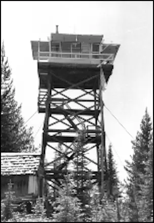
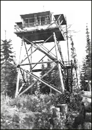
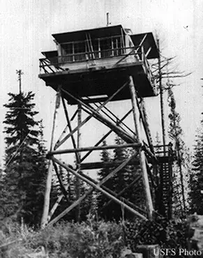
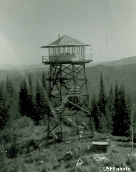
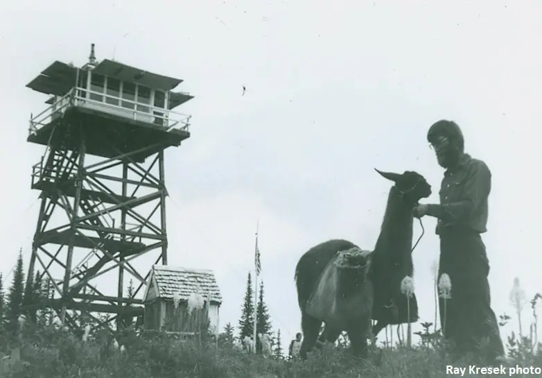
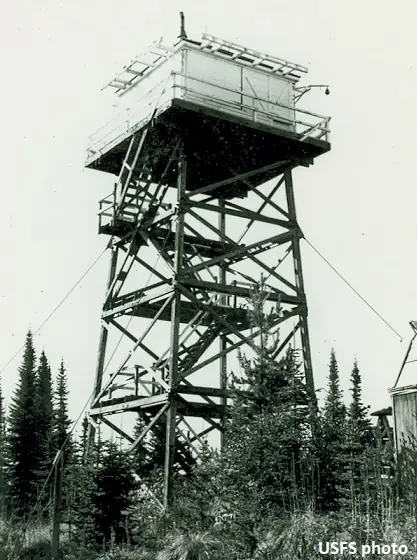
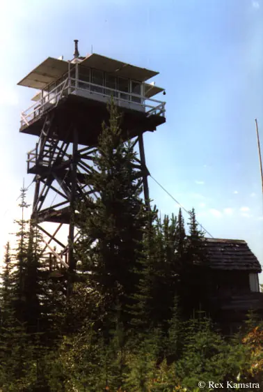
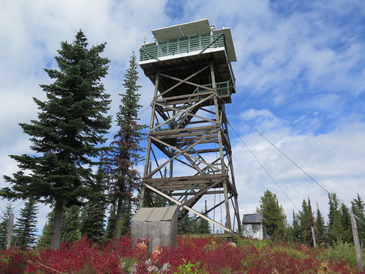
Photos keep their own rights and are shown with credit. Is one of these yours? You can ask for a different credit or for removal.
Where sources disagree
We show disagreements between sources instead of quietly picking one. If you know which is right, please tell us.
Sources disagree on the year it was built.
- firelookout.com -- Rex Kamstra's Forest Fire Lookout Page: 1933
- OpenStreetMap: 1953
- TrailChick: Washington State Fire Lookouts: 1953
Sources give different build years. Often one counts the first lookout on the site and another the structure there now.
Sources
- National Historic Lookout Register (NHLR) (opens another site) Gave us: name, location, county, elevation, what it is built of, register numbers, agency, ownership, dates, photos, links National Historic Lookout Register (nhlr.org) · All rights reserved (American Resources, Inc.); facts extracted only, no prose copied. · retrieved 4 Oct 2026
- Forest Fire Lookout Association (FFLA) - US lookout lists (opens another site) Gave us: type, status, register numbers, links Forest Fire Lookout Association (firelookout.org) · No licence stated; facts extracted only, no prose copied. · retrieved 8 Oct 2026
- firelookout.com -- Rex Kamstra's Forest Fire Lookout Page (opens another site) Gave us: design, height, dates, photos, links firelookout.com · No licence stated on the site; facts only (coordinates, elevation, built/destroyed years, design, agency). Photos mirrored with the site's stated credit. · retrieved 4 Oct 2026
- OpenStreetMap -- fire lookout structures (opens another site) Gave us: register numbers, links © OpenStreetMap contributors · ODbL 1.0. (c) OpenStreetMap contributors. · retrieved 4 Oct 2026
- FOREST LOOKOUTS -- western US (Ron Kemnow's weebly sites) (opens another site) Gave us: links Ron Kemnow's Forest Lookouts sites (westlookouts, californialookouts, idaholookouts, montanalookouts, oregonlookouts and washingtonlookouts .weebly.com) · No licence stated; facts only (county, land manager, status word, coordinates where the page's own map widget gives them, township-range-section, height and design hints, links). The site's own newspaper quotes, citations and narrative are not reproduced. · retrieved 8 Oct 2026
- TrailChick: Washington State Fire Lookouts (opens another site) Gave us: photos, links TrailChick (trailchick.com) · No licence stated; facts only (county, land manager, coordinates, elevation, lookout type, years built). The guide's text is not reproduced; its card photos are listed with credit to TrailChick, for the project's photo mirroring. · retrieved 8 Oct 2026
- Firefinder research Gave us: summary, design, height, agency, access, visiting details, dates, links, fact-check Firefinder research (sources cited in the story footnotes) · Our own research notes; each fact cites its source in the lookout's story
More about this lookout elsewhere
- NHLR register entry US 130 (nhlr.org) (opens another site)
- NHLR register entry (nhlr.org) (opens another site)
- Indian Mountain Lookout (SummitPost) (opens another site)
- FFLA Washington lookout list (firelookout.org) (opens another site)
- Indian Mtn. on firelookout.com (Rex Kamstra) (opens another site)
- Indian Mountain on Forest Lookouts, western US (Ron Kemnow) (opens another site)
- Indian Mountain in the TrailChick Washington lookout guide (opens another site)
- Wikidata item Q86929754 (opens another site)
- OpenStreetMap way 1352440479 (opens another site)
Firefinder takes facts (places, dates, numbers) from these sources and writes its own words. See all sources and licences.