Fire lookout · Okanogan County, Washington
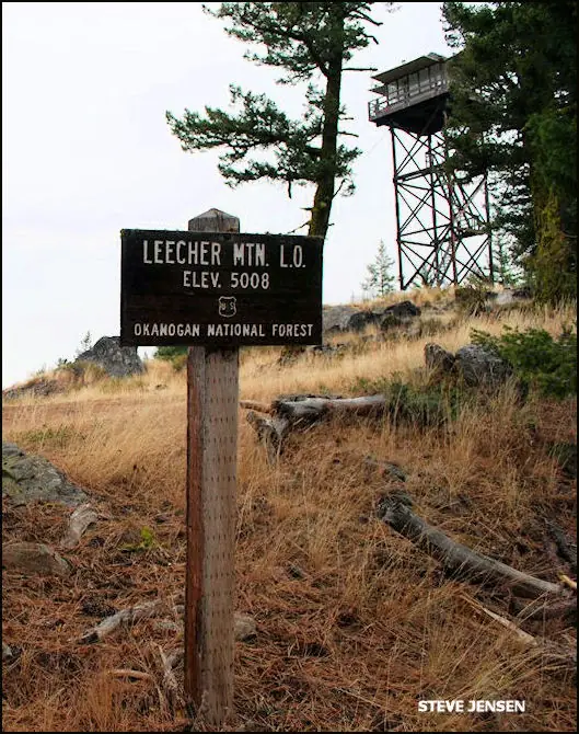
Leecher Mountain Lookout
Also known as Leecher, Mount Leecher
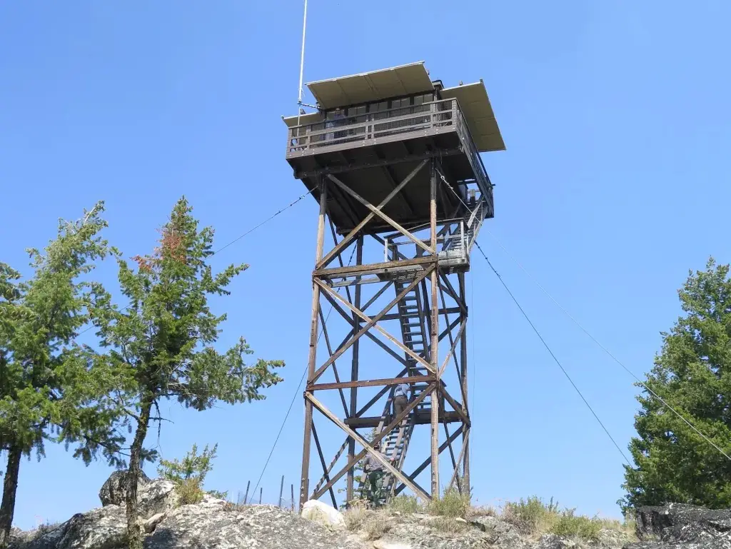
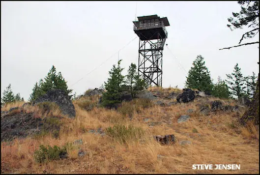
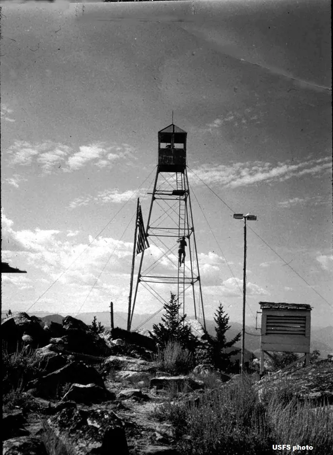
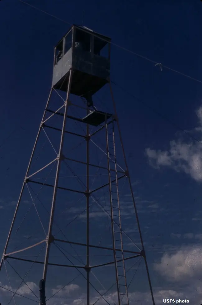
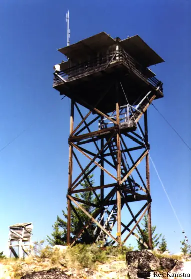
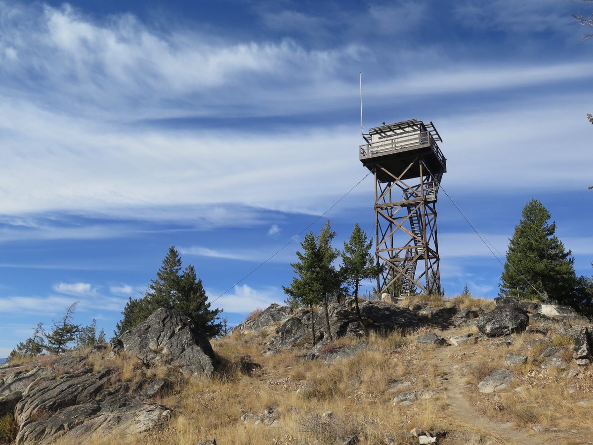
Leecher's summit has held a crow's nest, a windmill tower and a 1954 timber tower with an L-4 cab; the lookout stands restored and is reached by a short hike.
- Standing
- Open to the public
- Verified
Visit & stay
Not rentable. As far as we know, this lookout cannot be booked for overnight stays.
Access
Open to the public. Hike from a locked gate on Road 100 (WTA). Parking pass: Northwest Forest Pass or America the Beautiful Pass. Sources do not say whether visitors may enter the cab.
- Can you climb it?
- Unknown
- Road to the top?
- No, you have to hike
- Trail
- Drive Benson Creek Drive about 10 miles to spur Road 100, then 3 miles to a parking area at a locked gate. Hike listed as 2.4 mi round trip with 531 ft gain (WTA).
- Staffing
- Unknown
Facts
- Status
- Type
- Cab on a towerL-4 cab on a 40-41 ft timber tower (1954); earlier windmill tower and crow's nest on the same summitThe design: L-4
- Built of
- Wood
- Built
- 1918 sources disagree
- Height
- 41 ft (12.5 m)
- Elevation
- 5,008 ft (1,526 m)
- Agency
- U.S. Forest Service (Okanogan National Forest, Methow Valley Ranger District)
- Land
- Federal land
- Location
- Okanogan County, Washington
- Coordinates
- 48.25060, −120.00220
- Registers
- This entry
- VerifiedResearched, then checked independently. Updated 8 Oct 2026.
- Firefinder id
us-wa-leecher-mountain
View from the cab
What you see from the cab: every ridge out to about 93 miles, the named peaks in sight, and other fire lookouts within view, worked out from terrain data in your browser.
Downloads about 4.2 MB of terrain data the first time.
Or see what it could see on the map: the ground in its line of sight.
History
Then and now
- 1918 BuiltTree-top crow's nest, still standing about 1,000 ft south of the present tower. NHLR dates it 1920; firelookout.com and the Methow Valley FFLA say 1918Sources: nhlr.org, firelookout.com, mvffla.org
- 1921 BuiltWindmill tower with 6x6 ft cab (about 45 ft per firelookout.com and the Methow Valley FFLA)Sources: nhlr.org, firelookout.com, mvffla.org
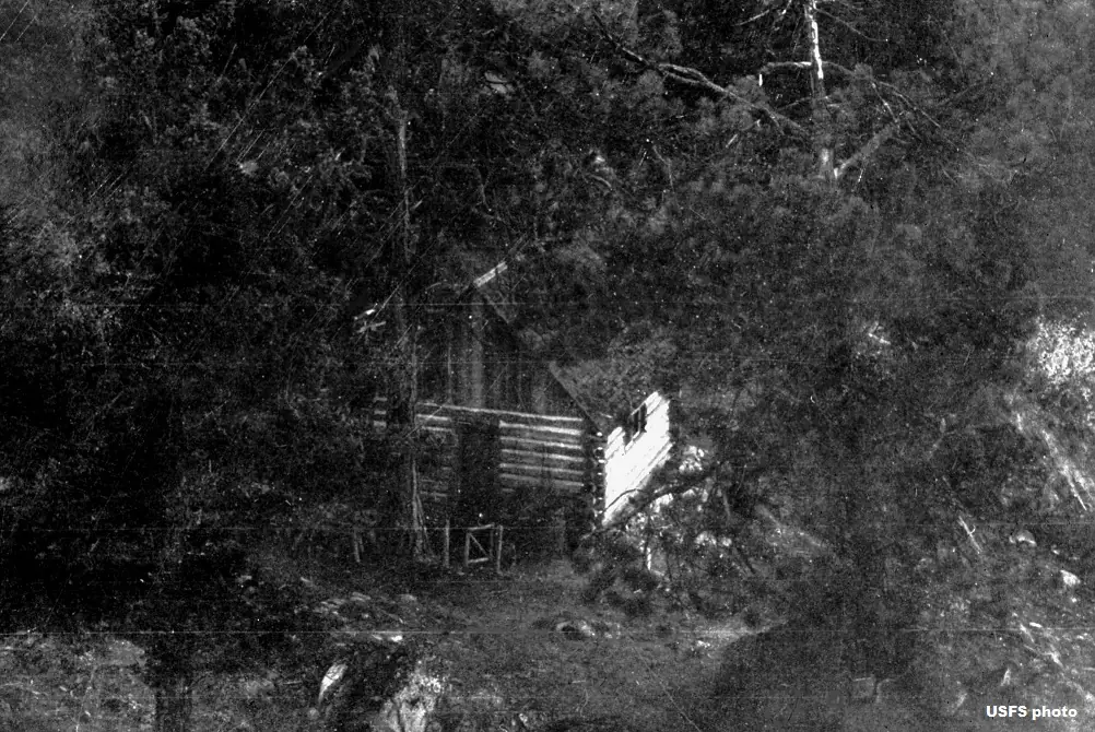
- 1922 BuiltLiving quarters beside the tower: log house per firelookout.com and the Methow Valley FFLA; ground house per NHLRSources: nhlr.org, firelookout.com, mvffla.org
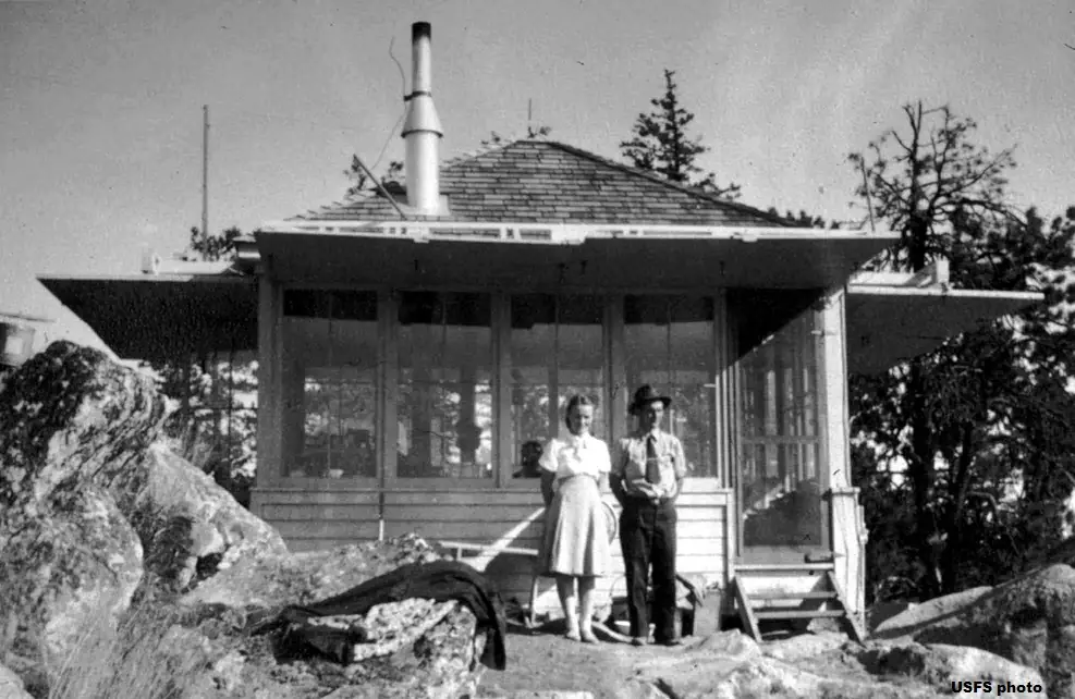
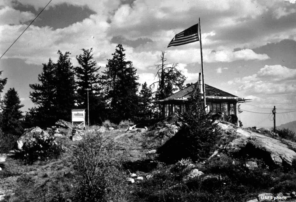
- 1936 Replaced by a new structureLog house replaced by an L-4 ground-house cab (NHLR gives 1941 for an L-4 on an 11-ft timber tower)Sources: firelookout.com, mvffla.org
- 1941 EventNHLR only: L-4 cab on an 11-ft timber tower built; windmill tower moved to Twisp Smokejumper Base for a training loftSource: nhlr.org
- 1954 BuiltPresent timber tower with L-4 cab, cab brought from Chiliwist Butte LookoutSources: nhlr.org, firelookout.com, mvffla.org
- 1954 MovedWindmill tower moved to a smokejumper base. Firelookout.com and the Methow Valley FFLA say the North Cascades base; NHLR says Twisp in 1941Sources: firelookout.com, mvffla.org
- No record between 1954 and 1980
- 1980 EventUsed for emergency summer fire detection from the 1980sSource: firelookout.com
- No record between 1980 and 2004
- 2004 Added to the National Historic Lookout RegisterRegistered October 14, 2004 as US 603, WA 55Source: nhlr.org
- 2009 RestoredRestoration work on the lookoutSources: firelookout.com, mvffla.org
- 2009 StaffedPlaced back into service after refurbishment.Source: firelookout.org
- 2010 StaffedReturned to full-time staffing (firelookout.com)Source: firelookout.com
- 2014 FireCarlton Complex fire burned neighboring trees; lookout and crow's nest survivedSource: mvffla.org
- 2014 StaffedBill Austin, 19 seasons at Goat Peak, posted to Leecher. WTA says a brief stint, moved back to Goat Peak before season end; the Methow Valley FFLA says he was evacuated by helicopterSources: mvffla.org, wta.org
- TodayStandingIt still stands, as far as our sources know.
Old maps of this spot
USGS topographic maps from the years a lookout stood may show it, often as a small symbol labelled “Lookout”. See the old topo maps around it on the Firefinder map, or find every scanned sheet of this spot on USGS TopoView (opens another site) (click the spot there to list them, with dates and downloads).
Story
Researched 8 Oct 2026, fact-checked.
Leecher Mountain Lookout sits at roughly 5,000 feet in Okanogan County, on Okanogan National Forest land administered by the Forest Service's Methow Valley Ranger District.1,2,3 The summit has held several structures over the years.1,2,3 The oldest is a tree-top crow's nest, still standing about 1,000 feet south of the present tower. Sources date it to 1918 or 1920.1,2,3
In 1921 a windmill tower with a six-by-six-foot cab went up, and a log house for living quarters followed in 1922.1,2,3 The log house was replaced by an L-4 cab in 1936, according to firelookout.com and the Methow Valley group.2,3 NHLR tells it differently. It dates an L-4 on an 11-foot timber tower to 1941, and it says the windmill tower went to the Twisp Smokejumper Base that year.1 Firelookout.com and the Methow Valley group place the windmill tower's move to a smokejumper base in 1954, at the North Cascades base.2,3
The tower standing today went up in 1954, with an L-4 cab brought from Chiliwist Butte Lookout.1,2,3 Sources give its height as 40 or 41 feet.1,2,3,4
Staffing has been uneven.2,3 Firelookout.com says the lookout was used for emergency summer fire detection from the 1980s, and that restoration in 2009 was followed by full-time staffing in 2010.2 In 2014 Bill Austin, known as Lightning Bill, who had staffed Goat Peak for 19 seasons, was posted here.3 The accounts of that summer differ.3,4 The Methow Valley group says the Carlton Complex fire surrounded the lookout and Austin was evacuated by helicopter. WTA says he was moved back to Goat Peak before the season ended.3,4
Both the lookout and the crow's nest came through the 2014 fire, which burned trees around them.3 The tower was restored in 2009.3 The NHLR registered the lookout on October 14, 2004, and says it has been recently renovated.1
To reach the trailhead, head south on Highway 153 past Twisp and turn left onto Benson Creek Drive. After about 10 miles, turn right onto spur Road 100 and go 3 more miles to a parking area at a locked gate.4 The hike is listed at 2.4 miles round trip with 531 feet of climb.4 WTA lists either a Northwest Forest Pass or an America the Beautiful Pass for parking. It also notes that a ranger may or may not be on the summit.4
- Leecher Mountain Lookout, National Historic Lookout Register, http://nhlr.org/lookouts/us/wa/leecher-mountain-lookout/ (accessed 2026-10-08). ↩
- Leecher Mtn. Fire Lookout Tower, firelookout.com, https://www.firelookout.com/wa/leecher.html (accessed 2026-10-08). ↩
- Mount Leecher, Methow Valley FFLA, https://www.mvffla.org/mount-leecher (accessed 2026-10-08). ↩
- Leecher Mountain Lookout, Washington Trails Association, https://www.wta.org/go-hiking/hikes/leecher-mountain-lookout (accessed 2026-10-08). ↩
Photos
Photos keep their own rights and are shown with credit. Is one of these yours? You can ask for a different credit or for removal.
Where sources disagree
We show disagreements between sources instead of quietly picking one. If you know which is right, please tell us.
Sources disagree on the year it was built.
- NHLR: 1954
- firelookout.com -- Rex Kamstra's Forest Fire Lookout Page: 1918
- TrailChick: Washington State Fire Lookouts: 1954
Sources give different build years. Often one counts the first lookout on the site and another the structure there now.
Sources
- National Historic Lookout Register (NHLR) (opens another site) Gave us: name, location, county, elevation, register numbers, agency, ownership, dates, photos, links National Historic Lookout Register (nhlr.org) · All rights reserved (American Resources, Inc.); facts extracted only, no prose copied. · retrieved 4 Oct 2026
- Forest Fire Lookout Association (FFLA) - US lookout lists (opens another site) Gave us: type, status, register numbers, links Forest Fire Lookout Association (firelookout.org) · No licence stated; facts extracted only, no prose copied. · retrieved 8 Oct 2026
- firelookout.com -- Rex Kamstra's Forest Fire Lookout Page (opens another site) Gave us: what it is built of, design, height, photos, links firelookout.com · No licence stated on the site; facts only (coordinates, elevation, built/destroyed years, design, agency). Photos mirrored with the site's stated credit. · retrieved 4 Oct 2026
- Forest Fire Lookout Association chapter reports (opens another site) Gave us: dates, links Forest Fire Lookout Association, chapter and restoration-grant reports (firelookout.org) · No licence stated; facts only (dates, names, the kind of work done). Every note is our own wording and every event links to the FFLA report it comes from. Positions are copied from the NHLR, FFLOS and FFLA records. · retrieved 8 Oct 2026
- OpenStreetMap -- fire lookout structures (opens another site) Gave us: links © OpenStreetMap contributors · ODbL 1.0. (c) OpenStreetMap contributors. · retrieved 4 Oct 2026
- FOREST LOOKOUTS -- western US (Ron Kemnow's weebly sites) (opens another site) Gave us: links Ron Kemnow's Forest Lookouts sites (westlookouts, californialookouts, idaholookouts, montanalookouts, oregonlookouts and washingtonlookouts .weebly.com) · No licence stated; facts only (county, land manager, status word, coordinates where the page's own map widget gives them, township-range-section, height and design hints, links). The site's own newspaper quotes, citations and narrative are not reproduced. · retrieved 8 Oct 2026
- TrailChick: Washington State Fire Lookouts (opens another site) Gave us: photos, links TrailChick (trailchick.com) · No licence stated; facts only (county, land manager, coordinates, elevation, lookout type, years built). The guide's text is not reproduced; its card photos are listed with credit to TrailChick, for the project's photo mirroring. · retrieved 8 Oct 2026
- FFLA chapters, affiliates and Friends groups: lookout pages (opens another site) Gave us: links FFLA chapters and Friends groups (each link names the group) · Links to the groups' own pages; facts only from the California-South chapter's tower table (register page, operator, condition). No text or photos reproduced. · retrieved 8 Oct 2026
- WillhiteWeb.com: Washington Fire Lookouts (opens another site) Gave us: links WillhiteWeb.com · No licence stated; names and page links only (the site's photos and text are not reproduced). · retrieved 8 Oct 2026
- Firefinder research Gave us: summary, design, height, agency, access, visiting details, dates, links, fact-check Firefinder research (sources cited in the story footnotes) · Our own research notes; each fact cites its source in the lookout's story
More about this lookout elsewhere
- NHLR register entry US 603 (nhlr.org) (opens another site)
- Leecher Mountain Lookout (Washington Trails Association) (opens another site)
- FFLA Washington lookout list (firelookout.org) (opens another site)
- Forest Fire Lookout Association chapter reports: work on Leecher Mountain Lookout (opens another site)
- Mount Leecher lookout: Methow Valley Forest Fire Lookout Association (opens another site)
- View Methow Valley news article about this lookout (opens another site)
- Leecher Mtn. on firelookout.com (Rex Kamstra) (opens another site)
- Leecher on Forest Lookouts, western US (Ron Kemnow) (opens another site)
- Mount Leecher in the TrailChick Washington lookout guide (opens another site)
- Leecher Mountain on WillhiteWeb.com Washington Fire Lookouts (opens another site)
- OpenStreetMap way 1313079674 (opens another site)
Firefinder takes facts (places, dates, numbers) from these sources and writes its own words. See all sources and licences.