Fire lookout · Cowlitz County, Washington
Powderhorn (Davis) Lookout Site
Also known as Powderhorn, Davis Mountain
Cowlitz County, WA lookout on Powder Horn Peak: L-4 cab (1930 or 1931), smokehouse tower, 1960 DNR live-in tower; discontinued 1969 and listed as gone.
- Gone
- Access unknown
- Verified
Gone: The lookout no longer stands. Only the site is left. Firetower.org says it is now gone and the Forest Fire Lookout Association lists the tower as gone; no source describes what remains at the site
Visit & stay
Gone: site only. The lookout no longer stands, so there is nothing to climb or rent.
Access
Access unknown
We do not know the access rules. Check with the land manager before you go.
- Road to the top?
- Unknown
- Trail
- WillhiteWeb describes a low mountain with a rocky summit that should offer views, reached from Highway 503 not far from I-5 and called a quick bonus peak; it describes no structure on the summit today
Facts
- Status
- Type
- Cab on a towerL-4 cab, then a two-story smokehouse-type tower, then a 20-foot wooden DNR live-in tower (1960)The design: L-4
- Built of
- Not recorded
- Built
- 1930
- Height
- Unknown
- Elevation
- 2,954 ft (900 m)
- Agency
- Washington State Division of Forestry/DNR
- Land
- Unknown
- Location
- Cowlitz County, Washington
- Coordinates
- 45.99326, −122.59660
- Registers
- This entry
- VerifiedResearched, then checked independently. Updated 9 Oct 2026.
- Firefinder id
us-wa-powderhorn-davis
View from the cab
What the lookout saw from its cab: every ridge out to about 93 miles, the named peaks in sight, and other fire lookouts within view, worked out from terrain data in your browser.
This lookout is gone. The view is reconstructed from its recorded site and a typical height for a lookout like it.
Downloads about 3.9 MB of terrain data the first time.
Or see what it could see on the map: the ground in its line of sight.
History
Then and now
- 1930 BuiltL-4 cab; a 1930 newspaper says it was in use by August 1930, while firetower.org and firelookout.com date it to 1931Sources: firelookout.com, firetower.org, washingtonlookouts.weebly.com
- 1930 First staffedEdward McGrill named as lookout when the new lookout went into useSource: washingtonlookouts.weebly.com
- No record between 1930 and 1947
- 1947 Replaced by a new structureTwo-story smokehouse-type tower with enlarged living quarters; firetower.org says the 1940sSources: washingtonlookouts.weebly.com, firetower.org, willhiteweb.com
- 1953 StaffedI.G. Driver manned the station the previous summer, with his dog as his only companionSource: washingtonlookouts.weebly.com
- 1954 StaffedI.G. Driver assigned again in June 1954Source: washingtonlookouts.weebly.com
- 1960 Replaced by a new structure20-foot wooden DNR live-in tower replaced the smokehouseSources: firetower.org, willhiteweb.com
- 1969 AbandonedDiscontinued because of air patrols, per The Oregonian (August 18, 1969); the same item says it would most likely be burned, a forecast onlySource: washingtonlookouts.weebly.com
- 1970 EventPlanned move to the Clark College campus in Vancouver as an exhibit; the project never happenedSources: firetower.org, willhiteweb.com
- No record between 1970 and 2000
- 2000 EventPhoto captioned Equipment on site, dated 7/24/2000; the latest dated on-site detail foundSource: firetower.org
- 2011 Added to the Former Fire Lookout Sites RegisterRegistered February 11, 2011 as FFLOS US 843, WA 44Source: firetower.org
- TodayGoneThe lookout no longer stands. Only the site is left.
Old maps of this spot
USGS topographic maps from the years a lookout stood may show it, often as a small symbol labelled “Lookout”. See the old topo maps around it on the Firefinder map, or find every scanned sheet of this spot on USGS TopoView (opens another site) (click the spot there to list them, with dates and downloads).
Story
Researched 9 Oct 2026, fact-checked.
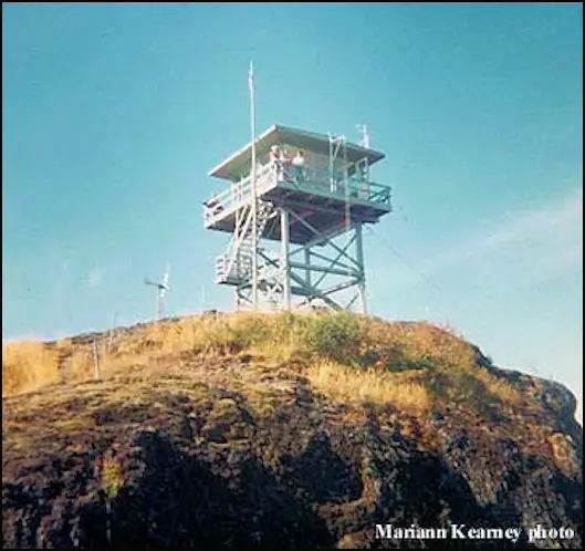
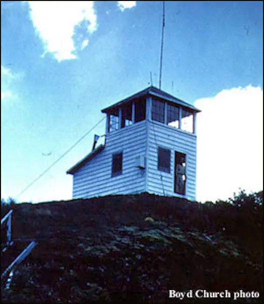
Powder Horn Peak, roughly nine to ten miles northeast of Woodland, first carried an L-4 cab.1,2 An August 3, 1930 newspaper reported that the Washington Forest Fire Association had opened its new lookout, with Edward McGrill as lookout.2 It had a telephone link to the other ranger stations. From it, the lookout could watch all of eastern Cowlitz County and the neighboring land in Lewis and Skamania counties.2 Sources disagree on the year: firetower.org and firelookout.com say 1931, while WillhiteWeb and the 1930 newspaper point to 1930.3,1,4,2
In the 1940s a two-story, 10-by-18-foot "smokehouse" tower replaced the cab.3 A 1947 state report describes that tower, with its living quarters enlarged.2
I.G. Driver manned the station in 1953 and again in 1954, with only his dog for company, and was due to be a senior at Columbia that fall.2
In 1960 a 20-foot wooden live-in tower from the state Department of Natural Resources replaced the smokehouse.3,4 A state report covering 1958 to 1960 says the department's own carpentry crew finished nine lookouts in those two years, one of them at Powderhorn, at an average cost of $8,000 apiece.2
In August 1969 The Oregonian reported that the lookout had been discontinued because of air patrols, and that it would most likely be burned.2 That was a forecast, not a report of a fire.2 A plan to relocate the tower to Clark College in Vancouver for display, scheduled for 1970, never went ahead.3,4 Firelookout.com lists the tower's years as 1960 to 1970, which conflicts with the 1969 discontinuation.1,2
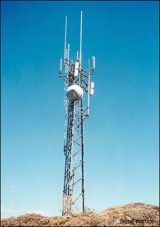
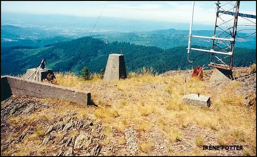
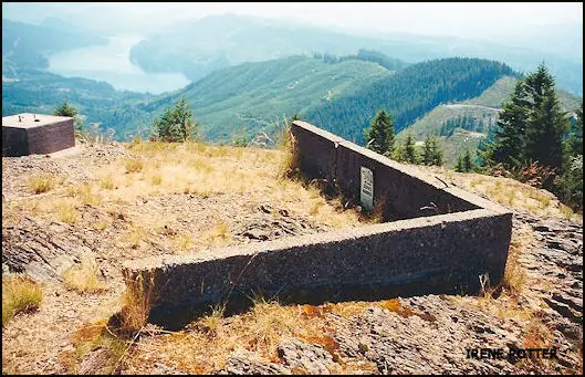
Firetower.org says the tower is now gone, and the Forest Fire Lookout Association lists the site as gone.3,5 The latest dated on-site detail is a firetower.org photo captioned "Equipment on site" and dated July 24, 2000.3 No source describes what, if anything, remains at the summit today.
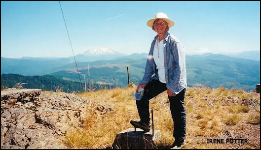
WillhiteWeb describes a low mountain with a rocky summit that should offer views, reached from Highway 503 not far from I-5, and it describes no structure on the summit today.4 No source says who owns the land or whether the summit is open to the public. WillhiteWeb's page title also says Davis Peak, but the association lists a separate ground site by that name near Cle Elum.4,5,6
- Powderhorn (Davis) Fire Lookout Tower, firelookout.com, https://www.firelookout.com/wa/powderhorn.html (accessed 2026-10-09). ↩
- Powderhorn - Forest Lookouts, Washington Lookouts (washingtonlookouts.weebly.com), https://washingtonlookouts.weebly.com/powderhorn.html (accessed 2026-10-09). ↩
- Powderhorn (Davis) Lookout Site, Former Fire Lookout Sites Register, http://firetower.org/lookouts/us/wa/powderhorn-davis-lookout-site/ (accessed 2026-10-09). ↩
- Powderhorn Lookout - Davis Peak Lookout, WillhiteWeb.com, http://willhiteweb.com/washington_fire_lookouts/powderhorn_lookout/davis_peak_274.htm (accessed 2026-10-09). ↩
- Washington Lookouts, Forest Fire Lookout Association, https://firelookout.org/lookouts/us/wa/ (accessed 2026-10-09). ↩
- Davis Peak - Salmon La Sac Hiking Trails, WillhiteWeb.com, http://www.willhiteweb.com/hiking/cle_elum/davis_peak/trail_202.htm (accessed 2026-10-09). ↩
Photos
Photos keep their own rights and are shown with credit. Is one of these yours? You can ask for a different credit or for removal.
Sources
- Former Fire Lookout Sites Register (FFLOS) (opens another site) Gave us: name, location, county, elevation, register numbers, agency, dates, photos, links Former Fire Lookout Sites Register (firetower.org) · All rights reserved (American Resources, Inc.); facts extracted only, no prose copied. · retrieved 4 Oct 2026
- Forest Fire Lookout Association (FFLA) - US lookout lists (opens another site) Gave us: type, status, register numbers, links Forest Fire Lookout Association (firelookout.org) · No licence stated; facts extracted only, no prose copied. · retrieved 8 Oct 2026
- firelookout.com -- Rex Kamstra's Forest Fire Lookout Page (opens another site) Gave us: links firelookout.com · No licence stated on the site; facts only (coordinates, elevation, built/destroyed years, design, agency). Photos mirrored with the site's stated credit. · retrieved 4 Oct 2026
- FOREST LOOKOUTS -- western US (Ron Kemnow's weebly sites) (opens another site) Gave us: links Ron Kemnow's Forest Lookouts sites (westlookouts, californialookouts, idaholookouts, montanalookouts, oregonlookouts and washingtonlookouts .weebly.com) · No licence stated; facts only (county, land manager, status word, coordinates where the page's own map widget gives them, township-range-section, height and design hints, links). The site's own newspaper quotes, citations and narrative are not reproduced. · retrieved 8 Oct 2026
- WillhiteWeb.com: Washington Fire Lookouts (opens another site) Gave us: links WillhiteWeb.com · No licence stated; names and page links only (the site's photos and text are not reproduced). · retrieved 8 Oct 2026
- Firefinder research Gave us: summary, design, status, agency, visiting details, dates, links, fact-check Firefinder research (sources cited in the story footnotes) · Our own research notes; each fact cites its source in the lookout's story
More about this lookout elsewhere
- FFLOS register entry US 843 (firetower.org) (opens another site)
- Powderhorn Lookout - Davis Peak Lookout (WillhiteWeb.com) (opens another site)
- FFLA Washington lookout list (firelookout.org) (opens another site)
- Powderhorn (Davis) on firelookout.com (Rex Kamstra) (opens another site)
- Powderhorn on Forest Lookouts, western US (Ron Kemnow) (opens another site)
- Davis Mountain on WillhiteWeb.com Washington Fire Lookouts (opens another site)
Firefinder takes facts (places, dates, numbers) from these sources and writes its own words. See all sources and licences.