Fire lookout · Okanogan County, Washington
Slate Peak Lookout
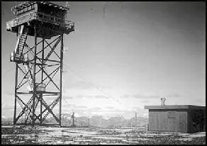
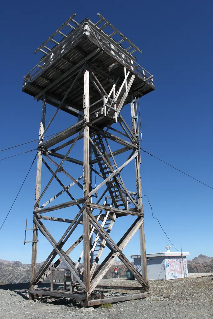
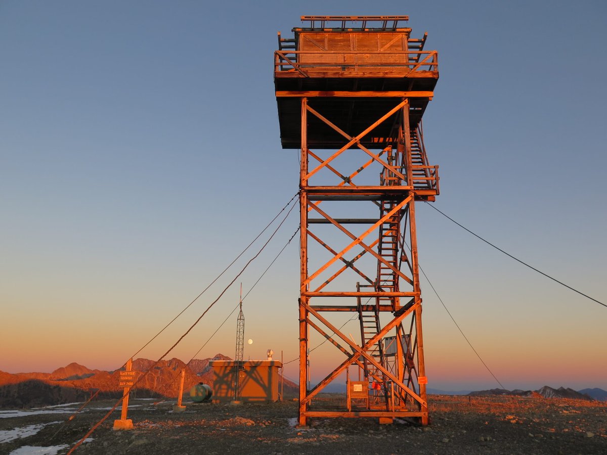
Okanogan NF lookout above Harts Pass. 1931 L-4 cab; 1954 ground cab; top 40 ft cut for an Air Force radar in 1956; 41-ft tower; collapsed winter 2026. Road closed; remains not described.
- Ruins
- Restricted access
- Verified
Ruins: Only footings or remains are left. Collapsed in the winter of 2026 (firelookout.com). WillhiteWeb says a windstorm blew the tower over in early 2026; MVFFLA gives no cause.
Visit & stay
Ruins: footings or remains only. There is no structure to climb or rent.
Access
Restricted access
Access is seasonal, gated or needs a permit. Check before you go. MVFFLA says Harts Pass Road was significantly damaged and will be closed by the Forest Service until repairs are complete. Visitors are asked to honor closures and avoid disturbing the site.
- Road to the top?
- Unknown
Facts
- Status
- sources disagree
- Type
- Cab on a towerL-4 cab on a 41-foot treated-timber tower (current structure, 1956)Cab: L-4; tower: Region 6 timber towers (CT, TT)
- Built of
- Wood
- Built
- 1924
- Height
- 41 ft (12.5 m)
- Elevation
- 7,308 ft (2,228 m)
- Agency
- U.S. Forest Service
- Land
- Federal land
- Location
- Okanogan County, Washington
- Coordinates
- 48.74180, −120.67940
- Registers
- This entry
- VerifiedResearched, then checked independently. Updated 9 Oct 2026.
- Firefinder id
us-wa-slate-peak
View from the cab
What the lookout saw from its cab: every ridge out to about 93 miles, the named peaks in sight, and other fire lookouts within view, worked out from terrain data in your browser.
This lookout is gone. The view is reconstructed from its recorded site and its recorded height.
Downloads about 4.4 MB of terrain data the first time.
Or see what it could see on the map: the ground in its line of sight.
History
Then and now
- 1924 BuiltReported first structure: a gable-roof cupola cabin. WillhiteWeb says it may never have existed.Sources: firelookout.com, washingtonlookouts.weebly.com, willhiteweb.com
- 1931 BuiltGable-roofed L-4 cab built; first telephone line strung to the summit the same yearSources: firelookout.com, willhiteweb.com
- 1931 First staffedPeak occupied for the first time (1931 item quoted by Weebly); Ed Allen and Raymond Johnson were completing the lookout house, then it was staffed for the rest of the seasonSources: washingtonlookouts.weebly.com, willhiteweb.com
- 1932 FireLightning bolt damaged the roof, disrupted the telephone and set the lookout's bed afireSource: willhiteweb.com
- 1932 StaffedLookout: Roy PaulSource: willhiteweb.com
- 1934 StaffedLookout: Al AndersonSource: willhiteweb.com
- No record between 1934 and 1954
- 1954 Replaced by a new structureHip-roofed L-4 ground cab placed on the summit. Register and WillhiteWeb say it came from Leecher Mountain; firelookout.com says that cab went to TwispSources: nhlr.org, mvffla.org, firelookout.com
- 1954 StaffedKnown lookout personnel: Bill Horn (firelookout.com)Source: firelookout.com
- 1956 BuiltCurrent structure: L-4 cab on a 40/41-foot timber tower (MVFFLA lists 1956 as the current structure build year; WillhiteWeb says the cab went back up between 1956 and 1960)Sources: mvffla.org, willhiteweb.com
- 1956 RemovedAir Force took the summit for a gap-filler radar station; cab removed and top 40 feet of the peak cut away. Firelookout.com dates this 1956 with a question mark, possibly laterSources: nhlr.org, firelookout.com, willhiteweb.com
- 1957 StaffedKnown lookout personnel: Carl Schmidt (firelookout.com)Source: firelookout.com
- 1961 EventRadar station declared excess in January; sold by bid for salvage, including the radar tower, by OctoberSource: willhiteweb.com
- 1963 StaffedMr. and Mrs. Jon Shepard were the lookouts; they left near the end of the season and Al Anderson of Winthrop finished itSource: willhiteweb.com
- No record between 1963 and 1994
- 1994 FirePressed into emergency service when nearby Goat Peak Lookout had to be evacuated for fireSources: mvffla.org, firelookout.com, willhiteweb.com
- 1996 FireUsed to monitor the Elbow Basin fire in the Pasayten Wilderness and relay radio messagesSources: mvffla.org, firelookout.com, willhiteweb.com
- 2000 Added to the National Historic Lookout RegisterDate registered November 4, 2000Source: nhlr.org
- No record between 2000 and 2026
- 2026 DestroyedTower collapsed over the winter (firelookout.com: winter of 2026; WillhiteWeb: windstorm in early 2026)Sources: mvffla.org, firelookout.com, willhiteweb.com
- TodayRuinsOnly footings or remains are left.
Old maps of this spot
USGS topographic maps from the years a lookout stood may show it, often as a small symbol labelled “Lookout”. See the old topo maps around it on the Firefinder map, or find every scanned sheet of this spot on USGS TopoView (opens another site) (click the spot there to list them, with dates and downloads).
Story
Researched 9 Oct 2026, fact-checked.
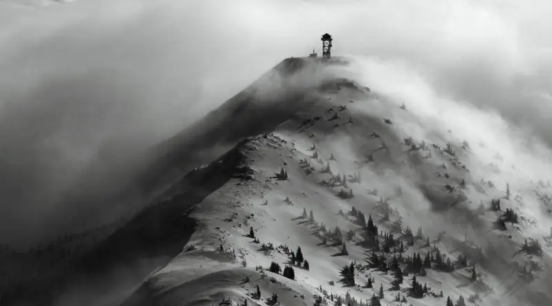
Slate Peak sits at the end of the highest road in Washington, near Harts Pass in the Okanogan National Forest.1,2 A gable-roofed cupola cabin is reported for 1924, but WillhiteWeb says it may never have existed.3,4
The first cab the sources agree on was a gable-roofed L-4, built in 1931, the year a telephone line reached the summit.3,4 A 1931 item quoted on one lookout site says the peak was occupied for the first time that year.2 Ed Allen and Raymond Johnson were still working on the lookout house in early September, after which it was staffed for the rest of the fire season.4
In 1954 the Forest Service set a hip-roofed L-4 ground cab on the summit.3,4 The register and WillhiteWeb say it came from Leecher Mountain, but firelookout.com says that cab went to Twisp instead.1,3,4 In 1956 the Air Force took over the summit for a radar station, removed the cab and cut the top 40 feet off the peak.1,4 Sources disagree on whether the radar was finished: the register says it was never built, firelookout.com says it was partly built, and WillhiteWeb says its tower was sold for salvage in 1961.1,3,4 A cab was back on a 40-foot tower by 1960, and MVFFLA dates the current structure to 1956.5,4
Staff named in the sources include Roy Paul in 1932, Al Anderson in 1934, Bill Horn in 1954 and Carl Schmidt in 1957.3,4 Mr. and Mrs. Jon Shepard staffed the lookout in 1963, and Al Anderson of Winthrop finished that season.4
A lightning bolt damaged the cabin's roof in 1932 and set Roy Paul's bed on fire.4 In 1994 the lookout was called into emergency duty when Goat Peak Lookout had to be evacuated.5,4 In 1996 it kept watch on the Elbow Basin fire and relayed radio messages.5,4
Firelookout.com says the lookout was abandoned for some years, with its bottom stairs removed, before the tower collapsed in the winter of 2026.3 WillhiteWeb says a windstorm blew it over in early 2026.4 MVFFLA says only that it collapsed over the winter and gives no cause.6
The Forest Service will close Harts Pass Road until repairs are finished, after significant damage to the road.6 MVFFLA and the district are documenting and salvaging what remains.6 The structure belongs to the Forest Service, and the group asks people to respect closures and not disturb the site.6 The register, which listed the lookout on November 4, 2000, describes it as kept up for emergency use.1 No source I read describes what remains on the summit today, so I cannot say what can be seen there.
- Slate Peak Lookout, National Historic Lookout Register, http://nhlr.org/lookouts/us/wa/slate-peak-lookout/ (accessed 2026-10-09). ↩
- Slate Peak, Forest Lookouts (Washington), washingtonlookouts.weebly.com, https://washingtonlookouts.weebly.com/slate-peak.html (accessed 2026-10-09). ↩
- Slate Peak Fire Lookout Tower, firelookout.com, https://www.firelookout.com/wa/slate.html (accessed 2026-10-09). ↩
- Slate Peak Lookout History, WillhiteWeb.com, https://willhiteweb.com/washington/fire_lookouts/slate_peak/history_097.htm (accessed 2026-10-09). ↩
- Slate Peak, Methow Valley Forest Fire Lookout Association, https://www.mvffla.org/slate-peak (accessed 2026-10-09). ↩
- Collapse of the Slate Peak Fire Lookout, Methow Valley Forest Fire Lookout Association, https://www.mvffla.org/news/collapse-of-the-slate-peak-fire-lookout (accessed 2026-10-09). ↩
Photos

Photos keep their own rights and are shown with credit. Is one of these yours? You can ask for a different credit or for removal.
Where sources disagree
We show disagreements between sources instead of quietly picking one. If you know which is right, please tell us.
Sources disagree on whether it still stands.
- FFLA: Ruins
- NHLR: Standing
- firelookout.com -- Rex Kamstra's Forest Fire Lookout Page: Gone
- OpenStreetMap: Standing
- TrailChick: Washington State Fire Lookouts: Gone
- Methow Valley Forest Fire Lookout Association: Gone
NHLR lists lookouts that were standing when registered. firelookout.com lists it, but not on its map of standing lookouts.
Sources
- National Historic Lookout Register (NHLR) (opens another site) Gave us: name, location, county, elevation, register numbers, agency, ownership, dates, photos, links National Historic Lookout Register (nhlr.org) · All rights reserved (American Resources, Inc.); facts extracted only, no prose copied. · retrieved 4 Oct 2026
- Forest Fire Lookout Association (FFLA) - US lookout lists (opens another site) Gave us: type, status, register numbers, links Forest Fire Lookout Association (firelookout.org) · No licence stated; facts extracted only, no prose copied. · retrieved 8 Oct 2026
- firelookout.com -- Rex Kamstra's Forest Fire Lookout Page (opens another site) Gave us: links firelookout.com · No licence stated on the site; facts only (coordinates, elevation, built/destroyed years, design, agency). Photos mirrored with the site's stated credit. · retrieved 4 Oct 2026
- Methow Valley Forest Fire Lookout Association (opens another site) Gave us: dates, links Methow Valley Forest Fire Lookout Association (mvffla.org) · No licence stated; facts only (dates, the kind of work done). Every note is our own wording and every event links to the association's post it comes from. Positions are copied from the NHLR records. · retrieved 8 Oct 2026
- Wikidata -- US fire lookout towers (Q748998 and subclasses) (opens another site) Gave us: photos, links Wikidata · CC0 1.0 (Wikidata). Images keep their own Commons licence/credit. · retrieved 4 Oct 2026
- OpenStreetMap -- fire lookout structures (opens another site) Gave us: what it is built of, height, register numbers, access, dates, links © OpenStreetMap contributors · ODbL 1.0. (c) OpenStreetMap contributors. · retrieved 4 Oct 2026
- FOREST LOOKOUTS -- western US (Ron Kemnow's weebly sites) (opens another site) Gave us: design, links Ron Kemnow's Forest Lookouts sites (westlookouts, californialookouts, idaholookouts, montanalookouts, oregonlookouts and washingtonlookouts .weebly.com) · No licence stated; facts only (county, land manager, status word, coordinates where the page's own map widget gives them, township-range-section, height and design hints, links). The site's own newspaper quotes, citations and narrative are not reproduced. · retrieved 8 Oct 2026
- TrailChick: Washington State Fire Lookouts (opens another site) Gave us: photos, links TrailChick (trailchick.com) · No licence stated; facts only (county, land manager, coordinates, elevation, lookout type, years built). The guide's text is not reproduced; its card photos are listed with credit to TrailChick, for the project's photo mirroring. · retrieved 8 Oct 2026
- FFLA chapters, affiliates and Friends groups: lookout pages (opens another site) Gave us: links FFLA chapters and Friends groups (each link names the group) · Links to the groups' own pages; facts only from the California-South chapter's tower table (register page, operator, condition). No text or photos reproduced. · retrieved 8 Oct 2026
- WillhiteWeb.com: Washington Fire Lookouts (opens another site) Gave us: links WillhiteWeb.com · No licence stated; names and page links only (the site's photos and text are not reproduced). · retrieved 8 Oct 2026
- Firefinder research Gave us: summary, design, height, status, agency, access, dates, links, fact-check Firefinder research (sources cited in the story footnotes) · Our own research notes; each fact cites its source in the lookout's story
More about this lookout elsewhere
- NHLR register entry US 359 (nhlr.org) (opens another site)
- FFLA Washington lookout list (firelookout.org) (opens another site)
- Methow Valley Forest Fire Lookout Association: work on Slate Peak Lookout (opens another site)
- Slate Peak lookout: Methow Valley Forest Fire Lookout Association (opens another site)
- Slate Peak on firelookout.com (Rex Kamstra) (opens another site)
- Slate Peak on Forest Lookouts, western US (Ron Kemnow) (opens another site)
- Slate Peak in the TrailChick Washington lookout guide (opens another site)
- Slate Peak on WillhiteWeb.com Washington Fire Lookouts (opens another site)
- Wikidata item Q86927104 (opens another site)
- OpenStreetMap way 987018127 (opens another site)
Firefinder takes facts (places, dates, numbers) from these sources and writes its own words. See all sources and licences.