Fire lookout · King County, Washington
Snoqualmie Lookout Site
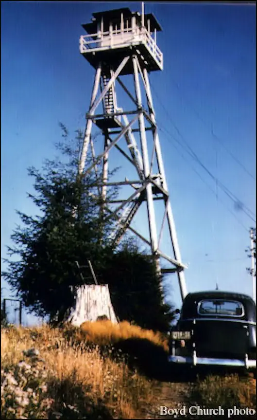
King County tree-farm tower built 1942 (1939 per one report), 50 ft with L-6 cab; AWS post 1942-43; removed 1965. Site logged, cables remain.
- Gone
- Permission required
- Verified
Permission required
You need permission from the tribe or landowner before visiting. Later owners Hancock Timber (2003) and Campbell Global (2015) require a non-motorized day-use permit (priced at $8 in 2016 per Willhite Web). Site is on logged timber land; the last half mile is overgrown and must be walked.
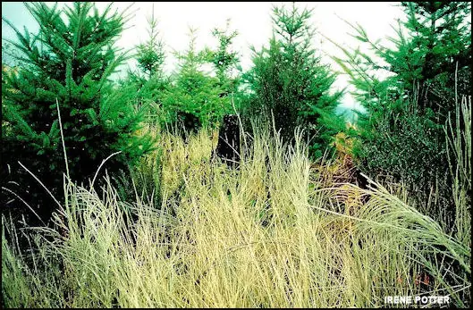
Gone: The lookout no longer stands. Only the site is left. Tower and cabin removed (Former Fire Lookout Sites) or destroyed (firelookout.com) in 1965. Late-1990s timber harvest removed or buried remaining foundations; a few logging cables remain on top.
Visit & stay
Gone: site only. The lookout no longer stands, so there is nothing to climb or rent.
Access
Permission required. See the warning at the top of this page.
- Road to the top?
- No, you have to hike
- Trail
- Willhite Web route from North Bend via Ballarat Street; gate on the left after 7.6 miles of road; 9 miles one way on old railroad grades, the last half mile overgrown and on foot.
Facts
- Status
- Type
- Cab on a tower50-ft pole tower with an L-6 cabin on top; a 1940 ranger cabin is also reportedThe design: L-6
- Built of
- Wood
- Built
- 1939
- Height
- 50 ft (15.2 m)
- Elevation
- 1,691 ft (515 m)
- Agency
- Washington DNR (builder, 1942); land later held by Hancock Timber (2003) and Campbell Global (2015); Former Fire Lookout Sites lists Hancock Insurance Forestry Division as administrator
- Land
- State land
- Location
- King County, Washington
- Coordinates
- 47.66072, −121.78311
- Registers
- This entry
- VerifiedResearched, then checked independently. Updated 9 Oct 2026.
- Firefinder id
us-wa-snoqualmie
View from the cab
What the lookout saw from its cab: every ridge out to about 93 miles, the named peaks in sight, and other fire lookouts within view, worked out from terrain data in your browser.
This lookout is gone. The view is reconstructed from its recorded site and its recorded height.
Downloads about 4.1 MB of terrain data the first time.
Or see what it could see on the map: the ground in its line of sight.
History
Then and now
- 1939 BuiltA 60-foot tower of Douglas fir piling erected on Section 9 per a 1939 Washington Forest Fire Association report quoted by Rex's page. Conflicts with the 1942 date.Source: washingtonlookouts.weebly.com
- 1939 First staffedLookout man housed in a tent as a temporary measure (Willhite Web and Rex's page)Sources: willhiteweb.com, washingtonlookouts.weebly.com
- 1940 BuiltRanger cabin built at the lookoutSources: willhiteweb.com, washingtonlookouts.weebly.com
- 1942 Built50-ft pole tower with an L-6 cab built by the Washington DNR (Former Fire Lookout Sites, firelookout.com, Willhite Web)Sources: firetower.org, firelookout.com, willhiteweb.com
- 1942 EventAircraft Warning Service station 'Dog 5-5' activated March 9, 1942 (Seattle Filter Center)Source: washingtonlookouts.weebly.com
- 1943 EventAircraft Warning Service station deactivated October 16, 1943; the site was retained by the State for fire detectionSource: washingtonlookouts.weebly.com
- No record between 1943 and 1965
- 1965 RemovedTower removed per Former Fire Lookout Sites and Willhite Web; firelookout.com says destroyed. Cascade Lookout built shortly after, higher on the same tree farm.Sources: firetower.org, firelookout.com, willhiteweb.com
- No record between 1965 and 2010
- 2010 Added to the Former Fire Lookout Sites RegisterRegistered September 28, 2010Source: firetower.org
- TodayGoneThe lookout no longer stands. Only the site is left.
Old maps of this spot
USGS topographic maps from the years a lookout stood may show it, often as a small symbol labelled “Lookout”. See the old topo maps around it on the Firefinder map, or find every scanned sheet of this spot on USGS TopoView (opens another site) (click the spot there to list them, with dates and downloads).
Story
Researched 9 Oct 2026, fact-checked.
The Snoqualmie lookout stood on a hill about 16 miles southeast of Monroe, in King County.1,2 It was on Weyerhaeuser's Snoqualmie Tree Farm.1
Washington's Department of Natural Resources put it up in 1942: a 50-foot pole tower topped by an L-6 cabin.1,2,3 Rex's Fire Lookout Page dates the first tower earlier.4 It quotes a 1939 Washington Forest Fire Association report describing a 60-foot tower erected on Section 9 that year, with the lookout man housed in a tent.4 Willhite Web also says a lookout man stayed in a tent in 1939, but it places the tower's construction in 1942.3 A ranger's cabin went up at the site in 1940.3,4
From March 9, 1942, to October 16, 1943, the site served as an Aircraft Warning Service post, with the existing lookout structure as its observation post.4 The state kept it for fire detection afterward.4
Former Fire Lookout Sites dates the tower's removal to 1965, shortly after the Cascade Lookout was built at a higher elevation on the same tree farm.1,3 firelookout.com says it was destroyed that year.2
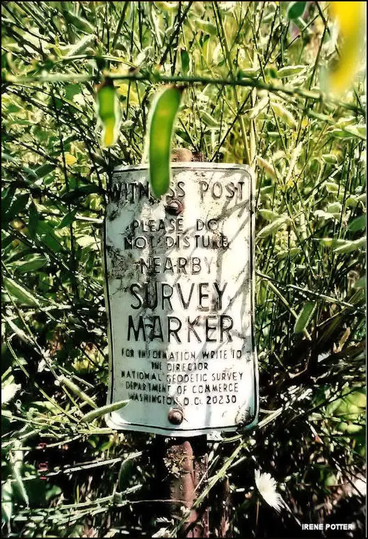
No standing structure is described at the site today.1,2,3 Willhite Web reports that a late-1990s timber harvest removed or buried what remained of the foundations, and that a few logging cables still sit on top.3 Former Fire Lookout Sites, whose photos are captioned 2000 and 2001, recorded only a wire in the brush as a remnant.1
Willhite Web traces the land from Weyerhaeuser to Hancock Timber in 2003 and then to Campbell Global in 2015.3 Those later owners require a non-motorized day-use permit, which Willhite Web priced at $8 in 2016.3 The route is 9 miles one way from North Bend, and its last half mile is overgrown and must be walked.3
- Snoqualmie Lookout Site, Former Fire Lookout Sites, http://firetower.org/lookouts/us/wa/snoqualmie-lookout-site/ (accessed 2026-10-09). ↩
- Snoqualmie Fire Lookout Tower, Fire Lookout (firelookout.com), https://www.firelookout.com/wa/snoqualmie.html (accessed 2026-10-09). ↩
- Snoqualmie Lookout - Tokul Creek - Tree Farm, WillhiteWeb.com, http://www.willhiteweb.com/washington_fire_lookouts/snoqualmie_lookout/tokul_012.htm (accessed 2026-10-09). ↩
- Snoqualmie - Forest Lookouts, Rex's Fire Lookout Page, https://washingtonlookouts.weebly.com/snoqualmie.html (accessed 2026-10-09). ↩
Photos
Photos keep their own rights and are shown with credit. Is one of these yours? You can ask for a different credit or for removal.
Sources
- Former Fire Lookout Sites Register (FFLOS) (opens another site) Gave us: name, location, county, elevation, what it is built of, register numbers, agency, dates, photos, links Former Fire Lookout Sites Register (firetower.org) · All rights reserved (American Resources, Inc.); facts extracted only, no prose copied. · retrieved 4 Oct 2026
- Forest Fire Lookout Association (FFLA) - US lookout lists (opens another site) Gave us: type, status, register numbers, links Forest Fire Lookout Association (firelookout.org) · No licence stated; facts extracted only, no prose copied. · retrieved 8 Oct 2026
- firelookout.com -- Rex Kamstra's Forest Fire Lookout Page (opens another site) Gave us: links firelookout.com · No licence stated on the site; facts only (coordinates, elevation, built/destroyed years, design, agency). Photos mirrored with the site's stated credit. · retrieved 4 Oct 2026
- FOREST LOOKOUTS -- western US (Ron Kemnow's weebly sites) (opens another site) Gave us: ownership, links Ron Kemnow's Forest Lookouts sites (westlookouts, californialookouts, idaholookouts, montanalookouts, oregonlookouts and washingtonlookouts .weebly.com) · No licence stated; facts only (county, land manager, status word, coordinates where the page's own map widget gives them, township-range-section, height and design hints, links). The site's own newspaper quotes, citations and narrative are not reproduced. · retrieved 8 Oct 2026
- Firefinder research Gave us: summary, design, height, status, agency, access, visiting details, dates, links, fact-check Firefinder research (sources cited in the story footnotes) · Our own research notes; each fact cites its source in the lookout's story
More about this lookout elsewhere
- FFLOS register entry US 685 (firetower.org) (opens another site)
- Snoqualmie Lookout - Tokul Creek - Tree Farm (WillhiteWeb.com) (opens another site)
- FFLA Washington lookout list (firelookout.org) (opens another site)
- Snoqualmie on firelookout.com (Rex Kamstra) (opens another site)
- Snoqualmie on Forest Lookouts, western US (Ron Kemnow) (opens another site)
Firefinder takes facts (places, dates, numbers) from these sources and writes its own words. See all sources and licences.