Fire lookout · Chelan County, Washington
Sugarloaf Mountain Lookout
Also known as Sugarloaf Peak Lookout
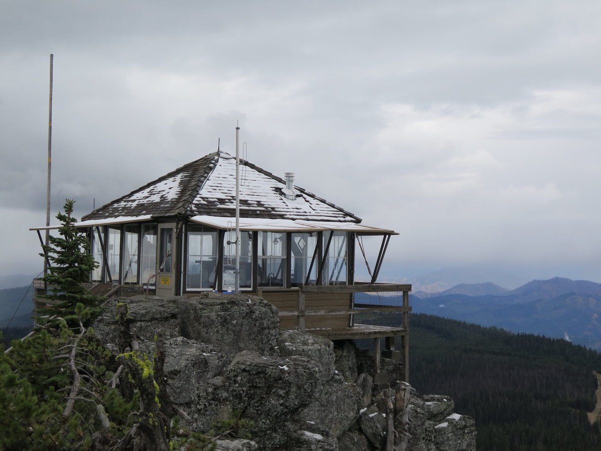
Drive-up L-4 lookout on Sugarloaf Peak (Wenatchee NF, WA), staffed every summer since 1914; its cab was moved from Lion Rock in 1949 and fires threatened it in 1970, 1994 and 2025.
- Standing
- Open to the public
- Verified
Visit & stay
Not rentable. As far as we know, this lookout cannot be booked for overnight stays.
Access
Open to the public. Drive-up on gravel roads; a gate on the spur road means a short walk to the lookout (about a quarter mile per WTA). Staffed lookout where visitors are welcomed.
- Can you climb it?
- Unknown
- Road to the top?
- Yes, you can drive up
- Trail
- Gravel route via Eagle Creek Road off Highway 209 and Van Creek Road (NF 7520); about 6 miles to the ridge road junction, then the spur road to the gate and a short walk (WTA, Willhite).
- Staffing
- Staffed during fire season
Facts
- Status
- Type
- Ground-level cabL-4 cab built at Lion Rock (1932 per Willhite and firelookout.com; 1933 per NHLR), moved to Sugarloaf in 1949 to replace a D-6 cupola cabinThe designs: L-4, D-6
- Built of
- Wood
- Built
- 1924
- Height
- Unknown
- Elevation
- 5,729 ft (1,746 m)
- Agency
- U.S. Forest Service, Wenatchee National Forest (Entiat Ranger District cooperator)
- Land
- Federal land
- Location
- Chelan County, Washington
- Coordinates
- 47.75682, −120.52770
- Registers
- This entry
- VerifiedResearched, then checked independently. Updated 8 Oct 2026.
- Firefinder id
us-wa-sugarloaf-mountain
View from the cab
What you see from the cab: every ridge out to about 93 miles, the named peaks in sight, and other fire lookouts within view, worked out from terrain data in your browser.
Downloads about 4.1 MB of terrain data the first time.
Or see what it could see on the map: the ground in its line of sight.
History
Then and now
- 1914 First staffedFirst used for fire detection with a heliograph station on the summit; the first station was just a campSources: willhiteweb.com, nhlr.org, firelookout.com
- 1924 BuiltD-6 cupola cabin added on the summit (WTA dates the start of lookout activity to 1924)Sources: firelookout.com, willhiteweb.com, wta.org
- 1932 BuiltL-4 cab built at Lion Rock (Willhite and firelookout.com); NHLR describes a 1933-vintage cabSources: willhiteweb.com, firelookout.com, nhlr.org
- 1933 Built'Built' field on NHLR detail pageSource: NHLR register entry
- No record between 1933 and 1949
- 1949 MovedL-4 cab moved from Lion Rock to the summit in sections, replacing the cupola cabinSources: nhlr.org, firelookout.com, willhiteweb.com
- No record between 1949 and 1970
- 1970 FireEntiat Fire (120,000 acres) threatened the lookoutSource: nhlr.org
- No record between 1970 and 1994
- 1994 BurnedTyee-Hatchery Fire threatened the lookout; the cab was saved by a Fort Lewis fire crew, but the outhouse burned (NHLR also says the garage burned)Sources: nhlr.org, firelookout.com, willhiteweb.com
- 1995 Added to the National Historic Lookout RegisterDate registered July 1, 1995 (NHLR US 124)Source: nhlr.org
- No record between 1995 and 2025
- 2025 FireLower Sugarloaf fire threatened the lookout (firelookout.com)Source: firelookout.com
- TodayStandingIt still stands, as far as our sources know.
Old maps of this spot
USGS topographic maps from the years a lookout stood may show it, often as a small symbol labelled “Lookout”. See the old topo maps around it on the Firefinder map, or find every scanned sheet of this spot on USGS TopoView (opens another site) (click the spot there to list them, with dates and downloads).
Story
Researched 8 Oct 2026, fact-checked.
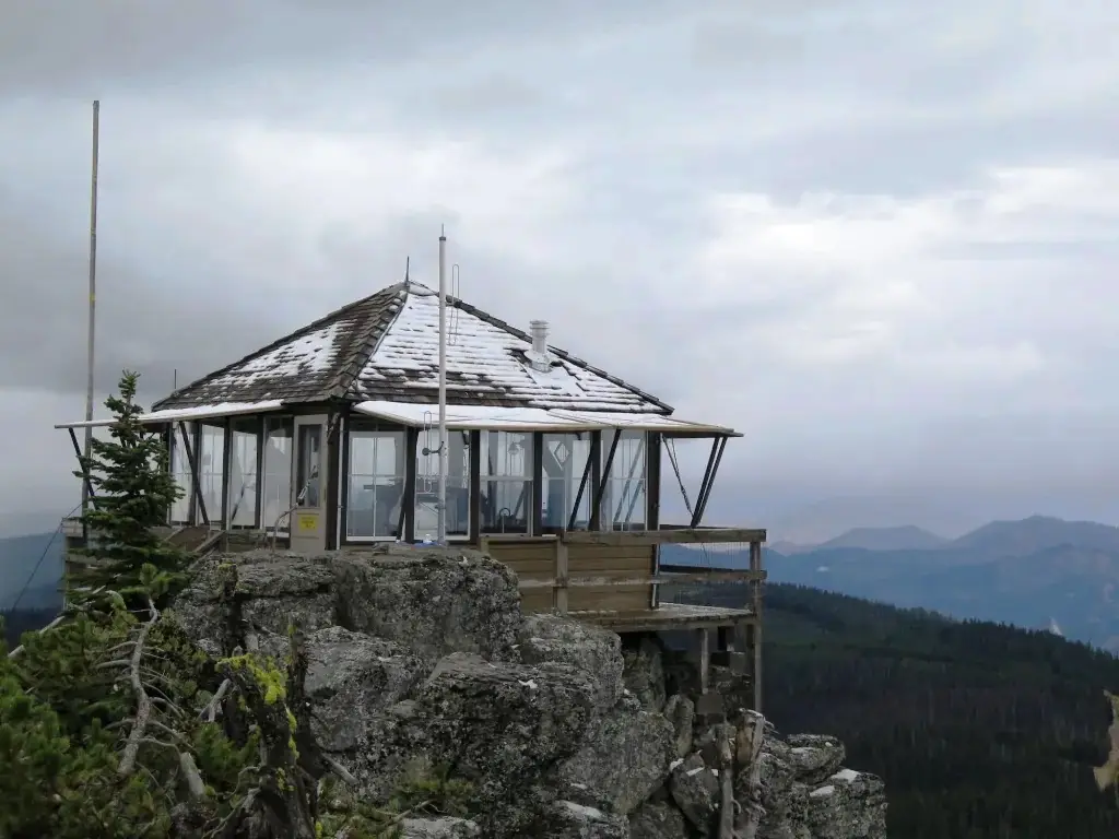
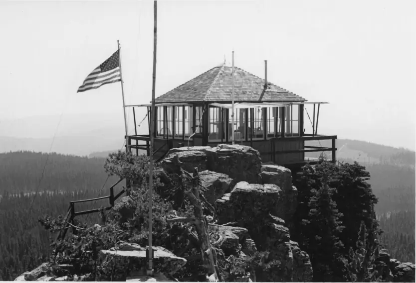
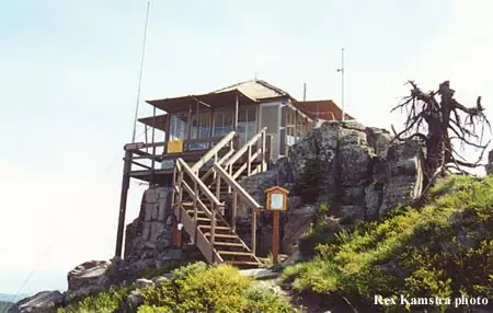
Sugarloaf Mountain Lookout stands on Sugarloaf Peak in the Wenatchee National Forest, about 12 miles north-northeast of Leavenworth in Chelan County, Washington.1,2 The site is also known as Sugarloaf Peak Lookout.3 Fire detection began on the summit in 1914, when a heliograph station was set up, and that first station was little more than a camp.3,1 A D-6 cupola cabin followed in 1924.2,3 WTA dates the start of lookout activity to 1924 instead.4
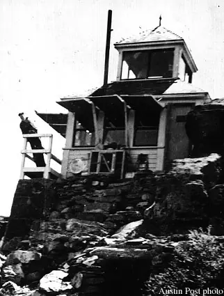
In 1949 the present L-4 cab was moved up from Lion Rock, where it had been built in 1932, and it replaced the cupola.3,2 The register gives the cab's vintage as 1933, so the build year differs between sources.1 Willhite's history says the building was sawed into sections for the move.3
The register says the lookout has been staffed every summer since it was established in 1914.1 Firelookout.com lists known lookout staff by year, including Ed Kassell in 1920 and Gladys West in 1922.2
The Entiat Fire of 1970, which burned 120,000 acres, threatened the lookout.1 In 1994 the Tyee-Hatchery Fire threatened it again. A Fort Lewis fire crew saved the cab, but the outhouse burned.1,3 The register also says the garage burned, while Willhite mentions only the outhouse.1,3 Firelookout.com says the cab survived and the outhouse did not.2 In 2025 the Lower Sugarloaf fire threatened the lookout again.2
The lookout is still in use, and Willhite notes that this makes it one of the longest continuously used lookouts in Washington.3 It is listed on the National Register of Historic Places under number 90001914.5
Visitors drive gravel roads to the spur road, which has a gate, so the last part is a short walk.3 WTA calls it a drive-up lookout and says the destination is only about a quarter mile from where you park.4
- Sugarloaf Mountain Lookout, National Historic Lookout Register, http://nhlr.org/lookouts/us/wa/sugarloaf-mountain-lookout/ (accessed 2026-10-08). ↩
- Sugarloaf Mtn. Fire Lookout Cabin, firelookout.com, https://www.firelookout.com/wa/sugarloaf.html (accessed 2026-10-08). ↩
- Sugarloaf Peak Lookout - Entiat Range, Washington Fire Lookouts (Willhite), https://www.willhiteweb.com/washington_fire_lookouts/sugarloaf_peak/entiat_range_242.htm (accessed 2026-10-08). ↩
- Sugarloaf, Washington Trails Association, https://www.wta.org/go-hiking/hikes/sugarloaf (accessed 2026-10-08). ↩
- Sugarloaf Peak Lookout, National Register Information System, https://npgallery.nps.gov/AssetDetail/NRIS/90001914 (accessed 2026-10-08). ↩
Photos
Photos keep their own rights and are shown with credit. Is one of these yours? You can ask for a different credit or for removal.
Sources
- National Historic Lookout Register (NHLR) (opens another site) Gave us: name, location, county, elevation, register numbers, agency, ownership, dates, photos, links National Historic Lookout Register (nhlr.org) · All rights reserved (American Resources, Inc.); facts extracted only, no prose copied. · retrieved 4 Oct 2026
- Forest Fire Lookout Association (FFLA) - US lookout lists (opens another site) Gave us: type, status, register numbers, links Forest Fire Lookout Association (firelookout.org) · No licence stated; facts extracted only, no prose copied. · retrieved 8 Oct 2026
- firelookout.com -- Rex Kamstra's Forest Fire Lookout Page (opens another site) Gave us: design, staffing, photos, links firelookout.com · No licence stated on the site; facts only (coordinates, elevation, built/destroyed years, design, agency). Photos mirrored with the site's stated credit. · retrieved 4 Oct 2026
- Wikidata -- US fire lookout towers (Q748998 and subclasses) (opens another site) Gave us: register numbers, links Wikidata · CC0 1.0 (Wikidata). Images keep their own Commons licence/credit. · retrieved 4 Oct 2026
- OpenStreetMap -- fire lookout structures (opens another site) Gave us: what it is built of, register numbers, access, links © OpenStreetMap contributors · ODbL 1.0. (c) OpenStreetMap contributors. · retrieved 4 Oct 2026
- FOREST LOOKOUTS -- western US (Ron Kemnow's weebly sites) (opens another site) Gave us: links Ron Kemnow's Forest Lookouts sites (westlookouts, californialookouts, idaholookouts, montanalookouts, oregonlookouts and washingtonlookouts .weebly.com) · No licence stated; facts only (county, land manager, status word, coordinates where the page's own map widget gives them, township-range-section, height and design hints, links). The site's own newspaper quotes, citations and narrative are not reproduced. · retrieved 8 Oct 2026
- TrailChick: Washington State Fire Lookouts (opens another site) Gave us: photos, links TrailChick (trailchick.com) · No licence stated; facts only (county, land manager, coordinates, elevation, lookout type, years built). The guide's text is not reproduced; its card photos are listed with credit to TrailChick, for the project's photo mirroring. · retrieved 8 Oct 2026
- WillhiteWeb.com: Washington Fire Lookouts (opens another site) Gave us: links WillhiteWeb.com · No licence stated; names and page links only (the site's photos and text are not reproduced). · retrieved 8 Oct 2026
- Firefinder research Gave us: summary, design, status, agency, access, visiting details, dates, links, fact-check Firefinder research (sources cited in the story footnotes) · Our own research notes; each fact cites its source in the lookout's story
More about this lookout elsewhere
- NHLR register entry US 124 (nhlr.org) (opens another site)
- Sugarloaf (Washington Trails Association) (opens another site)
- Sugarloaf Peak Lookout (National Register Information System (NPGallery)) (opens another site)
- FFLA Washington lookout list (firelookout.org) (opens another site)
- Sugarloaf Mtn. on firelookout.com (Rex Kamstra) (opens another site)
- Sugarloaf Peak on Forest Lookouts, western US (Ron Kemnow) (opens another site)
- Sugarloaf Peak in the TrailChick Washington lookout guide (opens another site)
- Sugarloaf Peak on WillhiteWeb.com Washington Fire Lookouts (opens another site)
- Wikidata item Q107356374 (opens another site)
- OpenStreetMap way 985737348 (opens another site)
Firefinder takes facts (places, dates, numbers) from these sources and writes its own words. See all sources and licences.