Fire lookout · Columbia County, Washington
Table Rock Lookout
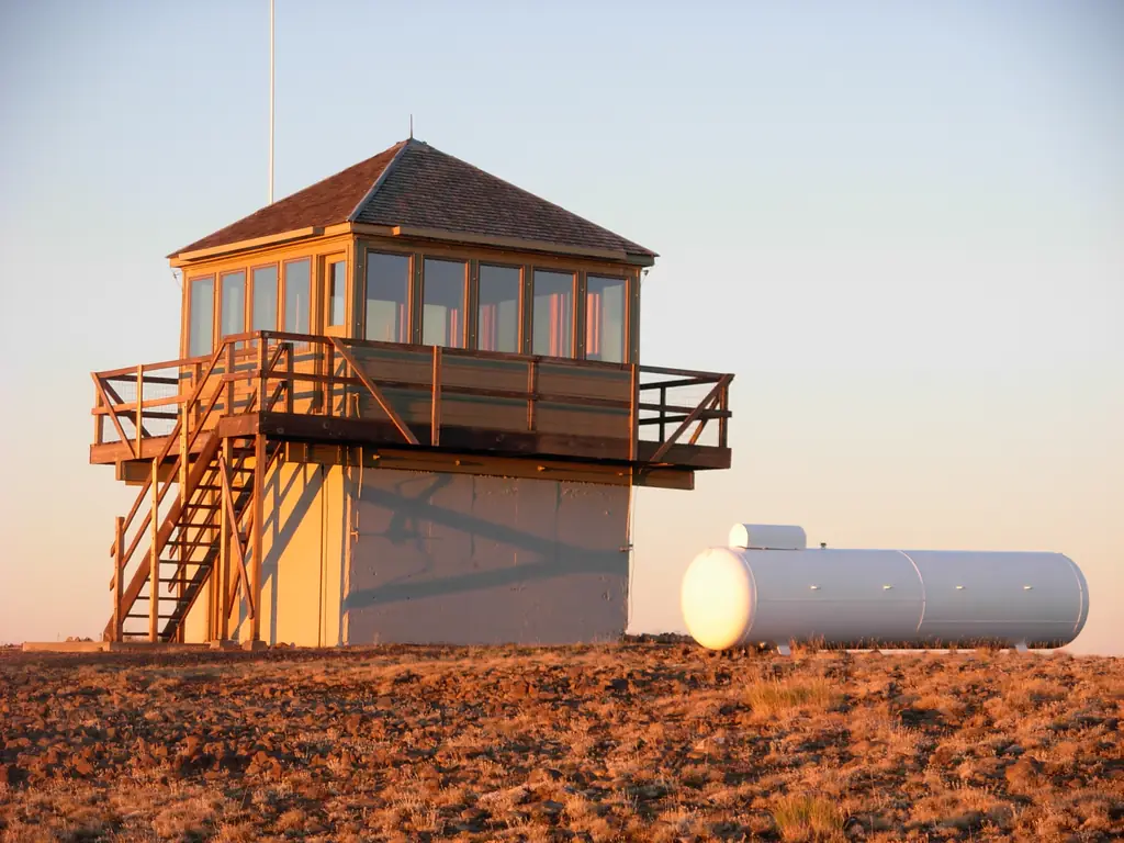
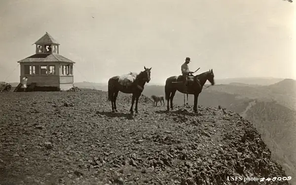
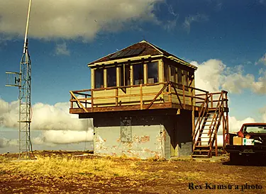
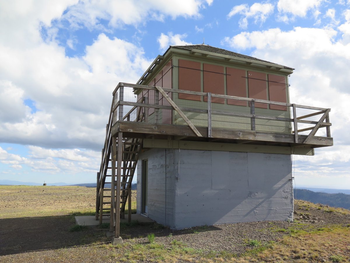
1949 L-4 cab on a 10-foot concrete base, after a 1929 D-6 cupola; staffed in summers; drive-up by gravel road in the Umatilla NF.
- Standing
- Open to the public
- Verified
Visit & stay
Not rentable. As far as we know, this lookout cannot be booked for overnight stays.
Access
Open to the public. Summit reached by road: gravel FR 64, then FR-475, which may be gated. Working Forest Service lookout; these sources do not describe the cab's interior.
- Can you climb it?
- Unknown
- Road to the top?
- Yes, you can drive up
- Trail
- WillhiteWeb lists the distance as drive-up or 0.5 miles; a restroom sits near the lookout.
- Staffing
- Staffed during fire season (as of 2019)
Facts
- Status
- Type
- Two-story buildingL-4 cab on a 10-foot concrete base (1949); the site's first lookout was a D-6 cupola cabin (1929)The designs: L-4, D-6
- Built of
- WoodGoing by its design; no source says so in words.
- Built
- 1929
- Height
- 10 ft (3.0 m)
- Elevation
- 6,249 ft (1,905 m)
- Agency
- U.S. Forest Service
- Land
- Federal land
- Location
- Columbia County, Washington
- Coordinates
- 46.03110, −117.91200
- Registers
- This entry
- VerifiedResearched, then checked independently. Updated 8 Oct 2026.
- Firefinder id
us-wa-table-rock
View from the cab
What you see from the cab: every ridge out to about 93 miles, the named peaks in sight, and other fire lookouts within view, worked out from terrain data in your browser.
Downloads about 4.0 MB of terrain data the first time.
Or see what it could see on the map: the ground in its line of sight.
History
Then and now
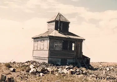
- 1929 BuiltFirst structure on the summit: a D-6 cupola cabin; sources say it survived into the late 1950sSources: firelookout.com, willhiteweb.com, trailchick.com
- 1930 FireOctober 1930 story, reprinted online: lookout reported a fire near Lewis Peak on August 22; a cooperator crew was loaded in 39 minutesSource: willhiteweb.com
- No record between 1930 and 1949
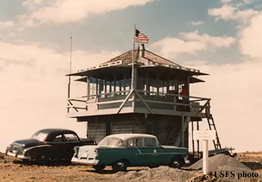
- 1949 BuiltPresent L-4 cab on a 10-foot concrete baseSources: firelookout.com, willhiteweb.com, summitpost.org
- No record between 1949 and 1965
- 1965 StaffedFrank Hohenadel listed as lookout personnel; the source gives the span as 194? to 1965Source: firelookout.com
- No record between 1965 and 1989
- 1989 AlteredCab remodeled: knotty pine interior, new insulation, thermopane windows; metal shutters addedSources: nhlr.org, trailchick.com
- No record between 1989 and 2015
- 2015 Added to the National Historic Lookout RegisterRegistered on the National Historic Lookout Register, January 3, 2015Source: nhlr.org
- TodayStandingIt still stands, as far as our sources know.
Old maps of this spot
USGS topographic maps from the years a lookout stood may show it, often as a small symbol labelled “Lookout”. See the old topo maps around it on the Firefinder map, or find every scanned sheet of this spot on USGS TopoView (opens another site) (click the spot there to list them, with dates and downloads).
Story
Researched 8 Oct 2026, fact-checked.
Table Rock Lookout sits on a flat, rocky summit in the Blue Mountains of Columbia County, Washington, inside the Umatilla National Forest.1,2,3 The summit's first lookout was a D-6 cupola cabin, put into use in 1929, and it stood about thirty years.2,4,5 The present L-4 cab went up on a 10-foot concrete base in 1949, and that base still stands.2,4,3 A 1950 newspaper article described the new tower as nearly finished yet already in service, and noted that the city's water department had a hand in it.4 The lookout watches over the Mill Creek watershed, the main water source for Walla Walla.1
The Forest Service has staffed the cab in summer.1,2 One name on record is Frank Hohenadel, listed as lookout personnel for a span the source gives as 194? to 1965.2 An October 1930 story, reprinted online, recalls that the lookout called in a fire near Lewis Peak on August 22, and that the cooperator in Walla Walla had men, tools and a truck ready to go 39 minutes after getting the call.4
A 1989 remodel gave the cab a knotty pine interior, added wall and ceiling insulation, thermopane windows and metal shutters.1,5 A 2012 visit report found the roof, exterior walls, deck and stairs in good shape, and a 2019 report called the lookout in excellent condition.1 The register listed the lookout on January 3, 2015.1
Today the summit is a drive-up destination.4 From Dayton, the route climbs into the hills and then turns onto gravel Forest Road 64.4 The last 4.5 miles can be rough for passenger cars, and snowdrifts can linger into June.4 The final half mile runs on FR-475, which may be gated.4 A high-clearance 4WD can drive onto the summit plateau if the gate half a mile from the top is open.5 Visitors to the summit can use a restroom close to the tower.3 I found no overnight rental program for the tower in these sources, and since the cab is a working Forest Service lookout, it is best seen from the summit grounds.
- Table Rock Lookout, National Historic Lookout Register, http://nhlr.org/lookouts/us/wa/table-rock-lookout/ (accessed 2026-10-08). ↩
- Table Rock Fire Lookout Tower, firelookout.com, https://www.firelookout.com/wa/tablerock.html (accessed 2026-10-08). ↩
- Table Rock, SummitPost, https://www.summitpost.org/table-rock/660802 (accessed 2026-10-08). ↩
- Table Rock Lookout - Umatilla National Forest, WillhiteWeb, https://www.willhiteweb.com/washington_fire_lookouts/table_rock_lookout/umatilla_national_forest_056.htm (accessed 2026-10-08). ↩
- Table Rock, TrailChick, https://trailchick.com/wa-state-fire-lookouts/table-rock-lookout/ (accessed 2026-10-08). ↩
Photos
Photos keep their own rights and are shown with credit. Is one of these yours? You can ask for a different credit or for removal.
Sources
- National Historic Lookout Register (NHLR) (opens another site) Gave us: name, location, county, elevation, register numbers, agency, ownership, dates, photos, links National Historic Lookout Register (nhlr.org) · All rights reserved (American Resources, Inc.); facts extracted only, no prose copied. · retrieved 4 Oct 2026
- Forest Fire Lookout Association (FFLA) - US lookout lists (opens another site) Gave us: type, status, register numbers, links Forest Fire Lookout Association (firelookout.org) · No licence stated; facts extracted only, no prose copied. · retrieved 8 Oct 2026
- firelookout.com -- Rex Kamstra's Forest Fire Lookout Page (opens another site) Gave us: what it is built of, design, height, staffing, dates, photos, links firelookout.com · No licence stated on the site; facts only (coordinates, elevation, built/destroyed years, design, agency). Photos mirrored with the site's stated credit. · retrieved 4 Oct 2026
- OpenStreetMap -- fire lookout structures (opens another site) Gave us: links © OpenStreetMap contributors · ODbL 1.0. (c) OpenStreetMap contributors. · retrieved 4 Oct 2026
- FOREST LOOKOUTS -- western US (Ron Kemnow's weebly sites) (opens another site) Gave us: links Ron Kemnow's Forest Lookouts sites (westlookouts, californialookouts, idaholookouts, montanalookouts, oregonlookouts and washingtonlookouts .weebly.com) · No licence stated; facts only (county, land manager, status word, coordinates where the page's own map widget gives them, township-range-section, height and design hints, links). The site's own newspaper quotes, citations and narrative are not reproduced. · retrieved 8 Oct 2026
- TrailChick: Washington State Fire Lookouts (opens another site) Gave us: photos, links TrailChick (trailchick.com) · No licence stated; facts only (county, land manager, coordinates, elevation, lookout type, years built). The guide's text is not reproduced; its card photos are listed with credit to TrailChick, for the project's photo mirroring. · retrieved 8 Oct 2026
- WillhiteWeb.com: Washington Fire Lookouts (opens another site) Gave us: links WillhiteWeb.com · No licence stated; names and page links only (the site's photos and text are not reproduced). · retrieved 8 Oct 2026
- Firefinder research Gave us: summary, design, status, agency, access, staffing, visiting details, dates, links, fact-check Firefinder research (sources cited in the story footnotes) · Our own research notes; each fact cites its source in the lookout's story
More about this lookout elsewhere
- NHLR register entry US 1097 (nhlr.org) (opens another site)
- NHLR register entry (nhlr.org) (opens another site)
- Table Rock (SummitPost) (opens another site)
- FFLA Washington lookout list (firelookout.org) (opens another site)
- Table Rock on firelookout.com (Rex Kamstra) (opens another site)
- Table Rock on Forest Lookouts, western US (Ron Kemnow) (opens another site)
- Table Rock in the TrailChick Washington lookout guide (opens another site)
- Table Rock on WillhiteWeb.com Washington Fire Lookouts (opens another site)
- OpenStreetMap way 441997370 (opens another site)
Firefinder takes facts (places, dates, numbers) from these sources and writes its own words. See all sources and licences.