Fire lookout · Pierce County, Washington
Tolmie Peak Lookout
A 1933 NPS rustic-style two-story lookout above Eunice Lake in Mount Rainier National Park, listed on the NRHP in 1991 and still occasionally volunteer-staffed.
- Standing
- Open to the public
- Verified
Visit & stay
Not rentable. As far as we know, this lookout cannot be booked for overnight stays.
Access
Open to the public. Reached by a maintained NPS trail from the Mowich Lake area; serves as a weekend visitor-contact point.
- Can you climb it?
- Yes
- Road to the top?
- No, you have to hike
- Trail
- Popular, family-friendly hike from Mowich Lake past Eunice Lake; parking fills in peak season.
- Staffing
- Unknown
Facts
- Status
- Type
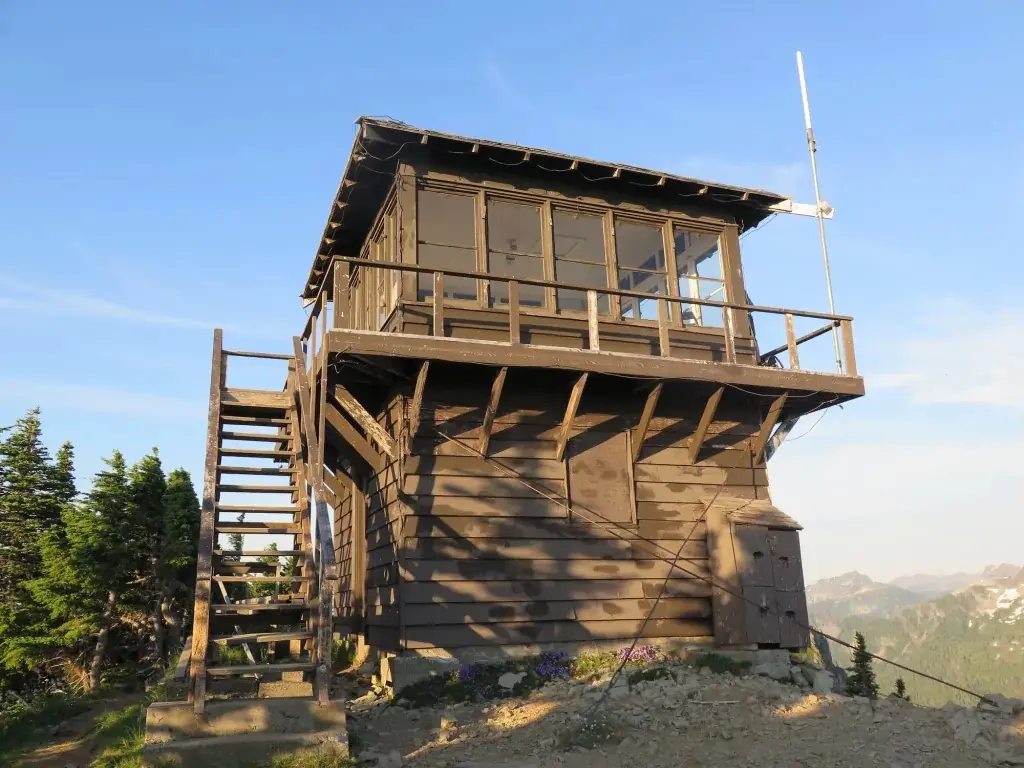
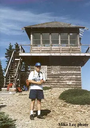
- Two-story buildingTwo-story NPS rustic-style lookout, lookout room over ground-floor storageThe design: National Park Service lookout
- Built of
- Wood
- Built
- 1933
- Height
- 14 ft (4.3 m)
- Elevation
- 5,929 ft (1,807 m)
- Agency
- National Park Service - Mount Rainier National Park
- Land
- Federal land
- Location
- Pierce County, Washington
- Coordinates
- 46.95754, −121.88092
- Registers
- This entry
- VerifiedResearched, then checked independently. Updated 8 Oct 2026.
- Firefinder id
us-wa-tolmie-peak
View from the cab
What you see from the cab: every ridge out to about 93 miles, the named peaks in sight, and other fire lookouts within view, worked out from terrain data in your browser.
Downloads about 4.1 MB of terrain data the first time.
Or see what it could see on the map: the ground in its line of sight.
History
Then and now
- 1933 BuiltBuilt as one of four lookouts raised in Mount Rainier NP 1932-1934, designed under NPS architect Edwin A. Nickel.Sources: nhlr.org, en.wikipedia.org
- 1933 AlteredNewly completed structure lost its roof to a windstorm and had to be repaired; it is now secured with cables to deadmen.Source: en.wikipedia.org
- No record between 1933 and 1991
- 1991 Listed on the National Register of Historic PlacesListed on the National Register of Historic Places, March 13, 1991, as part of the Mount Rainier National Historic Landmark District.Source: en.wikipedia.org
- No record between 1991 and 2022
- 2022 Added to the National Historic Lookout RegisterRegistered on the National Historic Lookout Register, April 13, 2022.Source: nhlr.org
- TodayStandingIt still stands, as far as our sources know.
Old maps of this spot
USGS topographic maps from the years a lookout stood may show it, often as a small symbol labelled “Lookout”. See the old topo maps around it on the Firefinder map, or find every scanned sheet of this spot on USGS TopoView (opens another site) (click the spot there to list them, with dates and downloads).
Story
Researched 4 Oct 2026, fact-checked.
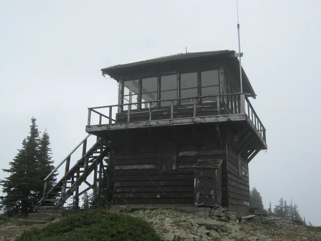
Tolmie Peak's lookout is one of four fire towers the National Park Service built inside Mount Rainier National Park between 1932 and 1934.1,2 Seven lookouts once stood inside the park in the 1930s; Tolmie Peak is one of only four that remain.3 It went up in 1933, designed under NPS architect Edwin A. Nickel in the agency's standard rustic two-story style: a lookout room on top with storage below.1,4 Soon after it was finished, a windstorm tore the roof off, and crews had to rebuild it; cables anchored to buried "deadmen" still brace the structure against wind today.2
The peak takes its name from William Fraser Tolmie, a Hudson's Bay Company employee who explored up the Puyallup River valley with Native guides in the early 1800s and is counted as the first non-Native person to set foot in what became the park.1
Unlike many backcountry lookouts that were decommissioned and left to decay, Tolmie Peak's tower has stayed in occasional use. It's sometimes staffed by volunteers in summer and serves as a weekend visitor-contact point, where NPS staff or volunteers talk with hikers who make the climb.1,2 It was added to the National Register of Historic Places on March 13, 1991, as part of the larger Mount Rainier National Historic Landmark District that covers the park's whole stock of Park Service rustic architecture.2
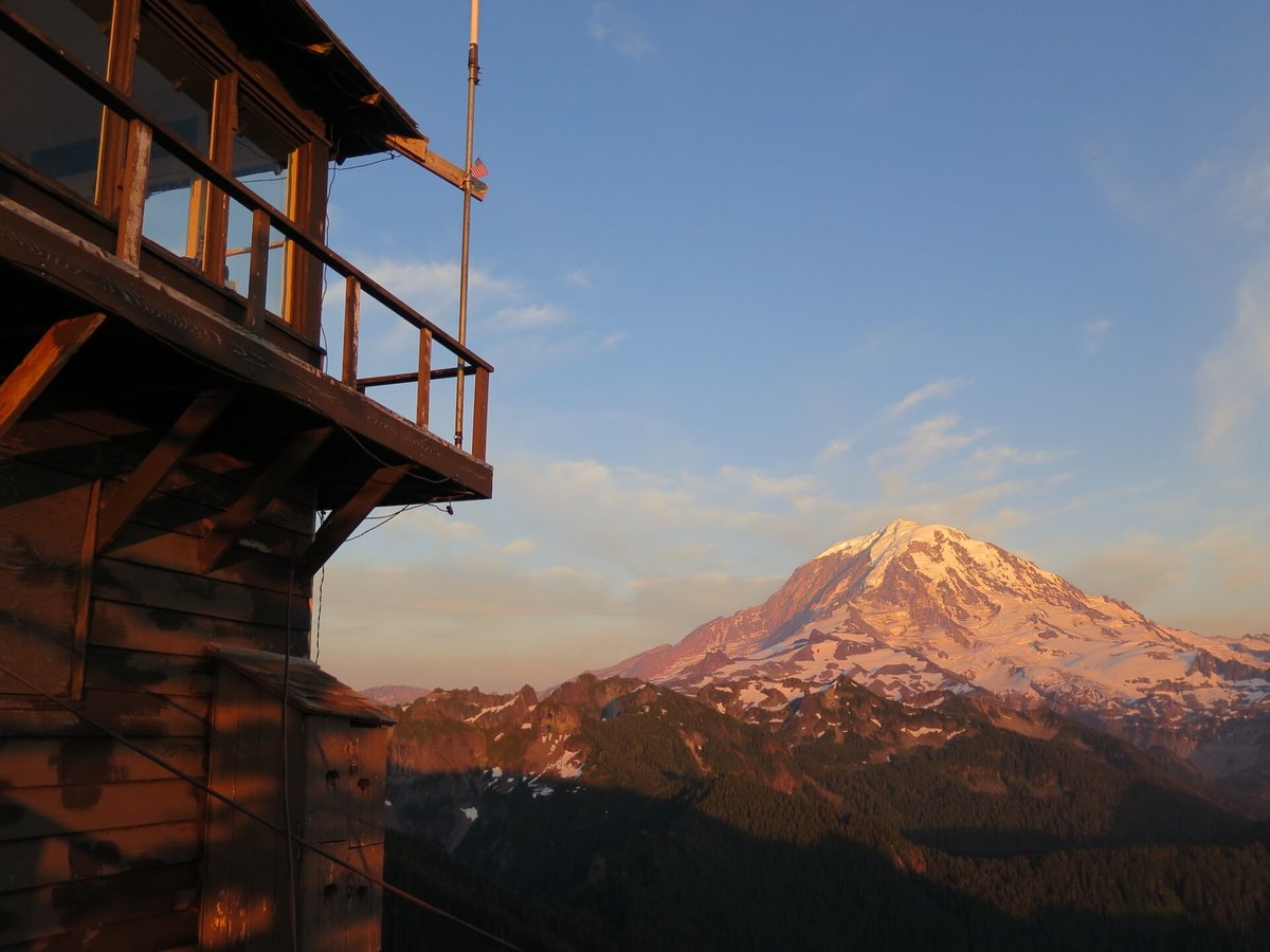
The lookout sits above Eunice Lake and is reached by a popular, family-friendly trail from the Mowich Lake area, a hike of a few miles with modest elevation gain and views that stretch to Mount Rainier, the Olympics, and on clear days Mount St. Helens.3 Parking at the Mowich Lake trailhead can fill up in peak season. The tower shows real wear from decades of mountain weather, and visitors should treat it as a historic structure rather than a shelter to count on.5
Photos

Photos keep their own rights and are shown with credit. Is one of these yours? You can ask for a different credit or for removal.
Sources
- National Historic Lookout Register (NHLR) (opens another site) Gave us: name, location, county, elevation, register numbers, agency, ownership, dates, photos, links National Historic Lookout Register (nhlr.org) · All rights reserved (American Resources, Inc.); facts extracted only, no prose copied. · retrieved 4 Oct 2026
- Forest Fire Lookout Association (FFLA) - US lookout lists (opens another site) Gave us: type, status, register numbers, links Forest Fire Lookout Association (firelookout.org) · No licence stated; facts extracted only, no prose copied. · retrieved 8 Oct 2026
- firelookout.com -- Rex Kamstra's Forest Fire Lookout Page (opens another site) Gave us: what it is built of, dates, photos, links firelookout.com · No licence stated on the site; facts only (coordinates, elevation, built/destroyed years, design, agency). Photos mirrored with the site's stated credit. · retrieved 4 Oct 2026
- Wikidata -- US fire lookout towers (Q748998 and subclasses) (opens another site) Gave us: register numbers, photos, links Wikidata · CC0 1.0 (Wikidata). Images keep their own Commons licence/credit. · retrieved 4 Oct 2026
- OpenStreetMap -- fire lookout structures (opens another site) Gave us: register numbers, links © OpenStreetMap contributors · ODbL 1.0. (c) OpenStreetMap contributors. · retrieved 4 Oct 2026
- FOREST LOOKOUTS -- western US (Ron Kemnow's weebly sites) (opens another site) Ron Kemnow's Forest Lookouts sites (westlookouts, californialookouts, idaholookouts, montanalookouts, oregonlookouts and washingtonlookouts .weebly.com) · No licence stated; facts only (county, land manager, status word, coordinates where the page's own map widget gives them, township-range-section, height and design hints, links). The site's own newspaper quotes, citations and narrative are not reproduced. · retrieved 8 Oct 2026
- TrailChick: Washington State Fire Lookouts (opens another site) Gave us: height, photos TrailChick (trailchick.com) · No licence stated; facts only (county, land manager, coordinates, elevation, lookout type, years built). The guide's text is not reproduced; its card photos are listed with credit to TrailChick, for the project's photo mirroring. · retrieved 8 Oct 2026
- WillhiteWeb.com: Washington Fire Lookouts (opens another site) Gave us: links WillhiteWeb.com · No licence stated; names and page links only (the site's photos and text are not reproduced). · retrieved 8 Oct 2026
- Firefinder research Gave us: summary, design, status, agency, access, visiting details, dates, links, fact-check Firefinder research (sources cited in the story footnotes) · Our own research notes; each fact cites its source in the lookout's story
More about this lookout elsewhere
- NHLR register entry US 1562 (nhlr.org) (opens another site)
- FFLA Washington lookout list (firelookout.org) (opens another site)
- Wikipedia: Tolmie Peak Fire Lookout (opens another site)
- Tolmie Peak Lookout - TrailChick (opens another site)
- Tolmie Peak Lookout - Forest Lookouts Page (opens another site)
- Tolmie Peak on firelookout.com (Rex Kamstra) (opens another site)
- Tolmie Peak on WillhiteWeb.com Washington Fire Lookouts (opens another site)
- Wikidata item Q7814452 (opens another site)
- OpenStreetMap way 348455953 (opens another site)
Firefinder takes facts (places, dates, numbers) from these sources and writes its own words. See all sources and licences.