Fire lookout · Okanogan County, Washington
Whitmore Mountain Lookout
Also known as Whitmore Lookout
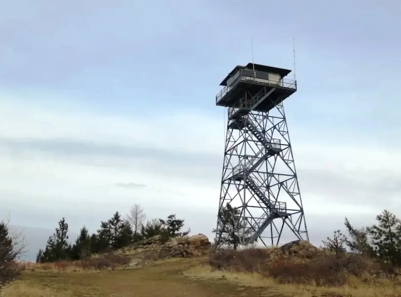
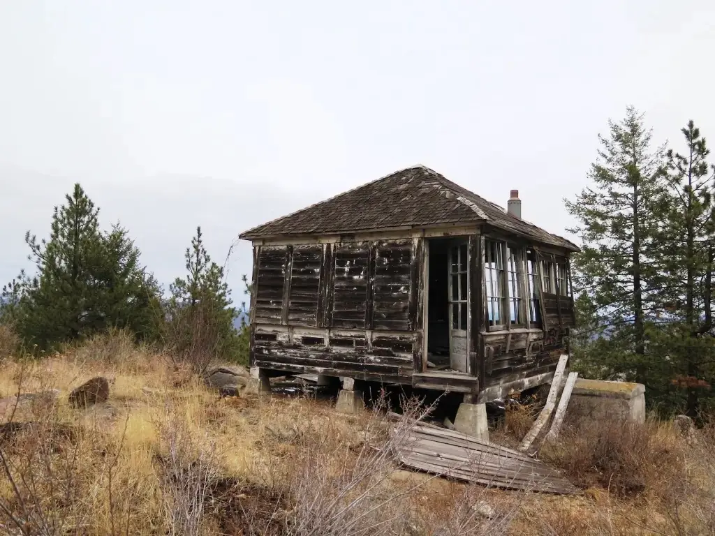
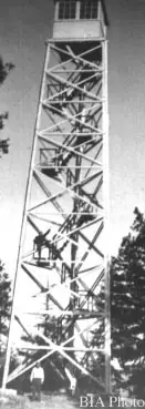
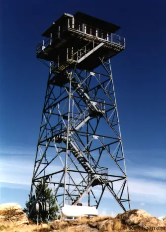
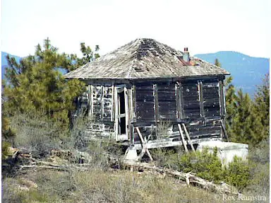
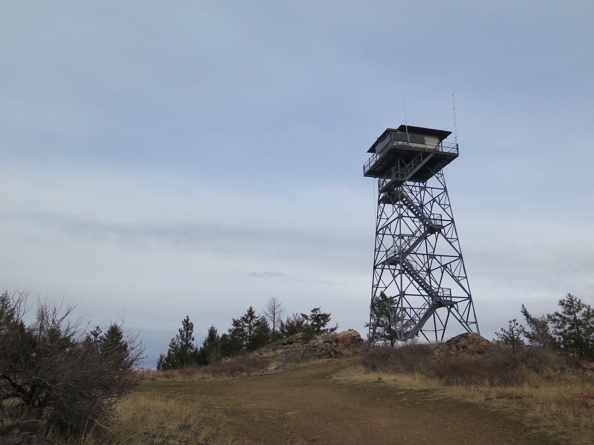
CCC-built L-4 cab and wooden tower of 1934-35 on Whitmore Mountain, Colville Reservation; a 53-ft steel live-in tower replaced it in the 1960s and is staffed each summer.
- Standing
- Tribal land: permission required
- Verified
Tribal land: permission required
This site is on tribal land. Ask the tribe for permission before visiting, and follow its rules. The steel tower is locked and sits on land granted by a private landowner. The register says you can climb the stairs to a viewing platform just below the cab, but no administrator source says whether visitors may use it. Ask the Colville Indian Reservation administrators before visiting.
Visit & stay
Not rentable. As far as we know, this lookout cannot be booked for overnight stays.
Access
Tribal land: permission required. See the warning at the top of this page.
- Can you climb it?
- Unknown
- Road to the top?
- Yes, you can drive up
- Trail
- TrailChick describes the site as driveable, with directions that follow BIA Road 67 from Nespelem. The historic L-4 cab is about a quarter mile from the steel tower.
- Staffing
- Staffed during fire season (as of 2024)
Facts
- Status
- Type
- Cab on a tower53 ft all-steel live-in tower (built in the 1960s); the historic L-4 cab (1934) stands about a quarter mile awayThe design: L-4
- Built of
- Steel
- Built
- 1934 sources disagree
- Height
- 53 ft (16.2 m)
- Elevation
- 3,938 ft (1,200 m)
- Agency
- Colville Indian Reservation
- Land
- Tribal land
- Location
- Okanogan County, Washington
- Coordinates
- 48.17832, −119.24978
- Registers
- This entry
- VerifiedResearched, then checked independently. Updated 8 Oct 2026.
- Firefinder id
us-wa-whitmore-mountain
View from the cab
What you see from the cab: every ridge out to about 93 miles, the named peaks in sight, and other fire lookouts within view, worked out from terrain data in your browser.
Downloads about 4.2 MB of terrain data the first time.
Or see what it could see on the map: the ground in its line of sight.
History
Then and now
- 1934 BuiltL-4 cab built about a quarter mile northeast of the current steel lookout, per the registerSources: nhlr.org, trailchick.com
- 1934 EventWork camp on the mountain; lumber hauled up, poles cut and a trail builtSource: washingtonlookouts.weebly.com
- 1935 BuiltThree-legged 60 ft wooden tower with 7x7 ft cab built by CCC; the register gives a reported cost of $1,046 for both structuresSources: nhlr.org, washingtonlookouts.weebly.com
- 1943 StaffedTeachers hired as summer fire lookouts in the Colville national forest; Georgia Brown named on Whitmore MountainSource: washingtonlookouts.weebly.com
- No record between 1943 and 1960
- 1960 Built'Built' field on NHLR detail pageSource: NHLR register entry
- 1960 EventInspection report calls the wooden tower badly deteriorated and unsafe; proposes a 50 ft steel tower with quarters on top, 1,200 ft south of the old siteSource: washingtonlookouts.weebly.com
- 1962 EventLetter suggests moving the new tower a quarter mile southwest, onto privately owned landSource: washingtonlookouts.weebly.com
- No record between 1962 and 2021
- 2021 FireWhitmore fire started by lightning on August 3, 2021; crews dug a hand line around the historic L-4 cab and wrapped it; both lookouts survivedSources: nhlr.org, trailchick.com
- 2022 Added to the National Historic Lookout RegisterRegistered April 13, 2022 as US 1565, WA 92; nominated by Christine EstradaSource: nhlr.org
- TodayStandingIt still stands, as far as our sources know.
Old maps of this spot
USGS topographic maps from the years a lookout stood may show it, often as a small symbol labelled “Lookout”. See the old topo maps around it on the Firefinder map, or find every scanned sheet of this spot on USGS TopoView (opens another site) (click the spot there to list them, with dates and downloads).
Story
Researched 8 Oct 2026, fact-checked.
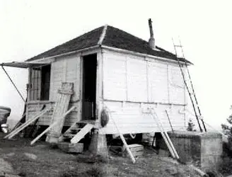
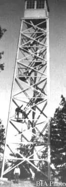
Whitmore Mountain rises on the Colville Indian Reservation in Okanogan County, about 13 miles west-northwest of Nespelem.1,2 Civilian Conservation Corps crews put up the first lookout here in 1934 and 1935: an L-4 cab about a quarter mile northeast of the current steel lookout, and a three-legged, 60-foot wooden tower.2,3 The register gives a reported cost of $1,046 for both structures.2 A June 1934 newspaper item describes a camp on the mountain with lumber hauled up and a trail being built.3 Firelookout.com and a TrailChick photo caption date the wooden tower to 1938, so the early dates are disputed.1,4
In 1943 a Colville paper noted that many teachers were working as fire lookouts that summer, and it named Georgia Brown on Whitmore Mountain.3
By 1960 the wooden tower was in trouble.3 A November 1960 inspection report called it badly deteriorated and unsafe, and proposed a 50-foot steel tower with quarters on top, built 1,200 feet south of the old site.3 A 1962 letter discussed moving the new tower a quarter mile southwest, onto private land.3
The present tower is a 53-foot all-steel live-in tower, built sometime in the 1960s.2,1 The register says permission was granted by a private landowner for it.2 The L-4 cab still stands on site, though it is in very poor condition.2 The steel tower is staffed every summer.2,4
Lightning started the Whitmore fire on August 3, 2021, and it spread across much of the Whitmore area.2 Fire crews cut a hand line around the historic L-4 cab and wrapped it to protect it, and both lookouts came through.2,4
The register says the lookout is locked, but adds that you can climb the stairs to a viewing platform just below the cab.2 I found no source from the administrators on whether visitors may use it, so ask before you go up. TrailChick describes the site as driveable and gives directions that follow BIA Road 67 from Nespelem.4 The register lists the Colville Indian Reservation as administrator, and it was registered on April 13, 2022, as US 1565, WA 92.2 Ask the administrators before you visit, and do not go up the tower without their permission.
- Whitmore Mtn. Fire Lookout Tower, Firelookout.com, https://www.firelookout.com/wa/whitmore.html (accessed 2026-10-08). ↩
- Whitmore Mountain Lookout, National Historic Lookout Register (nhlr.org), http://nhlr.org/lookouts/us/wa/whitmore-mountain-lookout/ (accessed 2026-10-08). ↩
- Whitmore Mountain, Forest Lookouts (washingtonlookouts.weebly.com), https://washingtonlookouts.weebly.com/whitmore-mountain.html (accessed 2026-10-08). ↩
- Whitmore Mountain, TrailChick, https://www.trailchick.com/wa-state-fire-lookouts/whitmore-mountain-lookout/ (accessed 2026-10-08). ↩
Photos
Photos keep their own rights and are shown with credit. Is one of these yours? You can ask for a different credit or for removal.
Where sources disagree
We show disagreements between sources instead of quietly picking one. If you know which is right, please tell us.
Sources disagree on the year it was built.
- NHLR: 1960
- firelookout.com -- Rex Kamstra's Forest Fire Lookout Page: 1938
- TrailChick: Washington State Fire Lookouts: 1935
Sources give different build years. Often one counts the first lookout on the site and another the structure there now.
Sources
- National Historic Lookout Register (NHLR) (opens another site) Gave us: name, location, county, elevation, what it is built of, register numbers, agency, ownership, access, dates, photos, links National Historic Lookout Register (nhlr.org) · All rights reserved (American Resources, Inc.); facts extracted only, no prose copied. · retrieved 4 Oct 2026
- Forest Fire Lookout Association (FFLA) - US lookout lists (opens another site) Gave us: type, status, register numbers, links Forest Fire Lookout Association (firelookout.org) · No licence stated; facts extracted only, no prose copied. · retrieved 8 Oct 2026
- firelookout.com -- Rex Kamstra's Forest Fire Lookout Page (opens another site) Gave us: design, height, staffing, photos, links firelookout.com · No licence stated on the site; facts only (coordinates, elevation, built/destroyed years, design, agency). Photos mirrored with the site's stated credit. · retrieved 4 Oct 2026
- OpenStreetMap -- fire lookout structures (opens another site) Gave us: links © OpenStreetMap contributors · ODbL 1.0. (c) OpenStreetMap contributors. · retrieved 4 Oct 2026
- FOREST LOOKOUTS -- western US (Ron Kemnow's weebly sites) (opens another site) Ron Kemnow's Forest Lookouts sites (westlookouts, californialookouts, idaholookouts, montanalookouts, oregonlookouts and washingtonlookouts .weebly.com) · No licence stated; facts only (county, land manager, status word, coordinates where the page's own map widget gives them, township-range-section, height and design hints, links). The site's own newspaper quotes, citations and narrative are not reproduced. · retrieved 8 Oct 2026
- TrailChick: Washington State Fire Lookouts (opens another site) Gave us: photos TrailChick (trailchick.com) · No licence stated; facts only (county, land manager, coordinates, elevation, lookout type, years built). The guide's text is not reproduced; its card photos are listed with credit to TrailChick, for the project's photo mirroring. · retrieved 8 Oct 2026
- Firefinder research Gave us: summary, design, height, status, agency, access, staffing, visiting details, dates, links, fact-check Firefinder research (sources cited in the story footnotes) · Our own research notes; each fact cites its source in the lookout's story
More about this lookout elsewhere
- NHLR register entry US 1565 (nhlr.org) (opens another site)
- FFLA Washington lookout list (firelookout.org) (opens another site)
- Whitmore Mountain Lookout - TrailChick (opens another site)
- Whitmore Mountain Lookout - Forest Lookouts Page (opens another site)
- Whitmore Mtn. on firelookout.com (Rex Kamstra) (opens another site)
- OpenStreetMap node 8153328697 (opens another site)
Firefinder takes facts (places, dates, numbers) from these sources and writes its own words. See all sources and licences.